- זמינות קבוצת הנתונים
- 2015-01-01T00:00:00Z–2016-01-01T00:00:00Z
- מפיק מערך הנתונים
- Deutsches Zentrum für Luft- und Raumfahrt (DLR)
- תגים
תיאור
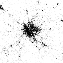
World Settlement Footprint (WSF) 2015 היא מסיכה בינארית ברזולוציה של 10 מטרים שמתווה את היקף ההתיישבות האנושית ברחבי העולם. המסיכה נוצרה על סמך תצלומי לוויין רב-זמניים של Landsat-8 ו-Sentinel-1 משנת 2014 עד 2015 (כ-217,000 ו-107,000 סצנות עברו עיבוד, בהתאמה).
הדינמיקה הזמנית של יישובים אנושיים לאורך זמן שונה באופן מובהק מזו של כל שאר סוגי המידע שאינם יישובים. לכן, בהינתן כל התמונות הרב-זמניות שזמינות באזור העניין במרווח הזמן שנבחר, נתונים סטטיסטיים זמניים מרכזיים (כלומר, ממוצע זמני, מינימום, מקסימום וכו') מחולצים עבור:
- ערך הפיזור לאחור המקורי במקרה של נתוני מכ"ם, וגם
- מדדים ספקטרליים שונים (למשל, מדד צמחייה, מדד שטחים בנויים וכו') שנגזרים אחרי ביצוע מיסוך עננים במקרה של תמונות אופטיות.
לאחר מכן, מוחלים בנפרד סכימות סיווג שונות שמבוססות על מכונות וקטור תומכות (SVM) על התכונות הזמניות האופטיות והתכונות הזמניות של מכ"ם, בהתאמה, ולבסוף, שתי התוצאות משולבות יחד בצורה נכונה.
כדי להעריך באופן כמותי את רמת הדיוק והמהימנות הגבוהה של השכבה, נערך תרגיל אימות נרחב בשיתוף עם Google, על סמך כמות עצומה של דוגמאות של נתוני אמת (כלומר, 900,000) שסומנו על ידי מיקור המונים של פרשנות תמונות. הגדרנו פרוטוקול שקוף וחזק מבחינה סטטיסטית, בהתאם לשיטות המומלצות בספרות המקצועית.
לכל הפרטים הטכניים, עיין בפרסום.
תחום תדרים
תחום תדרים
גודל הפיקסל: 10 מטרים (כל הפסים)
| שם | מינימום | מקסימום | גודל הפיקסל | תיאור |
|---|---|---|---|---|
settlement |
255 | 255 | 10 מטרים | אזור התיישבות אנושית |
תנאים והגבלות
תנאים והגבלות
ציטוטים ביבליוגרפיים
Marconcini, M., Metz-Marconcini, A., Üreyen, S., Palacios-Lopez, D., Hanke, W., Bachhofer, F., Zeidler, J., Esch, T., Gorelick, N., Kakarla, A., פגניני, מ' (Paganini, M.), Strano, E. (2020). התוויית המקומות שבהם בני אדם חיים, World Settlement Footprint 2015. Scientific Data, 7(1), 1-14. doi:10.1038/s41597-020-00580-5
מזהי DOI
סיור עם פלטפורמת Earth Engine
עורך קוד (JavaScript)
var dataset = ee.Image('DLR/WSF/WSF2015/v1');

var opacity = 0.75;
var blackBackground = ee.Image(0);
Map.addLayer(blackBackground, null, 'Black background', true, opacity);

var visualization = {
  min: 0,
  max: 255,
};
Map.addLayer(dataset, visualization, 'Human settlement areas');

Map.setCenter(90.45, 23.7, 7);