-
GHSL: Degree of Urbanization 1975-2030 V2-0 (P2023A)
מערך הנתונים הראסטר הזה מייצג סיווג עירוני-כפרי גלובלי רב-זמני, שבו נעשה שימוש בשיטה של שלב 1 של 'מידת העיור', שמומלצת על ידי ועדת הסטטיסטיקה של האו"ם. השיטה מבוססת על נתוני אוכלוסייה גלובלית בתצוגת רשת ונתוני שטח בנויה שנוצרו על ידי פרויקט GHSL לתקופה 1975-2030 במרווחי זמן של 5 שנים. התואר … ghsl jrc population sdg settlement -
GHSL: Global built-up surface 10m (P2023A)
מערך הנתונים הזה של רסטר מציג את התפלגות שטחי הבנייה, שמוצגים במטרות רבועות לכל תא רשת של 10 מ', לשנת 2018, כפי שנצפו בנתוני התמונות של S2. מערכי הנתונים מודדים: א) את שטח השטח המבונה הכולל, ו-ב) את שטח השטח המבונה שהוקצה לתאי רשת של… built built-environment builtup copernicus ghsl jrc -
GHSL: Global built-up surface 1975-2030 (P2023A)
מערך הנתונים הרסטרי הזה מציג את התפלגות המשטחים המאוכלסים, שמוצגים במטרות רבועות לכל תא רשת בגודל 100 מטר. מערך הנתונים כולל את המדדים הבאים: א) שטח הבנייה הכולל, ב) שטח הבנייה שהוקצה לתא רשת עם שימוש עיקרי לא למגורים (NRES). הנתונים משוערים מבחינה מרחבית-זמנית או… built built-environment builtup copernicus ghsl jrc -
GHSL: Global settlement characteristics (10 m) 2018 (P2023A)
מערך הנתונים הרסטרי המרחבי הזה מתאר את ההתיישבויות האנושיות ברזולוציה של 10 מ', ומפרט את המאפיינים הפנימיים שלהן מבחינת הרכיבים הפונקציונליים והקשורים לגובה של הסביבה הבנויה. מידע נוסף על מוצרי הנתונים של GHSL זמין בדוח GHSL Data Package 2023 … building built builtup copernicus ghsl height -
World Settlement Footprint 2015
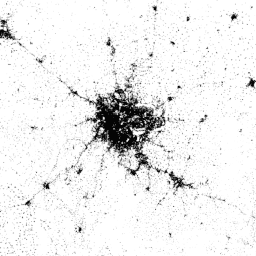
'היקף ההתיישבות האנושית בעולם' (WSF) לשנת 2015 הוא מסכה בינארית ברזולוציה של 10 מטר שמציגה את היקף ההתיישבות האנושית ברחבי העולם. המסכה נוצרה באמצעות תמונות מרובות-זמנים של Landsat-8 ו-Sentinel-1 בשנים 2014-2015 (מתוך כ-217,000 ו-107,000 סצנות שעברו עיבוד, בהתאמה). הדינמיקה הזמנית של יישוב אנושי … landcover landsat-derived population sentinel1-derived settlement urban
Datasets tagged settlement in Earth Engine
[null,null,[],[[["\u003cp\u003eThe World Settlement Footprint 2015 dataset provides a global, 10m resolution binary mask showing the extent of human settlements using 2014-2015 Landsat-8 and Sentinel-1 imagery.\u003c/p\u003e\n"],["\u003cp\u003eThe GHSL datasets offer various perspectives on global built-up areas, including settlement characteristics, built-up surface extent over time, and degree of urbanization.\u003c/p\u003e\n"],["\u003cp\u003eGHSL data is available at different resolutions (10m and 100m) and provides insights into built-up surface area and functional characteristics like building height and residential/non-residential use.\u003c/p\u003e\n"],["\u003cp\u003eThe Degree of Urbanization dataset from GHSL classifies areas globally as rural or urban using a multitemporal approach and gridded population and built-up surface data.\u003c/p\u003e\n"],["\u003cp\u003eThese datasets are derived from various satellite imagery sources including Landsat-8, Sentinel-1, and Sentinel-2 and cover different time periods from 1975 to 2030.\u003c/p\u003e\n"]]],[],null,["# Datasets tagged settlement in Earth Engine\n\n-\n\n |------------------------------------------------------------------------------------------------------------------------------------------------------------------------------------------------------------------------------------------------------------------------------------------------------------------------------------------------|\n | [### GHSL: Degree of Urbanization 1975-2030 V2-0 (P2023A)](/earth-engine/datasets/catalog/JRC_GHSL_P2023A_GHS_SMOD_V2-0) |\n | This raster dataset represents a global, multitemporal rural-urban classification, applying the \"Degree of Urbanisation\" stage I methodology recommended by UN Statistical Commission, based on global gridded population and built-up surface data generated by the GHSL project for the epochs 1975-2030 in 5-year intervals. The Degree ... |\n | [ghsl](/earth-engine/datasets/tags/ghsl) [jrc](/earth-engine/datasets/tags/jrc) [population](/earth-engine/datasets/tags/population) [sdg](/earth-engine/datasets/tags/sdg) [settlement](/earth-engine/datasets/tags/settlement) |\n\n-\n\n |---------------------------------------------------------------------------------------------------------------------------------------------------------------------------------------------------------------------------------------------------------------------------------------------------|\n | [### GHSL: Global built-up surface 10m (P2023A)](/earth-engine/datasets/catalog/JRC_GHSL_P2023A_GHS_BUILT_S_10m) |\n | This raster dataset depicts the distribution of built-up surfaces, expressed in square metres per 10 m grid cell, for 2018 as observed from the S2 image data. The datasets measure: a) the total built-up surface, and b) the built-up surface allocated to grid cells of ... |\n | [built](/earth-engine/datasets/tags/built) [built-environment](/earth-engine/datasets/tags/built-environment) [builtup](/earth-engine/datasets/tags/builtup) [copernicus](/earth-engine/datasets/tags/copernicus) [ghsl](/earth-engine/datasets/tags/ghsl) [jrc](/earth-engine/datasets/tags/jrc) |\n\n-\n\n |--------------------------------------------------------------------------------------------------------------------------------------------------------------------------------------------------------------------------------------------------------------------------------------------------------------------------|\n | [### GHSL: Global built-up surface 1975-2030 (P2023A)](/earth-engine/datasets/catalog/JRC_GHSL_P2023A_GHS_BUILT_S) |\n | This raster dataset depicts the distribution of built-up surfaces, expressed in square metres per 100 m grid cell. The dataset measures: a) the total built-up surface, and b) the built-up surface allocated to grid cells of predominant non-residential (NRES) use. Data are spatially-temporally interpolated or ... |\n | [built](/earth-engine/datasets/tags/built) [built-environment](/earth-engine/datasets/tags/built-environment) [builtup](/earth-engine/datasets/tags/builtup) [copernicus](/earth-engine/datasets/tags/copernicus) [ghsl](/earth-engine/datasets/tags/ghsl) [jrc](/earth-engine/datasets/tags/jrc) |\n\n-\n\n |---------------------------------------------------------------------------------------------------------------------------------------------------------------------------------------------------------------------------------------------------------------------------------------------------------------|\n | [### GHSL: Global settlement characteristics (10 m) 2018 (P2023A)](/earth-engine/datasets/catalog/JRC_GHSL_P2023A_GHS_BUILT_C) |\n | This spatial raster dataset delineates human settlements at 10 m resolution, and describes their inner characteristics in terms of the functional and height-related components of the built environment. More information about the GHSL data products can be found in the GHSL Data Package 2023 report ... |\n | [building](/earth-engine/datasets/tags/building) [built](/earth-engine/datasets/tags/built) [builtup](/earth-engine/datasets/tags/builtup) [copernicus](/earth-engine/datasets/tags/copernicus) [ghsl](/earth-engine/datasets/tags/ghsl) [height](/earth-engine/datasets/tags/height) |\n\n-\n\n |-------------------------------------------------------------------------------------------------------------------------------------------------------------------------------------------------------------------------------------------------------------------------------------------------------------------------------------------|\n | [### World Settlement Footprint 2015](/earth-engine/datasets/catalog/DLR_WSF_WSF2015_v1) |\n | The World Settlement Footprint (WSF) 2015 is a 10m resolution binary mask outlining the extent of human settlements globally derived by means of 2014-2015 multitemporal Landsat-8 and Sentinel-1 imagery (of which \\~217,000 and \\~107,000 scenes have been processed, respectively). The temporal dynamics of human settlements ... |\n | [landcover](/earth-engine/datasets/tags/landcover) [landsat-derived](/earth-engine/datasets/tags/landsat-derived) [population](/earth-engine/datasets/tags/population) [sentinel1-derived](/earth-engine/datasets/tags/sentinel1-derived) [settlement](/earth-engine/datasets/tags/settlement) [urban](/earth-engine/datasets/tags/urban) |"]]