MACAv2-METDATA veri kümesi, ABD'nin bitişik eyaletlerini kapsayan 20 küresel iklim modelinden oluşan bir koleksiyondur. Çok değişkenli uyarlanabilir oluşturulmuş analoglar (MACA) yöntemi, geçmişteki önyargıları kaldırmak ve iklim modeli çıkışındaki mekansal kalıpları eşleştirmek için bir eğitim veri kümesi (ör. meteorolojik gözlem veri kümesi) kullanan istatistiksel bir ölçek küçültme yöntemidir.
MACA yöntemi, 20 küresel iklim modelinin (GCM'ler) model çıkışını ölçeklendirmek için kullanıldı. Bu modeller, Birleşik Model Karşılaştırma Projesi 5'in (CMIP5) tarihi GCM zorlamaları (1950-2005) ve gelecekteki temsili konsantrasyon yolları (RCP'ler) RCP 4.5 ve RCP 8.5 senaryoları (2006-2100) için GCM'lerin doğal çözünürlüğünden 4 km'ye kadar ölçeklendirildi.
Yüzeye yakın günlük maksimum sıcaklığın aylık ortalaması
tasmin
K
239,47*
316,2*
metre
Yüzeye yakın minimum günlük sıcaklığın aylık ortalaması
huss
Kütle oranı
0*
0,03*
metre
Yüzeye yakın ortalama günlük özgül nemin aylık ortalaması
pr
mm
0*
3691,91*
metre
Yüzeydeki aylık toplam yağış miktarı
rsds
W/m^2
15,84*
419*
metre
Yüzeydeki ortalama günlük kısa dalga radyasyonunun aylık ortalaması
was
m/sn
0,23*
14,16*
metre
Aylık ortalama günlük ortalama yüzeye yakın rüzgar hızı
* tahmini minimum veya maksimum değer
Resim Özellikleri
Resim Özellikleri
Ad
Tür
Açıklama
senaryo
Dize
CMIP5 senaryosunun adı ("rcp85", "rcp45" veya "historical" değerlerinden biri)
model
Dize
CMIP5 modelinin adı (ör. "inmcm4")
ensemble
Dize
"r1i1p1" veya "r6i1p1"
ay
ÇİFT
Yıl içindeki ayın dizini (ör. 1-12)
Kullanım Şartları
Kullanım Şartları
MACA veri kümeleri, ABD hükümetinin sağladığı fonlarla oluşturulmuş olup ABD'de kamu alanı kapsamındadır.
Daha net bir şekilde ifade etmek gerekirse, aksi belirtilmedikçe MACA veri kümeleri Creative Commons CC0 1.0 Universal lisansıyla sunulur.
Kısacası John Abatzoglou, telif hakkı yasası kapsamında dünya genelinde eser üzerindeki tüm haklarından (ilgili ve komşu haklar dahil) yasaların izin verdiği ölçüde feragat eder. İzin almadan, ticari amaçlar da dahil olmak üzere çalışmayı kopyalayabilir, değiştirebilir, dağıtabilir ve gerçekleştirebilirsiniz. John Abatzoglou, eserle ilgili hiçbir garanti vermez ve geçerli yasaların izin verdiği en geniş kapsamda eserin tüm kullanımlarıyla ilgili sorumluluğu reddeder. Kullanıcılar, bu veri kümesinin kullanımı sonucunda oluşturulan rapor ve yayınlarda kullanılan kaynağı uygun şekilde alıntılamalı ve verilerin elde edildiği tarihi belirtmelidir. Daha fazla bilgi için MACA Referansları ve Lisans sayfasına bakın.
Alıntılar
Alıntılar:
Abatzoglou J.T. ve Brown T.J., A comparison of statistical downscaling
methods suited for wildfire applications, International Journal
of Climatology(2012) doi:10.1002/joc.2312.
MACAv2-METDATA veri kümesi, ABD'nin bitişik bölgelerini kapsayan 20 küresel iklim modelinden oluşan bir koleksiyondur. Çok değişkenli uyarlanabilir oluşturulmuş analoglar (MACA) yöntemi, geçmişteki önyargıları kaldırmak ve iklim modeli çıkışındaki mekansal kalıpları eşleştirmek için bir eğitim veri kümesi (ör. meteorolojik gözlem veri kümesi) kullanan istatistiksel bir ölçek küçültme yöntemidir. …
[null,null,[],[[["\u003cp\u003eThe MACAv2-METDATA dataset provides monthly summaries of climate data for the conterminous US, downscaled to a 4km resolution.\u003c/p\u003e\n"],["\u003cp\u003eIt includes data from 20 global climate models, covering historical periods (1950-2005) and future scenarios (RCP 4.5 and RCP 8.5) up to the year 2100.\u003c/p\u003e\n"],["\u003cp\u003eThe dataset utilizes the Multivariate Adaptive Constructed Analogs (MACA) method to reduce biases and improve spatial patterns in climate model outputs.\u003c/p\u003e\n"],["\u003cp\u003eKey variables include maximum/minimum temperature, specific humidity, precipitation, shortwave radiation, and wind speed.\u003c/p\u003e\n"],["\u003cp\u003eThe data is freely available for research, education, and nonprofit use under a Creative Commons CC0 1.0 Universal dedication.\u003c/p\u003e\n"]]],[],null,["# MACAv2-METDATA Monthly Summaries: University of Idaho, Multivariate Adaptive Constructed Analogs Applied to Global Climate Models\n\nDataset Availability\n: 1900-01-01T00:00:00Z--2099-12-31T00:00:00Z\n\nDataset Provider\n:\n\n\n [University of California Merced](http://www.climatologylab.org/maca.html)\n\nCadence\n: 1 Month\n\nTags\n:\n[climate](/earth-engine/datasets/tags/climate) [conus](/earth-engine/datasets/tags/conus) [geophysical](/earth-engine/datasets/tags/geophysical) [idaho](/earth-engine/datasets/tags/idaho) [maca](/earth-engine/datasets/tags/maca) [monthly](/earth-engine/datasets/tags/monthly) \n\n#### Description\n\nThe MACAv2-METDATA dataset is a collection of 20 global\nclimate models covering the conterminous USA. The Multivariate Adaptive\nConstructed Analogs (MACA) method is a statistical downscaling\nmethod which utilizes a training dataset (i.e. a meteorological\nobservation dataset) to remove historical biases and match spatial\npatterns in climate model output.\n\nThe MACA method was used to downscale the model output from 20\nglobal climate models (GCMs) of the Coupled Model Inter-Comparison\nProject 5 (CMIP5) for the historical GCM forcings (1950-2005) and\nthe future Representative Concentration Pathways (RCPs) RCP 4.5\nand RCP 8.5 scenarios (2006-2100) from the native resolution of\nthe GCMS to 4km.\n\nThis version contains monthly summaries.\n\nThe full list of models can be found at:\n\u003chttps://climate.northwestknowledge.net/MACA/GCMs.php\u003e\n\n### Bands\n\n\n**Pixel Size**\n\n4638.3 meters\n\n**Bands**\n\n| Name | Units | Min | Max | Pixel Size | Description |\n|----------|---------------|----------|-----------|------------|-----------------------------------------------------------------------|\n| `tasmax` | K | 251.95\\* | 330.64\\* | meters | Monthly average of maximum daily temperature near surface |\n| `tasmin` | K | 239.47\\* | 316.2\\* | meters | Monthly average of minimum daily temperature near surface |\n| `huss` | Mass fraction | 0\\* | 0.03\\* | meters | Monthly average of mean daily specific humidity near surface |\n| `pr` | mm | 0\\* | 3691.91\\* | meters | Total monthly precipitation amount at surface |\n| `rsds` | W/m\\^2 | 15.84\\* | 419\\* | meters | Monthly average of mean daily downward shortwave radiation at surface |\n| `was` | m/s | 0.23\\* | 14.16\\* | meters | Monthly average of mean daily near surface wind speed |\n\n\\* estimated min or max value\n\n### Image Properties\n\n**Image Properties**\n\n| Name | Type | Description |\n|----------|--------|----------------------------------------------------------------------|\n| scenario | STRING | Name of the CMIP5 scenario, one of 'rcp85', 'rcp45', or 'historical' |\n| model | STRING | Name of the CMIP5 model, eg 'inmcm4' |\n| ensemble | STRING | Either 'r1i1p1' or 'r6i1p1' |\n| month | DOUBLE | The index of the month in the year, ie 1-12 |\n\n### Terms of Use\n\n**Terms of Use**\n\nThe MACA datasets were created with funding from the\nUS government and are in the public domain in the United States.\nFor further clarity, unless otherwise noted, the MACA datasets\nare made available with a Creative Commons CC0 1.0 Universal dedication.\nIn short, John Abatzoglou waives all rights to the work worldwide\nunder copyright law, including all related and neighboring rights,\nto the extent allowed by law. You can copy, modify, distribute,\nand perform the work, even for commercial purposes, all without\nasking permission. John Abatzoglou makes no warranties about the\nwork, and disclaims liability for all uses of the work, to the\nfullest extent permitted by applicable law. Users should properly\ncite the source used in the creation of any reports and publications\nresulting from the use of this dataset and note the date when the\ndata was acquired. For more information refer to the [MACA References\nand License](https://climate.northwestknowledge.net/MACA/MACAreferences.php)\npage.\n\n### Citations\n\nCitations:\n\n- Abatzoglou J.T. and Brown T.J., A comparison of statistical downscaling\n methods suited for wildfire applications, International Journal\n of Climatology(2012) [doi:10.1002/joc.2312](https://doi.org/10.1002/joc.2312).\n\n### Explore with Earth Engine\n\n| **Important:** Earth Engine is a platform for petabyte-scale scientific analysis and visualization of geospatial datasets, both for public benefit and for business and government users. Earth Engine is free to use for research, education, and nonprofit use. To get started, please [register for Earth Engine access.](https://console.cloud.google.com/earth-engine)\n\n### Code Editor (JavaScript)\n\n```javascript\n
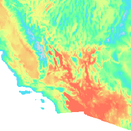
var dataset = ee.ImageCollection('IDAHO_EPSCOR/MACAv2_METDATA_MONTHLY')\n .filter(ee.Filter.date('2018-07-01', '2018-08-01'));\nvar maximumTemperature = dataset.select('tasmax');\nvar maximumTemperatureVis = {\n min: 290.0,\n max: 314.0,\n palette: ['d8d8d8', '4addff', '5affa3', 'f2ff89', 'ff725c'],\n};\nMap.setCenter(-115.356, 38.686, 5);\nMap.addLayer(maximumTemperature, maximumTemperatureVis, 'Maximum Temperature');\n```\n[Open in Code Editor](https://code.earthengine.google.com/?scriptPath=Examples:Datasets/IDAHO_EPSCOR/IDAHO_EPSCOR_MACAv2_METDATA_MONTHLY) \n[MACAv2-METDATA Monthly Summaries: University of Idaho, Multivariate Adaptive Constructed Analogs Applied to Global Climate Models](/earth-engine/datasets/catalog/IDAHO_EPSCOR_MACAv2_METDATA_MONTHLY) \nThe MACAv2-METDATA dataset is a collection of 20 global climate models covering the conterminous USA. The Multivariate Adaptive Constructed Analogs (MACA) method is a statistical downscaling method which utilizes a training dataset (i.e. a meteorological observation dataset) to remove historical biases and match spatial patterns in climate model output. The ... \nIDAHO_EPSCOR/MACAv2_METDATA_MONTHLY, climate,conus,geophysical,idaho,maca,monthly \n1900-01-01T00:00:00Z/2099-12-31T00:00:00Z \n24.9 -124.9 49.6 -67 \nGoogle Earth Engine \nhttps://developers.google.com/earth-engine/datasets\n\n- [](https://doi.org/http://www.climatologylab.org/maca.html)\n- [](https://doi.org/https://developers.google.com/earth-engine/datasets/catalog/IDAHO_EPSCOR_MACAv2_METDATA_MONTHLY)"]]