ALOS World 3D - 30m (AW3D30) هي مجموعة بيانات عالمية لنموذج السطح الرقمي (DSM) بدقة أفقية تبلغ حوالي 30 مترًا (شبكة ثانية قوسية واحدة). تستند مجموعة البيانات إلى مجموعة بيانات DSM
(إصدار شبكة 5 أمتار) من بيانات التضاريس ثلاثية الأبعاد العالمية.
يمكنك الاطّلاع على مزيد من التفاصيل في المستندات الخاصة بمجموعة البيانات.
تجمع مجموعة البيانات التي تمّت إضافتها هذه البيانات من الإصدارات 3.1 و4.0 و4.1.
الإصدار 4.1 (أبريل 2024): يتضمّن هذا التحديث الرئيسي 19,051 قطعة تغطي مناطق العالم (باستثناء القارة القطبية الجنوبية واليابان). تتضمّن هذه النسخة بيانات تكميلية جديدة لملء الفراغات وتصحيح الحالات الشاذة الجزئية التي تم رصدها في الإصدارَين 3.1 و3.2، بالإضافة إلى إعادة ملء الفراغات. للحصول على معلومات حول تعديلات معيّنة على المربّعات في الإصدار 4.1، يُرجى استخدام فلتر الإصدار 4.1 على مربّعات الخرائط أو الرجوع إلى أحدث وصف للتنسيق.
الإصدار 4.0 (أبريل 2023): تم إصدار 1,886 قطعة في هذا التحديث، ما أدّى إلى تحسين المناطق الواقعة عند خطوط العرض المنخفضة والمتوسطة والمناطق الواقعة جنوب خط عرض 60 درجة.
تشمل التغييرات الرئيسية ما يلي:
1. بيانات تكميلية جديدة لملء الفراغات
2. تصحيح التشوهات الجزئية وإعادة ملء الفراغات (بقعتان).
3- تم تعديل السواحل للمناطق الواقعة جنوب خط العرض 60 درجة (44 مربّعًا).
4. تم إيقاف قناع المياه لبحر قزوين واستكماله ببيانات الارتفاع
(54 مربّعًا).
5- تم استخراج مناطق جديدة جزئية غير طبيعية وتصحيحها في أمريكا الجنوبية (1,786 قطعة).
6. للحصول على معلومات تفصيلية حول المربّعات في الإصدار 4.0، يُرجى استخدام فلتر الإصدار 4.0 على مربّعات الخرائط أو الرجوع إلى وصف التنسيق.
الإصدار 3.2، الذي تم إطلاقه في كانون الثاني (يناير) 2021، هو إصدار محسّن تم إنشاؤه من خلال إعادة النظر في التنسيق في منطقة خطوط العرض العالية والبيانات المساعدة وطريقة المعالجة. تم اعتماد مسافة مختلفة بين وحدات البكسل لكل منطقة خط عرض في منطقة خط العرض المرتفع. تم تغيير بيانات السواحل، وهي إحدى مجموعات البيانات المساعدة، وتم استخدام بيانات تكميلية جديدة. بالإضافة إلى ذلك، تم استخدام الإصدار 3 من AW3D كمصدر بيانات لليابان.
علاوةً على ذلك، تم تحسين طريقة رصد القيم الشاذة في العملية.
يتم احتساب ارتفاع نموذج التضاريس الرقمي AW3D DSM من خلال عملية مطابقة الصور
تستخدم زوجًا مجسمًا من الصور الضوئية. يتم تحديد السُحب والثلج والجليد تلقائيًا أثناء المعالجة وتطبيق معلومات القناع. ومع ذلك، تبقى أحيانًا نقاط غير متطابقة، خاصةً حول (أو على حواف) مناطق السحب والثلج والجليد، ما يتسبّب في حدوث بعض الأخطاء في الارتفاع في نموذج DSM النهائي.
النطاقات
حجم البكسل 30 مترًا
النطاقات
الاسم
الحد الأدنى
الحد الأقصى
حجم البكسل
الوصف
DSM
-433*
8768*
أمتار
الارتفاع فوق مستوى سطح البحر عدد صحيح ذو 16 بت
الارتفاع (بالمتر) الذي تم تحويله من الارتفاع الإهليلجي استنادًا إلى نظام ITRF97
وGRS80، باستخدام نموذج الجيود EGM96†1.
STK
1*
54*
أمتار
تمثّل هذه السمة عدد عمليات التجميع لوحدة DSM الخاصة بالمشهد المستخدَمة في إنتاج DSM. يتم اشتقاق النطاق من خلال إعادة أخذ عينات من رقم التجميع بدقة 5 أمتار إلى دقة 30 مترًا.
MSK
أمتار
قناع 8 بت للنطاق
قناع البتات لـ MSK
وحدات البت من 0 إلى 7: تم إنشاؤها من نموذج DSM الذي تمت إعادة أخذ عيّنات منه.
0: صالح
1: قناع السحب والثلج (غير صالح)
2: قناع المياه البرية والارتباط المنخفض (صالح)
3: قناع البحر (صالح)
4: فراغ مملوء بـ GSI DTM (صالح)
8: تم ملء الفراغ باستخدام بيانات من مهمة التصوير الطبوغرافي الراداري المكوكية
الإصدار 3 من SRTM-1 (صالح).
12: تم ملء الفراغ باستخدام PRISM DSM (صالح).
16: تم ملء الفراغ بنموذج الارتفاع الرقمي (DEM) الخاص بـ ViewFinder Panoramas (صالح).
24: تم ملء المساحة الفارغة باستخدام ASTER GDEM v2 (صالح).
28: تم ملء الفراغ باستخدام ArcticDEM v2 (صالح).
32: فراغ مملوء بنموذج ارتفاع رقمي (DEM) صالح من TanDEM-X بدقة 90 مترًا
36: تم ملء الفراغ باستخدام الإصدار 3 من ArcticDEM (صالح).
40: تم ملء الفراغ باستخدام ASTER GDEM الإصدار 3 (صالح).
44: تم ملء الفراغ باستخدام الإصدار 1.1 من REMA (صالح).
48: تم ملء الفراغ باستخدام بيانات Copernicus DEM GLO-30 (صالحة).
52: تم ملء الفراغ باستخدام ArcticDEM الإصدار 4 (صالح).
252: تم ملء الفراغ باستخدام طريقة IDW المطبَّقة (gdal_fillnodata) (صالح)
"تي Tadono, H. Ishida, F. أودا، إس. نايتو، ك. Minakawa, H. Iwamoto
Precise Global DEM Generation By ALOS PRISM, ISPRS Annals of
the Photogrammetry, Remote Sensing and Spatial Information Sciences,
Vol.II-4, pp.71-76, 2014. ملف PDF
ي. Takaku, T. تادونو، ك. Tsutsui : Generation of High Resolution
Global DSM from ALOS PRISM, The International Archives of the Photogrammetry,
Remote Sensing and Spatial Information Sciences, Vol. XL-4, pp.243-248,
ISPRS, 2014. ملف PDF
ي. Takaku, T. تادونو، ك. Tsutsui, M. Ichikawa : Validation of
'AW3D' Global DSM Generated from ALOS PRISM, ISPRS
Annals of the Photogrammetry, Remote Sensing and Spatial Information
Sciences, Vol.III-4, pp.25-31, 2016. ملف PDF
"تي Tadono, H. Nagai, H. Ishida, F. أودا، إس. نايتو، ك. Minakawa,
H. Iwamoto : Initial Validation of the 30 m-mesh Global Digital
Surface Model Generated by ALOS PRISM, The International Archives
of the Photogrammetry, Remote Sensing and Spatial Information Sciences,
ISPRS, Vol. XLI-B4, pp.157-162, 2016. ملف PDF
ي. Takaku, T. Tadono, M. Doutsu, F. Ohgushi وH. Kai, : "Updates of
'AW3D30' ALOS Global Digital Surface Model in Antarctica with Other Open
Access Datasets", Int. Arch. Photogramm. Remote Sens. Spatial Inf. Sci.,
XLIII-B4-2021، من 401 إلى 408، 2021. ملف PDF
ALOS World 3D - 30m (AW3D30) هي مجموعة بيانات عالمية لنموذج السطح الرقمي (DSM) بدقة أفقية تبلغ حوالي 30 مترًا (شبكة ثانية قوسية واحدة). تستند مجموعة البيانات إلى مجموعة بيانات نموذج التضاريس الرقمي (DSM) (إصدار شبكة 5 أمتار) من بيانات التضاريس ثلاثية الأبعاد العالمية. تتوفّر تفاصيل إضافية في مستندات مجموعة البيانات. …
[null,null,[],[],[],null,["# ALOS DSM: Global 30m v4.1\n\nDataset Availability\n: 2006-01-24T00:00:00Z--2011-05-12T00:00:00Z\n\nDataset Provider\n:\n\n\n [JAXA Earth Observation Research Center](https://www.eorc.jaxa.jp/ALOS/en/dataset/aw3d30/aw3d30_e.htm)\n\nTags\n:\n[alos](/earth-engine/datasets/tags/alos) [dem](/earth-engine/datasets/tags/dem) [elevation](/earth-engine/datasets/tags/elevation) [elevation-topography](/earth-engine/datasets/tags/elevation-topography) [geophysical](/earth-engine/datasets/tags/geophysical) [jaxa](/earth-engine/datasets/tags/jaxa) [topography](/earth-engine/datasets/tags/topography) \n\n#### Description\n\nALOS World 3D - 30m (AW3D30) is a global digital surface\nmodel (DSM) dataset with a horizontal resolution of approximately\n30 meters (1 arcsec mesh). The dataset is based on the DSM dataset\n(5-meter mesh version) of the [World 3D Topographic Data](https://www.aw3d.jp/en/).\nMore details are available in the dataset [documentation](https://www.eorc.jaxa.jp/ALOS/en/dataset/aw3d30/data/aw3d30v4.1_product_e_1.0.pdf).\n\nThis ingested dataset combines data from versions 3.1, 4.0, and 4.1.\n\nVersion 4.1 (April 2024): This major update released 19,051 tiles covering\nglobal regions (excluding Antarctica and Japan). It incorporates new\nsupplementary data for void filling and corrects partial anomalies found in\nversions 3.1 and 3.2, along with re-filling voids. For specific tile updates\nin v4.1, please use the v4.1 filter on map tiles or consult the latest\nformat description.\n\nVersion 4.0 (April 2023): This update released 1,886 tiles, improving low\nand mid-latitude regions and areas south of 60 degrees latitude.\n\nKey changes include:\n1. New supplementary data for void filling.\n2. Correction of partial anomalies and re-filling of voids (2 tiles).\n3. Updated coastlines for regions south of 60 degrees latitude (44 tiles).\n4. Disabled Caspian Sea water mask and supplemented with elevation data\n(54 tiles).\n5. Extracted and corrected new partial anomaly areas in South America\n(1,786 tiles).\n6. For detailed tile information for v4.0, please use the v4.0 filter on\nmap tiles or refer to the format description.\n\nVersion 3.2, released in January 2021, is an improved version created by\nreconsidering the format in the high latitude area, auxiliary data, and\nprocessing method. Different pixel spacing for each latitude zone was\nadopted at high latitude area. Coastline data, which is one of the\nauxiliary datasets, was changed, and new supplementary data was used. In\naddition, as a source data for Japan, AW3D version 3 was also used.\nFurthermore, the method of detecting anomalous values in the process was\nimproved.\n| **Note:** See the code example for the recommended way of computing slope. Unlike most DEMs in Earth Engine, this is an image collection due to multiple resolutions of source files that make it impossible to mosaic them into a single asset, so the slope computations need a reprojection.\n\nThe AW3D DSM elevation is calculated by an image matching process\nthat uses a stereo pair of optical images. Clouds, snow, and ice are\nautomatically identified during processing and applied the\nmask information. However, mismatched points sometimes\nremain especially surrounding (or at the edges of) clouds, snow,\nand ice areas, which cause some height errors in the final DSM.\n\n### Bands\n\n\n**Pixel Size**\n\n30 meters\n\n**Bands**\n\n| Name | Min | Max | Pixel Size | Description |\n|-------|--------|--------|------------|-------------------------------------------------------------------------------------------------------------------------------------------------------------|---|---|---|---|---|---|---|---|---|---|---|---|---|---|---|---|---|---|---|---|---|---|---|---|---|---|---|---|---|---|---|---|---|---|---|---|---|---|---|---|---|---|---|---|---|---|---|---|---|---|---|---|---|---|---|---|---|---|---|---|---|---|---|---|---|---|---|---|---|---|---|---|---|---|---|---|---|---|---|---|---|---|---|---|---|---|---|---|---|---|---|---|---|---|---|\n| `DSM` | -433\\* | 8768\\* | meters | Height above sea level. Signed 16 bits. Elevation (in meter) converted from the ellipsoidal height based on ITRF97 and GRS80, using EGM96†1 geoid model. |\n| `STK` | 1\\* | 54\\* | meters | Stacking number of the scene unit DSM used in producing DSM. The band is derived by resampling the stacking number for 5m resolution DSM to 30m resolution. |\n| `MSK` | | | meters | 8-bit mask for the band. |\n| Bitmask for MSK - Bits 0-7: Generated from resampled DSM. - 0: Valid - 1: Cloud and snow mask (invalid). - 2: Land water and low correlation mask (valid). - 3: Sea mask (valid). - 4: Void filled with GSI DTM (valid). - 8: Void filled with Shuttle Radar Topography Mission SRTM-1 Version 3 (valid). - 12: Void filled with PRISM DSM (valid). - 16: Void filled with ViewFinder Panoramas DEM (valid). - 24: Void filled with ASTER GDEM v2 (valid). - 28: Void filled with ArcticDEM v2 (valid). - 32: Void filled with TanDEM-X 90m DEM (valid). - 36: Void filled with ArcticDEM v3 (valid). - 40: Void filled with ASTER GDEM v3 (valid). - 44: Void filled with REMA v1.1 (valid). - 48: Void filled with Copernicus DEM GLO-30 (valid). - 52: Void filled with ArcticDEM v4 (valid). - 252: Void filled with applied IDW method (gdal_fillnodata) (valid) ||||||||||||||||||||||||||||||||||||||||||||||||||||||||||||||||||||||||||||||||||||||||||||||||||||\n\n\\* estimated min or max value\n\n### Terms of Use\n\n**Terms of Use**\n\nThis dataset is available to use with no charge under\nthe conditions specified in the [Terms of use for ALOS Global Digital\nSurface Model](https://earth.jaxa.jp/en/data/policy/).\n\n### Citations\n\nCitations:\n\n-\n\n T. Tadono, H. Ishida, F. Oda, S. Naito, K. Minakawa, H. Iwamoto\n : Precise Global DEM Generation By ALOS PRISM, ISPRS Annals of\n the Photogrammetry, Remote Sensing and Spatial Information Sciences,\n Vol.II-4, pp.71-76, 2014. [PDF file](https://www.isprs-ann-photogramm-remote-sens-spatial-inf-sci.net/II-4/71/2014/isprsannals-II-4-71-2014.pdf)\n- J. Takaku, T. Tadono, K. Tsutsui : Generation of High Resolution\n Global DSM from ALOS PRISM, The International Archives of the Photogrammetry,\n Remote Sensing and Spatial Information Sciences, Vol. XL-4, pp.243-248,\n ISPRS, 2014. [PDF file](https://www.int-arch-photogramm-remote-sens-spatial-inf-sci.net/XL-4/243/2014/isprsarchives-XL-4-243-2014.pdf)\n- J. Takaku, T. Tadono, K. Tsutsui, M. Ichikawa : Validation of\n 'AW3D' Global DSM Generated from ALOS PRISM, ISPRS\n Annals of the Photogrammetry, Remote Sensing and Spatial Information\n Sciences, Vol.III-4, pp.25-31, 2016. [PDF file](https://www.isprs-ann-photogramm-remote-sens-spatial-inf-sci.net/III-4/25/2016/isprs-annals-III-4-25-2016.pdf)\n- T. Tadono, H. Nagai, H. Ishida, F. Oda, S. Naito, K. Minakawa,\n H. Iwamoto : Initial Validation of the 30 m-mesh Global Digital\n Surface Model Generated by ALOS PRISM, The International Archives\n of the Photogrammetry, Remote Sensing and Spatial Information Sciences,\n ISPRS, Vol. XLI-B4, pp.157-162, 2016. [PDF file](https://www.int-arch-photogramm-remote-sens-spatial-inf-sci.net/XLI-B4/157/2016/isprs-archives-XLI-B4-157-2016.pdf)\n- J. Takaku, T. Tadono, M. Doutsu, F. Ohgushi, and H. Kai, : \"Updates of\n 'AW3D30' ALOS Global Digital Surface Model in Antarctica with Other Open\n Access Datasets\", Int. Arch. Photogramm. Remote Sens. Spatial Inf. Sci.,\n XLIII-B4-2021, 401-408, 2021. [PDF file](https://www.int-arch-photogramm-remote-sens-spatial-inf-sci.net/XLIII-B4-2021/401/2021/isprs-archives-XLIII-B4-2021-401-2021.pdf)\n\n### Explore with Earth Engine\n\n| **Important:** Earth Engine is a platform for petabyte-scale scientific analysis and visualization of geospatial datasets, both for public benefit and for business and government users. Earth Engine is free to use for research, education, and nonprofit use. To get started, please [register for Earth Engine access.](https://console.cloud.google.com/earth-engine)\n\n### Code Editor (JavaScript)\n\n```javascript\n
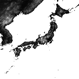
var dataset = ee.ImageCollection('JAXA/ALOS/AW3D30/V4_1');\nvar elevation = dataset.select('DSM');\nvar elevationVis = {\n min: 0,\n max: 5000,\n palette: ['0000ff', '00ffff', 'ffff00', 'ff0000', 'ffffff']\n};\nMap.setCenter(138.73, 35.36, 11);\nMap.addLayer(elevation, elevationVis, 'Elevation');\n\n// Reproject an image mosaic using a projection from one of the image tiles,\n// rather than using the default projection returned by .mosaic().\nvar proj = elevation.first().select(0).projection();\nvar slopeReprojected = ee.Terrain.slope(elevation.mosaic()\n .setDefaultProjection(proj));\nMap.addLayer(slopeReprojected, {min: 0, max: 45}, 'Slope');\n```\n[Open in Code Editor](https://code.earthengine.google.com/?scriptPath=Examples:Datasets/JAXA/JAXA_ALOS_AW3D30_V4_1) \n[ALOS DSM: Global 30m v4.1](/earth-engine/datasets/catalog/JAXA_ALOS_AW3D30_V4_1) \nALOS World 3D - 30m (AW3D30) is a global digital surface model (DSM) dataset with a horizontal resolution of approximately 30 meters (1 arcsec mesh). The dataset is based on the DSM dataset (5-meter mesh version) of the World 3D Topographic Data. More details are available in the dataset documentation. ... \nJAXA/ALOS/AW3D30/V4_1, alos,dem,elevation,elevation-topography,geophysical,jaxa,topography \n2006-01-24T00:00:00Z/2011-05-12T00:00:00Z \n-90 -180 90 180 \nGoogle Earth Engine \nhttps://developers.google.com/earth-engine/datasets\n\n- [](https://doi.org/https://www.eorc.jaxa.jp/ALOS/en/dataset/aw3d30/aw3d30_e.htm)\n- [](https://doi.org/https://developers.google.com/earth-engine/datasets/catalog/JAXA_ALOS_AW3D30_V4_1)"]]