- 資料集可用性
- 2001-01-01T00:00:00Z–2021-01-01T00:00:00Z
- 資料集來源
- 歐盟執委會聯合研究中心 (European Commission, Joint Research Centre),全球野火資訊系統 (Global Wildfire Information System)
- 標記
說明
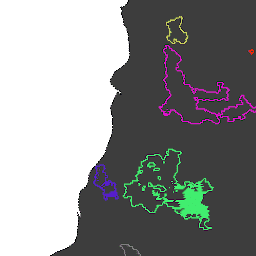
火災邊界是根據 MODIS 資料集 MCD64A1 繪製。這些資料是根據演算法計算得出,該演算法會將燒毀區域的時空關係編碼至圖形結構中。
每起火災都有專屬號碼,可識別該事件。
資料表結構定義
資料表結構定義
| 名稱 | 類型 | 說明 |
|---|---|---|
| ID | INT | 火災的數字 ID |
| InitialDate | INT | 自 1970 年 1 月 1 日起算,以毫秒為單位的初始觸發日期 |
使用條款
使用條款
引用內容
引用內容:
Artés, T.、Oom, D.、De Rigo, D.、Durrant, T. H. Maianti, P.、Libertà, G.、& San-Miguel-Ayanz, J. (2019). 全球野火資料集,用於分析火災制度和火災行為。Scientific data, 6(1), 1-11. doi:10.1038/s41597-019-0312-2
DOI
使用 Earth Engine 探索
程式碼編輯器 (JavaScript)
// Folder name for a series of tables.
var folder = 'JRC/GWIS/GlobFire/v2/DailyPerimeters';

// List available tables using ee.data.listAssets with asynchronous callback.
function printAssetList(listAssetsOutput) {
  print('Asset list:', listAssetsOutput['assets']);
}
ee.data.listAssets(folder, {}, printAssetList);

// Define a table name (table id) identified from the list of available tables.
var tableName = 'JRC/GWIS/GlobFire/v2/DailyPerimeters/2020';

var computeArea = function(f) {
  return f.set({'area': f.area()});
};

// Import a selected table as a FeatureCollection.
var features = ee.FeatureCollection(tableName).map(computeArea);

// Visualization parameters for linear fire area gradient.
var visParams = {
  palette: ['f5ff64', 'b5ffb4', 'beeaff', 'ffc0e8', '8e8dff', 'adadad'],
  min: 0,
  max: 600000000,
  opacity: 0.8,
};

// Paint fire perimeters to an image using computed fire area as the value property.
var image = ee.Image().float().paint(features, 'area');

// Display the image to the map (include features for exploring with Inspector).
Map.addLayer(image, visParams, 'GlobFire 2020');
Map.addLayer(features, null, 'For Inspector', false);
Map.setCenter(-121.23, 39.7, 12);