- Disponibilidade do conjunto de dados
- 2000-01-01T00:00:00Z–2001-01-01T00:00:00Z
- Produtor de conjunto de dados
- NASA SEDAC no Center for International Earth Science Information Network
- Tags
Descrição
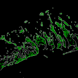
O banco de dados foi preparado usando dados de satélite Landsat do ano 2000. Mais de mil cenas do Landsat obtidas do Centro de Observação e Ciência de Recursos da Terra (EROS,na sigla em inglês) do USGS foram classificadas usando técnicas híbridas de classificação de imagens digitais supervisionadas e não supervisionadas. Esse banco de dados é a primeira e mais abrangente avaliação de manguezais do mundo (Giri et al., 2011). O financiamento parcial desta pesquisa foi fornecido pela NASA.
O banco de dados de manguezais está sendo usado para identificar áreas prioritárias para a conservação de manguezais, estudar o papel das florestas de mangue na proteção de vidas e propriedades contra desastres naturais (por exemplo, tsunamis), contabilidade de carbono e conservação da biodiversidade. O USGS EROS usa os dados para estudar o impacto do aumento do nível do mar nos ecossistemas de manguezais. O banco de dados serve como um valor de referência para o monitoramento de manguezais.
Bandas
Bandas
Tamanho do pixel: 30 metros (todas as bandas)
| Nome | Tamanho do pixel | Descrição |
|---|---|---|
1 |
30 metros | Manguezais |
1 Tabela de classes
| Valor | Cor | Descrição |
|---|---|---|
| 1 | #d40115 | Manguezais |
Termos de Uso
Termos de Uso
Os conjuntos de dados do Landsat são criados pelo governo federal e, portanto, pertencem ao domínio público. Eles podem ser usados, transferidos ou reproduzidos sem restrição de direitos autorais.
O USGS precisa ser reconhecido ou creditado como fonte de dados. Para isso, inclua uma linha de citação de texto, como no exemplo abaixo.
(Nome do produto, da imagem, da fotografia ou do conjunto de dados) cortesia do Serviço Geológico dos EUA
Exemplo: imagem do Landsat-7, cortesia do Serviço Geológico dos EUA
Consulte as diretrizes do sistema de identidade visual do USGS para mais detalhes sobre a citação e o reconhecimento adequados dos produtos do USGS.
Citações
Giri, C., E. Ochieng, L.L.Tieszen, Z. Zhu, A. Singh, T. Loveland, J. Masek, e N. Duke. 2013. Distribuição global de florestas de mangue, 2000. Palisades, NY: NASA Socioeconomic Data and Applications Center (SEDAC). https://doi.org/10.7927/H4J67DW8. Acessado em DIA MÊS ANO
Giri, C., E. Ochieng, L. L. Tieszen, Z. Zhu, A. Singh, T. Loveland, J. Masek, e N. Duke. 2010. Status and Distribution of Mangrove Forests of the World Using Earth Observation Satellite Data. Global Ecology and Biogeography: A Journal of Macroecology 20(1): 154-159. https://doi.org/10.1111/j.1466-8238.2010.00584.x.
Identificadores DOI
Explore com o Earth Engine
Editor de código (JavaScript)
var dataset = ee.ImageCollection('LANDSAT/MANGROVE_FORESTS');
var mangrovesVis = {
  min: 0,
  max: 1.0,
  palette: ['d40115'],
};
Map.setCenter(-44.5626, -2.0164, 9);
Map.addLayer(dataset, mangrovesVis, 'Mangroves');