EMIT 프로젝트는 NASA 지구과학부 (ESD)의 프로그램 책임자가 지휘하는 Earth Venture-Instrument (EV-I) 프로그램의 일부입니다.
EMIT는 국제우주정거장 (ISS)에 설치할 수 있도록 개조된 VSWIR 적외선 Dyson 이미징 분광계로 구성됩니다. EMIT는 380~2,500나노미터 사이의 복사량을 측정하며, 대역폭은 약 7nm입니다.
데이터는 적도에서 폭이 약 75km인 스와스에서 수집되며 지상 샘플링 거리는 약 60m입니다. 자세한 내용은 제공업체의 NASA EMIT 개요를 참고하세요.
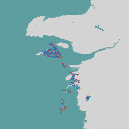
EMIT는 메탄, 이산화탄소, 수증기를 비롯한 온실가스를 매핑하는 데 특히 유용한 도구였습니다. 이는 항공 데이터의 이전 결과와 일치하지만, EMIT의 전 세계적 특성, 재방문 빈도, 넓은 스와스 덕분에 온실가스 검색을 조사할 수 있는 전례 없는 기회가 제공되었습니다.
EMIT 2B단계 추정 메탄 기둥 복합체 (EMITL2BCH4PLM) 버전 1 데이터 제품은 불확실성 데이터와 함께 백만 분의 1 미터 (ppm m) 단위로 추정된 메탄 기둥 복합체를 제공합니다. EMITL2BCH4PLM 데이터 제품은 메탄 기둥 복합체가 식별된 경우에만 생성됩니다.
대역
Pixel Size 72000 meters
대역
이름
단위
픽셀 크기
설명
methane_plume_complex
ppm m
미터
예상 메탄 기둥 복합체입니다.
이미지 속성
이미지 속성
이름
유형
설명
global_plume_identifier
문자열
전역 플룸 식별 번호
Concentration_Uncertainty
DOUBLE
농도의 불확실성
DAAC_Scene_Names
STRING_LIST
DAAC 장면 이름
DAAC_Scene_Numbers
STRING_LIST
DAAC 장면 번호
DCID
문자열
데이터 수집 식별자
Latitude_of_max_concentration
DOUBLE
농도가 가장 높은 위도
Longitude_of_max_concentration
DOUBLE
최대 농도의 경도
Max_Plume_Concentration
DOUBLE
최대 연기 농도
오비트
문자열
고유 궤도 번호
Plume_ID
문자열
고유 연기 식별 번호
Scene_FIDs
STRING_LIST
장면 FID
이용약관
이용약관
LP DAAC를 통해 획득한 NASA EMIT 데이터 및 제품에는 후속 사용, 판매 또는 재배포에 제한이 없습니다.
인용
인용:
Green, R., Thorpe, A., Brodrick, P., Chadwick, D., Elder, C.,
Villanueva-Weeks, C., Fahlen, J., Coleman, R., Jensen, D., Olsen-Duvall, W.,
Lundeen, S., Lopez, A., Thompson, D. (2023). EMIT L2B Estimated Methane
Plume Complexes 60 m V001 [데이터 세트]. NASA EOSDIS Land Processes Distributed
Active Archive Center. https://doi.org/10.5067/EMIT/EMITL2BCH4PLM.001에서 2024년 3월 6일에 액세스함
EMIT 프로젝트는 NASA 지구과학부 (ESD) 프로그램 디렉터가 지휘하는 Earth Venture-Instrument (EV-I) 프로그램의 일부입니다. EMIT는 국제우주정거장 (ISS)에 설치할 수 있도록 개조된 VSWIR 적외선 다이슨 이미징 분광계로 구성됩니다. EMIT는 380~2,500나노미터 사이의 복사 휘도를 측정합니다.
[null,null,[],[[["\u003cp\u003eThe NASA EMIT L2B Estimated Methane Plume Complexes dataset provides estimated methane plume complexes and uncertainty data in parts per million meter (ppm m).\u003c/p\u003e\n"],["\u003cp\u003eData is collected globally by the EMIT instrument on the International Space Station with a ground sampling distance of 60m and a swath width of ~75km.\u003c/p\u003e\n"],["\u003cp\u003eThis dataset is useful for identifying and quantifying methane plumes, supporting greenhouse gas research and environmental monitoring efforts.\u003c/p\u003e\n"],["\u003cp\u003eEMIT data is freely available for use, sale, and redistribution without restrictions.\u003c/p\u003e\n"],["\u003cp\u003eThe dataset can be accessed and analyzed through Google Earth Engine using the provided code snippet.\u003c/p\u003e\n"]]],[],null,["# Earth Surface Mineral Dust Source Investigation- Methane Plume Complexes\n\nDataset Availability\n: 2022-08-10T00:00:00Z--2024-10-26T17:21:33Z\n\nDataset Provider\n:\n\n\n [NASA Jet Propulsion Laboratory](https://earth.jpl.nasa.gov/emit/data/data-products/)\n\nCadence\n: 1 Day\n\nTags\n:\n[atmosphere](/earth-engine/datasets/tags/atmosphere) [daily](/earth-engine/datasets/tags/daily) [emit](/earth-engine/datasets/tags/emit) [methane](/earth-engine/datasets/tags/methane) [nasa](/earth-engine/datasets/tags/nasa) \n\n#### Description\n\nThe EMIT Project is part of the Earth Venture-Instrument (EV-I) Program\ndirected by the Program Director of the NASA Earth Science Division (ESD).\nEMIT is comprised of a VSWIR Infrared Dyson imaging spectrometer adapted for\ninstallation on the International Space Station (ISS). EMIT measures\nradiance between 380 and 2500 nanometers, with an approximate 7 nm bandpass.\nData are collected in a swath that is approximately 75 km wide at the\nequator, with an approximate ground sampling distance of 60 m. See the\nprovider's [NASA EMIT Overview](https://lpdaac.usgs.gov/documents/1695/EMIT_L2B_GHG_User_Guide_V1.pdf)\nfor more details.\n\nEMIT was a particularly useful tool for mapping out greenhouse gases,\nincluding methane, carbon dioxide, and water vapor. This is consistent with\nprevious findings from airborne data, but global nature, revisit frequency\nand wide swath of EMIT provided an unprecedented opportunity to investigate\ngreenhouse gas retrievals.\n\nThe EMIT Level 2B Estimated Methane Plume Complexes (EMITL2BCH4PLM) Version\n1 data product provides estimated methane plume complexes in parts per\nmillion meter (ppm m) along with uncertainty data. The EMITL2BCH4PLM data\nproduct will only be generated where methane plume complexes have been\nidentified.\n\n### Bands\n\n\n**Pixel Size**\n\n72000 meters\n\n**Bands**\n\n| Name | Units | Pixel Size | Description |\n|-------------------------|-------|------------|----------------------------------|\n| `methane_plume_complex` | ppm m | meters | Estimated Methane plume complex. |\n\n### Image Properties\n\n**Image Properties**\n\n| Name | Type | Description |\n|--------------------------------|-------------|--------------------------------------|\n| global_plume_identifier | STRING | Global Plume Identification Number |\n| Concentration_Uncertainty | DOUBLE | Uncertainity in Concentration |\n| DAAC_Scene_Names | STRING_LIST | DAAC Scene Names |\n| DAAC_Scene_Numbers | STRING_LIST | DAAC Scene Numbers |\n| DCID | STRING | Data Collection Identifier |\n| Latitude_of_max_concentration | DOUBLE | Latitute with maximum concentration |\n| Longitude_of_max_concentration | DOUBLE | Longitude with maximum concentration |\n| Max_Plume_Concentration | DOUBLE | Maximum Plume Concentration |\n| Orbit | STRING | Unique orbit number |\n| Plume_ID | STRING | Unique Plume Identification number |\n| Scene_FIDs | STRING_LIST | Scene FIDs |\n\n### Terms of Use\n\n**Terms of Use**\n\nNASA EMIT data and products acquired through the LP DAAC\nhave no restrictions on subsequent use, sale, or redistribution.\n\n### Citations\n\nCitations:\n\n- Green, R., Thorpe, A., Brodrick, P., Chadwick, D., Elder, C.,\n Villanueva-Weeks, C., Fahlen, J., Coleman, R., Jensen, D., Olsen-Duvall, W.,\n Lundeen, S., Lopez, A., Thompson, D. (2023). EMIT L2B Estimated Methane\n Plume Complexes 60 m V001 \\[Data set\\]. NASA EOSDIS Land Processes Distributed\n Active Archive Center. Accessed 2024-03-06 from\n \u003chttps://doi.org/10.5067/EMIT/EMITL2BCH4PLM.001\u003e\n\n### DOIs\n\n- \u003chttps://doi.org/10.5067/EMIT/EMITL2BCH4PLM.001\u003e\n\n### Explore with Earth Engine\n\n| **Important:** Earth Engine is a platform for petabyte-scale scientific analysis and visualization of geospatial datasets, both for public benefit and for business and government users. Earth Engine is free to use for research, education, and nonprofit use. To get started, please [register for Earth Engine access.](https://console.cloud.google.com/earth-engine)\n\n### Code Editor (JavaScript)\n\n```javascript\nvar dataset = ee.ImageCollection('NASA/EMIT/L2B/CH4PLM');\nvar emitEnhancement = dataset.select('methane_plume_complex');\nvar emitEnhancementVis = {\n min: 0,\n max: 100.0,\n palette: ['d7191c', 'fdae61', 'ffffbf', 'abd9e9', '2c7bb6'],\n};\nMap.setCenter(53.99, 39.11, 8);\nMap.addLayer(\n emitEnhancement, emitEnhancementVis,\n 'Emit Enhancement');\n```\n[Open in Code Editor](https://code.earthengine.google.com/?scriptPath=Examples:Datasets/NASA/NASA_EMIT_L2B_CH4PLM) \n[Earth Surface Mineral Dust Source Investigation- Methane Plume Complexes](/earth-engine/datasets/catalog/NASA_EMIT_L2B_CH4PLM) \nThe EMIT Project is part of the Earth Venture-Instrument (EV-I) Program directed by the Program Director of the NASA Earth Science Division (ESD). EMIT is comprised of a VSWIR Infrared Dyson imaging spectrometer adapted for installation on the International Space Station (ISS). EMIT measures radiance between 380 and 2500 nanometers, ... \nNASA/EMIT/L2B/CH4PLM, atmosphere,daily,emit,methane,nasa \n2022-08-10T00:00:00Z/2024-10-26T17:21:33Z \n-90 -180 90 180 \nGoogle Earth Engine \nhttps://developers.google.com/earth-engine/datasets\n\n- [https://doi.org/10.5067/EMIT/EMITL2BCH4PLM.001](https://doi.org/https://earth.jpl.nasa.gov/emit/data/data-products/)\n- [https://doi.org/10.5067/EMIT/EMITL2BCH4PLM.001](https://doi.org/https://developers.google.com/earth-engine/datasets/catalog/NASA_EMIT_L2B_CH4PLM)"]]