The Landsat Vegetation Continuous Fields (VCF) tree cover layers contain
estimates of the percentage of horizontal ground in each 30-m pixel covered
by woody vegetation greater than 5 meters in height. The dataset is available
for four epochs centered on the years 2000, 2005, 2010 and 2015. The dataset
is derived from the GFCC Surface Reflectance product (GFCC30SR), which is
based on enhanced Global Land Survey (GLS) datasets. The GLS datasets are
composed of high-resolution Landsat 5 Thematic Mapper (TM) and Landsat 7
Enhanced Thematic Mapper Plus (ETM+) images at 30 meter resolution.
Tree cover, the proportional, vertically projected area of vegetation
(including leaves, stems, branches, etc.) of woody plants above a given
height, affects terrestrial energy and water exchanges, photosynthesis and
transpiration, net primary production, and carbon and nutrient fluxes. Tree
cover also affects habitat quality and movements of wildlife, residential
property value for humans, and other ecosystem services. The continuous
classification scheme of the VCF product enables better depiction of land
cover gradients than traditional discrete classification schemes.
Importantly for detection and monitoring of forest changes (e.g.,
deforestation and degradation), tree cover provides a measurable attribute
upon which to define forest cover and its changes. Changes in tree cover
over time can be used to monitor and retrieve site-specific histories of
forest change.
The dataset has been produced for four year epochs: 2000, 2005, 2010, and
2015 with an image in the collection for each available WRS2 path/row.
Provider's Note: Due to the end of NASA MEaSUREs funding, free versions of this dataset are no
longer being produced. Interested parties can obtain updated and expanded versions at
www.terraPulse.com.
Bands
Pixel Size 30 meters
Bands
Name
Units
Min
Max
Pixel Size
Description
tree_canopy_cover
%
0
100
meters
The percentage of pixel area covered by trees.
uncertainty
meters
RMSE for tree-canopy_cover
source_index
meters
Identity of source image used for the particular pixel. This is an index
into the per image metadata array 'sources'. Only available for 2000, 2005, and 2010.
Image Properties
Image Properties
Name
Type
Description
path
DOUBLE
Path
pathrow
STRING
Path and row
row
DOUBLE
Row
sources
DOUBLE
Sources. Only available for 2000, 2005, and 2010.
tree_canopy_cover_class_palette
DOUBLE
Tree canopy cover class palette
tree_canopy_cover_class_values
DOUBLE
Tree canopy cover class values
year
DOUBLE
Year
Terms of Use
Terms of Use
Intellectual property rights to this dataset belong to
University of Maryland, Department of Geographical Sciences and NASA. Usage
is free if acklowedgement is made.
Citations
Citations:
Paper/Methods Citation: Sexton, J. O., Song, X.-P., Feng, M., Noojipady,
P., Anand, A., Huang, C., Kim, D.-H., Collins, K.M., Channan, S.,
DiMiceli, C., Townshend, J.R.G. (2013). Global, 30-m resolution
continuous fields of tree cover: Landsat-based rescaling of MODIS
Vegetation Continuous Fields with lidar-based estimates of error.
International Journal of Digital Earth, 130321031236007.
doi:10.1080/17538947.2013.786146.
The Landsat Vegetation Continuous Fields (VCF) tree cover layers contain estimates of the percentage of horizontal ground in each 30-m pixel covered by woody vegetation greater than 5 meters in height. The dataset is available for four epochs centered on the years 2000, 2005, 2010 and 2015. The dataset is …
[null,null,[],[[["\u003cp\u003eThe NASA/MEASURES/GFCC/TC/v3 dataset provides estimates of tree canopy cover globally at 30-meter resolution, derived from Landsat imagery.\u003c/p\u003e\n"],["\u003cp\u003eData is available for four epochs centered on 2000, 2005, 2010, and 2015, representing the percentage of ground covered by woody vegetation over 5 meters tall.\u003c/p\u003e\n"],["\u003cp\u003eThe dataset is useful for monitoring forest change, habitat quality assessment, and studying various ecosystem services.\u003c/p\u003e\n"],["\u003cp\u003eFree versions are no longer being produced by NASA MEaSUREs, but updated versions are commercially available from TerraPulse.\u003c/p\u003e\n"],["\u003cp\u003eIntellectual property rights belong to the University of Maryland and NASA; usage is free with proper acknowledgement.\u003c/p\u003e\n"]]],[],null,["# Global Forest Cover Change (GFCC) Tree Cover Multi-Year Global 30m\n\nDataset Availability\n: 2000-01-01T00:00:00Z--2015-01-01T00:00:00Z\n\nDataset Provider\n:\n\n\n [NASA LP DAAC at the USGS EROS Center](https://doi.org/10.5067/MEaSUREs/GFCC/GFCC30TC.003)\n\nCadence\n: 5 Years\n\nTags\n:\n[forest](/earth-engine/datasets/tags/forest) [forest-biomass](/earth-engine/datasets/tags/forest-biomass) [glcf](/earth-engine/datasets/tags/glcf) [landsat-derived](/earth-engine/datasets/tags/landsat-derived) [nasa](/earth-engine/datasets/tags/nasa) [umd](/earth-engine/datasets/tags/umd) \n\n#### Description\n\nThe Landsat Vegetation Continuous Fields (VCF) tree cover layers contain\nestimates of the percentage of horizontal ground in each 30-m pixel covered\nby woody vegetation greater than 5 meters in height. The dataset is available\nfor four epochs centered on the years 2000, 2005, 2010 and 2015. The dataset\nis derived from the GFCC Surface Reflectance product (GFCC30SR), which is\nbased on enhanced Global Land Survey (GLS) datasets. The GLS datasets are\ncomposed of high-resolution Landsat 5 Thematic Mapper (TM) and Landsat 7\nEnhanced Thematic Mapper Plus (ETM+) images at 30 meter resolution.\n\nTree cover, the proportional, vertically projected area of vegetation\n(including leaves, stems, branches, etc.) of woody plants above a given\nheight, affects terrestrial energy and water exchanges, photosynthesis and\ntranspiration, net primary production, and carbon and nutrient fluxes. Tree\ncover also affects habitat quality and movements of wildlife, residential\nproperty value for humans, and other ecosystem services. The continuous\nclassification scheme of the VCF product enables better depiction of land\ncover gradients than traditional discrete classification schemes.\nImportantly for detection and monitoring of forest changes (e.g.,\ndeforestation and degradation), tree cover provides a measurable attribute\nupon which to define forest cover and its changes. Changes in tree cover\nover time can be used to monitor and retrieve site-specific histories of\nforest change.\n\nThe dataset has been produced for four year epochs: 2000, 2005, 2010, and\n2015 with an image in the collection for each available WRS2 path/row.\n\nDocumentation:\n\n- [User's guide](https://lpdaac.usgs.gov/documents/1371/GFCC_User_Guide_V1.pdf)\n\n- [Algorithm Theoretical Basis Document (ATBD)](https://lpdaac.usgs.gov/documents/1370/GFCC_ATBD.pdf)\n\nProvider's Note: Due to the end of NASA MEaSUREs funding, free versions of this dataset are no\nlonger being produced. Interested parties can obtain updated and expanded versions at\nwww.terraPulse.com.\n\n### Bands\n\n\n**Pixel Size**\n\n30 meters\n\n**Bands**\n\n| Name | Units | Min | Max | Pixel Size | Description |\n|---------------------|-------|-----|-----|------------|----------------------------------------------------------------------------------------------------------------------------------------------------------------|\n| `tree_canopy_cover` | % | 0 | 100 | meters | The percentage of pixel area covered by trees. |\n| `uncertainty` | | | | meters | RMSE for tree-canopy_cover |\n| `source_index` | | | | meters | Identity of source image used for the particular pixel. This is an index into the per image metadata array 'sources'. Only available for 2000, 2005, and 2010. |\n\n### Image Properties\n\n**Image Properties**\n\n| Name | Type | Description |\n|---------------------------------|--------|---------------------------------------------------|\n| path | DOUBLE | Path |\n| pathrow | STRING | Path and row |\n| row | DOUBLE | Row |\n| sources | DOUBLE | Sources. Only available for 2000, 2005, and 2010. |\n| tree_canopy_cover_class_palette | DOUBLE | Tree canopy cover class palette |\n| tree_canopy_cover_class_values | DOUBLE | Tree canopy cover class values |\n| year | DOUBLE | Year |\n\n### Terms of Use\n\n**Terms of Use**\n\nIntellectual property rights to this dataset belong to\nUniversity of Maryland, Department of Geographical Sciences and NASA. Usage\nis free if acklowedgement is made.\n\n### Citations\n\nCitations:\n\n- Paper/Methods Citation: Sexton, J. O., Song, X.-P., Feng, M., Noojipady,\n P., Anand, A., Huang, C., Kim, D.-H., Collins, K.M., Channan, S.,\n DiMiceli, C., Townshend, J.R.G. (2013). Global, 30-m resolution\n continuous fields of tree cover: Landsat-based rescaling of MODIS\n Vegetation Continuous Fields with lidar-based estimates of error.\n International Journal of Digital Earth, 130321031236007.\n [doi:10.1080/17538947.2013.786146](https://doi.org/10.1080/17538947.2013.786146).\n\n### DOIs\n\n- \u003chttps://doi.org/10.5067/MEaSUREs/GFCC/GFCC30TC.003\u003e\n\n### Explore with Earth Engine\n\n| **Important:** Earth Engine is a platform for petabyte-scale scientific analysis and visualization of geospatial datasets, both for public benefit and for business and government users. Earth Engine is free to use for research, education, and nonprofit use. To get started, please [register for Earth Engine access.](https://console.cloud.google.com/earth-engine)\n\n### Code Editor (JavaScript)\n\n```javascript\n
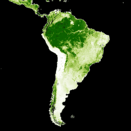
var dataset = ee.ImageCollection('NASA/MEASURES/GFCC/TC/v3')\n .filter(ee.Filter.date('2015-01-01', '2015-12-31'));\nvar treeCanopyCover = dataset.select('tree_canopy_cover');\nvar treeCanopyCoverVis = {\n min: 0.0,\n max: 100.0,\n palette: ['ffffff', 'afce56', '5f9c00', '0e6a00', '003800'],\n};\nMap.setCenter(-88.6, 26.4, 3);\nMap.addLayer(treeCanopyCover.mean(), treeCanopyCoverVis, 'Tree Canopy Cover');\n```\n[Open in Code Editor](https://code.earthengine.google.com/?scriptPath=Examples:Datasets/NASA/NASA_MEASURES_GFCC_TC_v3) \n[Global Forest Cover Change (GFCC) Tree Cover Multi-Year Global 30m](/earth-engine/datasets/catalog/NASA_MEASURES_GFCC_TC_v3) \nThe Landsat Vegetation Continuous Fields (VCF) tree cover layers contain estimates of the percentage of horizontal ground in each 30-m pixel covered by woody vegetation greater than 5 meters in height. The dataset is available for four epochs centered on the years 2000, 2005, 2010 and 2015. The dataset is ... \nNASA/MEASURES/GFCC/TC/v3, forest,forest-biomass,glcf,landsat-derived,nasa,umd \n2000-01-01T00:00:00Z/2015-01-01T00:00:00Z \n-90 -180 90 180 \nGoogle Earth Engine \nhttps://developers.google.com/earth-engine/datasets\n\n- [https://doi.org/10.5067/MEaSUREs/GFCC/GFCC30TC.003](https://doi.org/https://doi.org/10.5067/MEaSUREs/GFCC/GFCC30TC.003)\n- [https://doi.org/10.5067/MEaSUREs/GFCC/GFCC30TC.003](https://doi.org/https://developers.google.com/earth-engine/datasets/catalog/NASA_MEASURES_GFCC_TC_v3)"]]