-
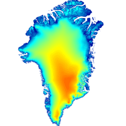
2000 年格陵兰镶嵌图 - 格陵兰冰层测绘项目 (GIMP)
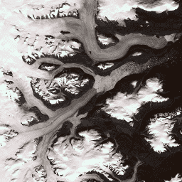
此数据集提供了一幅完整的格陵兰冰盖 15 米分辨率影像镶嵌图,该镶嵌图基于 1999 年至 2002 年的 Landsat 7 ETM+ 和 RADARSAT-1 SAR 影像生成。相关方法包括影像云掩膜、全色锐化、影像采样和调整大小等技术的组合。 arctic gimp greenland imagery nasa polar -
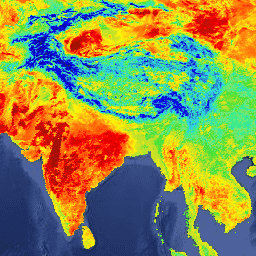
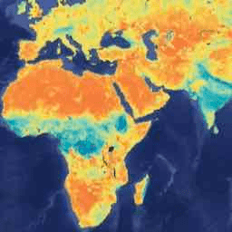
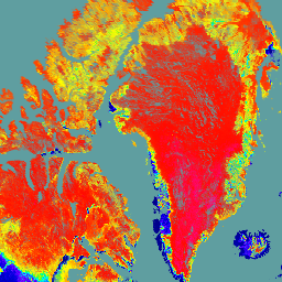
AG100:ASTER 全球发射率数据集 100 米 V003

高级星载热发射和反射辐射计全球发射率数据库 (ASTER-GED) 由美国国家航空航天局 (NASA) 的喷气推进实验室 (JPL)(加利福尼亚理工学院)开发。此产品包含所有 5 个 ASTER 热红外波段的平均发射率和标准差… aster 海拔 发射率 地球物理 红外 jpl -
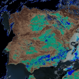
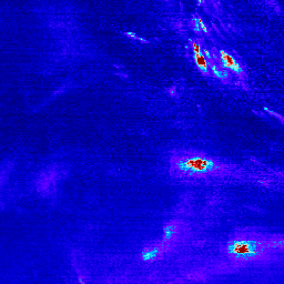
ASTER L1T 辐射率

注意:由于 ASTER 仪器存在技术问题,2024 年 11 月 28 日至 2025 年 1 月 16 日期间的数据收集存在缺口。如需了解详情,请参阅美国地质调查局的公告。高级星载热发射和反射辐射计 (ASTER) 是一种多光谱成像仪,可… aster imagery nasa nir radiance satellite-imagery -
Daymet V4:每日地面天气和气候学摘要

Daymet V4 提供美国本土、夏威夷和波多黎各的网格化每日天气参数估计值(波多黎各的数据从 1950 年开始提供)。它源自所选气象站数据和各种支持性数据源。与之前版本相比,Daymet … climate daily daylight flux geophysical nasa -
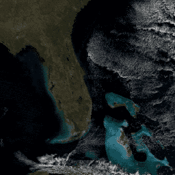
来自协调的 Landsat Sentinel-2 (DSWx-HLS) V1 的动态地表水范围

此数据集包含 1 级动态 OPERA 地表水范围产品版本 3。这些数据是自 2023 年 4 月起经过验证的地表水范围观测数据。产品文档中介绍了使用方面的已知问题和注意事项。用于生成每个产品的输入数据集是“Harmonized … 地球物理 Landsat 衍生 NASA OPERA Sentinel2 衍生 地表 -
基于 Sentinel-1 的动态地表水范围 (DSWx-S1) V1

此数据集包含来自 Sentinel-1 的 3 级动态 OPERA 地表水范围 (DSWX-S1)。DSWx-S1 可提供近乎全球的陆地地表水范围地理映射,空间分辨率为 30 米,采用军事网格参考系统 (MGRS) 网格系统,时间重访频率介于… 地球物理 nasa opera sentinel1-derived surface surface-ground-water -
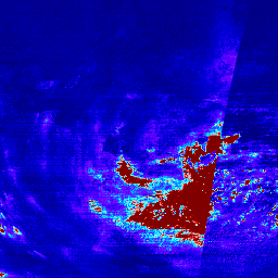
EMIT L1B 传感器处校准的辐射率和地理定位数据 60 米

EMIT 项目是 NASA 地球科学部 (ESD) 项目主管指导下的地球风险仪器 (EV-I) 计划的一部分。EMIT 由一个 VSWIR 红外戴森成像光谱仪组成,该光谱仪经过改造,可安装在国际空间站 (ISS) 上。EMIT 可测量辐射… daily emit nasa radiance satellite-imagery -
EMIT L2A 地表反射率估计值和不确定性以及掩码 60 米

EMIT 项目是 NASA 地球科学部 (ESD) 项目主管指导下的地球风险仪器 (EV-I) 计划的一部分。EMIT 由一个 VSWIR 红外戴森成像光谱仪组成,该光谱仪经过改造,可安装在国际空间站 (ISS) 上。EMIT 可测量辐射… daily emit nasa reflectance satellite-imagery -
地球表面矿物尘埃源调查 - 甲烷增强

EMIT 项目是 NASA 地球科学部 (ESD) 项目主管指导下的地球风险仪器 (EV-I) 计划的一部分。EMIT 由一个 VSWIR 红外戴森成像光谱仪组成,该光谱仪经过改造,可安装在国际空间站 (ISS) 上。EMIT 可测量辐射… atmosphere daily emit methane nasa -
地球表面矿物尘埃源调查 - 甲烷羽流复合体

EMIT 项目是 NASA 地球科学部 (ESD) 项目主管指导下的地球风险仪器 (EV-I) 计划的一部分。EMIT 由一个 VSWIR 红外戴森成像光谱仪组成,该光谱仪经过改造,可安装在国际空间站 (ISS) 上。EMIT 可测量辐射… atmosphere daily emit methane nasa -
FIRMS:资源管理系统火灾信息

资源管理系统火灾信息 (FIRMS) 数据集的 Earth Engine 版本包含光栅化的 LANCE 火灾检测产品。LANCE 使用标准 MODIS MOD14/MYD14 火点和热异常产品处理近乎实时 (NRT) 的火点位置。每… eosdis 火灾 firms 地球物理 热点 lance -
FLDAS:Famine Early Warning Systems Network (FEWS NET) Land Data Assimilation System

FLDAS 数据集(McNally 等人,2017 年)旨在帮助在数据稀疏的发展中国家环境中进行粮食安全评估。它包含许多与气候相关的变量的信息,包括水分含量、湿度、蒸散量、平均土壤温度、总降水率等。FLDAS 数据集有多种不同的版本;… climate cryosphere evapotranspiration humidity ldas monthly -
GEDI L2A Raster Canopy Top Height(版本 2)
GEDI 的 2A 级地理定位高程和高度指标产品 (GEDI02_A) 主要由 100 个相对高度 (RH) 指标组成,这些指标共同描述了 GEDI 收集的波形。原始 GEDI02_A 产品是一个点表,空间分辨率(平均足迹)为 25 米。… 海拔 森林生物质 GEDI LARSE NASA 树木覆盖率 -
GEDI L2A Vector Canopy Top Height(版本 2)

GEDI 的 2A 级地理定位高程和高度指标产品 (GEDI02_A) 主要由 100 个相对高度 (RH) 指标组成,这些指标共同描述了 GEDI 收集的波形。原始 GEDI02_A 产品是一个点表,空间分辨率(平均足迹)为 25 米。… 海拔 森林生物质 GEDI LARSE NASA 树木覆盖率 -
GEDI L2A 表格索引

这是基于 LARSE/GEDI/GEDI02_A_002 中 L2A 表格几何图形创建的特征集合。每个特征代表源表格的多边形足迹,包含其资源 ID 和起止时间戳。更多信息请参阅用户指南。全球生态系统动态调查 (GEDI) 任务… 海拔 森林生物质 GEDI LARSE NASA 表格 -
GEDI L2B 栅格冠层覆盖率垂直剖面指标(版本 2)
GEDI Level 2B Canopy Cover and Vertical Profile Metrics 产品 (GEDI02_B) 可从每个 GEDI 波形中提取生物物理指标。这些指标基于从 L1B 波形得出的方向性间隙概率剖面。植被剖面测量值之间的垂直步长(在 GEDI 中称为 dZ)… 海拔 森林生物质 GEDI LARSE NASA 树木覆盖率 -
GEDI L2B Vector Canopy Cover Vertical Profile Metrics(版本 2)
GEDI Level 2B Canopy Cover and Vertical Profile Metrics 产品 (GEDI02_B) 可从每个 GEDI 波形中提取生物物理指标。这些指标基于从 L1B 波形得出的方向性间隙概率剖面。植被剖面测量值之间的垂直步长(在 GEDI 中称为 dZ)… 海拔 森林生物质 GEDI LARSE NASA 树木覆盖率 -
GEDI L2B 表格索引

这是基于 LARSE/GEDI/GEDI02_B_002 中 L2B 表格几何图形创建的特征集合。每个特征代表源表格的多边形足迹,包含其资源 ID 和起止时间戳。更多信息请参阅用户指南。全球生态系统动态调查 (GEDI) 任务… 海拔 森林生物质 GEDI LARSE NASA 表格 -
GEDI L4A 地上生物质密度,版本 2.1

此数据集包含地面生态系统动态调查 (GEDI) 4A 级 (L4A) 版本 2 的地上生物量密度(AGBD;单位为 Mg/ha)预测值,以及每个采样地理定位激光足迹内的预测标准误差估计值。在此版本中,数据粒度为子轨道。高度指标… 海拔 森林生物质 GEDI LARSE NASA 树木覆盖率 -
GEDI L4A Raster Aboveground Biomass Density, Version 2.1

此数据集包含地面生态系统动态调查 (GEDI) 4A 级 (L4A) 版本 2 的地上生物量密度(AGBD;单位为 Mg/ha)预测值,以及每个采样地理定位激光足迹内的预测标准误差估计值。在此版本中,数据粒度为子轨道。高度指标… 海拔 森林生物质 GEDI LARSE NASA 树木覆盖率 -
GEDI L4A 表格索引

这是基于 LARSE/GEDI/GEDI04_A_002 中 L4A 表格几何图形创建的特征集合。每个特征代表源表格的多边形足迹,包含其资源 ID 和起止时间戳。更多信息请参阅用户指南。全球生态系统动态调查 (GEDI) 任务… 海拔 森林生物质 GEDI LARSE NASA 表格 -
GEDI L4B 网格化地上生物质密度(版本 2)

此全球生态系统动态调查 (GEDI) L4B 产品基于从任务周 19(2019 年 4 月 18 日开始)到任务周 138(2021 年 8 月 4 日结束)的观测结果,提供 1 公里 x 1 公里的平均地上生物量密度 (AGBD) 估计值。GEDI L4A 覆盖区生物量产品将… 海拔 森林生物质 GEDI LARSE NASA 树木覆盖率 -
GEOS-CF fcst htf v1:Goddard 地球观测系统成分预报

本数据集包含高时间频率 (htf) 数据的气象预报 (fcst)。使用“creation_time”和“forecast_time”属性选择感兴趣的数据。Goddard 地球观测系统成分预报 (GEOS-CF) 系统是 NASA 全球建模与同化办公室 (GMAO) 开发的高分辨率 (0.25°) 全球成分预测系统。 大气 成分 预报 geos gmao nasa -
GEOS-CF fcst tavg1hr v1:Goddard 地球观测系统成分预报

本数据集包含时间平均频率数据 (tavg1hr) 的气象预报 (fcst)。使用“creation_time”和“forecast_time”属性选择感兴趣的数据。Goddard 地球观测系统成分预报 (GEOS-CF) 系统是 NASA 全球建模与同化办公室 (GMAO) 开发的高分辨率 (0.25°) 全球成分预测系统。 大气 成分 预报 geos gmao nasa -
GEOS-CF rpl htf v1:Goddard 地球观测系统成分预报

本数据集包含高时间频率 (htf) 数据的气象重放 (rpl)。Goddard 地球观测系统成分预报 (GEOS-CF) 系统是 NASA 全球建模与同化办公室 (GMAO) 开发的高分辨率 (0.25°) 全球成分预测系统。GEOS-CF 为大气化学研究提供了一款新工具,旨在… 大气 成分 预报 geos gmao nasa -
GEOS-CF rpl tavg1hr v1:Goddard 地球观测系统成分预报

此数据集包含时间平均一小时数据 (tavg1hr) 的气象重放 (rpl)。它是通过合并原始 GEOS-CF 集合 chm_tavg_1hr_g1440x721_v1、met_tavg_1hr_g1440x721_x1 和 xgc_tavg_1hr_g1440x721_x1 构建的。Goddard 地球观测系统成分预报 (GEOS-CF) 系统是 NASA 全球建模与同化办公室 (GMAO) 开发的高分辨率 (0.25°) 全球成分预测系统。 大气 成分 预报 geos gmao nasa -
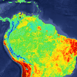
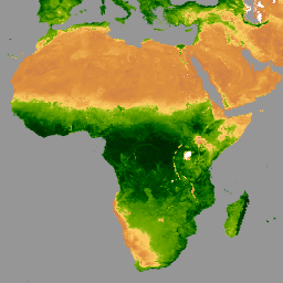
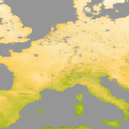
来自 AVHRR 传感器(第 3 代)的 GIMMS NDVI

GIMMS NDVI 是根据 NOAA 的多个 AVHRR 传感器生成的,适用于全球 1/12 度经纬度网格。最新版本的 GIMMS NDVI 数据集名为 NDVI3g(第三代 GIMMS NDVI,来自 AVHRR 传感器)。 avhrr nasa ndvi noaa 植被 植被指数 -
GLCF:Landsat 全球内陆水体

全球内陆水体数据集显示了内陆地表水体,包括淡水湖和咸水湖、河流和水库。自 GLS 2000 纪元以来,已识别出 3,650,723 平方公里的内陆水域,其中约四分之三位于北美洲和亚洲。寒带森林和苔原… glcf landsat-derived nasa surface-ground-water umd water -
GLDAS-2.1:全球陆面数据同化系统

NASA 全球陆面数据同化系统第 2 版 (GLDAS-2) 包含三个组成部分:GLDAS-2.0、GLDAS-2.1 和 GLDAS-2.2。GLDAS-2.0 完全由普林斯顿气象强迫输入数据强迫,并提供 1948 年至 2014 年的时间上一致的序列。GLDAS-2.1 采用模型… 3 小时 气候 冰冻圈 蒸发 强迫 地球物理 -
GLDAS-2.2:全球陆面数据同化系统

NASA 全球陆面数据同化系统第 2 版 (GLDAS-2) 包含三个组成部分:GLDAS-2.0、GLDAS-2.1 和 GLDAS-2.2。GLDAS-2.0 完全由普林斯顿气象强迫输入数据强迫,并提供 1948 年至 2014 年的时间上一致的序列。GLDAS-2.1 采用模型… 3 小时 气候 冰冻圈 蒸发 强迫 地球物理 -
GLIMS 2023:全球陆地冰川太空测量
“全球陆地冰测量计划”(GLIMS) 是一项国际计划,旨在反复调查全球约 20 万条冰川。该项目旨在创建一份全球全面的陆地冰川清单,包括冰川面积、几何形状、地表速度和雪线的测量结果… 冰冻圈 冰川 glims 冰 landcover nasa -
GLIMS Current:Global Land Ice Measurements From Space

“全球陆地冰测量计划”(GLIMS) 是一项国际计划,旨在反复调查全球约 20 万条冰川。该项目旨在创建一份全球全面的陆地冰川清单,包括冰川面积、几何形状、地表速度和雪线的测量结果… 冰冻圈 冰川 glims 冰 landcover nasa -
GPM:全球降水测量任务 (GPM) 版本 07

全球降水测量 (GPM) 是一项国际卫星任务,旨在每三小时提供一次全球范围内的雨雪观测数据,实现观测数据的更新换代。Integrated Multi-satellitE Retrievals for GPM (IMERG) 是一种统一的算法,可提供降雨估计值,并将 GPM 中所有被动微波仪器的数据相结合… climate geophysical gpm imerg jaxa nasa -
GPM:每月全球降水测量 (GPM) v6

IMERG-Final 版本“06”已于 2021 年 9 月停止生成。版本“07”预计将于 2022 年 9 月发布全球降水测量 (GPM) 是一项国际卫星任务,旨在每三小时提供一次全球范围内的雨雪观测数据。Integrated Multi-satellitE Retrievals for … climate geophysical gpm imerg jaxa monthly -
GPM:每月全球降水测量 (GPM) vRelease 07

全球降水测量 (GPM) 是一项国际卫星任务,旨在每三小时提供一次全球范围内的雨雪观测数据,实现观测数据的更新换代。Integrated Multi-satellitE Retrievals for GPM (IMERG) 是一种统一的算法,可提供降雨估计值,并将 GPM 中所有被动微波仪器的数据相结合… climate geophysical gpm imerg jaxa monthly -
GPWv411:根据联合国 2015 年修订版 WPP 国家/地区总数进行了调整(世界网格化人口版本 4.11)

此数据集包含每 30 角秒网格单元的人数估计值,这些估计值在相对空间分布方面与国家人口普查和人口登记数据保持一致,但经过调整,以符合联合国《2015 年世界人口展望》修订版中的国家/地区总人口数。此数据集包含一张图片… ciesin gpw nasa population -
GPWv411:基本人口特征(世界网格化人口第 4.11 版)

此数据集包含与国家人口普查和人口登记数据相一致的每 30 角秒网格单元的人口估计值(按年龄和性别划分)。根据 2010 年的人口普查数据,每个年龄和性别类别都有一张图片。一般文档“The Gridded Population of … ciesin gpw nasa population -
GPWv411:数据背景信息(世界网格化人口分布数据第 4.11 版)
此数据集根据普查文件中提供的信息,对估计人口为零的像素进行分类。一般文档“世界网格化人口”第 4 版 (GPWv4) 修订版本 11 对 2000 年、2005 年、2010 年、2015 年和 2020 年的全球人口分布进行了建模,… ciesin gpw nasa population -
GPWv411:陆地面积(世界网格化人口第 4.11 版)

此数据集包含每个像素内陆地(不包括永久性冰和水)的估计地表面积(以平方公里为单位),用于计算 GPW v4.11 人口密度数据集。一般文档“全球网格化人口版本 4 (GPWv4)”,… ciesin gpw nasa population -
GPWv411:平均行政单位面积(世界网格化人口版本 4.11)

此数据集包含用于创建人口数量和密度网格的输入单位的平均面积。一般文档“世界网格化人口”第 4 版(GPWv4),修订版本 11 对 2000 年、2005 年、2010 年、2015 年等年份的全球人口分布进行了建模。 ciesin gpw nasa population -
GPWv411:国家标识符网格(世界网格化人口版本 4.11)

此数据集表示用于生成 GPW v4.11 人口估计值的普查数据源。具有相同值的像素表示相同的数据源,通常是国家或地区。一般文档“世界网格化人口第 4 版 (GPWv4)”,修订版本 11 模型… ciesin gpw nasa population -
GPWv411:人口数(世界网格化人口第 4.11 版)

此数据集包含与国家人口普查和人口登记数据相一致的每 30 角秒网格单元格的人数估计值。每个建模年份都有一张图片。一般文档备注:由于此集合的影像金字塔政策为 MEAN,因此缩小会… ciesin gpw nasa population -
GPWv411:人口密度(世界网格化人口第 4.11 版)
此数据集包含与国家人口普查和人口登记数据一致的每平方公里人口数估计值。每个建模年份都有一张图片。一般文档“世界网格化人口”第 4 版 (GPWv4) 修订版 11 对全球人口分布进行了建模,… ciesin gpw nasa population -
GPWv411:未根据联合国数据调整的人口密度(世界网格化人口第 4.11 版)

此数据集包含每 30 角秒网格单元的人数估计值,这些估计值在相对空间分布方面与国家人口普查和人口登记数据保持一致,但经过调整,以符合联合国《2015 年世界人口展望》修订版中的国家/地区总人口数。此数据集包含一张图片… ciesin gpw nasa population -
GPWv411:水域(世界网格化人口 4.11 版)

此数据集包含每个像素内的水域(永久性冰和水)面积估计值,用于计算 GPW v4.11 人口密度数据集。一般文档“世界网格化人口”第 4 版 (GPWv4) 修订版本 11 对全球人口分布进行了建模… ciesin gpw nasa population surface-ground-water -
GPWv411:水掩码(世界网格化人口版本 4.11)

此数据集用于识别水像素;非水像素会被遮盖。水掩码用于从人口分配中排除水域和永久性冰区。一般文档“世界网格化人口”第 4 版 (GPWv4) 修订版 11 对全球人口分布进行了建模… ciesin gpw nasa population surface-ground-water -
GRACE 月度质量网格 - 海洋 EOFR
GRACE Tellus Monthly Mass Grids 提供相对于 2004-2010 年时间平均基线的月度重力异常。此数据集中的数据以“等效水厚度”为单位,表示质量偏差(以厘米为单位的水垂直范围)。如需了解详情,请参阅提供方的… crs gfz grace gravity jpl mass -
GRACE 月度质量网格版本 06 版本 04 - 陆地

月度陆地质量网格包含水质量异常值,以等效水厚度表示,该厚度是根据指定时间跨度内 GRACE 和 GRACE-FO 的时变重力观测结果得出的,并且相对于指定的时间平均参考周期。等效水厚度表示总陆地水存储区异常值… crs gfz grace gravity jpl land -
GRACE 月度质量网格版本 06 版本 04 - 海洋
GRACE Tellus Monthly Mass Grids 提供相对于 2004-2010 年时间平均基线的月度重力异常。此数据集中的数据以“等效水厚度”为单位,表示质量偏差(以厘米为单位的水垂直范围)。如需了解详情,请参阅提供方的… crs gfz grace gravity jpl mass -
GRACE 月度质量网格版本 6.3 版本 4 - 全球 Mascon

此数据集包含网格化月度全球蓄水量/高度异常值(相对于时间平均值),这些数据源自 GRACE 和 GRACE-FO,并由 JPL 使用 Mascon 方法 (RL06.3Mv04) 进行处理。这些数据以 netCDF 格式提供在单个数据文件中,可用于分析… grace 重力 jpl mascon 质量 nasa -
GRACE 月度质量网格版本 04 - 全球 Mascon(CRI 过滤)

此数据集包含网格化月度全球蓄水量/高度异常值(相对于时间平均值),这些数据源自 GRACE 和 GRACE-FO,并由 JPL 使用 Mascon 方法 (RL06.3Mv04) 进行处理。这些数据以 netCDF 格式提供在单个数据文件中,可用于分析… grace 重力 jpl mascon 质量 nasa -
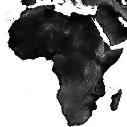
GTOPO30:全球 30 角秒高程

GTOPO30 是一种全球数字高程模型 (DEM),水平网格间距为 30 角秒(约 1 公里)。该 DEM 源自多个地形信息栅格和矢量源。GTOPO30 于 1996 年底完成,历时三年开发而成,… dem 海拔 海拔-地形 地球物理 nasa 地形 -
全球 2020 年森林分类(IPCC 地上生物质第 1 级估计值),版本 1

此数据集提供 2020 年按状态/条件划分的全球森林类别,分辨率约为 30 米。这些数据有助于根据 2019 年修订版《2006 年 IPCC 国家温室气体清单指南》生成天然森林中地上干木质生物量密度 (AGBD) 的一级估计值。 地上 生物质 碳 分类 森林 森林生物质 -
全球地上和地下生物质碳密度地图

此数据集提供了 2010 年地上和地下生物质碳密度的时态一致且协调的全球地图,空间分辨率为 300 米。地上生物质地图整合了木本、草地、农田和苔原生物质的特定土地覆盖遥感地图。输入地图为 … 地上 生物质 碳 密度 森林 森林生物质 -
全球森林冠层高度,2005 年

此数据集表示全球树高,基于地球科学激光测高仪系统 (GLAS) 的机载激光雷达数据 (2005) 和辅助地理空间数据融合而成。如需了解详情,请参阅 Simard 等人 (2011)。 冠层 森林 森林生物质 地球物理 jpl NASA -
全球森林覆盖变化 (GFCC) 多年全球 30 米树木覆盖率

Landsat 植被连续场 (VCF) 树木覆盖率层包含对每个 30 米像素中被高度超过 5 米的木本植被覆盖的水平地面百分比的估计值。该数据集适用于以 2000 年、2005 年、2010 年为中心年份的四个时间段。 forest forest-biomass glcf landsat-derived nasa umd -
全球红树林分布,v1 (2000)

该数据库是使用 2000 年的 Landsat 卫星数据准备的。我们使用混合监督和非监督数字图像分类技术对从 USGS 地球资源观测和科学中心 (EROS) 获得的 1,000 多个 Landsat 场景进行了分类。该数据库是第一个也是最全面的全球土地覆盖数据库,… 年度 CIESIN 森林生物质 全球 Landsat 衍生数据 红树林 -
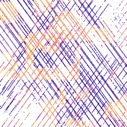
全球季节性 Sentinel-1 干涉相干性和后向散射 V2019 后向散射

该数据集是首个此类空间表示法,可呈现多季节全球 C 波段合成孔径雷达 (SAR) 干涉重复通过相干性和后向散射特征。覆盖范围包括从北纬 82 度到南纬 79 度的陆地和冰盖。该数据集源自多时相… backscatter earth-big-data jpl nasa polarization radar -
全球季节性 Sentinel-1 干涉相干性和后向散射 V2019 相干性

该数据集是首个此类空间表示法,可呈现多季节全球 C 波段合成孔径雷达 (SAR) 干涉重复通过相干性和后向散射特征。覆盖范围包括从北纬 82 度到南纬 79 度的陆地和冰盖。该数据集源自多时相… earth-big-data jpl nasa polarization radar sar -
全球季节性 Sentinel-1 干涉相干性和后向散射 V2019 衰减模型参数

该数据集是首个此类空间表示法,可呈现多季节全球 C 波段合成孔径雷达 (SAR) 干涉重复通过相干性和后向散射特征。覆盖范围包括从北纬 82 度到南纬 79 度的陆地和冰盖。该数据集源自多时相… earth-big-data jpl nasa polarization radar sar -
全球季节性 Sentinel-1 干涉相干性和后向散射 V2019 入射叠掩阴影

该数据集是首个此类空间表示法,可呈现多季节全球 C 波段合成孔径雷达 (SAR) 干涉重复通过相干性和后向散射特征。覆盖范围包括从北纬 82 度到南纬 79 度的陆地和冰盖。该数据集源自多时相… earth-big-data jpl nasa polarization radar sar -
格陵兰 DEM - 格陵兰测绘项目 (GIMP)
此数字高程模型 (DEM) 是根据 ASTER 和 SPOT-5 DEM 组合构建而成,适用于大约 82.5°N 以南的冰盖外围和边缘(即低于平衡线高程),以及冰盖内部和极北地区的 AVHRR 光度测斜术(Scambos 和 … 北极 海拔地形 GIMP 格陵兰 NASA 极地 -
格陵兰冰盖和海洋掩码 - 格陵兰测绘项目 (GIMP)

此数据集提供了格陵兰冰盖的完整陆地冰和海洋分类掩码(分辨率为 15 米)。冰盖是使用以下影像的组合进行绘制的:USGS 分发的 Landsat 7 Enhanced Thematic Mapper Plus (ETM+) 的正射校正全色(波段 8)影像,以及… 北极 冰冻圈 gimp 格陵兰 冰 nasa -
网格化 GEDI 植被结构指标和生物质密度(包含 COUNTS 指标),像素大小为 12 公里

此数据集包含近乎全球范围的、可直接用于分析的、多分辨率网格化植被结构指标,这些指标源自 NASA 全球生态系统动态调查 (GEDI) 2 级和 4A 级产品,与直径为 25 米的激光雷达足迹相关联。此数据集全面呈现了近乎全球范围的植被结构,其中包括… 生物质 树冠 森林 森林生物质 GEDI LARSE -
网格化 GEDI 植被结构指标和生物质密度(包含 COUNTS 指标),像素大小为 1 公里

此数据集包含近乎全球范围的、可直接用于分析的、多分辨率网格化植被结构指标,这些指标源自 NASA 全球生态系统动态调查 (GEDI) 2 级和 4A 级产品,与直径为 25 米的激光雷达足迹相关联。此数据集全面呈现了近乎全球范围的植被结构,其中包括… 生物质 树冠 森林 森林生物质 GEDI LARSE -
网格化 GEDI 植被结构指标和生物质密度(包含 COUNTS 指标),像素大小为 6 公里

此数据集包含近乎全球范围的、可直接用于分析的、多分辨率网格化植被结构指标,这些指标源自 NASA 全球生态系统动态调查 (GEDI) 2 级和 4A 级产品,与直径为 25 米的激光雷达足迹相关联。此数据集全面呈现了近乎全球范围的植被结构,其中包括… 生物质 树冠 森林 森林生物质 GEDI LARSE -
网格化 GEDI 植被结构指标和生物质密度,12 公里像素大小

此数据集包含近乎全球范围的、可直接用于分析的、多分辨率网格化植被结构指标,这些指标源自 NASA 全球生态系统动态调查 (GEDI) 2 级和 4A 级产品,与直径为 25 米的激光雷达足迹相关联。此数据集全面呈现了近乎全球范围的植被结构,其中包括… 生物质 树冠 森林 森林生物质 GEDI LARSE -
网格化 GEDI 植被结构指标和生物质密度,像素大小为 1 公里
此数据集包含近乎全球范围的、可直接用于分析的、多分辨率网格化植被结构指标,这些指标源自 NASA 全球生态系统动态调查 (GEDI) 2 级和 4A 级产品,与直径为 25 米的激光雷达足迹相关联。此数据集全面呈现了近乎全球范围的植被结构,其中包括… 生物质 树冠 森林 森林生物质 GEDI LARSE -
网格化 GEDI 植被结构指标和生物质密度,像素大小为 6 公里

此数据集包含近乎全球范围的、可直接用于分析的、多分辨率网格化植被结构指标,这些指标源自 NASA 全球生态系统动态调查 (GEDI) 2 级和 4A 级产品,与直径为 25 米的激光雷达足迹相关联。此数据集全面呈现了近乎全球范围的植被结构,其中包括… 生物质 树冠 森林 森林生物质 GEDI LARSE -
HLSL30:HLS-2 Landsat Operational Land Imager 地表反射率和 TOA 亮度每日全球 30 米

Harmonized Landsat Sentinel-2 (HLS) 项目通过虚拟的卫星传感器星座提供一致的地表反射率 (SR) 和大气层顶 (TOA) 亮度数据。OLI(陆地业务成像仪)搭载于 NASA/USGS 联合开发的 Landsat 8 和 Landsat 9 卫星上,而 MSI(多光谱… 陆地卫星 nasa 卫星图像 哨兵 usgs -
HLSS30:HLS Sentinel-2 多光谱仪地表反射率每日全球 30 米

Harmonized Landsat Sentinel-2 (HLS) 项目可提供一致的地表反射率数据,这些数据来自美国航空航天局 (NASA) 和美国地质调查局 (USGS) 联合 Landsat 8 卫星上的 Operational Land Imager (OLI),以及欧洲哥白尼 Sentinel-2A 卫星上的 Multi-Spectral Instrument (MSI)。通过组合测量,可以每 2-3 天对陆地进行一次全球观测… 陆地卫星 nasa 卫星图像 哨兵 usgs -
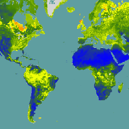
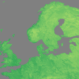
MCD12C1.061 MODIS 地表覆盖类型年度全球 0.05 度 CMG

Terra 和 Aqua 组合的中等分辨率成像光谱辐射计 (MODIS) 土地覆盖气候模型网格 (CMG) (MCD12C1) 版本 6.1 数据产品提供了平铺 MCD12Q1 版本 6.1 数据产品的空间聚合和重新投影版本。国际地圈生物圈计划 (IGBP)、马里兰大学… landcover landuse-landcover modis nasa usgs yearly -
MCD12Q1.061 MODIS 土地覆被类型年度全球 500 米
Terra 和 Aqua 组合的中等分辨率成像光谱辐射计 (MODIS) 土地覆盖类型 (MCD12Q1) 版本 6.1 数据产品以年为间隔提供全球土地覆盖类型。MCD12Q1 版本 6.1 数据产品是通过对 MODIS Terra 和 Aqua 反射率数据进行监督分类得出的。土地… landcover landuse-landcover modis nasa usgs yearly -
MCD15A3H.061 MODIS 叶面积指数/FPAR 4 天全球 500 米

MCD15A3H 版本 6.1 中等分辨率成像光谱辐射计 (MODIS) 4 级产品,即组合的光合有效辐射吸收比 (FPAR) 和叶面积指数 (LAI) 产品,是一个 4 天合成数据集,像素大小为 500 米。该算法会从所有…中选择最佳像素 fpar global lai modis nasa plant-productivity -
MCD19A1.061:陆地表面 BRF 每日 L2G 全球 500 米和 1 公里

MCD19A1 版本 6.1 数据产品是中等分辨率成像光谱辐射计 (MODIS) Terra 和 Aqua 组合地表双向反射率因子 (BRF) 格网化 2 级产品,以 500 米和 1 千米分辨率每日生成。如需了解详情,请参阅 MAIAC 用户指南。 气溶胶 aod aqua 每日 全球 maiac -
MCD19A2.061:Terra 和 Aqua MAIAC 陆地气溶胶光学深度(每日 1 公里)

MCD19A2 V6.1 数据产品是 MODIS Terra 和 Aqua 组合的多角度大气校正 (MAIAC) 陆地气溶胶光学厚度 (AOD) 格网化 2 级产品,以 1 公里分辨率每日生成。如需了解详情,请参阅 MAIAC 用户指南。注意:此产品具有… 气溶胶 aod aqua 大气 每日 全球 -
MCD43A1.061 MODIS BRDF-Albedo 模型参数 每日 500 米

MCD43A1 V6.1 双向反射率分布函数和反照率 (BRDF/Albedo) 模型形参数据集是一种 500 米分辨率的每日 16 天产品。儒略日表示 16 天反演周期的第 9 天,因此观测结果会加权,以估计当天的 BRDF/反照率。… 反照率 brdf 每日 全球 modis nasa -
MCD43A2.061 MODIS BRDF-反照率质量每日 500 米

MCD43A2 V6.1 双向反射率分布函数和反照率 (BRDF/Albedo) 质量数据集是一种 500 米分辨率的每日 16 天产品。它包含相应的 16 天 MCD43A3 反照率和 MCD43A4 天底 BRDF (NBAR) 产品的所有质量信息。MCD43A2 包含各个波段的质量和观测信息… 反照率 brdf 每日 全球 modis nasa -
MCD43A3.061 MODIS 反照率每日 500 米

MCD43A3 V6.1 反照率模型数据集是一种每日 16 天的产品。它为每个 MODIS 地表反射率波段(波段 1 至波段 7)以及 3 个宽光谱波段提供方向半球反射率(黑空反照率)和双半球反射率(白空反照率)。 albedo black-sky daily global modis nasa -
MCD43A4.061 MODIS 天底 BRDF 调整后的反射率每日 500 米

MCD43A4 V6.1 天底双向反射率分布函数调整后的反射率 (NBAR) 产品提供 MODIS“陆地”波段 1-7 的 500 米反射率数据。这些值会使用双向反射率分布函数进行调整,以模拟从天底视角收集的值。… 反照率 brdf 每日 全球 modis nasa -
MCD43C3.061 BRDF/反照率每日 L3 0.05 度 CMG

MCD43C3 版本 6.1 双向反射率分布函数和反照率 (BRDF/Albedo) 反照率数据集采用 Terra 和 Aqua 卫星 MODIS 16 天观测数据,基于 0.05 度(赤道处约 5,600 米)气候模拟网格 (CMG) 每日生成。数据在时间维度上加权至反演周期的第 9 天… 反照率 晴空 双向反射率分布函数 (BRDF) 每日 全球 MODIS -
MCD64A1.061 MODIS 烧毁区域月度全球 500 米

Terra 和 Aqua 组合的 MCD64A1 版本 6.1 烧毁面积数据产品是一种每月更新的全球网格化 500 米产品,包含每个像素的烧毁面积和质量信息。MCD64A1 烧毁区域测绘方法采用 500 米 MODIS 地表反射率影像,并结合 1 公里 MODIS 火点观测数据。该算法… burn change-detection fire geophysical global mcd64a1 -
MERRA-2 M2I3NVAER:气溶胶混合比 V5.12.4

M2I3NVAER(或 inst3_3d_aer_Nv)是 Modern-Era Retrospective analysis for Research and Applications 版本 2 (MERRA-2) 中的瞬时三维 3 小时数据集合。此集合包含 72 个模型层中气溶胶混合比参数的同化,例如粉尘、二氧化硫、海盐、黑碳和… 气溶胶 大气 尘埃 质量 merra nasa -
MERRA-2 M2T1NXAER:气溶胶诊断 V5.12.4

M2T1NXAER(或 tavg1_2d_aer_Nx)是现代纪元回顾性分析研究和应用第 2 版 (MERRA-2) 中的每小时时间平均二维数据集。此数据集包含同化气溶胶诊断数据,例如气溶胶组分(黑碳、尘埃、海盐、硫酸盐和有机碳)的柱质量密度、地表… 气溶胶 大气 碳 尘埃 质量 merra -
MERRA-2 M2T1NXSLV:单层诊断 V5.12.4

M2T1NXSLV(或 tavg1_2d_slv_Nx)是现代研究和应用时代回顾性分析版本 2 (MERRA-2) 中的每小时时间平均二维数据集合。此集合包含常用垂直高度的气象诊断信息,例如 2 米(或 10 米、850 hPa、500 hPa、250 hPa)高度的气温,… atmosphere climate humidity merra nasa pressure -
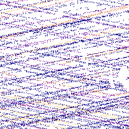
MEaSUREs Greenland Ice Velocity: Selected Glacier Site Velocity Maps from Optical Images Version 2

此数据集是 NASA“在研究环境中制作地球系统数据记录”(MEaSUREs) 计划的一部分,包含所选冰川出口区域的平均月度速度地图。这些地图是通过跟踪 Landsat … 北极 冰冻圈 gimp 格陵兰 冰 nasa -
MOD08_M3.061 Terra 大气月度全球产品

MOD08_M3 V6.1 是一种大气全球产品,包含大气参数的月度 1x1 度网格平均值。这些参数与大气气溶胶粒子属性、总臭氧负荷、大气水汽、云光学和物理属性以及大气稳定性指数有关。… 大气 气候 地球物理 全球 modis 月度 -
MOD09A1.061 Terra 地表反射率 8 天全球 500 米
MOD09A1 V6.1 产品提供 Terra MODIS 波段 1-7 在 500 米分辨率下的地表光谱反射率估计值,并针对气体、气溶胶和瑞利散射等大气条件进行了校正。除了七个反射率波段外,还有一个质量层和四个观测… 8 天 全球 modis nasa satellite-imagery sr -
MOD09GA.061 Terra 地表反射率每日全球 1 公里和 500 米

MODIS 地表反射率产品可提供地表光谱反射率的估计值,该值是在没有大气散射或吸收的情况下于地面测得的。低级别数据已针对大气气体和气溶胶进行校正。MOD09GA 版本 6.1 提供波段 1-7 的数据,… daily global modis nasa satellite-imagery sr -
MOD09GQ.061 Terra 地表反射率每日全球 250 米
MODIS 地表反射率产品可提供地表光谱反射率的估计值,该值是在没有大气散射或吸收的情况下于地面测得的。低级别数据已针对大气气体和气溶胶进行校正。MOD09GQ 版本 6.1 提供波段 1 和 … daily global modis nasa satellite-imagery sr -
MOD09Q1.061 Terra 地表反射率 8 天全球 250 米
MOD09Q1 产品提供波段 1 和 2 的地表光谱反射率估计值,分辨率为 250 米,并针对气体、气溶胶和瑞利散射等大气条件进行了校正。除了这两个反射率波段,该产品还包含一个质量层。对于每个… 8 天 全球 mod09q1 modis nasa 卫星图像 -
MOD10A1.061 Terra 积雪每日全球 500 米

MOD10A1 V6.1 积雪每日全球 500 米产品包含积雪、积雪反照率、积雪覆盖率和质量评估 (QA) 数据。积雪覆盖率数据基于一种积雪测绘算法,该算法采用归一化差异积雪指数 (NDSI) 和其他标准测试。常规… albedo cryosphere daily geophysical global modis -
MOD10A2.061 Terra 雪盖 8 天 L3 全球 500 米

MOD10A2 是 Terra 卫星上 MODIS 的积雪覆盖数据集。该数据集以 500 米的分辨率报告 8 天期间的最大积雪覆盖范围。之所以选择 8 天的合成周期,是因为这是精确的地面轨道重复周期。 冰冻圈 每日 地球物理 全球 modis nasa -
MOD11A1.061 Terra 地表温度与发射率每日全球 1 公里

MOD11A1 V6.1 产品以 1200 x 1200 公里网格提供每日地表温度 (LST) 和发射率值。温度值源自 MOD11_L2 观测带产品。在 30 度纬度以上,部分像素可能有多项观测结果,其中晴空条件… climate daily emissivity global lst modis -
MOD11A2.061 Terra 地表温度与发射率 8 天全球 1 公里

MOD11A2 V6.1 产品以 1200 x 1200 公里网格提供平均 8 天地表温度 (LST)。MOD11A2 中的每个像素值都是相应 8 天时间段内收集的所有相应 MOD11A1 LST 像素的简单平均值。MOD11A2 会执行… 8 天 气候 发射率 全球 lst mod11a2 -
MOD13A1.061 Terra Vegetation Indices 16-Day Global 500m

MOD13A1 V6.1 产品可提供基于每个像素的植被指数 (VI) 值。其中包含两个主要的植被层。第一个是归一化差值植被指数 (NDVI),它被称为现有美国国家海洋和大气管理局 (NOAA) 植被指数的连续性指数。 16-day evi global modis nasa ndvi -
MOD13A2.061 Terra Vegetation Indices 16-Day Global 1km

MOD13A2 V6.1 产品提供两种植被指数 (VI):归一化差值植被指数 (NDVI) 和增强型植被指数 (EVI)。NDVI 被称为连续性指数,可与现有的美国国家海洋和大气管理局-高级甚高分辨率辐射计 (NOAA-AVHRR) 派生的 NDVI 进行比较。… 16-day evi global modis nasa ndvi -
MOD13A3.061 植被指数月度 L3 全球 1 km SIN 网格

MOD13A3 V6.1 产品数据以每月为单位提供,空间分辨率为 1 公里 (km)。在生成此月度产品时,该算法会提取与相应月份重叠的所有 MOD13A2 产品,并采用加权时间平均值。植被指数用于对全球植被进行监测… evi global modis monthly nasa ndvi -
MOD13C1.061:Terra 植被指数 16 天 L3 全球 0.05 度气候模型网格

Terra 中等分辨率成像光谱辐射计 (MODIS) 植被指数 16 天 (MOD13C1) 版本 6.1 产品可提供每个像素的植被指数 (VI) 值。其中包含两个主要植被层。第一个是归一化差值植被指数 (NDVI),它与 … 保持连续性 16 天 全球 nasa terra usgs 植被 -
MOD13Q1.061 Terra Vegetation Indices 16-Day Global 250m

MOD13Q1 V6.1 产品可提供每个像素的植被指数 (VI) 值。其中包含两个主要植被层。第一个是归一化差值植被指数 (NDVI),它是现有美国国家海洋和大气管理局 (NOAA) 植被指数的连续性指数。第二个是增强型植被指数 (EVI),它可用于优化 NDVI,以减少大气影响并提高植被敏感度。 16-day evi global modis nasa ndvi -
MOD14A1.061:Terra 热异常和火灾每日全球 1 公里

MOD14A1 V6.1 数据集提供每日 1 公里分辨率的火灾掩膜合成数据,这些数据源自 MODIS 4 微米和 11 微米辐射亮度。火灾检测策略基于对火灾的绝对检测(当火势足以检测到时)以及相对于…的检测。 daily fire global modis nasa terra -
MOD14A2.061:Terra 热异常与火灾 8 天全球 1 公里

MOD14A2 V6.1 数据集提供 1 公里分辨率的 8 天火点掩模合成数据。它包含合成周期内各个像素类别的最大值。除了火点掩模之外,还提供相关的质量信息层。文档:用户指南算法理论基础… 8 天 火灾 全球 modis nasa terra -
MOD15A2H.061:Terra 叶面积指数/FPAR 8 天全球 500 米

MOD15A2H V6.1 MODIS 组合叶面积指数 (LAI) 和光合有效辐射吸收比 (FPAR) 产品是一个 8 天合成数据集,分辨率为 500 米。该算法会从 Terra 传感器在 8 天内采集的所有图像中选择“最佳”像素。… 8 天 fpar 全球 lai modis nasa -
MOD16A2.061:Terra 净蒸发蒸腾量 8 天全球 500 米

MOD16A2 版本 6.1 蒸散/潜热通量产品是一种 8 天合成产品,以 500 米像素分辨率生成。MOD16 数据产品集合所用的算法基于 Penman-Monteith 方程的逻辑,其中包括每日气象再分析数据输入… 8 天 蒸发蒸腾 全球 mod16a2 modis nasa -
MOD16A2GF.061:Terra 净蒸发蒸腾量(已填补缺口)8 天全球 500 米

Terra 中等分辨率成像光谱辐射计 (MODIS) MOD16A2GF 版本 6.1 蒸散量/潜热通量 (ET/LE) 产品是一种年终间隙填充的 8 天合成数据集,以 500 米 (m) 像素分辨率生成。用于 MOD16 数据产品集合的算法基于以下逻辑:… 8 天 蒸发蒸腾 全球 modis nasa 水汽 -
MOD17A2H.061:Terra 总初级生产力 8 天全球 500 米

MOD17A2H V6.1 总初级生产力 (GPP) 产品是累积的 8 天合成产品,像素大小为 500 米。该产品基于辐射利用效率概念,可潜在地用作数据模型的输入来计算陆地能量、碳、水循环过程等。 8 天 全球 gpp modis nasa 光合作用 -
MOD17A2HGF.061:Terra 总初级生产力 8 天全球 500 米

MOD17A2HGF 版本 6.1 总初级生产力 (GPP) 产品是基于辐射利用效率概念的累积 8 天合成值,像素大小为 500 米 (m),可潜在用作数据模型的输入来计算陆地能量、碳、水… 8 天 全球 gpp modis nasa 光合作用 -
MOD17A3HGF.061:Terra 净初级生产力缺口填充年度全球 500 米
MOD17A3HGF V6.1 产品提供 500 米像素分辨率的年总初级生产力和净初级生产力(GPP 和 NPP)信息。年度 NPP 是根据指定年份的所有 8 天净光合作用(PSN) 产品 (MOD17A2H) 的总和计算得出的。PSN 值是 … 的差值 global gpp nasa npp photosynthesis plant-productivity -
MOD21A1D.061 Terra 地表温度和 3 波段发射率每日全球 1 公里

MOD21A1D 数据集每天由白天 2 级格网 (L2G) 中间 LST 产品生成,空间分辨率为 1,000 米。L2G 流程可将每日 MOD21 轨道分片数据映射到正弦 MODIS 网格,并存储落在网格单元格中的所有观测结果… climate daily emissivity global lst nasa -
MOD21A1N.061 Terra 地表温度和 3 波段发射率每日全球 1 公里

MOD21A1N 数据集每天由夜间 2 级格网 (L2G) 中间 LST 产品生成,空间分辨率为 1,000 米。L2G 流程可将每日 MOD21 轨道分片数据映射到正弦 MODIS 网格,并存储落在网格单元格中的所有观测结果… climate daily emissivity global lst nasa -
MOD21C1.061 Terra 地表温度和 3 波段发射率每日 L3 全球 0.05 度 CMG

MOD21C1 数据集采用白天 2 级格网 (L2G) 中间 LST 产品,基于 0.05 度(赤道处约 5,600 米)气候模拟网格 (CMG) 每日生成。L2G 流程可将每日 MOD21 轨道分片数据映射到正弦 MODIS 网格,并存储所有… climate daily emissivity global lst nasa -
MOD21C2.061 Terra 地表温度和 3 波段发射率 8 天 L3 全球 0.05 度 CMG

MOD21C2 数据集是一种 8 天合成 LST 产品,它使用基于简单平均方法的算法。该算法根据 8 天时间段内所有无云的 MOD21A1D 和 MOD21A1N 每日采集数据计算平均值。与 MOD21A1 数据集不同的是,… climate emissivity global lst nasa surface-temperature -
MOD21C3.061 Terra 地表温度和 3 波段发射率月度 L3 全球 0.05 度 CMG
MOD21C3 数据集是一种月度合成 LST 产品,它使用基于简单平均方法的算法。该算法根据 8 天时间段内所有无云的 MOD21A1D 和 MOD21A1N 每日采集数据计算平均值。与 MOD21A1 数据集不同的是,… climate emissivity global lst monthly nasa -
MOD44B.061 Terra 植被连续场年度全球 250 米

Terra MODIS 植被连续场 (VCF) 产品是全球地表植被覆盖估计值的亚像素级表示。该模型旨在以基本植被特征的比例来连续表示地球的陆地表面,可提供三种地表覆盖成分的渐变:树木覆盖率百分比、… 年度 地球物理 全球 土地利用和土地覆盖 MODIS NASA -
MOD44W.006 Terra 陆地水体掩码,基于 MODIS 和 SRTM 年度全球 250 米数据得出

MOD44W V6 陆地/水体掩膜 250 米产品是使用经过 MODIS 数据训练并经过 MOD44W V5 产品验证的决策树分类器得出的。应用了一系列掩膜来解决地形阴影、烧伤痕迹、多云或冰盖等已知问题… 地球物理 mod44w modis nasa srtm 地表-地下水 -
MODOCGA.006 Terra 海洋反射率每日全球 1 公里
MODOCGA V6 海洋反射率产品包含来自 Terra MODIS 波段 8-16 的 1 公里反射率数据。该产品被称为海洋反射率,因为波段 8-16 主要用于生成海洋产品,但由于图块…,因此该产品并非海洋产品 daily global modis nasa oceans reflectance -
MYD08_M3.061 Aqua 大气月度全球产品

MYD08_M3 V6.1 是一种大气全球产品,包含大气形参的月度 1x1 度网格平均值。这些参数与大气气溶胶粒子属性、总臭氧负荷、大气水汽、云光学和物理属性以及大气稳定性指数有关。… aqua 大气 气候 地球物理 全球 modis -
MYD09A1.061 Aqua 地表反射率 8 天全球 500 米

MYD09A1 V6.1 产品提供 Aqua MODIS 波段 1-7 的地表光谱反射率估计值,分辨率为 500 米,并针对气体、气溶胶和瑞利散射等大气条件进行了校正。除了七个反射率波段之外,还有一个质量层和四个观测… 8 天 aqua 全球 modis nasa 卫星图像 -
MYD09GA.061 Aqua 地表反射率每日全球 1 公里和 500 米
MODIS 地表反射率产品可提供地表光谱反射率的估计值,该值是在没有大气散射或吸收的情况下于地面测得的。低级别数据已针对大气气体和气溶胶进行校正。MYD09GA 版本 6.1 以 … 格式提供波段 1-7。 aqua daily global modis nasa satellite-imagery -
MYD09GQ.061 Aqua 地表反射率每日全球 250 米

MODIS 地表反射率产品可提供地表光谱反射率的估计值,该值是在没有大气散射或吸收的情况下于地面测得的。低级别数据已针对大气气体和气溶胶进行校正。MYD09GQ 版本 6.1 提供波段 1 和 … aqua daily global modis nasa satellite-imagery -
MYD09Q1.061 Aqua 地表反射率 8 天全球 250 米

MYD09Q1 产品提供波段 1 和 2 的地表光谱反射率估计值,分辨率为 250 米,并针对气体、气溶胶和瑞利散射等大气条件进行了校正。除了这两个反射率波段,该产品还包含一个质量层。对于每个… 8 天 aqua 全球 modis nasa 卫星图像 -
MYD10A1.061 Aqua 积雪每日全球 500 米

MYD10A1 V6 积雪每日全球 500 米产品包含积雪、积雪反照率、积雪覆盖率和质量评估 (QA) 数据。积雪数据基于采用归一化差值积雪指数 (NDSI) 和其他标准测试的积雪测绘算法。一般… albedo aqua cryosphere daily geophysical global -
MYD11A1.061 Aqua 地表温度与发射率每日全球 1 公里

MYD11A1 V6.1 产品以 1200 x 1200 公里网格提供每日地表温度 (LST) 和发射率值。温度值源自 MYD11_L2 观测带产品。在 30 度纬度以上,部分像素可能有多项观测结果,其中晴空条件 … aqua climate daily emissivity global lst -
MYD11A2.061 Aqua 地表温度与发射率 8 天全球 1 公里
MYD11A2 V6.1 产品以 1200 x 1200 公里网格提供平均 8 天地表温度 (LST)。MYD11A2 中的每个像素值都是相应 MYD11A1 LST 像素在相应 8 天内收集的所有值的简单平均值。MYD11A2 会执行… 8 天 aqua climate emissivity global lst -
MYD13A1.061 Aqua Vegetation Indices 16-Day Global 500m

MYD13A1 V6.1 产品以每个像素为基础提供植被指数 (VI) 值。有两个主要的植被层。第一个是归一化差值植被指数 (NDVI),它被称为现有美国国家海洋和大气管理局 (NOAA) … 16-day aqua evi global modis nasa -
MYD13A2.061 Aqua Vegetation Indices 16-Day Global 1km

MYD13A2 V6.1 产品提供两种植被指数 (VI):归一化差值植被指数 (NDVI) 和增强型植被指数 (EVI)。NDVI 被称为连续性指数,可与现有的美国国家海洋和大气管理局-高级甚高分辨率辐射计 (NOAA-AVHRR) 派生的 NDVI 进行比较。… 16-day aqua evi global modis nasa -
MYD13A3.061 Aqua Vegetation Indices Monthly L3 Global 1 km SIN Grid
Aqua 中等分辨率成像光谱辐射计 (MODIS) 植被指数 (MYD13A3) 版本 6.1 数据以网格化 3 级产品的形式提供,采用正弦投影,空间分辨率为 1 公里 (km),每月更新一次。在生成此月度产品时,该算法会提取所有 MYD13A2 产品,这些产品… aqua evi global modis monthly nasa -
MYD13C1.061:Aqua 植被指数 16 天 L3 全球 0.05 度 CMG

Aqua 中等分辨率成像光谱辐射计 (MODIS) 植被指数 16 天 (MYD13C1) 版本 6.1 产品以像素为单位提供植被指数 (VI) 值。主要有两层植被。第一个是归一化差值植被指数 (NDVI),它与…保持连续性 16 天 aqua 全球 nasa usgs 植被 -
MYD13Q1.061 Aqua Vegetation Indices 16-Day Global 250m

MYD13Q1 V6.1 产品以每个像素为基础提供植被指数 (VI) 值。主要有两层植被。第一个是归一化差值植生指数 (NDVI),它被称为现有美国国家海洋和大气管理局 (NOAA) … 16-day aqua evi global modis nasa -
MYD14A1.061:Aqua 热异常和火灾每日全球 1 公里

MYD14A1 V6.1 数据集提供每日火灾掩膜合成数据,分辨率为 1 公里,源自 MODIS 4 微米和 11 微米辐射亮度。火灾检测策略基于对火灾的绝对检测(当火势足以检测到时)以及相对于…的检测。 aqua daily fire global modis nasa -
MYD14A2.061:Aqua 热异常与火灾 8 天全球 1 公里

MYD14A2 V6.1 数据集以 1 公里分辨率提供 8 天的火点掩模合成数据。它包含合成周期内各个像素类别的最大值。除了火点掩模之外,还提供相关的质量信息层。文档:用户指南算法理论基础… 8 天 aqua fire global modis nasa -
MYD15A2H.061:Aqua 叶面积指数/FPAR 8 天全球 500 米

MYD15A2H V6.1 MODIS 组合叶面积指数 (LAI) 和光合有效辐射吸收比 (FPAR) 产品是一个 8 天合成数据集,分辨率为 500 米。该算法会从 Aqua 传感器在 8 天内采集的所有像素中选择“最佳”像素。… 8 天 aqua fpar global lai modis -
MYD16A2.061:Aqua 净蒸发量 8 天 L4 全球 500 米 SIN 网格 V061
MYD16A2 版本 6.1 蒸散/潜热通量产品是一种 8 天合成产品,像素分辨率为 500 米。用于 MOD16 数据产品集合的算法基于 Penman-Monteith 方程的逻辑,其中包括每日气象再分析数据输入以及… 8 天 蒸发蒸腾 全球 modis nasa 水汽 -
MYD17A2H.061:Aqua 总初级生产力 8 天全球 500 米

MYD17A2H V6.1 总初级生产力 (GPP) 产品是累积的 8 天合成产品,分辨率为 500 米。该产品基于辐射利用效率概念,可潜在用作数据模型的输入,以计算陆地能量、碳、水循环过程,以及… 8 天 aqua global gpp modis nasa -
MYD17A3HGF.061:Aqua 净初级生产量缺口填充年度全球 500 米

MYD17A3HGF V6.1 产品提供有关年总初级生产力 (GPP) 和净初级生产力 (NPP) 的信息,分辨率为 500 米。年度 NPP 是根据指定年份的所有 8 天净光合作用(PSN) 产品 (MYD17A2H) 的总和得出的。PSN 值是 … 的差值 aqua global gpp nasa npp photosynthesis -
MYD21A1D.061 Aqua 地表温度和 3 波段发射率每日全球 1 公里

MYD21A1D 数据集每天由白天 2 级格网 (L2G) 中间 LST 产品生成,空间分辨率为 1,000 米。L2G 流程可将每日 MOD21 轨道分片数据映射到正弦 MODIS 网格,并存储落在网格单元格中的所有观测结果… aqua climate daily emissivity global lst -
MYD21A1N.061 Aqua 地表温度和 3 波段发射率每日全球 1 公里

MYD21A1N 数据集每天由夜间 2 级格网 (L2G) 中间 LST 产品生成,空间分辨率为 1,000 米。L2G 流程可将每日 MOD21 轨道分片数据映射到正弦 MODIS 网格,并存储落在网格单元格中的所有观测结果… aqua climate daily emissivity global lst -
MYD21C1.061 Aqua 地表温度和 3 波段发射率每日 L3 全球 0.05 度 CMG

MYD21C1 数据集基于白天 2 级格网 (L2G) 中间 LST 产品,采用 0.05 度(赤道处约 5,600 米)气候模拟网格 (CMG) 每日生成。L2G 流程可将每日 MYD21 轨道分片数据映射到正弦 MODIS 网格,并存储所有… aqua climate daily emissivity global lst -
MYD21C2.061 Aqua 地表温度和 3 波段发射率 8 天 L3 全球 0.05 度 CMG

MYD21C2 数据集是一种 8 天合成 LST 产品,它使用基于简单平均方法的算法。该算法根据 8 天时间段内所有无云的 MYD21A1D 和 MYD21A1N 每日采集数据计算平均值。与 MYD21A1 数据集不同的是,… aqua climate emissivity global lst nasa -
MYD21C3.061 Aqua 地表温度和 3 波段发射率月度 L3 全球 0.05 度 CMG

MYD21C3 数据集是一种月度合成 LST 产品,它使用基于简单平均方法的算法。该算法根据 8 天时间段内所有无云的 MYD21A1D 和 MYD21A1N 每日采集数据计算平均值。与 MYD21A1 数据集不同的是,… aqua climate emissivity global lst monthly -
MYDOCGA.006 Aqua 海洋反射率每日全球 1 公里

MYDOCGA V6 海洋反射率产品包含来自 Aqua MODIS 波段 8-16 的 1 公里反射率数据。该产品被称为海洋反射率,因为波段 8-16 主要用于生成海洋产品,但由于图块…,它并不是海洋产品。 aqua daily global modis nasa oceans -
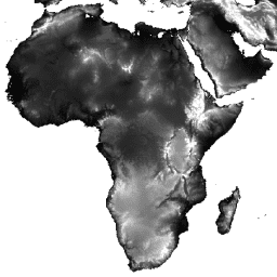
NASA SRTM 数字高程 30 米
航天飞机雷达地形测绘任务 (SRTM,参见 Farr 等人,2007 年) 数字高程数据是一项国际研究成果,获得了近乎全球范围的数字高程模型。此 SRTM V3 产品 (SRTM Plus) 由 NASA JPL 提供,分辨率为 1 角秒… dem 海拔 海拔-地形 地球物理 nasa srtm -
NASADEM:NASA 30 米数字高程模型
NASADEM 是对 SRTM 数据的重新处理,通过纳入来自 ASTER GDEM、ICESat GLAS 和 PRISM 数据集的辅助数据,提高了准确性。最重要的处理改进包括通过改进的相位解缠和使用 ICESat GLAS 数据进行控制来减少空白。文档:用户指南 dem 海拔 海拔-地形 地球物理 nasa srtm -
NEX-DCP30:NASA 地球交换降尺度气候预测的集成统计数据

NASA NEX-DCP30 数据集包含美国本土的降尺度气候情景,这些情景源自在耦合模式比较项目第 5 阶段(CMIP5,参见 Taylor 等人,2012 年)下进行的一般环流模型 (GCM) 运行,并涵盖四种温室… cag climate cmip5 geophysical ipcc nasa -
NEX-DCP30:NASA Earth Exchange 降尺度气候预测

NASA NEX-DCP30 数据集包含美国本土的降尺度气候情景,这些情景源自在耦合模式比较项目第 5 阶段(CMIP5,参见 Taylor 等人,2012 年)下进行的一般环流模型 (GCM) 运行,并涵盖四种温室… cag climate cmip5 geophysical ipcc nasa -
NEX-GDDP-CMIP6:NASA 地球交换全球每日降尺度气候预测

NEX-GDDP-CMIP6 数据集包含全球降尺度气候情景,这些情景源自在耦合模式比较项目第 6 阶段 (CMIP6,参见 Thrasher 等人,2022 年) 下开展的全球环流模式 (GCM) 运行,并涵盖四种“第一级”温室气体排放情景中的两种… cag climate gddp geophysical ipcc nasa -
NEX-GDDP:NASA Earth Exchange 全球每日降尺度气候预测

NASA NEX-GDDP 数据集包含全球降尺度气候情景,这些情景源自在耦合模式比较项目第 5 阶段 (CMIP5,参见 Taylor 等人,2012 年) 下进行的通用环流模型 (GCM) 运行,并涵盖四种温室气体排放情景中的两种。 cag climate cmip5 gddp geophysical ipcc -
NLDAS-2:北美陆面数据同化系统驱动场

陆面数据同化系统 (LDAS) 会结合多种观测源(例如雨量计数据、卫星数据和雷达降水测量数据),生成地表或近地表气候属性的估计值。此数据集是北美陆面数据同化系统 (NLDAS-2) 第 2 阶段的主要(默认)驱动文件(文件 A)… climate evaporation forcing geophysical hourly humidity -
OPERA Radiometric Terrain-Corrected SAR Backscatter from Sentinel-1 Static Layers V1.0

此产品包含与 OPERA 辐射校正地形的 Sentinel-1 SAR 反向散射数据集关联的静态雷达几何图层。由于 S1 任务的轨道管较窄,因此入射角、局部入射角、观测次数和 RTC 面积归一化因子 (ANF) 等雷达几何图层… jpl nasa opera sar satellite-imagery sentinel1-derived -
OPERA 辐射地形校正的 Sentinel-1 SAR 反向散射 V1.0

此产品包含相对于地形进行归一化的雷达后向散射。它可将与地面散射物体(例如地表粗糙度和土壤湿度和/或植被)的物理属性相关的信号进行映射。OPERA RTC-S1 产品源自哥白尼 Sentinel-1 干涉宽幅 (IW) … backscatter jpl nasa opera polarization radar -
海洋颜色 SMI:标准映射图像 MODIS Aqua 数据

此 3 级产品包括在 EOSDIS 下生成或收集的海洋颜色和卫星海洋生物学数据。该数据集可用于研究沿海地区的生物学和水文学、沿海海洋生境的多样性和地理分布变化、生物地球化学通量和… 生物学 叶绿素 modis nasa oceandata 大洋 -
海洋颜色 SMI:标准映射图像 MODIS Terra 数据

此 3 级产品包括在 EOSDIS 下生成或收集的海洋颜色和卫星海洋生物学数据。该数据集可用于研究沿海地区的生物学和水文学、沿海海洋生境的多样性和地理分布变化、生物地球化学通量和… 生物学 叶绿素 modis nasa oceandata 大洋 -
海洋颜色 SMI:标准映射图像 SeaWiFS 数据

此 3 级产品包括在 EOSDIS 下生成或收集的海洋颜色和卫星海洋生物学数据。该数据集可用于研究沿海地区的生物学和水文学、沿海海洋生境的多样性和地理分布变化、生物地球化学通量和… 生物学 叶绿素 美国国家航空航天局 (NASA) 海洋数据 海洋 反射率 -
重新处理的 GLDAS-2.0:全球陆面数据同化系统

NASA 全球陆面数据同化系统第 2 版 (GLDAS-2) 包含三个组成部分:GLDAS-2.0、GLDAS-2.1 和 GLDAS-2.2。GLDAS-2.0 完全由普林斯顿气象强迫输入数据强迫,并提供 1948 年至 2014 年的时间上一致的序列。GLDAS-2.1 采用模型… 3 小时 气候 冰冻圈 蒸发 强迫 地球物理 -
SPL3SMP_E.005 SMAP L3 Radiometer Global Daily 9 km Soil Moisture

自 2023-12-04 起的数据可在 NASA/SMAP/SPL3SMP_E/006 集合中获取。此 3 级 (L3) 土壤湿度产品提供由土壤湿度主动被动 (SMAP) L 波段辐射计检索到的全球陆地表面状况的每日合成数据。此处的每日数据是从降轨(当地时间 … drought nasa smap soil soil-moisture surface -
SPL3SMP_E.006 SMAP L3 辐射计全球每日 9 公里土壤湿度
2023-12-04 之前的数据可在旧版 NASA/SMAP/SPL3SMP_E/005 集合中找到。这些图片最终会重新处理并添加到此合集中。此 L3 级土壤湿度产品提供由土壤湿度主动被动 (SMAP) L 波段雷达检索到的全球陆地表面状况的每日合成数据… drought nasa smap soil soil-moisture surface -
SPL4SMGP.008 SMAP L4 全球 3 小时 9 公里地表和根区土壤湿度
SMAP Level-4 (L4) 土壤湿度产品包括地表土壤湿度(0-5 厘米垂直平均值)、根区土壤湿度(0-100 厘米垂直平均值)和其他研究产品(未经过验证),包括地表气象强迫变量、土壤温度、蒸发蒸腾和净辐射。此数据集正式称为… drought nasa smap soil soil-moisture surface -
TEMPO 网格化 HCHO(经过质量保证过滤)垂直列 V03
甲醛 Level 3 集合可提供常规网格上的微量气体信息,涵盖 TEMPO 正常观测的视场。3 级文件是通过合并构成 TEMPO 东西向扫描周期的所有 2 级文件中的信息而得出的。栅格包含以下信息… air-quality formaldehyde nasa pollution satellite-imagery tempo -
TEMPO 网格化 HCHO 垂直柱 V03
甲醛 Level 3 集合可提供常规网格上的微量气体信息,涵盖 TEMPO 正常观测的视场。3 级文件是通过合并构成 TEMPO 东西向扫描周期的所有 2 级文件中的信息而得出的。栅格包含以下信息… air-quality formaldehyde nasa pollution satellite-imagery tempo -
TEMPO 网格化 NO2(经过质量保证过滤)对流层和平流层柱浓度 V03
二氧化氮 Level 3 文件提供常规网格上的微量气体信息,涵盖 TEMPO 视场以进行名义 TEMPO 观测。Level 3 文件是通过合并构成 TEMPO 东西向扫描周期的所有 Level 2 文件中的信息得出的。光栅包含… air-quality nasa nitrogen-dioxide pollution satellite-imagery tempo -
TEMPO 网格化 NO2 对流层和平流层柱浓度 V03
二氧化氮 Level 3 文件提供常规网格上的微量气体信息,涵盖 TEMPO 视场以进行名义 TEMPO 观测。Level 3 文件是通过合并构成 TEMPO 东西向扫描周期的所有 Level 2 文件中的信息得出的。光栅包含… air-quality nasa nitrogen-dioxide pollution satellite-imagery tempo -
TEMPO 网格化臭氧总柱 V03(临时)

TEMPO 网格化臭氧总柱 V03(临时)是一个 3 级数据集,可在北美洲的规则网格上提供基本的臭氧总柱信息。该数据由 IS-40e 平台上的 TEMPO 仪器生成,通过组合和重新网格化 2 级数据创建而成,… air-quality nasa ozone pollution satellite-imagery tempo -
TOMS 和 OMI 合并的臭氧数据 v4

全臭氧测绘光谱仪 (TOMS) 数据是主要的长期连续记录,其中包含基于卫星的观测结果,可用于监测过去 25 年全球和区域总臭氧的变化趋势。这些数据由 NASA 戈达德太空飞行中心的 Laboratory for Atmospheres 制作… 大气 气候 地球物理 nasa 臭氧 -
TRMM 3B42:3 小时降水估计值

热带降雨测量任务 (TRMM) 是 NASA 与日本宇宙航空研究开发机构 (JAXA) 之间的联合任务,旨在监测和研究热带降雨。34B2 产品包含网格化、经过 TRMM 调整的合并红外降水(毫米/小时)和 RMS 降水误差估计值,时间分辨率为 3 小时… 3 小时 气候 地球物理 jaxa nasa 降水 -
TRMM 3B43:月度降水估计值

此集合不再更新。请参阅 IMERG 月度此数据集以算法方式合并了来自多颗卫星(包括 SSMI、SSMIS、MHS、AMSU-B 和 AMSR-E)的微波数据,每颗卫星都经过了与 TRMM 组合仪器的相互校准。算法 3B43 每月执行一次,以生成单个… climate geophysical jaxa nasa precipitation rainfall -
VJ114IMGTDL_NRT 日光栅:VIIRS (NOAA-20) 375 米波段活动火点

NOAA-20 (JPSS-1) 可见光红外成像辐射计套件 (VIIRS) 主动火点探测产品基于该仪器的 375 米标称分辨率数据。与其他粗分辨率(≥ 1 公里)卫星火灾探测产品相比,改进后的 375 米数据在探测相对较小的火灾时具有更高的响应能力… eosdis 火灾 firms 地球物理 热点 lance -
VNP09GA:VIIRS 地表反射率每日 500 米和 1 公里

可见光红外成像辐射计套件 (VIIRS) 每日地表反射率 (VNP09GA) 产品可提供来自 Suomi 国家极地轨道合作伙伴卫星计划 (S-NPP) VIIRS 传感器的陆地表面反射率估计值。提供的数据包含三个影像波段(I1、I2、I3),名义分辨率为 500 米(约 463 米)… daily nasa noaa npp reflectance satellite-imagery -
VNP09H1:VIIRS 地表反射率 8 天 L3 全球 500 米

8 天可见光红外成像辐射仪套件 (VIIRS) 地表反射率 (VNP09H1) 第 1 版合成产品可提供 Suomi 国家极轨伙伴卫星 (Suomi NPP) VIIRS 传感器在标称分辨率 500 米(约 463 米)的三个影像波段(I1、I2、I3)的地表反射率估计值。… daily nasa noaa npp reflectance satellite-imagery -
VNP13A1.002:VIIRS 植被指数 16 天 500 米

Suomi 国家极地轨道合作伙伴卫星计划 (S-NPP) NASA 可见光红外成像辐射计套件 (VIIRS) 植被指数 (VNP13A1) 数据产品通过在 16 天的采集期内以 500 米的分辨率选择最佳可用像素来提供植被指数。VNP13 数据产品旨在… 16 天 evi nasa ndvi noaa npp -
VNP14A1.002:热异常/火灾每日 L3 全球 1 公里 SIN 网格

Suomi 国家极地轨道合作伙伴卫星计划 NASA 可见光红外成像辐射计套件 (VIIRS) 热异常/火点 (VNP14A1) 第 1 版数据产品可提供有关活跃火点和其他热异常的每日信息。VNP14A1 数据产品是全球 1 公里网格化火点复合数据,由 … fire land nasa noaa surface viirs -
VNP14IMGTDL_NRT 日光栅:VIIRS (S-NPP) 375 米波段活跃火情

Suomi NPP 可见光红外成像辐射计套件 (VIIRS) 主动火点探测产品基于该仪器的 375 米标称分辨率数据。与其他粗分辨率(≥ 1 公里)卫星火灾探测产品相比,改进后的 375 米数据在探测相对较小的火灾时具有更高的响应能力… eosdis 火灾 firms 地球物理 热点 lance -
VNP15A2H:LAI/FPAR 8 天 L4 全球 500 米 SIN 网格

可见光红外成像辐射计套件 (VIIRS) 叶面积指数 (LAI) 和光合有效辐射吸收比 (FPAR) 第 1 版数据产品以 500 米分辨率 (VNP15A2H) 提供有关植被冠层的信息。VIIRS 传感器位于 NOAA/NASA 联合 Suomi 国家极地轨道合作伙伴卫星计划 (Suomi NPP) 卫星上。 land nasa noaa surface vegetation-indices viirs -
VNP21A1D.002:1 公里逐日白天地表温度与发射率
NASA Suomi 国家极地轨道合作伙伴卫星计划 (Suomi NPP) 可见光红外成像辐射计套件 (VIIRS) 地表温度与发射率 (LST&E) 昼间第 1 版产品 (VNP21A1D),系由昼间 2 级格网 (L2G) 中间产品每日汇编而成。L2G 流程可将每日 VNP21 轨道分片数据映射到… climate daily day land nasa noaa -
VNP21A1N.002:1 公里逐日夜间地表温度与发射率

NASA Suomi 国家极地轨道合作伙伴卫星计划 (Suomi NPP) 可见光红外成像辐射计套件 (VIIRS) 地表温度与发射率 (LST&E) 夜间第 1 版产品 (VNP21A1N),系由夜间 2 级格网 (L2G) 中间产品每日汇编而成。L2G 流程可将每日 VNP21 轨道分片数据映射到… climate daily land nasa night noaa -
VNP22Q2.002:地表物候年度 L3 全球 500 米 SIN 网格

Suomi 国家极地轨道合作伙伴卫星计划 (Suomi NPP) NASA 可见光红外成像辐射计套件 (VIIRS) 地表物候年度 (VNP22Q2) 第 2 版数据产品以年度间隔提供全球地表物候 (GLSP) 指标。VNP22Q2 数据产品源自双波段的时间序列… land nasa ndvi noaa npp onset-greenness -
VNP43IA1:BRDF/反照率模型参数每日 L3 全球 500 米 SIN 网格

Suomi 国家极地轨道合作伙伴卫星计划 (Suomi NPP) NASA 可见光红外成像辐射计套件 (VIIRS) 双向反射率分布函数 (BRDF) 和反照率模型形参 (VNP43IA1) 第 1 版产品提供 500 米分辨率的核权重(形参)。VNP43IA1 产品每天使用 16 天的 VIIRS 数据生成… land nasa noaa satellite-imagery surface viirs -
VNP43IA2:BRDF/反照率质量每日 L3 全球 500 米 SIN 网格

Suomi 国家极地轨道合作伙伴卫星计划 (Suomi NPP) NASA 可见光红外成像辐射计套件 (VIIRS) 双向反射率分布函数 (BRDF) 和反照率质量 (VNP43IA2) 第 1 版产品以 500 米分辨率提供 BRDF 和反照率质量。VNP43IA2 产品每天生成一次,使用 16 天的 VIIRS … land nasa noaa satellite-imagery surface viirs -
VNP43IA4:BRDF/反照率质量每日 L3 全球 500 米 SIN 网格
NASA/NOAA Suomi 国家极地轨道合作伙伴卫星计划 (Suomi NPP) 可见光红外成像辐射计套件 (VIIRS) 天底双向反射率分布函数 (BRDF) 调整后的反射率 (NBAR) 第 2 版产品以 500 米分辨率提供 NBAR 估计值。VNP43IA4 产品每天使用 16 天的 VIIRS 数据生成… brdf land nasa noaa satellite-imagery surface -
VNP46A1:VIIRS 每日网格化昼夜波段 500 米线性纬度经度网格夜间

Suomi 国家极地轨道合作伙伴卫星计划 (SNPP) 可见光红外成像辐射计套件 (VIIRS) 支持一种昼夜频段 (DNB) 传感器,可提供全球每日夜间可见光和近红外 (NIR) 光测量数据,适用于地球系统科学和应用。VIIRS DNB 在弱光条件下的超高灵敏度… daily dnb nasa noaa population viirs -
VNP46A2:VIIRS 采用月球间隙填充技术的 BRDF 夜间灯光每日 L3 全球 500 米数据
Suomi 国家极地轨道合作伙伴卫星计划 (SNPP) 可见光红外成像辐射计套件 (VIIRS) 支持昼夜频段 (DNB) 传感器,可提供夜间可见光和近红外(NIR) 光的全球每日测量数据,适用于地球系统科学和应用。VIIRS DNB 在弱光条件下的超高灵敏度… brdf daily nasa nighttime noaa population -
VNP64A1.002:月度烧毁面积 L4 全球 500 米 SIN 网格

Suomi 国家极地轨道合作伙伴卫星计划 (Suomi NPP) NASA 可见光红外成像辐射计套件 (VIIRS) 烧毁面积 (VNP64A1) 第 2 版数据产品是一种每月更新的全球格网化 500 米产品,包含每个像素的烧毁面积和质量信息。VNP64 烧毁区域测绘方法采用 750 米 VIIRS … burn change-detection fire land nasa surface
Datasets tagged nasa in Earth Engine
[null,null,[],[],["ASTER L1T Radiance data collection stopped due to technical issues. GPWv411 datasets provide population estimates, density, land area, and water area per grid cell, based on census data. FIRMS offers real-time fire locations. GLIMS inventories land ice. GEDI datasets contain elevation, height, and biomass metrics in various formats. Other datasets include mangrove forest distribution and vegetation metrics in different pixel sizes and resolutions. MODIS and VIIRS products measure reflectance, land surface temperature, vegetation, fire, and atmospheric conditions. Additionally, data on soil moisture, ozone, precipitation, elevation, and ice are detailed.\n"]]