NASA NEX-GDDP veri kümesi, Küresel İklim Modeli (GCM) kapsamında yürütülen ve ölçeği küçültülmüş iklim senaryolarından oluşur. Bu senaryolar, Birleşik Model Karşılaştırma Projesi 5. Aşaması (CMIP5, bkz. Taylor ve diğerleri, 2012) kapsamında ve Temsili Konsantrasyon Yolları (RCP'ler, bkz. Meinshausen ve diğerleri, 2011) olarak bilinen dört sera gazı emisyonu senaryosundan ikisinde yürütülmüştür.
CMIP5 GCM çalıştırmaları, Hükümetlerarası İklim Değişikliği Paneli'nin (IPCC AR5) Beşinci Değerlendirme Raporu'nu desteklemek için geliştirilmiştir.
Bu veri kümesi, NASA Earth Exchange kullanılarak Climate Analytics Group ve NASA Ames Araştırma Merkezi tarafından hazırlanmış ve NASA Center for Climate Simulation (NCCS) tarafından dağıtılmıştır.
Bantlar
Piksel Boyutu 27830 metre
Bantlar
Ad
Birimler
Min.
Maks.
Piksel Boyutu
Açıklama
pr
kg/m^2/s
0*
0,42*
metre
Yüzeydeki günlük ortalama yağış; her türden bulutun (hem büyük ölçekli hem de konvektif) sıvı ve katı fazlarını içerir.
tasmin
K
165,31*
318,89*
metre
Günlük minimum yüzeye yakın hava sıcaklığının günlük ortalaması
tasmax
K
188,38*
335,13*
metre
Günlük maksimum yüzeye yakın hava sıcaklığının günlük ortalaması
CMIP5 senaryosunun adı. Şunlardan biridir: "historical", "rcp45", "rcp85". Burada "historical" geriye dönük model çalıştırmalarını (2006 öncesi) ifade eder.
Thrasher, B., Maurer, E. P., McKellar, C., & Duffy, P. B., 2012:
Technical Note: Bias correcting climate model simulated daily temperature
extremes with quantile mapping. Hydrology and Earth System Sciences,
16(9), 3309-3314.
doi:10.5194/hess-16-3309-2012
NASA NEX-GDDP veri kümesi, Küresel İklim Modeli (GCM) kapsamında yürütülen ve Küresel İklim Modeli Karşılaştırma Projesi 5. Aşama (CMIP5, bkz. Taylor ve diğerleri, 2012) kapsamında gerçekleştirilen küresel ölçekte iklim senaryolarından oluşur. Bu senaryolar, dört sera gazı emisyonu senaryosundan ikisi olan …
[null,null,[],[[["\u003cp\u003eThe NASA NEX-GDDP dataset provides downscaled climate scenarios derived from CMIP5 GCM runs, covering two greenhouse gas emissions scenarios (RCPs).\u003c/p\u003e\n"],["\u003cp\u003eIt includes daily projections of precipitation, minimum and maximum near-surface air temperature from 1950 to 2100 at a 27830-meter resolution.\u003c/p\u003e\n"],["\u003cp\u003eDeveloped by the Climate Analytics Group and NASA Ames Research Center, this dataset is publicly available without restrictions.\u003c/p\u003e\n"],["\u003cp\u003eData is available for various CMIP5 models and scenarios, including 'historical', 'rcp45', and 'rcp85'.\u003c/p\u003e\n"],["\u003cp\u003eUsers can explore the dataset and access code examples through the Google Earth Engine platform.\u003c/p\u003e\n"]]],[],null,["# NEX-GDDP: NASA Earth Exchange Global Daily Downscaled Climate Projections\n\nDataset Availability\n: 1950-01-01T00:00:00Z--2100-12-31T00:00:00Z\n\nDataset Provider\n:\n\n\n [NASA / Climate Analytics Group](https://www.nccs.nasa.gov/services/data-collections/land-based-products/nex-gddp)\n\nCadence\n: 1 Day\n\nTags\n:\n[cag](/earth-engine/datasets/tags/cag) [climate](/earth-engine/datasets/tags/climate) [cmip5](/earth-engine/datasets/tags/cmip5) [gddp](/earth-engine/datasets/tags/gddp) [geophysical](/earth-engine/datasets/tags/geophysical) [ipcc](/earth-engine/datasets/tags/ipcc) [nasa](/earth-engine/datasets/tags/nasa) [nex](/earth-engine/datasets/tags/nex) [precipitation](/earth-engine/datasets/tags/precipitation) [temperature](/earth-engine/datasets/tags/temperature) \n\n#### Description\n\nThe NASA NEX-GDDP dataset is comprised of downscaled climate scenarios\nfor the globe that are derived from the General Circulation Model (GCM)\nruns conducted under the Coupled Model Intercomparison Project Phase 5\n(CMIP5, see [Taylor et al. 2012](https://journals.ametsoc.org/doi/abs/10.1175/BAMS-D-11-00094.1))\nand across two of the four greenhouse gas emissions scenarios known as\nRepresentative Concentration Pathways (RCPs, see [Meinshausen et\nal. 2011](https://rd.springer.com/article/10.1007%2Fs10584-011-0156-z#page-1)).\nThe CMIP5 GCM runs were developed in support of the Fifth Assessment\nReport of the Intergovernmental Panel on Climate Change (IPCC AR5).\n\nThis dataset was prepared by the Climate Analytics Group and NASA Ames\nResearch Center using the NASA Earth Exchange, and distributed by the NASA\nCenter for Climate Simulation (NCCS).\n\n### Bands\n\n\n**Pixel Size**\n\n27830 meters\n\n**Bands**\n\n| Name | Units | Min | Max | Pixel Size | Description |\n|----------|-----------|----------|----------|------------|------------------------------------------------------------------------------------------------------------------------------------------|\n| `pr` | kg/m\\^2/s | 0\\* | 0.42\\* | meters | Daily mean of precipitation at surface; includes both liquid and solid phases from all types of clouds (both large-scale and convective) |\n| `tasmin` | K | 165.31\\* | 318.89\\* | meters | Daily mean of the daily-minimum near-surface air temperature |\n| `tasmax` | K | 188.38\\* | 335.13\\* | meters | Daily mean of the daily-maximum near-surface air temperature |\n\n\\* estimated min or max value\n\n### Image Properties\n\n**Image Properties**\n\n| Name | Type | Description |\n|----------|--------|----------------------------------------------------------------------------------------------------------------------------------------------------------------------------------------------------------------------------------------------------------------------------------------------------------------------------|\n| model | STRING | Name of the CMIP5 model. It is one of 'ACCESS1-0', 'bcc-csm1-1', 'BNU-ESM', 'CanESM2', 'CCSM4', 'CESM1-BGC', 'CNRM-CM5', 'CSIRO-Mk3-6-0', 'GFDL-CM3', 'GFDL-ESM2G', 'GFDL-ESM2M', 'inmcm4', 'IPSL-CM5A-LR', 'IPSL-CM5A-MR', 'MIROC-ESM', 'MIROC-ESM-CHEM', 'MIROC5', 'MPI-ESM-LR', 'MPI-ESM-MR', 'MRI-CGCM3', 'NorESM1-M'. |\n| scenario | STRING | Name of the CMIP5 scenario. It is one of: 'historical', 'rcp45', 'rcp85', where 'historical' designates retrospective model runs (pre-2006). |\n| year | DOUBLE | Calendar year |\n| month | DOUBLE | Calendar month |\n| day | DOUBLE | Calendar day |\n\n### Terms of Use\n\n**Terms of Use**\n\nThis dataset is in the public domain and is available\nwithout restriction on use and distribution. See [NASA's\nEarth Science Data \\& Information Policy](https://www.earthdata.nasa.gov/engage/open-data-services-and-software/data-and-information-policy)\nfor additional information.\n\n### Citations\n\nCitations:\n\n- Thrasher, B., Maurer, E. P., McKellar, C., \\& Duffy, P. B., 2012:\n Technical Note: Bias correcting climate model simulated daily temperature\n extremes with quantile mapping. Hydrology and Earth System Sciences,\n 16(9), 3309-3314.\n [doi:10.5194/hess-16-3309-2012](https://doi.org/10.5194/hess-16-3309-2012)\n\n### Explore with Earth Engine\n\n| **Important:** Earth Engine is a platform for petabyte-scale scientific analysis and visualization of geospatial datasets, both for public benefit and for business and government users. Earth Engine is free to use for research, education, and nonprofit use. To get started, please [register for Earth Engine access.](https://console.cloud.google.com/earth-engine)\n\n### Code Editor (JavaScript)\n\n```javascript\n
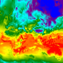
var dataset = ee.ImageCollection('NASA/NEX-GDDP')\n .filter(ee.Filter.date('2018-07-01', '2018-07-02'));\nvar minimumAirTemperature = dataset.select('tasmin');\nvar minimumAirTemperatureVis = {\n min: 240.0,\n max: 300.0,\n palette: ['blue', 'purple', 'cyan', 'green', 'yellow', 'red'],\n};\nMap.setCenter(71.72, 52.48, 3.0);\nMap.addLayer(\n minimumAirTemperature, minimumAirTemperatureVis, 'Minimum Air Temperature');\n```\n[Open in Code Editor](https://code.earthengine.google.com/?scriptPath=Examples:Datasets/NASA/NASA_NEX-GDDP) \n[NEX-GDDP: NASA Earth Exchange Global Daily Downscaled Climate Projections](/earth-engine/datasets/catalog/NASA_NEX-GDDP) \nThe NASA NEX-GDDP dataset is comprised of downscaled climate scenarios for the globe that are derived from the General Circulation Model (GCM) runs conducted under the Coupled Model Intercomparison Project Phase 5 (CMIP5, see Taylor et al. 2012) and across two of the four greenhouse gas emissions scenarios known as ... \nNASA/NEX-GDDP, cag,climate,cmip5,gddp,geophysical,ipcc,nasa,nex,precipitation,temperature \n1950-01-01T00:00:00Z/2100-12-31T00:00:00Z \n-90 -180 90 180 \nGoogle Earth Engine \nhttps://developers.google.com/earth-engine/datasets\n\n- [](https://doi.org/https://www.nccs.nasa.gov/services/data-collections/land-based-products/nex-gddp)\n- [](https://doi.org/https://developers.google.com/earth-engine/datasets/catalog/NASA_NEX-GDDP)"]]