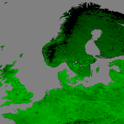
Suomi National Polar-Orbiting Partnership (S-NPP) NASA 가시광선 적외선 이미징 방사계 제품군 (VIIRS) 식생 지수 (VNP13A1) 데이터 제품은 500미터 해상도에서 16일 획득 기간 동안 사용 가능한 최적의 픽셀을 선택하는 프로세스를 통해 식생 지수를 제공합니다. VNP13 데이터 제품은 지구 관측 시스템 (EOS) 임무의 연속성을 촉진하기 위해 중간 해상도 이미징 분광계 (MODIS) Terra 및 Aqua 식생 지수 제품군을 따라 설계되었습니다.
VNP13 알고리즘 프로세스는 (1) 정규 식생 지수 (NDVI), (2) 향상된 식생 지수 (EVI), (3) 향상된 식생 지수-2 (EVI2)의 세 가지 식생 지수를 생성합니다.
(1) NDVI는 적색 및 근적외선 (NIR) 대역을 모두 사용하여 원격으로 감지된 가장 긴 연속 시계열 관측 중 하나입니다.
(2) EVI는 수관 피복에 더 민감한 약간 다른 식생 지수이며 NDVI는 엽록소에 더 민감합니다. (3) EVI2는 적색 대역과 NIR 대역을 사용하여 표준 3대역 EVI를 개혁한 것입니다. 이 개정은 파란색 밴드가 포함되지 않은 다른 EVI 모델과 VIIRS EVI를 비교할 때 발생하는 문제를 해결합니다. EVI2는 결국 표준 EVI가 됩니다.
이 제품에는 3개의 식생 지수 레이어와 함께 근적외선(NIR) 반사율, 3개의 단파 적외선(SWIR) 반사율(빨간색, 파란색, 녹색 반사율), 합성 연중일, 픽셀 신뢰도, 시야각 및 태양각, 품질 레이어도 포함됩니다.
Suomi National Polar-Orbiting Partnership (S-NPP) NASA Visible Infrared Imaging Radiometer Suite (VIIRS) 식생 지수 (VNP13A1) 데이터 제품은 500미터 해상도에서 16일 획득 기간 동안 사용 가능한 최적의 픽셀을 선택하는 과정을 통해 식생 지수를 제공합니다. VNP13 데이터 제품은 Moderate Resolution Imaging …
[null,null,[],[[["\u003cp\u003eThe NASA VIIRS VNP13A1 dataset provides vegetation indices (NDVI, EVI, EVI2) and reflectance data at 500m resolution over 16-day periods.\u003c/p\u003e\n"],["\u003cp\u003eThis dataset, available from 2012-01-17 to 2024-11-24, is designed for continuity with MODIS vegetation indices products.\u003c/p\u003e\n"],["\u003cp\u003eVNP13A1 includes quality assessment layers for pixel reliability, view and sun angles, and potential cloud or snow/ice presence.\u003c/p\u003e\n"],["\u003cp\u003eThe dataset is freely accessible through NASA LP DAAC and is easily integrated into Google Earth Engine for analysis.\u003c/p\u003e\n"],["\u003cp\u003eUsers are requested to cite the dataset appropriately in publications using data derived from this product.\u003c/p\u003e\n"]]],[],null,["Dataset Availability\n: 2012-01-17T00:00:00Z--2025-08-05T00:00:00Z\n\nDataset Provider\n:\n\n\n [NASA LP DAAC at the USGS EROS Center](https://doi.org/10.5067/VIIRS/VNP13A1.002)\n\nCadence\n: 8 Days\n\nTags\n:\n [16-day](/earth-engine/datasets/tags/16-day) [evi](/earth-engine/datasets/tags/evi) [nasa](/earth-engine/datasets/tags/nasa) [ndvi](/earth-engine/datasets/tags/ndvi) [noaa](/earth-engine/datasets/tags/noaa) [npp](/earth-engine/datasets/tags/npp) [vegetation](/earth-engine/datasets/tags/vegetation) [vegetation-indices](/earth-engine/datasets/tags/vegetation-indices) [viirs](/earth-engine/datasets/tags/viirs) \nvnp13a1 \n\nDescription \nThe Suomi National Polar-Orbiting Partnership (S-NPP) NASA Visible\nInfrared Imaging Radiometer Suite (VIIRS) Vegetation Indices (VNP13A1)\ndata product provides vegetation indices by a process of\nselecting the best available pixel over a 16-day acquisition period\nat 500 meter resolution. The VNP13 data products are designed\nafter the Moderate Resolution Imaging Spectroradiometer (MODIS)\nTerra and Aqua Vegetation Indices product suite to promote the\ncontinuity of the Earth Observation System (EOS) mission.\n\nThe VNP13 algorithm process produces three vegetation indices: (1)\nNormalized Difference Vegetation Index (NDVI), (2) the Enhanced\nVegetation Index (EVI), and (3) Enhanced Vegetation Index-2 (EVI2).\n(1) NDVI is one of the longest continual remotely sensed time series\nobservations, using both the red and near-infrared (NIR) bands.\n(2) EVI is a slightly different vegetation index that is more sensitive\nto canopy cover, while NDVI is more sensitive to chlorophyll. (3) EVI2\nis a reformation of the standard 3-band EVI, using the red band and\nNIR band. This reformation addresses arising issues when comparing\nVIIRS EVI to other EVI models that do not include a blue band. EVI2\nwill eventually become the standard EVI.\n\nAlong with the three Vegetation Indices layers, this product also\nincludes layers for near-infrared (NIR) reflectance; three shortwave\ninfrared (SWIR) reflectance-red, blue, and green reflectance; composite\nday of year; pixel reliability; view and sun angles, and a quality layer.\n\nFor additional information, visit the VIIRS [Land Product Quality\nAssessment website](https://landweb.modaps.eosdis.nasa.gov/browse?sensor=VIIRS&sat=SNPP) and see\nthe [User Guide](https://lpdaac.usgs.gov/documents/1372/VNP13_User_Guide_ATBD_V2.1.2.pdf).\n\nDocumentation:\n\n- [General Documentation](https://ladsweb.modaps.eosdis.nasa.gov/filespec/VIIRS/1/VNP13A1)\n\nBands\n\n\n**Pixel Size**\n\n500 meters\n\n**Bands**\n\n| Name | Units | Pixel Size | Wavelength | Description |\n|-----------------------------|-------|------------|-------------|--------------------------------------------|---|---|---|---|---|---|---|---|---|---|---|---|---|---|---|---|---|---|---|---|---|---|---|---|---|---|---|---|---|---|---|---|---|---|---|---|---|---|---|---|---|---|---|---|---|---|---|---|---|---|---|---|---|---|---|---|---|---|---|---|---|---|---|---|---|---|---|---|---|---|---|---|---|---|---|---|---|---|---|---|---|---|---|---|---|---|---|---|---|---|---|---|---|---|---|\n| `EVI` | | meters | None | 3 band Enhanced Vegetation Index |\n| `EVI2` | | meters | None | 2 band Enhanced Vegetation Index |\n| `NDVI` | | meters | None | Normalized Difference Vegetation Index |\n| `NIR_reflectance` | | meters | 846-885nm | Near-infrared Radiation reflectance |\n| `SWIR1_reflectance` | | meters | 1230-1250nm | Shortwave Infrared Radiation reflectance |\n| `SWIR2_reflectance` | | meters | 1580-1640nm | Shortwave Infrared Radiation reflectance |\n| `SWIR3_reflectance` | | meters | 2225-2275nm | Shortwave Infrared Radiation reflectance |\n| `VI_Quality` | | meters | None | Quality Assessment (QA) bit-field. |\n| Bitmask for VI_Quality - Bits 0-1: MODLAND_QA - 0: VI produced, good quality - 1: VI produced, but check other QA - 2: Pixel produced, but probably cloudy - 3: Pixel not produced due to other reason than clouds - Bits 2-5: VI Usefulness, higher values are worse. - 0: Highest Quality - 1: Lower quality - 2: Decreasing quality - 3: Decreasing quality - 4: Decreasing quality - 5: Decreasing quality - 6: Decreasing quality - 7: Decreasing quality - 8: Decreasing quality - 9: Decreasing quality - 10: Decreasing quality - 11: Decreasing quality - 12: Worst quality - 13: Quality so low that it is not useful - 14: L1B data faulty - 15: Not useful for any reason/not processed - Bits 6-7: Aerosol quantity - 0: Climatology - 1: Low - 2: Average - 3: High - Bit 8: Adjacent cloud detected - 0: No - 1: Yes - Bit 9: Adjacent BRDF correction performed - 0: No - 1: Yes - Bit 10: Mixed clouds - 0: No - 1: Yes - Bits 11-13: Land/Water Flag - 0: land \\& desert - 1: land no desert - 2: inland water - 3: sea_water - 5: coastal - Bit 14: Possible snow/ice - 0: No - 1: Yes - Bit 15: Possible shadow - 0: No - 1: Yes ||||||||||||||||||||||||||||||||||||||||||||||||||||||||||||||||||||||||||||||||||||||||||||||||||||\n| `red_reflectance` | | meters | 600-680nm | Red band reflectance |\n| `green_reflectance` | | meters | 545-656nm | Green band reflectance |\n| `blue_reflectance` | | meters | 478-498nm | Blue band reflectance |\n| `composite_day_of_the_year` | d | meters | None | Julian day of year |\n| `pixel_reliability` | | meters | None | Pixel usefulness using a simple rank class |\n| `relative_azimuth_angle` | deg | meters | None | Relative azimuth angle for each pixel |\n| `sun_zenith_angle` | deg | meters | None | Sun zenith angle for each pixel |\n| `view_zenith_angle` | deg | meters | None | View zenith angle for each pixel |\n\n**pixel_reliability Class Table**\n\n| Value | Color | Description |\n|-------|-------|-----------------------------|\n| 0 | None | Excellent |\n| 1 | None | Good |\n| 2 | None | Acceptable |\n| 3 | None | Marginal |\n| 4 | None | Pass |\n| 5 | None | Questionable |\n| 6 | None | Poor |\n| 7 | None | Cloud Shadow |\n| 8 | None | Snow/Ice |\n| 9 | None | Cloud |\n| 10 | None | Estimated |\n| 11 | None | LTAVG (taken from database) |\n\nTerms of Use\n\n**Terms of Use**\n\nLP DAAC NASA data are freely accessible; however, when an author\npublishes these data or works based on the data, it is requested that the\nauthor cite the datasets within the text of the publication and include a\nreference to them in the reference list.\n\nCitations \nCitations:\n\n- Please visit [LP DAAC 'Citing Our Data' page](https://lpdaac.usgs.gov/citing_our_data)\n for information on citing LP DAAC datasets.\n\nDOIs\n\n- \u003chttps://doi.org/10.5067/VIIRS/VNP13A1.002\u003e\n\nExplore with Earth Engine **Important:** Earth Engine is a platform for petabyte-scale scientific analysis and visualization of geospatial datasets, both for public benefit and for business and government users. Earth Engine is free to use for research, education, and nonprofit use. To get started, please [register for Earth Engine access.](https://console.cloud.google.com/earth-engine)\n\nCode Editor (JavaScript) \n\n```javascript\nvar dataset = ee.ImageCollection('NASA/VIIRS/002/VNP13A1')\n .filter(ee.Filter.date('2017-05-01', '2017-06-30'));\nvar rgb = dataset.select(['EVI']);\nvar rgbVis = {\n min: 0.0,\n max: 1.0,\n palette: ['000000', '004400', '008800', '00bb00', '00ff00'],\n};\nMap.setCenter(17.93, 7.71, 6);\nMap.addLayer(rgb, rgbVis, 'RGB');\n```\n[Open in Code Editor](https://code.earthengine.google.com/?scriptPath=Examples:Datasets/NASA/NASA_VIIRS_002_VNP13A1) \n[VNP13A1.002: VIIRS Vegetation Indices 16-Day 500m](/earth-engine/datasets/catalog/NASA_VIIRS_002_VNP13A1) \nThe Suomi National Polar-Orbiting Partnership (S-NPP) NASA Visible Infrared Imaging Radiometer Suite (VIIRS) Vegetation Indices (VNP13A1) data product provides vegetation indices by a process of selecting the best available pixel over a 16-day acquisition period at 500 meter resolution. The VNP13 data products are designed after the Moderate Resolution Imaging ... \nNASA/VIIRS/002/VNP13A1, 16-day,evi,nasa,ndvi,noaa,npp,vegetation,vegetation-indices,viirs \n2012-01-17T00:00:00Z/2025-08-05T00:00:00Z \n-90 -180 90 180 \nGoogle Earth Engine \nhttps://developers.google.com/earth-engine/datasets\n\n- [https://doi.org/10.5067/VIIRS/VNP13A1.002](https://doi.org/https://doi.org/10.5067/VIIRS/VNP13A1.002)\n- [https://doi.org/10.5067/VIIRS/VNP13A1.002](https://doi.org/https://developers.google.com/earth-engine/datasets/catalog/NASA_VIIRS_002_VNP13A1)"]]