Этот набор данных предоставляет сеточный анализ суточной температуры приземного воздуха над сушей на планете, включая суточные максимальные (Tmax) и минимальные (Tmin) температуры. Данные, охватывающие период с 1979 года по настоящее время, представлены на сетках широты и долготы с шагом 0,5 градуса, что соответствует разрешению анализа суточного количества осадков, проводимого Центром по контролю и профилактике заболеваний (CPC). При построении этого набора данных учитываются орографические эффекты. Его основная цель — поддержка мониторинга климата и проверки прогнозов. Входные данные берутся из архива ежедневных отчётов GTS (Глобальной системы телекоммуникаций) CPC, включая данные Tmax и Tmin примерно с 6000–7000 станций по всему миру.
Наборы данных NOAA CPC доступны без ограничений на использование или распространение. NOAA PSL требует от пользователя указания авторства и указания NOAA PSL, где это применимо, как источника данных.
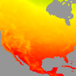
Этот набор данных представляет собой сеточный анализ суточной температуры приземного воздуха на всей территории Земли, включая суточные максимальные (Tmax) и минимальные (Tmin) температуры. Данные с 1979 года по настоящее время представлены в сетках широты и долготы с шагом 0,5 градуса, что соответствует разрешению анализа суточных глобальных осадков, проводимого Центром по контролю и профилактике заболеваний (CPC). Построение…
[null,null,[],[[["\u003cp\u003eThe NOAA/CPC/Temperature dataset provides daily maximum and minimum surface air temperatures over global land areas from 1979 to the present.\u003c/p\u003e\n"],["\u003cp\u003eData is presented on a 0.5-degree latitude/longitude grid and considers orographic effects for climate monitoring and forecast verification.\u003c/p\u003e\n"],["\u003cp\u003eThe dataset is based on reports from approximately 6,000 to 7,000 global stations and is freely available for use and distribution with proper attribution to NOAA PSL.\u003c/p\u003e\n"],["\u003cp\u003eUsers can explore and analyze this dataset further using Google Earth Engine.\u003c/p\u003e\n"]]],["The dataset offers a gridded analysis of daily surface air temperature, including maximum (Tmax) and minimum (Tmin), over global land areas. Data spans from January 1, 1979, to February 21, 2025, on 0.5-degree grids. It is provided by NOAA Physical Sciences Laboratory, derived from approximately 6,000 to 7,000 global stations. It provides a visualization platform, with the ability to apply filters to the data. Users can access and use the dataset without restrictions.\n"],null,["Dataset Availability\n: 1979-01-01T00:00:00Z--2025-08-30T00:00:00Z\n\nDataset Provider\n:\n\n\n [NOAA Physical Sciences Laboratory](https://psl.noaa.gov/data/gridded/data.cpc.globaltemp.html)\n\nTags\n:\n[climate](/earth-engine/datasets/tags/climate) [daily](/earth-engine/datasets/tags/daily) [noaa](/earth-engine/datasets/tags/noaa) [precipitation](/earth-engine/datasets/tags/precipitation) [weather](/earth-engine/datasets/tags/weather) \n\nDescription \nThis dataset provides a gridded analysis of daily surface air temperature\nover global land areas, including daily maximum (Tmax), minimum (Tmin)\ntemperatures. Spanning from 1979 to the present, the data is presented on\n0.5-degree latitude/longitude grids, aligning with the resolution of CPC's\ngauge-based global daily precipitation analysis. The construction of this\ndataset considers orographic effects. Its primary purpose is to support\nclimate monitoring and forecast verification activities. Input data\noriginates from the CPC archive of GTS (Global Telecommunication System)\ndaily reports, incorporating Tmax and Tmin data from approximately 6,000 to\n7,000 global stations.\n\nRefer [this](https://ftp.cpc.ncep.noaa.gov/precip/PEOPLE/wd52ws/global_temp/CPC-GLOBAL-T.pdf)\nfor technical documentation.\n\nBands\n\n\n**Pixel Size**\n\n55500 meters\n\n**Bands**\n\n| Name | Units | Min | Max | Pixel Size | Description |\n|--------|-------|----------|---------|------------|-------------------------------------------|\n| `tmax` | °C | -89.84\\* | 66.03\\* | meters | daily maximum temperature |\n| `tmin` | °C | -97.92\\* | 54.26\\* | meters | daily minimum temperature |\n| `nmax` | | 0\\* | 7\\* | meters | number of reports for maximum temperature |\n| `nmin` | | 0\\* | 7\\* | meters | number of reports for minimum temperature |\n\n\\* estimated min or max value\n\nTerms of Use\n\n**Terms of Use**\n\nThe NOAA CPC datasets are available without restriction\non use or distribution. NOAA PSL does request that the\nuser give proper attribution and identify NOAA PSL, where applicable,\nas the source of the data.\n\nExplore with Earth Engine **Important:** Earth Engine is a platform for petabyte-scale scientific analysis and visualization of geospatial datasets, both for public benefit and for business and government users. Earth Engine is free to use for research, education, and nonprofit use. To get started, please [register for Earth Engine access.](https://console.cloud.google.com/earth-engine)\n\nCode Editor (JavaScript) \n\n```javascript\nvar dataset = ee.ImageCollection('NOAA/CPC/Temperature').filter(ee.Filter.date('2018-01-01', '2019-01-01'));\nvar temperature = dataset.select('tmax');\nvar temperatureVis = {\n min: -40,\n max: 50,\n palette: ['#ADD8E6', '#008000', '#FFFF00', '#FFA500', '#FF0000', '#800080'],\n};\nMap.setCenter(-104.8, 49.1, 3);\nMap.addLayer(temperature, temperatureVis, 'NOAA CPC Temperature');\n```\n[Open in Code Editor](https://code.earthengine.google.com/?scriptPath=Examples:Datasets/NOAA/NOAA_CPC_Temperature) \n[CPC Global Unified Temperature](/earth-engine/datasets/catalog/NOAA_CPC_Temperature) \nThis dataset provides a gridded analysis of daily surface air temperature over global land areas, including daily maximum (Tmax), minimum (Tmin) temperatures. Spanning from 1979 to the present, the data is presented on 0.5-degree latitude/longitude grids, aligning with the resolution of CPC's gauge-based global daily precipitation analysis. The construction of ... \nNOAA/CPC/Temperature, climate,daily,noaa,precipitation,weather \n1979-01-01T00:00:00Z/2025-08-30T00:00:00Z \n-90 -180 90 180 \nGoogle Earth Engine \nhttps://developers.google.com/earth-engine/datasets\n\n- [](https://doi.org/https://psl.noaa.gov/data/gridded/data.cpc.globaltemp.html)\n- [](https://doi.org/https://developers.google.com/earth-engine/datasets/catalog/NOAA_CPC_Temperature)"]]