AI-generated Key Takeaways
-
This global accessibility map provides land-based travel time in minutes to the nearest hospital or clinic for a nominal year 2019.
-
The map includes both general travel time and "walking-only" travel time using non-motorized transport.
-
The dataset utilizes healthcare facility locations from OpenStreetMap (healthsites.io) and Google Maps, augmented with continental-scale data for Africa and Australia.
-
The analysis uses a "friction surface" based on various geographical datasets and least-cost-path algorithms to calculate travel times.
-
This work is licensed under a Creative Commons Attribution 4.0 International License.
- Dataset Availability
- 2019-01-01T00:00:00Z–2020-01-01T00:00:00Z
- Dataset Provider
- Malaria Atlas Project
- Tags
Description
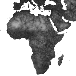
This global accessibility map enumerates land-based travel time (in minutes) to the nearest hospital or clinic for all areas between 85 degrees north and 60 degrees south for a nominal year 2019. It also includes "walking-only" travel time, using non-motorized means of transportation only.
Major data collection efforts underway by OpenStreetMap, Google Maps, and academic researchers have been harnessed to compile the most complete collection of healthcare facility locations to date. This map was produced through a collaboration between MAP (University of Oxford), Telethon Kids Institute (Perth, Australia), Google, and the University of Twente, Netherlands.
This project builds on previous work published by Weiss et al 2018 (doi:10.1038/nature25181). Weiss et al (2018) utilised datasets for roads (comprising the first ever global-scale use of Open Street Map and Google roads datasets), railways, rivers, lakes, oceans, topographic conditions (slope and elevation), landcover types, and national borders. These datasets were each allocated a speed or speeds of travel in terms of time to cross each pixel of that type. The datasets were then combined to produce a "friction surface": a map where every pixel is allocated a nominal overall speed of travel based on the types occurring within that pixel. For the current project, an updated friction surface was created to incorporate recent improvements within OSM roads data.
Least-cost-path algorithms (run in Google Earth Engine and, for high-latitude areas, in R) were used in conjunction with this friction surface to calculate the time of travel from all locations to the nearest (in time) healthcare facility. The healthcare facilities dataset utilized location data from two of the largest global databases: (1) OSM data that was collated and made available for download at www.healthsites.io; and (2) data extracted from Google Maps. The global datasets were augmented with continental-scale facility locations that were recently published for Africa and Australia. To facilitate comparisons between data sources, only facilities defined as hospitals and clinics were used. Multiple points found within the same pixel were merged to match the resolution of the analysis as defined by the selected gridded representation of the Earth's surface. Each pixel in the resultant accessibility map thus represents the modelled shortest time (in minutes) from that location to a hospital or clinic.
Source dataset credits are as described in the accompanying paper.
Bands
Pixel Size
927.67 meters
Bands
| Name | Units | Min | Max | Pixel Size | Description |
|---|---|---|---|---|---|
accessibility |
min | 0 | 41504.1 | meters | Travel time to the nearest hospital or clinic. |
accessibility_walking_only |
min | 0 | 138893 | meters | Travel time to the nearest hospital or clinic using non-motorized transport. |
Terms of Use
Terms of Use
This work is licensed under a Creative Commons Attribution 4.0 International License.
Citations
D.J. Weiss, A. Nelson, C.A. Vargas-Ruiz, K. Gligorić, S. Bavadekar, E. Gabrilovich, A. Bertozzi-Villa, J. Rozier, H.S. Gibson, T. Shekel, C. Kamath, A. Lieber, K. Schulman, Y. Shao, V. Qarkaxhija, A.K. Nandi, S.H. Keddie, S. Rumisha, E. Cameron, K.E. Battle, S. Bhatt, P.W. Gething. Global maps of travel time to healthcare facilities. Nature Medicine (2020).
Explore with Earth Engine
Code Editor (JavaScript)
var dataset = ee.Image('Oxford/MAP/accessibility_to_healthcare_2019');
var accessibility = dataset.select('accessibility');
var accessibilityVis = {
  min: 0.0,
  max: 41556.0,
  gamma: 4.0,
};
Map.setCenter(18.98, 6.66, 2);
Map.addLayer(accessibility, accessibilityVis, 'Accessibility');