- ডেটাসেট উপলব্ধতা
- 2019-01-01T00:00:00Z–2020-01-01T00:00:00Z
- ডেটাসেট প্রদানকারী
- ম্যালেরিয়া অ্যাটলাস প্রকল্প
- ট্যাগ
- ঘর্ষণ
বর্ণনা
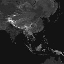
এই গ্লোবাল ঘর্ষণ পৃষ্ঠটি 2019 সালের একটি নামমাত্র বছরের জন্য 85 ডিগ্রি উত্তর এবং 60 ডিগ্রি দক্ষিণের মধ্যে সমস্ত ল্যান্ড পিক্সেলের জন্য ভূমি-ভিত্তিক ভ্রমণের গতি গণনা করে। এতে "শুধুমাত্র হাঁটা-চলা" ভ্রমণের গতিও অন্তর্ভুক্ত রয়েছে, শুধুমাত্র পরিবহনের অ-মোটর চালিত উপায় ব্যবহার করে। এই মানচিত্রটি এমএপি (অক্সফোর্ড বিশ্ববিদ্যালয়), টেলিথন কিডস ইনস্টিটিউট (পার্থ, অস্ট্রেলিয়া), গুগল এবং ইউনিভার্সিটি অফ টুয়েন্টি, নেদারল্যান্ডের মধ্যে সহযোগিতার মাধ্যমে তৈরি করা হয়েছে। এই প্রকল্পটি ওয়েইস এট আল 2018 ( doi:10.1038/nature25181 ) দ্বারা প্রকাশিত পূর্ববর্তী কাজের উপর ভিত্তি করে তৈরি করা হয়েছে। Weiss et al (2018) রাস্তাগুলির জন্য ডেটাসেটগুলি ব্যবহার করেছেন (ওপেন স্ট্রিট ম্যাপ এবং Google রাস্তার ডেটাসেটের প্রথমবারের মতো বিশ্বব্যাপী ব্যবহার সমন্বিত), রেলপথ, নদী, হ্রদ, মহাসাগর, টপোগ্রাফিক অবস্থা (ঢাল এবং উচ্চতা), ল্যান্ডকভারের ধরন এবং জাতীয় সীমানা। এই ডেটাসেটগুলিকে সেই ধরণের প্রতিটি পিক্সেল অতিক্রম করার জন্য সময়ের পরিপ্রেক্ষিতে একটি গতি বা ভ্রমণের গতি বরাদ্দ করা হয়েছিল। ডেটাসেটগুলিকে তখন একত্রিত করে একটি "ঘর্ষণ পৃষ্ঠ" তৈরি করা হয়েছিল; একটি মানচিত্র যেখানে প্রতিটি পিক্সেলকে সেই পিক্সেলের মধ্যে ঘটতে থাকা প্রকারের উপর ভিত্তি করে ভ্রমণের একটি নামমাত্র সামগ্রিক গতি বরাদ্দ করা হয়। বর্তমান প্রকল্পের জন্য, OSM রাস্তার ডেটার মধ্যে সাম্প্রতিক উন্নতিগুলিকে অন্তর্ভুক্ত করার জন্য একটি আপডেট করা ঘর্ষণ পৃষ্ঠ তৈরি করা হয়েছিল৷ এই ঘর্ষণ পৃষ্ঠ এবং 2015 সংস্করণের মধ্যে পার্থক্য (Weiss et al. 2018) অগত্যা অবকাঠামোর পরিবর্তনের নির্দেশক নয় (যেমন, নতুন রাস্তা তৈরি হচ্ছে)। এই ধরনের অসঙ্গতিগুলি উন্নত ডেটা মানের সাথে যুক্ত হওয়ার সম্ভাবনা বেশি, বিশেষ করে OSM রোড কভারেজের আপডেটগুলি। ফলস্বরূপ, ঘর্ষণ পৃষ্ঠতল এবং ফলে ভ্রমণ সময়ের মানচিত্রগুলির মধ্যে তুলনা সতর্কতার সাথে করা উচিত এবং সাধারণত সময়ের সাথে অ্যাক্সেসের পরিবর্তনগুলিকে প্রতিনিধিত্বকারী হিসাবে ব্যাখ্যা করা উচিত নয়। এই মানচিত্রটি এই বরাদ্দকরণ প্রক্রিয়া থেকে ভ্রমণের গতির প্রতিনিধিত্ব করে, যা এক মিটার ভ্রমণের জন্য প্রয়োজনীয় মিনিটের এককে প্রকাশ করে। এটি রেফারেন্সযুক্ত কাগজে বর্ণিত বিশ্বব্যাপী স্বাস্থ্যসেবা অ্যাক্সেসিবিলিটি মানচিত্রের পিছনে অন্তর্নিহিত ডেটাসেট গঠন করে।
উত্স ডেটাসেট ক্রেডিটগুলি সহগামী কাগজে বর্ণনা করা হয়েছে৷
ব্যান্ড
পিক্সেল সাইজ
927.67 মিটার
ব্যান্ড
| নাম | ইউনিট | মিন | সর্বোচ্চ | পিক্সেল সাইজ | বর্ণনা |
|---|---|---|---|---|---|
friction | মিনিট/মিটার | 0.000429 | 87.3075 | মিটার | ভূমি ভিত্তিক ভ্রমণ গতি। |
friction_walking_only | মিনিট/মিটার | 0.012 | 87.3075 | মিটার | অ-মোটর চালিত পরিবহন ব্যবহার করে ভূমি-ভিত্তিক ভ্রমণের গতি। |
ব্যবহারের শর্তাবলী
ব্যবহারের শর্তাবলী
এই কাজটি ক্রিয়েটিভ কমন্স অ্যাট্রিবিউশন 4.0 আন্তর্জাতিক লাইসেন্সের অধীনে লাইসেন্সপ্রাপ্ত।
উদ্ধৃতি
ডিজে ওয়েইস, এ. নেলসন, সিএ ভার্গাস-রুইজ, কে. গ্লিগোরিচ, এস. বাভাদেকর, ই. গ্যাব্রিলোভিচ, এ. বার্তোজি-ভিলা, জে. রোজিয়ের, এইচএস গিবসন, টি. শেকেল, সি. কামাথ, এ. লিবার, কে. শুলম্যান, ওয়াই শাও, ভি. কার্কাডি ই, এস, কে, রুর্কমি, এস. ক্যামেরন, কেই ব্যাটল, এস ভাট, পিডব্লিউ গেথিং। স্বাস্থ্যসেবা সুবিধাগুলিতে ভ্রমণের সময়ের বৈশ্বিক মানচিত্র। নেচার মেডিসিন (2020)।
আর্থ ইঞ্জিন দিয়ে অন্বেষণ করুন
কোড এডিটর (জাভাস্ক্রিপ্ট)
var dataset = ee.Image('Oxford/MAP/friction_surface_2019');
var landBasedTravelSpeed = dataset.select('friction');
var visParams = {
  min: 0.0022,
  max: 0.04,
  palette: [
    '313695', '4575b4', '74add1', 'abd9e9', 'e0f3f8', 'ffffbf', 'fee090',
    'fdae61', 'f46d43', 'd73027', 'a50026'
  ],
};
Map.setCenter(43.55, 36.98, 4);
Map.addLayer(landBasedTravelSpeed, visParams, 'Land-based travel speed');