- ডেটাসেট উপলব্ধতা
- 2010-01-01T00:00:00Z-2010-01-02T00:00:00Z
- ডেটাসেট প্রদানকারী
- মার্কিন যুক্তরাষ্ট্রের আদমশুমারি ব্যুরো
- ট্যাগ
- জনসংখ্যাগত
বর্ণনা
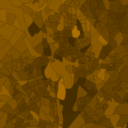
মার্কিন যুক্তরাষ্ট্রের আদমশুমারি ব্যুরো নিয়মিতভাবে TIGER নামে একটি জিওডাটাবেস প্রকাশ করে। এই সারণীতে 2010 সালের আদমশুমারি জনসংখ্যার প্রোফাইল 1 মানগুলি আদমশুমারি ট্র্যাক্ট দ্বারা একত্রিত করা হয়েছে। ট্র্যাক্ট এলাকাগুলি ব্যাপকভাবে পরিবর্তিত হয়, তবে শহুরে এলাকায় মোটামুটি একটি আশেপাশের সমতুল্য। মার্কিন যুক্তরাষ্ট্র, ডিস্ট্রিক্ট অফ কলম্বিয়া, পুয়ের্তো রিকো এবং দ্বীপ অঞ্চলগুলিকে কভার করে প্রায় 74,000 বহুভুজ বৈশিষ্ট্য রয়েছে।
সমস্ত TIGER 2010 পণ্যের সম্পূর্ণ প্রযুক্তিগত বিবরণের জন্য, TIGER প্রযুক্তিগত ডকুমেন্টেশন দেখুন।
প্রতিটি ট্র্যাক্টে DP1 জনসংখ্যা পরিমাপের যোগফল সহ বৈশিষ্ট্যগুলিও অন্তর্ভুক্ত থাকে যা সীমাকে ছেদ করে। DP1 লুকআপ টেবিলের সংক্ষিপ্ত নাম কলামের মতোই কলামগুলির নাম রয়েছে৷
টেবিল স্কিমা
টেবিল স্কিমা
| নাম | টাইপ | বর্ণনা |
|---|---|---|
| aland10 | দ্বিগুণ | জমির এলাকা |
| জল10 | দ্বিগুণ | জল এলাকা |
| geoid10 | STRING | সেন্সাস ট্র্যাক্ট আইডেন্টিফায়ার: স্টেট FIPS কোড, কাউন্টি FIPS কোড এবং সেন্সাস ট্র্যাক্ট কোডের সংমিশ্রণ |
| intptlat10 | STRING | অভ্যন্তরীণ বিন্দুর অক্ষাংশ |
| intptlon10 | STRING | অভ্যন্তরীণ বিন্দুর দ্রাঘিমাংশ |
| namelsad10 | STRING | আইনগত/পরিসংখ্যানগত এলাকার বিবরণ এবং আদমশুমারির ট্র্যাক্টের নাম |
| আকৃতি_ক্ষেত্র | দ্বিগুণ | বর্গ ডিগ্রীতে এলাকা |
| আকৃতি_দৈর্ঘ্য | দ্বিগুণ | ডিগ্রী মধ্যে ঘের |
ব্যবহারের শর্তাবলী
ব্যবহারের শর্তাবলী
ইউএস সেন্সাস ব্যুরো একটি অ্যাপ্লিকেশন প্রোগ্রামিং ইন্টারফেস (API) এর মাধ্যমে মেশিন-পাঠযোগ্য বিন্যাসে তার কিছু পাবলিক ডেটা অফার করে। API এর মাধ্যমে আপনার জন্য উপলব্ধ সমস্ত বিষয়বস্তু, ডকুমেন্টেশন, কোড এবং সম্পর্কিত উপকরণগুলি এই শর্তাবলীর অধীন৷
উদ্ধৃতি
ডেটা সেট থেকে প্রাপ্ত কোনো প্রতিবেদন, প্রকাশনা, নতুন ডেটা সেট, প্রাপ্ত পণ্য বা পরিষেবা তৈরির জন্য ব্যবহারকারীদের উচিত US সেন্সাস ব্যুরোকে উদ্ধৃত করা ।
আর্থ ইঞ্জিন দিয়ে অন্বেষণ করুন
কোড এডিটর (জাভাস্ক্রিপ্ট)
var dataset = ee.FeatureCollection('TIGER/2010/Tracts_DP1');
var visParams = {
  min: 0,
  max: 4000,
  opacity: 0.8,
};

// Turn the strings into numbers
dataset = dataset.map(function (f) {
  return f.set('shape_area', ee.Number.parse(f.get('dp0010001')));
});

Map.setCenter(-103.882, 43.036, 8);
var image = ee.Image().float().paint(dataset, 'dp0010001');

Map.addLayer(image, visParams, 'TIGER/2010/Tracts_DP1');
Map.addLayer(dataset, null, 'for Inspector', false);
একটি ফিচারভিউ হিসাবে কল্পনা করুন
FeatureView হল একটি FeatureCollection শুধুমাত্র দেখার জন্য, ত্বরিত উপস্থাপনা। আরো বিস্তারিত জানার জন্য, FeatureView ডকুমেন্টেশন দেখুন।
কোড এডিটর (জাভাস্ক্রিপ্ট)
var fvLayer = ui.Map.FeatureViewLayer('TIGER/2010/Tracts_DP1_FeatureView');

var visParams = {
  opacity: 0.8,
  color: {
    property: 'dp0010001',
    mode: 'linear',
    palette: ['black', 'white'],
    min: 0,
    max: 4000
  }
};

fvLayer.setVisParams(visParams);
fvLayer.setName('US census tracts demographics');

Map.setCenter(-103.882, 43.036, 8);
Map.add(fvLayer);