- Dostępność zbioru danych
- 2010-01-01T00:00:00Z–2010-01-02T00:00:00Z
- Dostawca zbioru danych
- United States Census Bureau
- Tagi
Opis
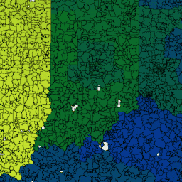
Obszary tabelaryzacji kodów pocztowych (ZCTA) to przybliżone reprezentacje obszarów 5-cyfrowych kodów pocztowych Poczty Stanów Zjednoczonych (USPS). Amerykańskie Biuro Spisu Ludności definiuje obszary ZCTA, przypisując każdy blok spisu ludności zawierający adresy do jednego obszaru ZCTA, zwykle do obszaru ZCTA, który odzwierciedla najczęściej występujący kod pocztowy dla adresów w tym bloku. Bloki, które nie zawierają adresów, ale są całkowicie otoczone przez jeden obszar kodów pocztowych (enklawy), są przypisywane do otaczającego je obszaru kodów pocztowych. Bloki otoczone przez wiele obszarów kodów pocztowych są dodawane do jednego z nich na podstawie najdłuższego wspólnego obwodu.
Amerykańskie Biuro Spisu Ludności identyfikuje obszary statystyczne 5-cyfrowych kodów pocztowych za pomocą 5-znakowego kodu numerycznego, który reprezentuje najczęściej występujący kod pocztowy USPS w danym obszarze statystycznym. Ten kod może zawierać zera na początku.
Użytkownicy danych nie powinni używać kodów ZCTA do identyfikowania oficjalnego kodu pocztowego USPS do dostarczania poczty. USPS okresowo zmienia kody pocztowe, aby usprawnić dostarczanie poczty. Kody pocztowe obejmujące głównie adresy niemieszkalne lub skrytki pocztowe mogą nie mieć odpowiadającego im obszaru ZCTA, ponieważ proces wyznaczania granic wykorzystuje głównie adresy mieszkalne, co powoduje odchylenie w stronę kodów pocztowych używanych do dostarczania poczty w miastach.
Pełne szczegóły techniczne wszystkich produktów TIGER 2010 znajdziesz w dokumentacji technicznej TIGER.
Schemat tabeli
Schemat tabeli
| Nazwa | Typ | Opis |
|---|---|---|
| ALAND10 | LICZBA ZMIENNOPRZECINKOWA O PODWÓJNEJ PRECYZJI | Powierzchnia lądu według spisu ludności z 2010 r. |
| AWATER10 | LICZBA ZMIENNOPRZECINKOWA O PODWÓJNEJ PRECYZJI | Obszar wodny według spisu powszechnego z 2010 r. |
| CLASSFP10 | CIĄG ZNAKÓW | Kod klasy FIPS 55 z 2010 r. |
| FUNCSTAT10 | CIĄG ZNAKÓW | Stan funkcjonalny spisu powszechnego z 2010 r. (zawsze „S” w przypadku „jednostki statystycznej”). |
| GEOID10 | CIĄG ZNAKÓW | Identyfikator obszaru statystycznego 5-cyfrowego kodu pocztowego z 2010 r. |
| INTPTLAT10 | CIĄG ZNAKÓW | Szerokość geograficzna wewnętrznego punktu spisu powszechnego z 2010 r. |
| INTPTLON10 | CIĄG ZNAKÓW | Długość geograficzna wewnętrznego punktu spisu powszechnego z 2010 r. |
| MTFCC10 | CIĄG ZNAKÓW | Kod klasy obiektu MAF/TIGER (zawsze „G6350”). |
| ZCTA5CE10 | CIĄG ZNAKÓW | Kod obszaru statystycznego 5-cyfrowego kodu pocztowego z 2010 r. |
Warunki korzystania z usługi
Warunki korzystania z usługi
Amerykańskie Biuro Spisu Ludności udostępnia niektóre ze swoich publicznych danych w formacie czytelnym dla maszyn za pomocą interfejsu API. Wszystkie treści, dokumentacja, kod i materiały powiązane udostępniane Ci za pomocą interfejsu API podlegają niniejszym warunkom.
Cytaty
W przypadku tworzenia raportów, publikacji, nowych zbiorów danych, produktów pochodnych lub usług na podstawie zbioru danych użytkownicy powinni cytować US Census Bureau.
Odkrywanie za pomocą Earth Engine
Edytor kodu (JavaScript)
var dataset = ee.FeatureCollection('TIGER/2010/ZCTA5');
var visParams = {
  palette: ['black', 'purple', 'blue', 'green', 'yellow', 'orange', 'red'],
  min: 500000,
  max: 1000000000,
};

var zctaOutlines = ee.Image().float().paint({
  featureCollection: dataset,
  color: 'black',
  width: 1
});

var image = ee.Image().float().paint(dataset, 'ALAND10');
Map.setCenter(-93.8008, 40.7177, 6);
Map.addLayer(image, visParams, 'TIGER/2010/ZCTA5');
Map.addLayer(zctaOutlines, {}, 'borders');
Map.addLayer(dataset, {}, 'for Inspector', false);
Wyświetlanie jako widok cech
FeatureView to przyspieszona reprezentacja FeatureCollection, którą można tylko wyświetlać. Więcej informacji znajdziesz w
FeatureView dokumentacji.
Edytor kodu (JavaScript)
var fvLayer = ui.Map.FeatureViewLayer('TIGER/2010/ZCTA5_FeatureView');

var visParams = {
  opacity: 1,
  polygonStrokeColor: 'black',
  polygonFillColor: {
    property: 'ALAND10',
    mode: 'linear',
    palette: ['black', 'purple', 'blue', 'green', 'yellow', 'orange', 'red'],
    min: 5e5,
    max: 5e9
  }
};

fvLayer.setVisParams(visParams);
fvLayer.setName('US census zip codes');

Map.setCenter(-93.8008, 40.7177, 6);
Map.add(fvLayer);