Зоны табуляции почтовых индексов (ZCTA) – это приблизительное представление пятизначных почтовых индексов Почтовой службы США (USPS). Бюро переписи населения определяет ZCTA, относя каждый блок переписи, содержащий адреса, к одной зоне табуляции почтовых индексов, обычно к ZCTA, которая отражает наиболее часто встречающийся почтовый индекс для адресов в этом блоке. Блоки, не содержащие адресов, но полностью окруженные одной зоной табуляции почтовых индексов (анклавы), относятся к окружающей ZCTA; блоки, окруженные несколькими ZCTA, будут добавлены к одной ZCTA на основе самой длинной общей границы.
Бюро переписи населения США идентифицирует области табулирования пятизначных почтовых индексов, используя пятизначный цифровой код, представляющий наиболее часто встречающийся почтовый индекс USPS в пределах данной зоны переписи населения. Этот код может содержать начальные нули.
Пользователям данных не следует использовать коды ZCTA для определения официального почтового индекса USPS при доставке почты. USPS периодически меняет почтовые индексы для повышения эффективности доставки почты. Почтовые индексы, охватывающие преимущественно нежилые помещения или адреса абонентских ящиков, могут не иметь соответствующего кода ZCTA, поскольку при определении используются преимущественно жилые адреса, что приводит к смещению в сторону почтовых индексов, используемых для доставки почты в городском стиле.
Функциональный статус по данным переписи 2010 года (всегда «S» — «Статистическая единица»).
ГЕОИД10
НИТЬ
Идентификатор области табулирования 5-значного почтового индекса переписи населения 2010 года
INTPTLAT10
НИТЬ
Широта внутренней точки переписи 2010 года
INTPTLON10
НИТЬ
Долгота внутренней точки по данным переписи 2010 года
MTFCC10
НИТЬ
Код класса объектов MAF/TIGER (Всегда «G6350».)
ZCTA5CE10
НИТЬ
Таблица 5-значных почтовых индексов переписи населения 2010 года. Код города
Условия эксплуатации
Бюро переписи населения США предоставляет часть своих общедоступных данных в машиночитаемом формате через интерфейс прикладного программирования (API). Весь контент, документация, код и сопутствующие материалы, предоставляемые вам через API, регулируются настоящими условиями .
Цитаты
Цитаты:
Для создания любых отчетов, публикаций, новых наборов данных, производных продуктов или услуг на основе набора данных пользователи должны ссылаться на Бюро переписи населения США .
Зоны табуляции почтовых индексов (ZCTA) представляют собой приблизительное представление пятизначных почтовых индексов Почтовой службы США (USPS). Бюро переписи населения определяет ZCTA, относя каждый блок переписи, содержащий адреса, к одной зоне табуляции почтовых индексов, обычно к ZCTA, которая отражает наиболее часто встречающийся почтовый индекс для…
TIGER/2010/ZCTA5, перепись, инфраструктура-границы, таблица, тигр, США
[null,null,[],[[["\u003cp\u003eThe TIGER/2010/ZCTA5 dataset provides approximate area representations of U.S. Postal Service 5-digit ZIP Codes based on the 2010 Census.\u003c/p\u003e\n"],["\u003cp\u003eZCTAs are defined by allocating Census blocks to the most frequently occurring ZIP Code within that block, primarily using residential addresses.\u003c/p\u003e\n"],["\u003cp\u003eThis dataset includes attributes such as land and water area, Census class code, geographic identifier, and latitude/longitude of the internal point.\u003c/p\u003e\n"],["\u003cp\u003eUsers should not use ZCTAs to determine official USPS ZIP Codes for mail delivery as they are subject to change.\u003c/p\u003e\n"],["\u003cp\u003eThe dataset is available in Earth Engine as a FeatureCollection and a FeatureView for visualization and analysis.\u003c/p\u003e\n"]]],["The US Census Bureau provides 2010 ZIP Code Tabulation Areas (ZCTAs) data, representing approximate 5-digit ZIP Codes. ZCTAs are defined by assigning census blocks to the most frequent ZIP Code, excluding non-residential areas. The dataset, available from 2010-01-01T00:00:00Z to 2010-01-02T00:00:00Z, includes land and water areas, identifiers, and internal point coordinates. Users can explore the data in Google Earth Engine using `FeatureCollection` or `FeatureView` and visualize it with provided JavaScript code, subject to Census Bureau terms and conditions.\n"],null,["# TIGER: US Census 5-digit ZIP Code Tabulation Areas 2010\n\nDataset Availability\n: 2010-01-01T00:00:00Z--2010-01-02T00:00:00Z\n\nDataset Provider\n:\n\n\n [United States Census Bureau](https://www.census.gov/programs-surveys/geography/guidance/tiger-data-products-guide.html)\n\nTags\n:\n [census](/earth-engine/datasets/tags/census) [infrastructure-boundaries](/earth-engine/datasets/tags/infrastructure-boundaries) [table](/earth-engine/datasets/tags/table) [tiger](/earth-engine/datasets/tags/tiger) [us](/earth-engine/datasets/tags/us) \n zcta \nzip-code \n\n#### Description\n\nZIP Code tabulation areas (ZCTAs) are approximate area representations of\nU.S. Postal Service (USPS) 5-digit ZIP Codes.\nThe Census Bureau defines ZCTAs by allocating each\nCensus block that contains addresses to a single ZIP Code tabulation area, usually\nto the ZCTA that reflects the most frequently occurring ZIP Code for the\naddresses within that block. Blocks that do not contain addresses but that\nare completely surrounded by a single ZIP Code tabulation area (enclaves)\nare assigned to the surrounding ZCTA; those surrounded by multiple ZCTAs\nwill be added to a single ZCTA based on the longest shared border.\n\nThe Census Bureau identifies 5-digit ZIP Code tabulation areas using a 5-\ncharacter numeric code that represents the most frequently occurring USPS\nZIP Code within that ZCTA. This code may contain leading zeros.\n\nData users should not use ZCTAs to identify the official USPS ZIP Code for\nmail delivery. The USPS makes periodic changes to ZIP Codes to support more\nefficient mail delivery. ZIP Codes that cover primarily nonresidential or\npost office box addresses may not have a corresponding ZCTA because the\ndelineation process uses primarily residential addresses, resulting in a\nbias towards ZIP Codes used for city-style mail delivery.\n\nFor full technical details on all TIGER 2010 products, see the [TIGER\ntechnical documentation](https://www2.census.gov/geo/pdfs/maps-data/data/tiger/tgrshp2010/TGRSHP10SF1.pdf).\n\n### Table Schema\n\n**Table Schema**\n\n| Name | Type | Description |\n|------------|--------|-----------------------------------------------------------------------|\n| ALAND10 | DOUBLE | 2010 Census Land area |\n| AWATER10 | DOUBLE | 2010 Census Water area |\n| CLASSFP10 | STRING | 2010 Census FIPS 55 class code |\n| FUNCSTAT10 | STRING | 2010 Census functional status (Always \"S\", for \"Statistical entity\".) |\n| GEOID10 | STRING | 2010 Census 5-digit ZIP Code Tabulation Area identifier |\n| INTPTLAT10 | STRING | 2010 Census latitude of the internal point |\n| INTPTLON10 | STRING | 2010 Census longitude of the internal point |\n| MTFCC10 | STRING | MAF/TIGER feature class code (Always \"G6350\".) |\n| ZCTA5CE10 | STRING | 2010 Census 5-digit ZIP Code Tabulation Area code |\n\n### Terms of Use\n\n**Terms of Use**\n\nThe U.S. Census Bureau offers some of its public data\nin machine-readable format via an Application Programming Interface\n(API). All of the content, documentation, code and related materials\nmade available to you through the API are subject to [these terms and\nconditions](https://www.census.gov/data/developers/about/terms-of-service.html).\n\n### Citations\n\nCitations:\n\n- For the creation of any reports, publications, new data sets, derived\n products, or services resulting from the data set, users should\n [cite the US Census Bureau](https://www.census.gov/about/policies/citation.html).\n\n### Explore with Earth Engine\n\n| **Important:** Earth Engine is a platform for petabyte-scale scientific analysis and visualization of geospatial datasets, both for public benefit and for business and government users. Earth Engine is free to use for research, education, and nonprofit use. To get started, please [register for Earth Engine access.](https://console.cloud.google.com/earth-engine)\n\n### Code Editor (JavaScript)\n\n```javascript\n
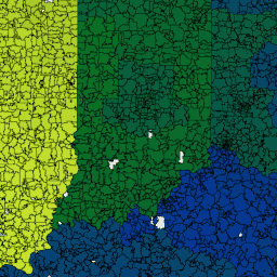
var dataset = ee.FeatureCollection('TIGER/2010/ZCTA5');\nvar visParams = {\n palette: ['black', 'purple', 'blue', 'green', 'yellow', 'orange', 'red'],\n min: 500000,\n max: 1000000000,\n};\n\nvar zctaOutlines = ee.Image().float().paint({\n featureCollection: dataset,\n color: 'black',\n width: 1\n});\n\nvar image = ee.Image().float().paint(dataset, 'ALAND10');\nMap.setCenter(-93.8008, 40.7177, 6);\nMap.addLayer(image, visParams, 'TIGER/2010/ZCTA5');\nMap.addLayer(zctaOutlines, {}, 'borders');\nMap.addLayer(dataset, {}, 'for Inspector', false);\n```\n[Open in Code Editor](https://code.earthengine.google.com/?scriptPath=Examples:Datasets/TIGER/TIGER_2010_ZCTA5)\n\n### Visualize as a FeatureView\n\n\nA `FeatureView` is a view-only, accelerated representation of a\n`FeatureCollection`. For more details, visit the\n[`FeatureView` documentation.](/earth-engine/guides/featureview_overview)\n| **Important:** Earth Engine is a platform for petabyte-scale scientific analysis and visualization of geospatial datasets, both for public benefit and for business and government users. Earth Engine is free to use for research, education, and nonprofit use. To get started, please [register for Earth Engine access.](https://console.cloud.google.com/earth-engine)\n\n### Code Editor (JavaScript)\n\n```javascript\nvar fvLayer = ui.Map.FeatureViewLayer('TIGER/2010/ZCTA5_FeatureView');\n\nvar visParams = {\n opacity: 1,\n polygonStrokeColor: 'black',\n polygonFillColor: {\n property: 'ALAND10',\n mode: 'linear',\n palette: ['black', 'purple', 'blue', 'green', 'yellow', 'orange', 'red'],\n min: 5e5,\n max: 5e9\n }\n};\n\nfvLayer.setVisParams(visParams);\nfvLayer.setName('US census zip codes');\n\nMap.setCenter(-93.8008, 40.7177, 6);\nMap.add(fvLayer);\n```\n[Open in Code Editor](https://code.earthengine.google.com/?scriptPath=Examples:Datasets/TIGER/TIGER_2010_ZCTA5_FeatureView) \n[TIGER: US Census 5-digit ZIP Code Tabulation Areas 2010](/earth-engine/datasets/catalog/TIGER_2010_ZCTA5) \nZIP Code tabulation areas (ZCTAs) are approximate area representations of U.S. Postal Service (USPS) 5-digit ZIP Codes. The Census Bureau defines ZCTAs by allocating each Census block that contains addresses to a single ZIP Code tabulation area, usually to the ZCTA that reflects the most frequently occurring ZIP Code for ... \nTIGER/2010/ZCTA5, census,infrastructure-boundaries,table,tiger,us \n2010-01-01T00:00:00Z/2010-01-02T00:00:00Z \n-14.69 -180 71.567 -64.435 \nGoogle Earth Engine \nhttps://developers.google.com/earth-engine/datasets\n\n- [](https://doi.org/https://www.census.gov/programs-surveys/geography/guidance/tiger-data-products-guide.html)\n- [](https://doi.org/https://developers.google.com/earth-engine/datasets/catalog/TIGER_2010_ZCTA5)"]]