- Dostępność zbioru danych
- 2002-06-15T00:00:00Z–2023-11-17T00:00:00Z
- Dostawca zbioru danych
- USDA Farm Production and Conservation - Business Center, Geospatial Enterprise Operations
- Tagi
Opis
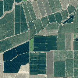
Program National Agriculture Imagery Program (NAIP) pozyskuje zdjęcia lotnicze w okresie wegetacyjnym w Stanach Zjednoczonych kontynentalnych.
Projekty NAIP są realizowane co roku w zależności od dostępnych środków i cyklu pozyskiwania zdjęć. Od 2003 r. zdjęcia NAIP były pozyskiwane w 5-letnim cyklu. Rok 2008 był rokiem przejściowym, a w 2009 r. rozpoczął się trzyletni cykl.
Zdjęcia NAIP są wykonywane z odległości 1 metra od powierzchni ziemi (GSD) z dokładnością poziomą, która mieści się w granicach 6 metrów od punktów kontrolnych na ziemi, które można zidentyfikować na zdjęciach i które są używane podczas sprawdzania obrazów.
Starsze zdjęcia były zbierane przy użyciu 3 pasm (czerwonego, zielonego i niebieskiego: RGB), ale nowsze zdjęcia są zwykle zbierane z dodatkowym pasmem bliskiej podczerwieni (RGBN). Identyfikatory zasobów RGB zaczynają się od „n”, identyfikatory zasobów NRG zaczynają się od „c”, a identyfikatory zasobów RGBN zaczynają się od „m_”.
Niektóre starsze zdjęcia mają GSD wynoszący 2 metry.
Pasma
Pasma
Rozmiar piksela: 0,6 m (wszystkie pasma)
| Nazwa | Jednostki | Rozmiar piksela | Opis |
|---|---|---|---|
R |
dn | 0,6 metra | Czerwony |
G |
dn | 0,6 metra | Zielony |
B |
dn | 0,6 metra | Niebieski |
N |
dn | 0,6 metra | Bliska podczerwień |
Warunki korzystania z usługi
Warunki korzystania z usługi
Większość informacji prezentowanych na stronie internetowej FSA jest uważana za informacje należące do domeny publicznej. Informacje z domeny publicznej można swobodnie rozpowszechniać i kopiować, ale prosimy o podawanie odpowiednich informacji o autorze, zdjęciu lub obrazie. Więcej informacji znajdziesz na stronie FSA Policies and Links.
Użytkownicy powinni podać źródło danych: USDA Farm Production and Conservation - Business Center, Geospatial Enterprise Operations.
Cytaty
USDA Farm Production and Conservation - Business Center, Geospatial Enterprise Operations
Odkrywaj za pomocą Earth Engine
Edytor kodu (JavaScript)
var dataset = ee.ImageCollection('USDA/NAIP/DOQQ')
                  .filter(ee.Filter.date('2017-01-01', '2018-12-31'));
var trueColor = dataset.select(['R', 'G', 'B']);
var trueColorVis = {
  min: 0,
  max: 255,
};
Map.setCenter(-73.9958, 40.7278, 15);
Map.addLayer(trueColor, trueColorVis, 'True Color');
import ee
import geemap.core as geemap
Colab (Python)
dataset = ee.ImageCollection('USDA/NAIP/DOQQ').filter(
    ee.Filter.date('2017-01-01', '2018-12-31')
)

true_color = dataset.select(['R', 'G', 'B'])

true_color_vis = {'min': 0, 'max': 255}

m = geemap.Map()
m.set_center(-73.9958, 40.7278, 15)
m.add_layer(true_color, true_color_vis, 'True Color')
m