Jest to spójny zbiór danych DEM 3DEP dla Stanów Zjednoczonych, który obejmuje 48 stanów kontynentalnych, Hawaje i terytoria Stanów Zjednoczonych. Usługa jest częściowo dostępna na Alasce i będzie rozszerzana na cały stan w ramach inicjatywy Alaska Mapping Initiative.
Odległość między punktami na ziemi wynosi około 10 metrów w kierunku północ-południe, ale w kierunku wschód-zachód jest zmienna ze względu na zbieżność południków wraz z szerokością geograficzną.
Zbiór danych 1m jest pozyskiwany jako USGS_3DEP_1m.
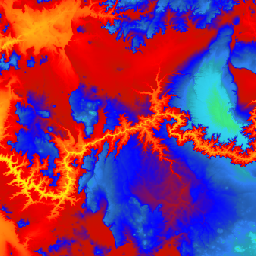
Jest to bezszwowy zbiór danych 3DEP DEM dla Stanów Zjednoczonych, który obejmuje 48 stanów kontynentalnych, Hawaje i terytoria Stanów Zjednoczonych. Obecnie dostępny jest częściowy zasięg w Alasce, który jest rozszerzany na cały stan w ramach inicjatywy Alaska Mapping Initiative. Odległość od ziemi wynosi około 10 metrów w kierunku północnym/południowym, ale…
[null,null,[],[],[],null,["# USGS 3DEP 10m National Map Seamless (1/3 Arc-Second)\n\nDataset Availability\n: 1998-08-16T00:00:00Z--2020-05-06T00:00:00Z\n\nDataset Provider\n:\n\n\n [United States Geological Survey](https://www.usgs.gov/core-science-systems/ngp/3dep/about-3dep-products-services)\n\nTags\n:\n[3dep](/earth-engine/datasets/tags/3dep) [dem](/earth-engine/datasets/tags/dem) [elevation](/earth-engine/datasets/tags/elevation) [elevation-topography](/earth-engine/datasets/tags/elevation-topography) [geophysical](/earth-engine/datasets/tags/geophysical) [topography](/earth-engine/datasets/tags/topography) [usgs](/earth-engine/datasets/tags/usgs) \n\n#### Description\n\nThis is the seamless 3DEP DEM dataset for the U.S.\nwith full coverage of the 48 conterminous states, Hawaii, and\nU.S. territories. Alaska coverage is partially available now and is being\nexpanded to statewide coverage as part of the Alaska Mapping Initiative.\nGround spacing is approximately 10 meters north/south, but variable\neast/west due to convergence of meridians with latitude.\n\nThe 1m dataset is ingested\nas [USGS_3DEP_1m](/earth-engine/datasets/catalog/USGS_3DEP_1m).\n\nDataset uploaded by [Farmers Business Network](https://fbn.com).\n\n### Bands\n\n**Bands**\n\n| Name | Units | Pixel Size | Description |\n|-------------|-------|-------------|-------------|\n| `elevation` | m | 10.2 meters | Elevation |\n\n### Terms of Use\n\n**Terms of Use**\n\nMost U.S. Geological Survey (USGS) information resides\nin the public domain and may be used without restriction. Additional\ninformation on [Acknowledging or Crediting USGS as Information\nSource](https://www.usgs.gov/information-policies-and-instructions/crediting-usgs)\nis available.\n\n### Citations\n\nCitations:\n\n- U.S. Geological Survey, 3D Elevation Program 10-Meter Resolution Digital Elevation Model.\n\n### Explore with Earth Engine\n\n| **Important:** Earth Engine is a platform for petabyte-scale scientific analysis and visualization of geospatial datasets, both for public benefit and for business and government users. Earth Engine is free to use for research, education, and nonprofit use. To get started, please [register for Earth Engine access.](https://console.cloud.google.com/earth-engine)\n\n### Code Editor (JavaScript)\n\n```javascript\nvar dataset = ee.ImageCollection('USGS/3DEP/10m_collection')\nvar elevation = dataset.select('elevation');\n\nMap.setCenter(-112.8598, 36.2841, 7);\nMap.addLayer(elevation, {min: 0, max: 3000, palette: [\n '3ae237', 'b5e22e', 'd6e21f', 'fff705', 'ffd611', 'ffb613', 'ff8b13',\n 'ff6e08', 'ff500d', 'ff0000', 'de0101', 'c21301', '0602ff', '235cb1',\n '307ef3', '269db1', '30c8e2', '32d3ef', '3be285', '3ff38f', '86e26f'\n ],\n}, 'elevation');\n```\n[Open in Code Editor](https://code.earthengine.google.com/?scriptPath=Examples:Datasets/USGS/USGS_3DEP_10m_collection) \n[USGS 3DEP 10m National Map Seamless (1/3 Arc-Second)](/earth-engine/datasets/catalog/USGS_3DEP_10m_collection) \nThis is the seamless 3DEP DEM dataset for the U.S. with full coverage of the 48 conterminous states, Hawaii, and U.S. territories. Alaska coverage is partially available now and is being expanded to statewide coverage as part of the Alaska Mapping Initiative. Ground spacing is approximately 10 meters north/south, but ... \nUSGS/3DEP/10m_collection, 3dep,dem,elevation,elevation-topography,geophysical,topography,usgs \n1998-08-16T00:00:00Z/2020-05-06T00:00:00Z \n-16.6 -171 76.9 164 \nGoogle Earth Engine \nhttps://developers.google.com/earth-engine/datasets\n\n- [](https://doi.org/https://www.usgs.gov/core-science-systems/ngp/3dep/about-3dep-products-services)\n- [](https://doi.org/https://developers.google.com/earth-engine/datasets/catalog/USGS_3DEP_10m_collection)"]]