- Dostępność zbioru danych
- 2017-04-22T00:00:00Z–2017-04-23T00:00:00Z
- Dostawca zbioru danych
- United States Geological Survey
- Tagi
Opis
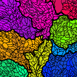
Zbiór danych o granicach zlewni (Watershed Boundary Dataset, WBD) to kompleksowy zbiór danych o jednostkach hydrologicznych (HU) zgodny z kryteriami krajowymi dotyczącymi wyznaczania granic i rozdzielczości. Określa obszar, z którego woda powierzchniowa spływa do danego punktu, z wyjątkiem obszarów przybrzeżnych lub nad jeziorami, gdzie może być wiele ujść, zgodnie z Federalnymi standardami i procedurami dotyczącymi krajowego zbioru danych o granicach zlewni. Granice zlewni są wyznaczane wyłącznie na podstawie naukowych zasad hydrologicznych, bez faworyzowania żadnych granic administracyjnych ani specjalnych projektów, a także bez uwzględniania konkretnych programów lub agencji. Celem zdefiniowania jednostek hydrologicznych dla WBD jest ustalenie podstawowych ram granic zlewni, obejmujących wszystkie obszary lądowe i powierzchniowe.
Jednostki hydrologiczne są wyznaczane w skali 1:24 000 w przypadku kontynentalnej części Stanów Zjednoczonych, w skali 1:25 000 w przypadku Hawajów i Karaibów oraz w skali 1:63 360 w przypadku Alaski, zgodnie z krajowymi standardami dokładności map (NMAS). WBD są reprezentowane jako wielokąty, które definiują granice jednostek administracyjnych. Jednostki hydrologiczne mają przypisany kod jednostki hydrologicznej (HUC), który składa się z 2–12 cyfr. Kody te określają, gdzie w kraju znajduje się jednostka i na jakim poziomie działa. Liczba cyfr w kodzie HUC jest powiązana z 6 poziomami szczegółowości WBD: wielokąty niższego poziomu obejmują większe obszary niż wielokąty wyższego poziomu. Im wyższy poziom, tym więcej cyfr w kodzie HUC, ponieważ poprzednie poziomy są w nim zagnieżdżone.
Atrybuty wielokątów WBD obejmują HUC, rozmiar (w akrach i kilometrach kwadratowych), nazwę, HUC poniżej, typ zlewni, obszary nieprzynoszące wody i modyfikacje przepływu. Atrybuty linii WBD zawierają najwyższy poziom jednostki hydrologicznej dla każdej granicy, informacje o źródle linii i modyfikacje przepływu.
| Nazwa | Poziom | Cyfra | Kod HU |
|---|---|---|---|
| Region | 1 | 2 | 2 |
| Podregion | 2 | 4 | 4 |
| Basin | 3 | 6 | 6 |
| Podzlewnia | 4 | 8 | 8 |
| Watershed | 5 | 10 | 10 |
| Podzlewnia | 6 | 12 | 12 |
*Obliczone przez dostawcę danych.
Schemat tabeli
Schemat tabeli
| Nazwa | Typ | Opis |
|---|---|---|
| areaacres | CIĄG ZNAKÓW | Rozmiar cechy w akrach |
| areasqkm | CIĄG ZNAKÓW | Rozmiar obiektu w kilometrach kwadratowych |
| gnis_id | CIĄG ZNAKÓW | Unikalny numer powiązany z nazwą jednostki hydrologicznej z bazą danych nazw GNIS (zawsze pusty). |
| loaddate | CIĄG ZNAKÓW | Data załadowania danych do oficjalnej bazy danych dostawcy |
| metasource | CIĄG ZNAKÓW | Unikalny identyfikator, który łączy element z tabelami metadanych. |
| nazwa | CIĄG ZNAKÓW | Nazwa GNIS obszaru geograficznego, w którym znajduje się jednostka hydrologiczna |
| shape_area | CIĄG ZNAKÓW | Powierzchnia obiektu w jednostkach wewnętrznych do kwadratu |
| shape_leng | CIĄG ZNAKÓW | Długość funkcji w jednostkach wewnętrznych |
| sourcedata | CIĄG ZNAKÓW | Miejsce na krótki opis typu danych podstawowych używanych do aktualizowania lub zmieniania bieżącego WBD (zawsze puste). |
| sourcefeat | CIĄG ZNAKÓW | Identyfikuje element nadrzędny funkcji, jeśli funkcja jest wynikiem podziału lub scalenia (zawsze pusta). |
| sourceorig | CIĄG ZNAKÓW | Opis agencji, która utworzyła dane podstawowe użyte do ulepszenia WBD (zawsze puste) |
| stany | CIĄG ZNAKÓW | Określa stany lub obszary zewnętrzne, w których znajduje się lub z którymi graniczy jednostka hydrologiczna. |
| tnmid | CIĄG ZNAKÓW | Unikalne 40-znakowe pole, które jednoznacznie identyfikuje każdy element w bazie danych. |
| huc2 | CIĄG ZNAKÓW | Unikalny kod jednostki hydrologicznej |
Warunki korzystania z usługi
Warunki usługi
Większość informacji z US Geological Survey (USGS) należy do domeny publicznej i może być wykorzystywana bez ograniczeń. Dostępne są dodatkowe informacje na temat uznawania lub podawania USGS jako źródła informacji.
Cytaty
Współpraca między Departamentem Rolnictwa Stanów Zjednoczonych – Służbą Ochrony Zasobów Naturalnych (USDA-NRCS), Służbą Geologiczną Stanów Zjednoczonych (USGS) i Agencją Ochrony Środowiska (EPA). Zbiór danych o granicach zlewni (Watershed Boundary Dataset, WBD) został utworzony na podstawie różnych źródeł z każdego stanu i zagregowany w standardową warstwę krajową do wykorzystania w planowaniu strategicznym i rozliczaniu. Watershed Boundary Dataset for HUC# [Online WWW]. Dostępny adres URL: (https://datagateway.nrcs.usda.gov) [Dostęp: 22.04.2017].
Odkrywaj za pomocą Earth Engine
Edytor kodu (JavaScript)
var dataset = ee.FeatureCollection('USGS/WBD/2017/HUC02');

var visualization = {
  color: '808080',
  strokeWidth: 1
};

dataset = dataset.draw(visualization);

Map.setCenter(-105.861, 39.529, 7);
Map.addLayer(dataset, null, 'Basins');
Wyświetlanie jako widok cech
FeatureView to przyspieszona reprezentacja FeatureCollection, którą można tylko wyświetlać. Więcej informacji znajdziesz w
FeatureView dokumentacji.
Edytor kodu (JavaScript)
var fvLayer = ui.Map.FeatureViewLayer('USGS/WBD/2017/HUC02_FeatureView');

var visParams = {
  color: '808080',
  lineWidth: 1
};

fvLayer.setVisParams(visParams);
fvLayer.setName('Basins');

Map.setCenter(-105.861, 39.529, 7);
Map.add(fvLayer);