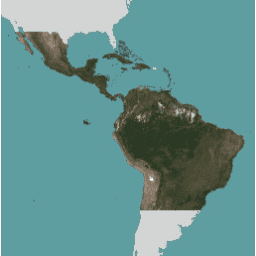
NICFI Satellite Data Program Basemaps for Tropical Forest Monitoring - Americas
সেভ করা পৃষ্ঠা গুছিয়ে রাখতে 'সংগ্রহ' ব্যবহার করুন
আপনার পছন্দ অনুযায়ী কন্টেন্ট সেভ করুন ও সঠিক বিভাগে রাখুন।
বর্ণনা এই চিত্র সংগ্রহটি গ্রীষ্মমন্ডলীয় বনের ক্ষতি হ্রাস এবং বিপরীত করার প্রাথমিক উদ্দেশ্যে গ্রীষ্মমন্ডলীয় অঞ্চলের উচ্চ-রেজোলিউশন স্যাটেলাইট পর্যবেক্ষণে অ্যাক্সেস সরবরাহ করে, জলবায়ু পরিবর্তনের বিরুদ্ধে লড়াইয়ে অবদান, জীববৈচিত্র্য সংরক্ষণ, বন পুনরুদ্ধার, পুনরুদ্ধার এবং বর্ধিতকরণে অবদান, এবং টেকসই উন্নয়নের জন্য যা অবশ্যই ব্যবহার করা উচিত।
বেসম্যাপগুলি কীভাবে অ্যাক্সেস করবেন তা শিখতে, এখানে সাইন আপ নির্দেশাবলী অনুসরণ করুন।
এনআইসিএফআই স্যাটেলাইট ডেটা প্রোগ্রাম মোজাইক (প্ল্যানেট-এনআইসিএফআই মোজাইক হিসাবেও উল্লেখ করা হয়) প্রতি 6 মাসে উত্পন্ন মাসিক এবং দ্বিবার্ষিক উভয় ধরনের সংগ্রহ রয়েছে। মোজাইকের ধরন ইমেজ মেটাডেটা ফিল্ড 'ক্যাডেন্স'-এ সংরক্ষণ করা হয়। পছন্দসই চিত্র খুঁজে পেতে প্রতিটি মোজাইকের শুরু এবং শেষ তারিখ সহ সেই ক্ষেত্রটি ব্যবহার করুন।
বেসম্যাপ সম্পর্কে সম্পূর্ণ বিশদ NICFI স্যাটেলাইট ডেটা প্রোগ্রাম বেসম্যাপ স্পেক- এ উপলব্ধ।
NICFI (নরওয়ের ইন্টারন্যাশনাল ক্লাইমেট অ্যান্ড ফরেস্ট ইনিশিয়েটিভ) স্যাটেলাইট ডেটা প্রোগ্রাম এবং অফার করা ডেটা সম্পর্কে আরও তথ্যের জন্য অনুগ্রহ করে প্রোগ্রামের ওয়েবসাইট দেখুন।
এনআইসিএফআই-এর মিশনের সমর্থনে, আপনি এই ডেটা সহ বেশ কয়েকটি প্রকল্পের জন্য ব্যবহার করতে পারেন তবে এতে সীমাবদ্ধ নয়:
বিশ্বের গ্রীষ্মমন্ডলীয় বন এবং তারা যে গুরুত্বপূর্ণ পরিষেবাগুলি প্রদান করে সে সম্পর্কে অগ্রিম বৈজ্ঞানিক গবেষণা করুন৷ টেকসই বন ব্যবস্থাপনা এবং উন্নয়নশীল গ্রীষ্মমন্ডলীয় বন দেশ এবং এখতিয়ারে ভূমি ব্যবহারের জন্য নীতিগুলি বাস্তবায়ন এবং উন্নত করুন। গ্রীষ্মমন্ডলীয় অঞ্চলে স্বচ্ছতা এবং জবাবদিহিতা বৃদ্ধি করুন। গ্রীষ্মমন্ডলীয় বনাঞ্চলের দেশগুলিতে আদিবাসী এবং স্থানীয় সম্প্রদায়ের অধিকার রক্ষা এবং উন্নত করা। বৈশ্বিক পণ্য এবং আর্থিক বাজার থেকে বনের উপর চাপ কমানোর জন্য সমাধান উদ্ভাবন করুন। ব্যান্ড পিক্সেল সাইজ 4.77 মিটার
ব্যান্ড
নাম মিন সর্বোচ্চ স্কেল পিক্সেল সাইজ বর্ণনা B
0 10000 0.0001 মিটার নীল
G
0 10000 0.0001 মিটার সবুজ
R
0 10000 0.0001 মিটার লাল
N
0 10000 0.0001 মিটার কাছাকাছি-ইনফ্রারেড
ইমেজ বৈশিষ্ট্য ইমেজ বৈশিষ্ট্য
নাম টাইপ বর্ণনা ক্যাডেন্স STRING ব্যবধান মোজাইক কভার করে: মাসিক বা দ্বিবার্ষিক
ব্যবহারের শর্তাবলী ব্যবহারের শর্তাবলী
NICFI স্যাটেলাইট ডেটা প্রোগ্রামের উদ্দেশ্যের সমর্থনে এই ডেটার ব্যবহার, পুনরুৎপাদন এবং বিতরণের সীমাবদ্ধতা রয়েছে। সম্পূর্ণ লাইসেন্সিং চুক্তি এখানে উপলব্ধ।
কপিরাইট বিজ্ঞপ্তি:
ছবি © 20xx প্ল্যানেট ল্যাবস PBC (যেখানে xx ব্যবহার করা বিষয়বস্তুর বছর বোঝায়)
উদ্ধৃতি প্ল্যানেট টিম (2017)। প্ল্যানেট অ্যাপ্লিকেশন প্রোগ্রাম ইন্টারফেস: পৃথিবীতে জীবনের জন্য মহাকাশে। সান ফ্রান্সিসকো, CA https://api.planet.com
আর্থ ইঞ্জিন দিয়ে অন্বেষণ করুন গুরুত্বপূর্ণ: আর্থ ইঞ্জিন হল পেটাবাইট-স্কেল বৈজ্ঞানিক বিশ্লেষণ এবং ভূ-স্থানিক ডেটাসেটগুলির ভিজ্যুয়ালাইজেশনের জন্য একটি প্ল্যাটফর্ম, উভয় জনসাধারণের সুবিধার জন্য এবং ব্যবসায়িক এবং সরকারী ব্যবহারকারীদের জন্য। আর্থ ইঞ্জিন গবেষণা, শিক্ষা এবং অলাভজনক ব্যবহারের জন্য বিনামূল্যে ব্যবহার করা যায়। শুরু করতে, দয়া করে আর্থ ইঞ্জিন অ্যাক্সেসের জন্য নিবন্ধন করুন৷ কোড এডিটর (জাভাস্ক্রিপ্ট)
// This collection is not publicly accessible. To sign up for access,
// please see https://developers.planet.com/docs/integrations/gee/nicfi
var nicfi = ee . ImageCollection ( 'projects/planet-nicfi/assets/basemaps/americas' );
// Filter basemaps by date and get the first image from filtered results
var basemap = nicfi . filter ( ee . Filter . date ( '2021-03-01' , '2021-07-01' )). first ();
Map . centerObject ( basemap , 4 );
var vis = { 'bands' : [ 'R' , 'G' , 'B' ], 'min' : 64 , 'max' : 5454 , 'gamma' : 1.8 };
Map . addLayer ( basemap , vis , '2021-03 mosaic' );
Map . addLayer (
basemap . normalizedDifference ([ 'N' , 'R' ]). rename ( 'NDVI' ),
{ min :- 0.55 , max : 0.8 , palette : [
'8bc4f9' , 'c9995c' , 'c7d270' , '8add60' , '097210'
]}, 'NDVI' , false ); কোড এডিটরে খুলুন
[null,null,[],[[["\u003cp\u003eThis dataset provides high-resolution satellite monitoring of the tropics to reduce and reverse tropical forest loss for non-commercial use.\u003c/p\u003e\n"],["\u003cp\u003eIt includes monthly and biannual mosaics with imagery available from 2015 to 2024.\u003c/p\u003e\n"],["\u003cp\u003eAccess to the dataset requires signing up through Planet, the dataset provider and catalog owner.\u003c/p\u003e\n"],["\u003cp\u003eThe dataset is intended for research, policy implementation, transparency, and the protection of indigenous rights related to tropical forests.\u003c/p\u003e\n"],["\u003cp\u003eImagery is at 4.77-meter resolution and includes Blue, Green, Red, and Near-infrared bands.\u003c/p\u003e\n"]]],[],null,["# NICFI Satellite Data Program Basemaps for Tropical Forest Monitoring - Americas\n\ninfo\n\n\nThis dataset is part of a Publisher Catalog, and not managed by Google Earth Engine.\n\nContact support@planet.com\n\nfor bugs or [view more datasets](https://developers.google.com/earth-engine/datasets/publisher/planet-nicfi)\nfrom the Planet Catalog. [Learn more about Publisher datasets](/earth-engine/datasets/publisher). \n[](https://planet.com/nicfi) \n\nCatalog Owner\n: Planet\n\nDataset Availability\n: 2015-12-01T00:00:00Z--2025-07-01T00:00:00Z\n\nDataset Provider\n:\n\n\n [Planet](https://planet.com/nicfi)\n\nTags\n:\n[basemaps](/earth-engine/datasets/tags/basemaps) [forest](/earth-engine/datasets/tags/forest) [nicfi](/earth-engine/datasets/tags/nicfi) [planet](/earth-engine/datasets/tags/planet) [planet-nicfi](/earth-engine/datasets/tags/planet-nicfi) [publisher-dataset](/earth-engine/datasets/tags/publisher-dataset) [satellite-imagery](/earth-engine/datasets/tags/satellite-imagery) [sr](/earth-engine/datasets/tags/sr) [surface-reflectance](/earth-engine/datasets/tags/surface-reflectance) [tropics](/earth-engine/datasets/tags/tropics) \n\n#### Description\n\nThis image collection provides access to high-resolution satellite\nmonitoring of the tropics for the primary purpose of reducing and reversing the\nloss of tropical forests, contributing to combating climate change, conserving\nbiodiversity, contributing to forest regrowth, restoration and enhancement, and\nfacilitating sustainable development, all of which must be Non-Commercial Use.\n\nTo learn how to access the Basemaps, follow the\n[sign up instructions here](https://developers.planet.com/docs/integrations/gee/nicfi/).\n\nThe NICFI Satellite Data Program mosaics (also referred to as Planet-NICFI\nmosaics) contain both monthly and biannual collections generated every\n6 months. The type of the mosaic is stored in the image metadata field\n'cadence'. Use that field along with the start and end date for each mosaic\nto find the desired imagery.\n\nFull details about the Basemaps are available in\n[NICFI Satellite Data Program Basemap spec](https://assets.planet.com/docs/NICFI_Basemap_Spec_Addendum.pdf).\n\nFor more information about the NICFI (Norway's International Climate\nand Forest Initiative) Satellite Data Program and the data offered,\nplease visit\n[the Program's website](https://assets.planet.com/docs/NICFI_General_FAQs.pdf).\n\nIn support of NICFI's mission, you can use this data for a number of projects\nincluding, but not limited to:\n\n- Advance scientific research about the world's tropical forests and the critical services they provide.\n- Implement and improve policies for sustainable forest management and land use in developing tropical forest countries and jurisdictions.\n- Increase transparency and accountability in the tropics.\n- Protect and improve the rights of indigenous peoples and local communities in tropical forest countries.\n- Innovate solutions towards reducing pressure on forests from global commodities and financial markets.\n\n### Bands\n\n\n**Pixel Size**\n\n4.77 meters\n\n**Bands**\n\n| Name | Min | Max | Scale | Pixel Size | Description |\n|------|-----|-------|--------|------------|---------------|\n| `B` | 0 | 10000 | 0.0001 | meters | Blue |\n| `G` | 0 | 10000 | 0.0001 | meters | Green |\n| `R` | 0 | 10000 | 0.0001 | meters | Red |\n| `N` | 0 | 10000 | 0.0001 | meters | Near-infrared |\n\n### Image Properties\n\n**Image Properties**\n\n| Name | Type | Description |\n|---------|--------|-----------------------------------------------------|\n| cadence | STRING | The interval the mosaic covers: monthly or biannual |\n\n### Terms of Use\n\n**Terms of Use**\n\nThis data has usage, reproduction, and distribution restrictions in support\nof the NICFI Satellite Data Program purpose. The full licensing agreement is available\n[here](https://assets.planet.com/docs/Planet_ParticipantLicenseAgreement_NICFI.pdf).\n\nCopyright notice:\n\nImage © 20xx Planet Labs PBC (where xx denotes the year of the content\nused)\n\n### Citations\n\nCitations:\n\n- Planet Team (2017). Planet Application Program Interface: In Space for Life\n on Earth. San Francisco, CA. \u003chttps://api.planet.com\u003e\n\n### Explore with Earth Engine\n\n| **Important:** Earth Engine is a platform for petabyte-scale scientific analysis and visualization of geospatial datasets, both for public benefit and for business and government users. Earth Engine is free to use for research, education, and nonprofit use. To get started, please [register for Earth Engine access.](https://console.cloud.google.com/earth-engine)\n\n### Code Editor (JavaScript)\n\n```javascript\n// This collection is not publicly accessible. To sign up for access,\n// please see https://developers.planet.com/docs/integrations/gee/nicfi\nvar nicfi = ee.ImageCollection('projects/planet-nicfi/assets/basemaps/americas');\n\n// Filter basemaps by date and get the first image from filtered results\nvar basemap= nicfi.filter(ee.Filter.date('2021-03-01','2021-07-01')).first();\n\nMap.centerObject(basemap, 4);\n\nvar vis = {'bands':['R','G','B'],'min':64,'max':5454,'gamma':1.8};\n\nMap.addLayer(basemap, vis, '2021-03 mosaic');\nMap.addLayer(\n basemap.normalizedDifference(['N','R']).rename('NDVI'),\n {min:-0.55,max:0.8,palette: [\n '8bc4f9', 'c9995c', 'c7d270','8add60','097210'\n ]}, 'NDVI', false);\n```\n[Open in Code Editor](https://code.earthengine.google.com/?scriptPath=Examples:Datasets/planet-nicfi/projects_planet-nicfi_assets_basemaps_americas) \n[NICFI Satellite Data Program Basemaps for Tropical Forest Monitoring - Americas](/earth-engine/datasets/catalog/projects_planet-nicfi_assets_basemaps_americas) \nThis image collection provides access to high-resolution satellite monitoring of the tropics for the primary purpose of reducing and reversing the loss of tropical forests, contributing to combating climate change, conserving biodiversity, contributing to forest regrowth, restoration and enhancement, and facilitating sustainable development, all of which must be Non-Commercial Use. ... \nprojects/planet-nicfi/assets/basemaps/americas, basemaps,forest,nicfi,planet,planet-nicfi,publisher-dataset,satellite-imagery,sr,surface-reflectance,tropics \n2015-12-01T00:00:00Z/2025-07-01T00:00:00Z \n-30.4 -118.5 30.4 -34.5 \nGoogle Earth Engine \nhttps://developers.google.com/earth-engine/datasets\n\n- [](https://doi.org/https://planet.com/nicfi)\n- [](https://doi.org/https://developers.google.com/earth-engine/datasets/catalog/projects_planet-nicfi_assets_basemaps_americas)"]]