-
WWF HydroSHEDS 흐름 누적, 15초
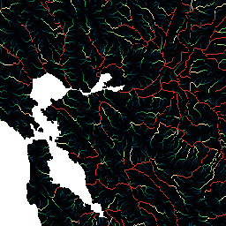
HydroSHEDS는 지역 및 전역 규모 애플리케이션에 수문학 정보를 일관된 형식으로 제공하는 매핑 제품입니다. 하천 네트워크, 유역 경계, 배수 방향, 흐름 누적 등 다양한 규모의 지리 참조 데이터 세트 (벡터 및 래스터)를 제공합니다. HydroSHEDS는 다음을 기반으로 합니다. accumulation drainage flow geophysical hydrography hydrology -
WWF HydroSHEDS 흐름 누적, 30초
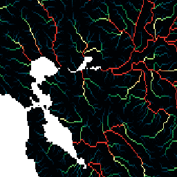
HydroSHEDS는 지역 및 전역 규모 애플리케이션에 수문학 정보를 일관된 형식으로 제공하는 매핑 제품입니다. 하천 네트워크, 유역 경계, 배수 방향, 흐름 누적 등 다양한 규모의 지리 참조 데이터 세트 (벡터 및 래스터)를 제공합니다. HydroSHEDS는 다음을 기반으로 합니다. accumulation drainage flow geophysical hydrography hydrology
Datasets tagged accumulation in Earth Engine
[null,null,[],[],["HydroSHEDS is a mapping product delivering hydrographic data for both regional and global applications. It includes geo-referenced datasets in vector and raster formats. These datasets encompass river networks, watershed boundaries, drainage directions, and flow accumulations at varying scales. This product provides consistent hydrographic information by mapping the geophysical flow and drainage. The product is provided at both 15 and 30 arc-seconds resolution.\n"]]