-
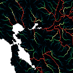
WWF HydroSHEDS 배수 방향, 15초
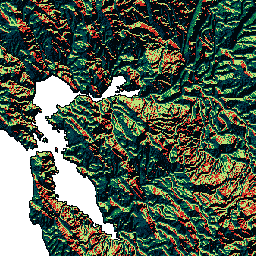
HydroSHEDS는 지역 및 전역 규모 애플리케이션에 일관된 형식으로 수로 정보를 제공하는 매핑 제품입니다. 하천 네트워크, 유역 경계, 배수 방향, 흐름 누적을 비롯한 다양한 규모의 지리 참조 데이터 세트 (벡터 및 래스터)를 제공합니다. HydroSHEDS는 …을 기반으로 합니다. 방향 배수 흐름 지구물리학 수로학 수문학 -
WWF HydroSHEDS 배수 방향, 3초
HydroSHEDS는 지역 및 전역 규모 애플리케이션에 일관된 형식으로 수로 정보를 제공하는 매핑 제품입니다. 하천 네트워크, 유역 경계, 배수 방향, 흐름 누적을 비롯한 다양한 규모의 지리 참조 데이터 세트 (벡터 및 래스터)를 제공합니다. HydroSHEDS는 …을 기반으로 합니다. 방향 배수 흐름 지구물리학 수로학 수문학 -
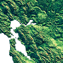
WWF HydroSHEDS 배수 방향, 30초
HydroSHEDS는 지역 및 전역 규모 애플리케이션에 일관된 형식으로 수로 정보를 제공하는 매핑 제품입니다. 하천 네트워크, 유역 경계, 배수 방향, 흐름 누적을 비롯한 다양한 규모의 지리 참조 데이터 세트 (벡터 및 래스터)를 제공합니다. HydroSHEDS는 …을 기반으로 합니다. 방향 배수 흐름 지구물리학 수로학 수문학 -
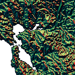
WWF HydroSHEDS 흐름 누적, 15초
HydroSHEDS는 지역 및 전역 규모 애플리케이션에 일관된 형식으로 수로 정보를 제공하는 매핑 제품입니다. 하천 네트워크, 유역 경계, 배수 방향, 흐름 누적을 비롯한 다양한 규모의 지리 참조 데이터 세트 (벡터 및 래스터)를 제공합니다. HydroSHEDS는 …을 기반으로 합니다. 누적 배수 흐름 지구물리학 수로학 수문학 -
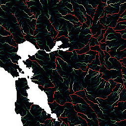
WWF HydroSHEDS 흐름 누적, 30초
HydroSHEDS는 지역 및 전역 규모 애플리케이션에 일관된 형식으로 수로 정보를 제공하는 매핑 제품입니다. 하천 네트워크, 유역 경계, 배수 방향, 흐름 누적을 비롯한 다양한 규모의 지리 참조 데이터 세트 (벡터 및 래스터)를 제공합니다. HydroSHEDS는 …을 기반으로 합니다. 누적 배수 흐름 지구물리학 수로학 수문학
Datasets tagged drainage in Earth Engine
[null,null,[],[],[]]