-
Mosaïque du Groenland de 2000 – Projet de cartographie des glaces du Groenland (GIMP)

Cet ensemble de données fournit une mosaïque d'images complète de la calotte glaciaire du Groenland à une résolution de 15 mètres. Il est dérivé des images Landsat 7 ETM+ et RADARSAT-1 SAR des années 1999 à 2002. Les méthodes incluent une combinaison de masquage des nuages, de panchromatisation, d'échantillonnage et de redimensionnement des images, … arctique gimp groenland imagerie nasa polaire -
Mosaïque ArcticDEM V4.1
ArcticDEM est une initiative public-privé de la National Geospatial-Intelligence Agency (NGA) et de la National Science Foundation (NSF) visant à produire automatiquement un modèle numérique de surface (DSM) de haute résolution et de haute qualité de l'Arctique à l'aide d'images stéréoscopiques optiques, du calcul haute performance et d'un logiciel de photogrammétrie Open Source. Il inclut la végétation, la canopée, les bâtiments et… arctic dem elevation-topography geophysical pgc umn -
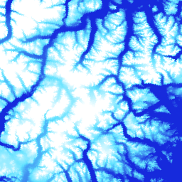
Bandes ArcticDEM

ArcticDEM est une initiative public-privé de la National Geospatial-Intelligence Agency (NGA) et de la National Science Foundation (NSF) visant à produire automatiquement un modèle numérique de surface (DSM) de haute résolution et de haute qualité de l'Arctique à l'aide d'images stéréoscopiques optiques, du calcul haute performance et d'un logiciel de photogrammétrie Open Source. Il inclut la végétation, la canopée, les bâtiments et… arctic dem elevation-topography geophysical pgc umn -
DEM du Groenland – Projet de cartographie du Groenland (GIMP)

Ce modèle numérique d'altitude (MNA) est construit à partir d'une combinaison de MNA ASTER et SPOT-5 pour la périphérie et la marge de la calotte glaciaire (c'est-à-dire en dessous de l'altitude de la ligne d'équilibre) au sud d'environ 82,5°N et de la photoclinométrie AVHRR à l'intérieur et à l'extrême nord de la calotte glaciaire (Scambos et … arctic elevation-topography gimp greenland nasa polar -
Masque de glace et d'océan du Groenland – Projet de cartographie du Groenland (GIMP)

Cet ensemble de données fournit des masques de classification complets des glaces terrestres et des océans à 15 mètres pour la calotte glaciaire du Groenland. La couverture de glace a été cartographiée à l'aide d'une combinaison d'images panchromatiques orthorectifiées (bande 8) du Landsat 7 Enhanced Thematic Mapper Plus (ETM+), distribuées par l'USGS, et … arctique cryosphère gimp groenland glace nasa -
MEaSUREs Greenland Ice Velocity: Selected Glacier Site Velocity Maps from Optical Images Version 2

Cet ensemble de données, qui fait partie du programme NASA Making Earth System Data Records for Use in Research Environments (MEaSUREs), se compose de cartes de vitesse mensuelles moyennes pour certaines zones de sortie de glaciers. Les cartes sont générées en suivant les caractéristiques visibles entre les paires d'images optiques acquises par Landsat… arctique cryosphère gimp groenland glace nasa
Datasets tagged arctic in Earth Engine
[null,null,[],[],["The content details datasets from the Greenland Ice Mapping Project (GIMP) and ArcticDEM initiatives. GIMP provides a 15m resolution ice/ocean classification mask and a 2000 image mosaic of Greenland derived from Landsat 7 and RADARSAT-1. It also includes a digital elevation model (DEM) and mean monthly glacier velocity maps. ArcticDEM, a joint NGA/NSF project, offers high-resolution digital surface models (DSMs) of the Arctic, encompassing features like vegetation and buildings.\n"]]