-
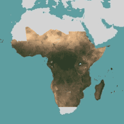
מפות בסיס של תוכנית נתוני הלוויין של NICFI למעקב אחר יערות טרופיים – אפריקה
אוסף התמונות הזה מספק גישה למעקב לווייני ברזולוציה גבוהה באזורים הטרופיים. המטרה העיקרית של המעקב היא לצמצם את אובדן היערות הטרופיים ולעצור אותו, לתרום למאבק בשינוי האקלים, לשמר את המגוון הביולוגי, לתרום לצמיחה מחדש של יערות, לשיקום ולשיפור שלהם ולקדם פיתוח בר-קיימא. כל אלה … basemaps forest nicfi planet planet-nicfi publisher-dataset -
מפות בסיס של תוכנית נתוני הלוויין של NICFI למעקב אחר יערות טרופיים – אמריקה
אוסף התמונות הזה מספק גישה למעקב לווייני ברזולוציה גבוהה באזורים הטרופיים. המטרה העיקרית של המעקב היא לצמצם את אובדן היערות הטרופיים ולעצור אותו, לתרום למאבק בשינוי האקלים, לשמר את המגוון הביולוגי, לתרום לצמיחה מחדש של יערות, לשיקום ולשיפור שלהם ולקדם פיתוח בר-קיימא. כל אלה … basemaps forest nicfi planet planet-nicfi publisher-dataset -
מפות בסיס של תוכנית נתוני הלוויין של NICFI למעקב אחר יערות טרופיים – אסיה
אוסף התמונות הזה מספק גישה למעקב לווייני ברזולוציה גבוהה באזורים הטרופיים. המטרה העיקרית של המעקב היא לצמצם את אובדן היערות הטרופיים ולעצור אותו, לתרום למאבק בשינוי האקלים, לשמר את המגוון הביולוגי, לתרום לצמיחה מחדש של יערות, לשיקום ולשיפור שלהם ולקדם פיתוח בר-קיימא. כל אלה … basemaps forest nicfi planet planet-nicfi publisher-dataset
Datasets tagged basemaps in Earth Engine
[null,null,[],[[["\u003cp\u003eThe NICFI Satellite Data Program provides high-resolution basemaps for monitoring tropical forests in Africa, the Americas, and Asia.\u003c/p\u003e\n"],["\u003cp\u003eThis program aims to reduce tropical forest loss, combat climate change, conserve biodiversity, and support forest regrowth and sustainable development.\u003c/p\u003e\n"],["\u003cp\u003eThe basemaps offer valuable data for researchers, policymakers, and conservationists working to protect and restore tropical forests.\u003c/p\u003e\n"]]],["High-resolution satellite imagery is available for monitoring tropical forests across Africa, the Americas, and Asia. The data is aimed at reducing tropical forest loss and combating climate change. It also aids in biodiversity conservation, forest regrowth, restoration, and sustainable development. This program, known as NICFI, provides access to satellite data from Planet, identified as planet-nicfi, to achieve these goals. These resources are considered as basemaps.\n"],null,["# Datasets tagged basemaps in Earth Engine\n\n-\n\n |--------------------------------------------------------------------------------------------------------------------------------------------------------------------------------------------------------------------------------------------------------------------------------------------------------------------------------------------------------------------|\n | [### NICFI Satellite Data Program Basemaps for Tropical Forest Monitoring - Africa](/earth-engine/datasets/catalog/projects_planet-nicfi_assets_basemaps_africa) |\n | This image collection provides access to high-resolution satellite monitoring of the tropics for the primary purpose of reducing and reversing the loss of tropical forests, contributing to combating climate change, conserving biodiversity, contributing to forest regrowth, restoration and enhancement, and facilitating sustainable development, all of ... |\n | [basemaps](/earth-engine/datasets/tags/basemaps) [forest](/earth-engine/datasets/tags/forest) [nicfi](/earth-engine/datasets/tags/nicfi) [planet](/earth-engine/datasets/tags/planet) [planet-nicfi](/earth-engine/datasets/tags/planet-nicfi) [publisher-dataset](/earth-engine/datasets/tags/publisher-dataset) |\n\n-\n\n |--------------------------------------------------------------------------------------------------------------------------------------------------------------------------------------------------------------------------------------------------------------------------------------------------------------------------------------------------------------------|\n | [### NICFI Satellite Data Program Basemaps for Tropical Forest Monitoring - Americas](/earth-engine/datasets/catalog/projects_planet-nicfi_assets_basemaps_americas) |\n | This image collection provides access to high-resolution satellite monitoring of the tropics for the primary purpose of reducing and reversing the loss of tropical forests, contributing to combating climate change, conserving biodiversity, contributing to forest regrowth, restoration and enhancement, and facilitating sustainable development, all of ... |\n | [basemaps](/earth-engine/datasets/tags/basemaps) [forest](/earth-engine/datasets/tags/forest) [nicfi](/earth-engine/datasets/tags/nicfi) [planet](/earth-engine/datasets/tags/planet) [planet-nicfi](/earth-engine/datasets/tags/planet-nicfi) [publisher-dataset](/earth-engine/datasets/tags/publisher-dataset) |\n\n-\n\n |--------------------------------------------------------------------------------------------------------------------------------------------------------------------------------------------------------------------------------------------------------------------------------------------------------------------------------------------------------------------|\n | [### NICFI Satellite Data Program Basemaps for Tropical Forest Monitoring - Asia](/earth-engine/datasets/catalog/projects_planet-nicfi_assets_basemaps_asia) |\n | This image collection provides access to high-resolution satellite monitoring of the tropics for the primary purpose of reducing and reversing the loss of tropical forests, contributing to combating climate change, conserving biodiversity, contributing to forest regrowth, restoration and enhancement, and facilitating sustainable development, all of ... |\n | [basemaps](/earth-engine/datasets/tags/basemaps) [forest](/earth-engine/datasets/tags/forest) [nicfi](/earth-engine/datasets/tags/nicfi) [planet](/earth-engine/datasets/tags/planet) [planet-nicfi](/earth-engine/datasets/tags/planet-nicfi) [publisher-dataset](/earth-engine/datasets/tags/publisher-dataset) |"]]