-
ETOPO1: globalny model wysokościowy o rozdzielczości 1 minuty łuku

ETOPO1 to globalny model rzeźby terenu Ziemi o rozdzielczości 1 minuty łuku, który uwzględnia topografię lądu i batymetrię oceanu. Został on utworzony na podstawie wielu globalnych i regionalnych zbiorów danych. Zawiera 2 zakresy wysokości: ice_surface i bedrock. bedrock dem elevation elevation-topography geophysical ice -
iSDAsoil Depth to Bedrock
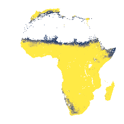
Głębokość do podłoża skalnego na głębokości 0–200 cm, prognozowana średnia i odchylenie standardowe. Ze względu na potencjalną maskę gruntów ornych, która została użyta do wygenerowania danych, wiele obszarów odsłoniętej skały (gdzie głębokość do podłoża skalnego wynosiłaby 0 cm) zostało zamaskowanych i dlatego pojawia się jako … afryka podłoże skalne isda gleby
Datasets tagged bedrock in Earth Engine
[null,null,[],[],["Two datasets describe bedrock characteristics. The first, iSDAsoil Depth to Bedrock, predicts the mean and standard deviation of bedrock depth in Africa from 0-200 cm. However, areas of exposed rock may be masked due to the data generation process. The second, ETOPO1, is a global relief model integrating land and ocean data, providing two elevation bands: ice surface and bedrock, with a one arc-minute resolution.\n"]]