-
Segmenti CCDC globali di Google basati su Landsat (1999-2019)
Questa raccolta contiene i risultati precomputati dell'esecuzione dell'algoritmo di rilevamento e classificazione dei cambiamenti continui (CCDC) su 20 anni di dati sulla riflettanza superficiale di Landsat. CCDC è un algoritmo di ricerca di breakpoint che utilizza l'adattamento armonico con una soglia RMSE dinamica per rilevare i breakpoint nei dati delle serie temporali. Il … rilevamento-variazioni google copertura-del-suolo da-landsat uso-del-suolo uso-del-suolo-copertura-del-suolo -
Livelli di mappatura delle acque superficiali globali del JRC, versione 1.4
Questo set di dati contiene mappe della posizione e della distribuzione temporale delle acque superficiali dal 1984 al 2021 e fornisce statistiche sull'estensione e sulla variazione di queste superfici d'acqua. Per ulteriori informazioni, consulta l'articolo del giornale associato: High-resolution mapping of global surface water and its … rilevamento-variazioni geofisico google jrc da Landsat superficie -
MCD64A1.061 MODIS Burned Area Monthly Global 500m
Il prodotto combinato Terra e Aqua MCD64A1 versione 6.1 relativo all'area bruciata è un prodotto mensile globale a griglia di 500 m contenente informazioni sulla qualità e sull'area bruciata per pixel. L'approccio di mappatura delle aree bruciate MCD64A1 utilizza immagini della riflettanza superficiale MODIS a 500 m abbinate a osservazioni di incendi attivi MODIS a 1 km. L'algoritmo… burn change-detection fire geophysical global mcd64a1 -
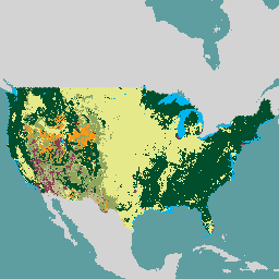
USFS Landscape Change Monitoring System v2024.10 (CONUS and OCONUS)
Questo prodotto fa parte della suite di dati del sistema di monitoraggio delle trasformazioni del paesaggio (LCMS). Mostra le classi di variazione, copertura del suolo e/o uso del suolo modellate con LCMS per ogni anno e copre gli Stati Uniti contigui (CONUS) e le aree al di fuori del CONUS (OCONUS), tra cui Alaska (AK), Porto … change-detection forest gtac landcover landuse landuse-landcover -
VNP64A1: Burned Area Monthly L4 Global 500m SIN Grid
Il prodotto dati giornaliero della versione 1 dell'area bruciata (VNP64A1) del radiometro per immagini a infrarossi visibili (VIIRS) della NASA Suomi National Polar-Orbiting Partnership (Suomi NPP) è un prodotto mensile a livello globale con una griglia di 500 m contenente informazioni sulla qualità e sull'area bruciata per pixel. L'approccio di mappatura delle aree bruciate VNP64 utilizza VIIRS a 750 m … burn change-detection fire land nasa noaa
Datasets tagged change-detection in Earth Engine
[null,null,[],[[["\u003cp\u003eThis webpage features curated datasets focused on land change detection using satellite imagery.\u003c/p\u003e\n"],["\u003cp\u003eDatasets provide insights into surface water changes, burned areas, and land cover/use transformations.\u003c/p\u003e\n"],["\u003cp\u003eData sources include Landsat, MODIS, VIIRS, and algorithms like CCDC for analyzing temporal patterns.\u003c/p\u003e\n"],["\u003cp\u003eGlobal and regional coverage is offered, with examples such as the USFS Landscape Change Monitoring System.\u003c/p\u003e\n"],["\u003cp\u003eThe collection spans multiple decades, enabling long-term change analysis and monitoring efforts.\u003c/p\u003e\n"]]],[],null,["# Datasets tagged change-detection in Earth Engine\n\n-\n\n |---------------------------------------------------------------------------------------------------------------------------------------------------------------------------------------------------------------------------------------------------------------------------------------------------------------------------------------------------|\n | [### Google Global Landsat-based CCDC Segments (1999-2019)](/earth-engine/datasets/catalog/GOOGLE_GLOBAL_CCDC_V1) |\n | This collection contains precomputed results from running the Continuous Change Detection and Classification (CCDC) algorithm on 20 years of Landsat surface reflectance data. CCDC is a break-point finding algorithm that uses harmonic fitting with a dynamic RMSE threshold to detect breakpoints in time-series data. The ... |\n | [change-detection](/earth-engine/datasets/tags/change-detection) [google](/earth-engine/datasets/tags/google) [landcover](/earth-engine/datasets/tags/landcover) [landsat-derived](/earth-engine/datasets/tags/landsat-derived) [landuse](/earth-engine/datasets/tags/landuse) [landuse-landcover](/earth-engine/datasets/tags/landuse-landcover) |\n\n-\n\n |---------------------------------------------------------------------------------------------------------------------------------------------------------------------------------------------------------------------------------------------------------------------------------------------------------------------------|\n | [### JRC Global Surface Water Mapping Layers, v1.4](/earth-engine/datasets/catalog/JRC_GSW1_4_GlobalSurfaceWater) |\n | This dataset contains maps of the location and temporal distribution of surface water from 1984 to 2021 and provides statistics on the extent and change of those water surfaces. For more information see the associated journal article: High-resolution mapping of global surface water and its ... |\n | [change-detection](/earth-engine/datasets/tags/change-detection) [geophysical](/earth-engine/datasets/tags/geophysical) [google](/earth-engine/datasets/tags/google) [jrc](/earth-engine/datasets/tags/jrc) [landsat-derived](/earth-engine/datasets/tags/landsat-derived) [surface](/earth-engine/datasets/tags/surface) |\n\n-\n\n |-----------------------------------------------------------------------------------------------------------------------------------------------------------------------------------------------------------------------------------------------------------------------------------------------------------------------------------------|\n | [### MCD64A1.061 MODIS Burned Area Monthly Global 500m](/earth-engine/datasets/catalog/MODIS_061_MCD64A1) |\n | The Terra and Aqua combined MCD64A1 Version 6.1 Burned Area data product is a monthly, global gridded 500m product containing per-pixel burned-area and quality information. The MCD64A1 burned-area mapping approach employs 500m MODIS Surface Reflectance imagery coupled with 1km MODIS active fire observations. The algorithm ... |\n | [burn](/earth-engine/datasets/tags/burn) [change-detection](/earth-engine/datasets/tags/change-detection) [fire](/earth-engine/datasets/tags/fire) [geophysical](/earth-engine/datasets/tags/geophysical) [global](/earth-engine/datasets/tags/global) [mcd64a1](/earth-engine/datasets/tags/mcd64a1) |\n\n-\n\n |-----------------------------------------------------------------------------------------------------------------------------------------------------------------------------------------------------------------------------------------------------------------------------------------------------------------------------|\n | [### USFS Landscape Change Monitoring System v2024.10 (CONUS and OCONUS)](/earth-engine/datasets/catalog/USFS_GTAC_LCMS_v2024-10) |\n | This product is part of the Landscape Change Monitoring System (LCMS) data suite. It shows LCMS-modeled change, land cover, and/or land use classes for each year and covers the Conterminous United States (CONUS) as well as areas outside the CONUS (OCONUS) including Alaska (AK), Puerto ... |\n | [change-detection](/earth-engine/datasets/tags/change-detection) [forest](/earth-engine/datasets/tags/forest) [gtac](/earth-engine/datasets/tags/gtac) [landcover](/earth-engine/datasets/tags/landcover) [landuse](/earth-engine/datasets/tags/landuse) [landuse-landcover](/earth-engine/datasets/tags/landuse-landcover) |\n\n-\n\n |---------------------------------------------------------------------------------------------------------------------------------------------------------------------------------------------------------------------------------------------------------------------------------------------------------------------------------------|\n | [### VNP64A1: Burned Area Monthly L4 Global 500m SIN Grid](/earth-engine/datasets/catalog/NOAA_VIIRS_001_VNP64A1) |\n | The daily Suomi National Polar-Orbiting Partnership (Suomi NPP) NASA Visible Infrared Imaging Radiometer Suite (VIIRS) Burned Area (VNP64A1) Version 1 data product is a monthly, global gridded 500m product containing per-pixel burned area and quality information. The VNP64 burned area mapping approach employs 750m VIIRS ... |\n | [burn](/earth-engine/datasets/tags/burn) [change-detection](/earth-engine/datasets/tags/change-detection) [fire](/earth-engine/datasets/tags/fire) [land](/earth-engine/datasets/tags/land) [nasa](/earth-engine/datasets/tags/nasa) [noaa](/earth-engine/datasets/tags/noaa) |"]]