-
ปริมาณน้ำฝนรายวันของ CHIRPS: ปริมาณน้ำฝนจากรังสีอินฟราเรดของศูนย์อันตรายจากสภาพอากาศพร้อมข้อมูลสถานี (เวอร์ชัน 2.0 สุดท้าย)

ข้อมูลปริมาณน้ำฝนกึ่งทั่วโลกที่มีมานานกว่า 30 ปีของศูนย์อันตรายจากสภาพอากาศ (Climate Hazards Center) ซึ่งเป็นข้อมูลปริมาณน้ำฝนอินฟราเรดที่มีข้อมูลสถานี (CHIRPS) CHIRPS ผสานรวมภาพจากดาวเทียมที่มีความละเอียด 0.05° กับข้อมูลสถานีในพื้นที่เพื่อสร้างอนุกรมเวลาของปริมาณน้ำฝนแบบกริดสำหรับการวิเคราะห์แนวโน้มและการตรวจสอบภัยแล้งตามฤดูกาล chg climate geophysical precipitation ucsb weather -
CHIRPS Precipitation Pentad: Climate Hazards Center InfraRed Precipitation With Station Data (เวอร์ชัน 2.0 สุดท้าย)

ข้อมูลปริมาณน้ำฝนกึ่งทั่วโลกที่มีมานานกว่า 30 ปีของศูนย์อันตรายจากสภาพอากาศ (Climate Hazards Center) ซึ่งเป็นข้อมูลปริมาณน้ำฝนอินฟราเรดที่มีข้อมูลสถานี (CHIRPS) CHIRPS ผสานรวมภาพจากดาวเทียมที่มีความละเอียด 0.05° กับข้อมูลสถานีในพื้นที่เพื่อสร้างอนุกรมเวลาของปริมาณน้ำฝนแบบกริดสำหรับการวิเคราะห์แนวโน้มและการตรวจสอบภัยแล้งตามฤดูกาล chg climate geophysical precipitation ucsb weather -
ปริมาณน้ำฝน CHIRPS แบบ 5 วัน: ปริมาณน้ำฝนอินฟราเรดของศูนย์อันตรายจากสภาพอากาศพร้อมข้อมูลสถานี (เวอร์ชัน 3.0)
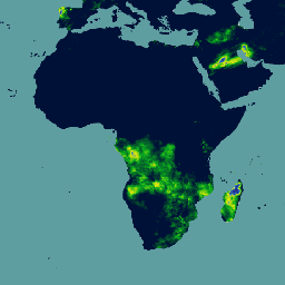
การตกตะกอนอินฟราเรดของศูนย์อันตรายจากสภาพอากาศที่มีสถานี (CHIRPS v3) เป็นชุดข้อมูลปริมาณน้ำฝนความละเอียดสูงแบบกึ่งทั่วโลกที่มีอายุมากกว่า 40 ปี โดยครอบคลุมตั้งแต่ 60°N ถึง 60°S และครอบคลุมลองจิจูดทั้งหมด ซึ่งให้ข้อมูลตั้งแต่ปี 1981 จนถึงปัจจุบัน CHIRPS v3 ผสานรวมการประมาณปริมาณน้ำฝนจากรังสีอินฟราเรดความร้อนที่อิงตามดาวเทียมกับการสังเกตการณ์สถานีในพื้นที่ … chc chg climate geophysical precipitation ucsb -
อุณหภูมิ CHIRTS รายวัน: ผลิตภัณฑ์ข้อมูลรายวันของอุณหภูมิอินฟราเรดของศูนย์อันตรายจากสภาพอากาศที่มีสถานี

ผลิตภัณฑ์ข้อมูลอุณหภูมิรายวันของศูนย์อันตรายจากสภาพอากาศ (Climate Hazards Center) ซึ่งวัดอุณหภูมิอินฟราเรดพร้อมข้อมูลอุณหภูมิจากสถานี (CHIRTS-daily; Verdin et al. 2020) เป็นชุดข้อมูลกริดความละเอียดสูงแบบกึ่งทั่วโลก (ความละเอียด 0.05° × 0.05°, 60°S - 70°N) ซึ่งให้ข้อมูลอุณหภูมิต่ำสุด (Tmin) และสูงสุด (Tmax) ที่ระดับ 2 เมตรในแต่ละวัน รวมถึงตัวแปรที่ได้มา 4 รายการ ได้แก่ แรงดันไอน้ำอิ่มตัว … chg climate daily era5 geophysical reanalysis
Datasets tagged chg in Earth Engine
[null,null,[],[],[]]