Обозначение: USGS GAP PAD-US v2.0 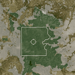
PAD-US — это официальный национальный реестр наземных и морских охраняемых территорий США, предназначенных для сохранения биологического разнообразия и других целей природного, рекреационного и культурного назначения, управляемых в этих целях посредством законных или иных эффективных мер. Эта база данных разделена на… сохранение-сервитуты обозначение инфраструктура-границы управление собственность охраняемые территории Сервитут: USGS GAP PAD-US v2.0 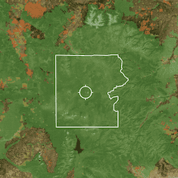
PAD-US — это официальный национальный реестр наземных и морских охраняемых территорий США, предназначенных для сохранения биологического разнообразия и других целей природного, рекреационного и культурного назначения, управляемых в этих целях посредством законных или иных эффективных мер. Эта база данных разделена на… сохранение-сервитуты обозначение инфраструктура-границы управление собственность охраняемые территории Плата: USGS GAP PAD-US v2.0 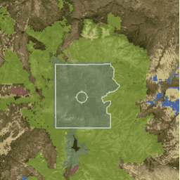
PAD-US — это официальный национальный реестр наземных и морских охраняемых территорий США, предназначенных для сохранения биологического разнообразия и других целей природного, рекреационного и культурного назначения, управляемых в этих целях посредством законных или иных эффективных мер. Эта база данных разделена на… сохранение-сервитуты обозначение инфраструктура-границы управление собственность охраняемые территории Провозглашение: USGS GAP PAD-US v2.0 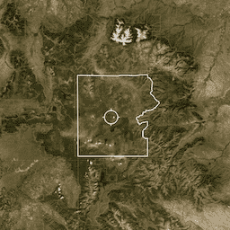
PAD-US — это официальный национальный реестр наземных и морских охраняемых территорий США, предназначенных для сохранения биологического разнообразия и других целей природного, рекреационного и культурного назначения, управляемых в этих целях посредством законных или иных эффективных мер. Эта база данных разделена на… сохранение-сервитуты обозначение инфраструктура-границы управление собственность охраняемые территории
Datasets tagged conservation-easements in Earth Engine
[null,null,[],[],[]]