Обозначение: USGS GAP PAD-US v2.0 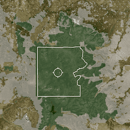
PAD-US — это официальный национальный реестр охраняемых территорий США на суше и на море, предназначенных для сохранения биологического разнообразия, а также для других видов использования в природных, рекреационных и культурных целях, управляемых в этих целях законными или иными эффективными способами. Эта база данных разделена на… обозначение природоохранных сервитутов границы инфраструктуры управление собственность охраняемые территории Сервитут: USGS GAP PAD-US v2.0 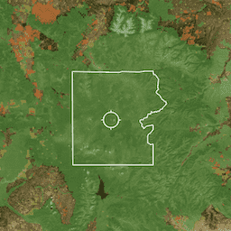
PAD-US — это официальный национальный реестр охраняемых территорий США на суше и на море, предназначенных для сохранения биологического разнообразия, а также для других видов использования в природных, рекреационных и культурных целях, управляемых в этих целях законными или иными эффективными способами. Эта база данных разделена на… обозначение природоохранных сервитутов границы инфраструктуры управление собственность охраняемые территории Плата: USGS GAP PAD-US v2.0 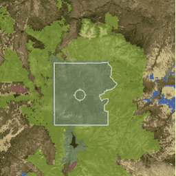
PAD-US — это официальный национальный реестр охраняемых территорий США на суше и на море, предназначенных для сохранения биологического разнообразия, а также для других видов использования в природных, рекреационных и культурных целях, управляемых в этих целях законными или иными эффективными способами. Эта база данных разделена на… обозначение природоохранных сервитутов границы инфраструктуры управление собственность охраняемые территории Прокламация: USGS GAP PAD-US v2.0 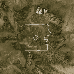
PAD-US — это официальный национальный реестр охраняемых территорий США на суше и на море, предназначенных для сохранения биологического разнообразия, а также для других видов использования в природных, рекреационных и культурных целях, управляемых в этих целях законными или иными эффективными способами. Эта база данных разделена на… обозначение природоохранных сервитутов границы инфраструктуры управление собственность охраняемые территории WDKBA: Всемирная база данных ключевых районов биоразнообразия (KBA) - март 2026 г. 
Если вас интересует доступ к набору данных KBA, пожалуйста, заполните форму запроса данных KBA, которая после одобрения предоставит вам прямой доступ в GEE. Ключевые зоны биоразнообразия (KBA) — это «места, вносящие значительный вклад в глобальное сохранение биоразнообразия» в наземных, пресноводных и морских экосистемах. … границы биоразнообразия экосистемы глобальный МСОП управление
Datasets tagged management in Earth Engine
[null,null,[],[],[]]