-
FIRMS: informacje o pożarze w systemie zarządzania zasobami
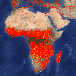
Wersja zbioru danych FIRMS w Earth Engine zawiera produkt wykrywania pożarów LANCE w postaci rastrowej. Aktywne pożary są wykrywane przez LANCE w czasie zbliżonym do rzeczywistego (NRT) za pomocą standardowego produktu MODIS MOD14/MYD14 Fire and Thermal Anomalies. Każdy eosdis fire firms geophysical hotspot lance -
VJ114IMGTDL_NRT Raster dzienny: VIIRS (NOAA-20) Pasmo 375 m Aktywny pożar
Produkt wykrywania pożarów aktywnych NOAA-20 (JPSS-1) Visible Infrared Imaging Radiometer Suite (VIIRS) opiera się na danych o nominalnej rozdzielczości 375 m. W porównaniu z innymi produktami do wykrywania pożarów z użyciem satelitów o mniejszej rozdzielczości (≥ 1 km) ulepszone dane o zasięgu 375 m zapewniają większą skuteczność w przypadku pożarów o względnie małej … eosdis fire firms geophysical hotspot lance -
VNP14IMGTDL_NRT Daily Raster: VIIRS (S-NPP) Band 375m Active Fire
Produkt wykrywania pożarów aktywnego Suomi NPP Visible Infrared Imaging Radiometer Suite (VIIRS) opiera się na danych o rozdzielczości nominalnej 375 m. W porównaniu z innymi produktami do wykrywania pożarów z użyciem satelitów o mniejszej rozdzielczości (≥ 1 km) ulepszone dane o zasięgu 375 m zapewniają większą skuteczność w przypadku pożarów o względnie małej … eosdis fire firms geophysical hotspot lance
Datasets tagged eosdis in Earth Engine
[null,null,[],[[["\u003cp\u003eThe Fire Information for Resource Management System (FIRMS) dataset provides near real-time active fire locations based on the MODIS MOD14/MYD14 Fire and Thermal Anomalies product.\u003c/p\u003e\n"],["\u003cp\u003eThe VIIRS Active Fire detection product offers improved 375m resolution data for greater response over smaller fires, available for both NOAA-20 and Suomi NPP satellites.\u003c/p\u003e\n"],["\u003cp\u003eAll datasets utilize LANCE (Land, Atmosphere Near real-time Capability for EOS) for fire detection and are available through Earth Engine.\u003c/p\u003e\n"]]],[],null,["# Datasets tagged eosdis in Earth Engine\n\n-\n\n |-----------------------------------------------------------------------------------------------------------------------------------------------------------------------------------------------------------------------------------------------------------------------------------------------------------------------|\n | [### FIRMS: Fire Information for Resource Management System](/earth-engine/datasets/catalog/FIRMS) |\n | The Earth Engine version of the Fire Information for Resource Management System (FIRMS) dataset contains the LANCE fire detection product in rasterized form. The near real-time (NRT) active fire locations are processed by LANCE using the standard MODIS MOD14/MYD14 Fire and Thermal Anomalies product. Each ... |\n | [eosdis](/earth-engine/datasets/tags/eosdis) [fire](/earth-engine/datasets/tags/fire) [firms](/earth-engine/datasets/tags/firms) [geophysical](/earth-engine/datasets/tags/geophysical) [hotspot](/earth-engine/datasets/tags/hotspot) [lance](/earth-engine/datasets/tags/lance) |\n\n-\n\n |---------------------------------------------------------------------------------------------------------------------------------------------------------------------------------------------------------------------------------------------------------------------------------------------------------------------------------|\n | [### VJ114IMGTDL_NRT Daily Raster: VIIRS (NOAA-20) Band 375m Active Fire](/earth-engine/datasets/catalog/NASA_LANCE_NOAA20_VIIRS_C2) |\n | NOAA-20 (JPSS-1) Visible Infrared Imaging Radiometer Suite (VIIRS) Active Fire detection product is based on the instrument's 375m nominal resolution data. Compared to other coarser resolution (≥ 1km) satellite fire detection products, the improved 375 m data provide greater response over fires of relatively small ... |\n | [eosdis](/earth-engine/datasets/tags/eosdis) [fire](/earth-engine/datasets/tags/fire) [firms](/earth-engine/datasets/tags/firms) [geophysical](/earth-engine/datasets/tags/geophysical) [hotspot](/earth-engine/datasets/tags/hotspot) [lance](/earth-engine/datasets/tags/lance) |\n\n-\n\n |--------------------------------------------------------------------------------------------------------------------------------------------------------------------------------------------------------------------------------------------------------------------------------------------------------------------------|\n | [### VNP14IMGTDL_NRT Daily Raster: VIIRS (S-NPP) Band 375m Active Fire](/earth-engine/datasets/catalog/NASA_LANCE_SNPP_VIIRS_C2) |\n | Suomi NPP Visible Infrared Imaging Radiometer Suite (VIIRS) Active Fire detection product is based on the instrument's 375m nominal resolution data. Compared to other coarser resolution (≥ 1km) satellite fire detection products, the improved 375 m data provide greater response over fires of relatively small ... |\n | [eosdis](/earth-engine/datasets/tags/eosdis) [fire](/earth-engine/datasets/tags/fire) [firms](/earth-engine/datasets/tags/firms) [geophysical](/earth-engine/datasets/tags/geophysical) [hotspot](/earth-engine/datasets/tags/hotspot) [lance](/earth-engine/datasets/tags/lance) |"]]