-
Estonia RGB low flying orthophotos

Ortofotomapy to zbiór zdjęć lotniczych obejmujący Estonię. Ortofotomapa to przetworzone zdjęcie lotnicze, z którego usunięto zniekształcenia spowodowane ukształtowaniem terenu, pochyleniem aparatu względem ziemi w momencie ekspozycji i projekcją środkową aparatu. Ortofotomapa cyfrowa ma określony … estonia low-flying orthophotos rgb -
Ortofotomapy RGB Estonii

Ortofotomapy to zbiór zdjęć lotniczych obejmujący Estonię. Ortofotomapa to przetworzone zdjęcie lotnicze, z którego usunięto zniekształcenia spowodowane ukształtowaniem terenu, pochyleniem aparatu względem ziemi w momencie ekspozycji i projekcją środkową aparatu. Ortofotomapa cyfrowa ma określony … estonia orthophotos rgb -
Estonia mono low flying orthophotos
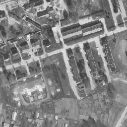
Ortofotomapy to zbiór zdjęć lotniczych obejmujący Estonię. Ortofotomapa to przetworzone zdjęcie lotnicze, z którego usunięto zniekształcenia spowodowane ukształtowaniem terenu, pochyleniem aparatu względem ziemi w momencie ekspozycji i projekcją środkową aparatu. Ortofotomapa cyfrowa ma określony … estonia low-flying orthophotos -
Estonia mono orthophotos
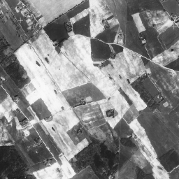
Ortofotomapy to zbiór zdjęć lotniczych obejmujący Estonię. Ortofotomapa to przetworzone zdjęcie lotnicze, z którego usunięto zniekształcenia spowodowane ukształtowaniem terenu, pochyleniem aparatu względem ziemi w momencie ekspozycji i projekcją środkową aparatu. Ortofotomapa cyfrowa ma określony … estonia orthophotos
Datasets tagged estonia in Earth Engine
[null,null,[],[],["The content describes aerial photo datasets, known as orthophotos, covering Estonia. These processed photos correct distortions from terrain, camera tilt, and central projection. There are mono and RGB orthophoto datasets, with some designated as low-flying. The datasets are tagged with \"estonia,\" \"orthophoto,\" and either \"rgb\" or \"low-flying\", depending on the specific characteristics of each set.\n"]]