-
Estonia RGB low flying orthophotos

Ortofotomapy to zbiór zdjęć lotniczych obejmujący Estonię. Ortofotomapa to przetworzone zdjęcie lotnicze, z którego usunięto zniekształcenia spowodowane ukształtowaniem terenu, pochyleniem aparatu względem ziemi w momencie ekspozycji i projekcją środkową aparatu. Ortofotomapa cyfrowa ma określony … estonia low-flying orthophotos rgb -
Estonia mono low flying orthophotos
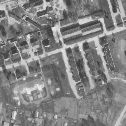
Ortofotomapy to zbiór zdjęć lotniczych obejmujący Estonię. Ortofotomapa to przetworzone zdjęcie lotnicze, z którego usunięto zniekształcenia spowodowane ukształtowaniem terenu, pochyleniem aparatu względem ziemi w momencie ekspozycji i projekcją środkową aparatu. Ortofotomapa cyfrowa ma określony … estonia low-flying orthophotos
Datasets tagged low-flying in Earth Engine
[null,null,[],[],["Estonia has aerial photo datasets called orthophotos. These are processed photos where distortions from terrain, camera tilt, and projection are removed. The datasets cover Estonia and are available in both monochrome and RGB formats. The photos were taken at low-flying altitudes. The datasets are referred to as Estonia mono low flying orthophotos and Estonia RGB low flying orthophotos.\n"]]