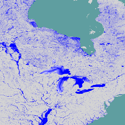
-
Global Flood Database v1(2000 ~ 2018 年)
Global Flood Database には、2000 ~ 2018 年に発生した 913 件の洪水イベントの範囲と時間分布の地図が含まれています。詳しくは、関連するジャーナル記事をご覧ください。洪水イベントは Dartmouth Flood Observatory から収集され、MODIS 画像の収集に使用されました。選択した 913 … flood surface surface-ground-water water -
JRC グローバル河川洪水ハザードマップ バージョン 1 [非推奨]
世界の河川洪水ハザードマップは、7 つの異なる洪水再発期間(10 年に 1 回から 500 年に 1 回)の河川ネットワークに沿った浸水を表すグリッド データセットです。新しい地図の入力河川流量データは、オープンソースの水文モデルを使用して生成されます。 flood monitoring surface-ground-water wri -
JRC Global River Flood Hazard Maps Version 2
世界の河川洪水ハザードマップは、7 つの異なる洪水再発期間(10 年に 1 回から 500 年に 1 回)の河川ネットワークに沿った浸水を表すグリッド データセットです。新しい地図の入力河川流量データは、オープンソースの水文モデルを使用して生成されます。 flood monitoring surface-ground-water wri -
WRI Aqueduct Baseline Annual バージョン 4.0
Aqueduct 4.0 は、複雑な水文データを水関連のリスクの直感的な指標に変換するために設計された、WRI の水リスク フレームワークの最新バージョンです。このデータセットでは、水量、水質、評判に関する懸念事項について 13 個の水リスク指標を厳選し、包括的なフレームワークにまとめました。5 つの … aqueduct flood monitoring surface-ground-water table wri -
WRI Aqueduct Baseline Monthly バージョン 4.0
Aqueduct 4.0 は、複雑な水文データを水関連のリスクの直感的な指標に変換するために設計された、WRI の水リスク フレームワークの最新バージョンです。このデータセットでは、水量、水質、評判に関する懸念事項について 13 個の水リスク指標を厳選し、包括的なフレームワークにまとめました。5 つの … aqueduct flood monitoring surface-ground-water table wri -
WRI Aqueduct Floods Hazard Maps Version 2
Aqueduct Floods のデータは、現在のベースライン条件と 2030 年、2050 年、2080 年の将来予測の両方で、河川と沿岸の洪水リスクを測定します。Aqueduct Floods は、ハザードマップの提供やリスク評価に加えて、堤防の価値を評価するための包括的な費用便益分析の実施にも役立ちます。 flood monitoring surface-ground-water wri -
WRI Aqueduct Future Annual Version 4.0
Aqueduct 4.0 は、複雑な水文データを水関連のリスクの直感的な指標に変換するために設計された、WRI の水リスク フレームワークの最新バージョンです。このデータセットでは、水量、水質、評判に関する懸念事項について 13 個の水リスク指標を厳選し、包括的なフレームワークにまとめました。5 つの … aqueduct flood monitoring surface-ground-water table wri
Datasets tagged flood in Earth Engine
[null,null,[],[[["\u003cp\u003eThe Global Flood Database provides maps of 913 flood events from 2000-2018, using MODIS imagery and data from the Dartmouth Flood Observatory.\u003c/p\u003e\n"],["\u003cp\u003eJRC Global River Flood Hazard Maps offer inundation data for various flood return periods, utilizing an open-source hydrological model.\u003c/p\u003e\n"],["\u003cp\u003eWRI Aqueduct Floods Hazard Maps measure current and future riverine and coastal flood risks, including projections for 2030, 2050, and 2080.\u003c/p\u003e\n"]]],["The datasets provide information on global flood events and water risk. The Global Flood Database maps 913 flood events from 2000-2018 using MODIS imagery. The JRC Global River Flood Hazard Maps offer gridded data on river inundation for various flood return periods. WRI Aqueduct Floods data assess riverine and coastal flood risks, including future projections. Aqueduct 4.0 datasets contain 13 water risk indicators related to quantity, quality, and reputational concerns.\n"],null,["# Datasets tagged flood in Earth Engine\n\n-\n\n |---------------------------------------------------------------------------------------------------------------------------------------------------------------------------------------------------------------------------------------------------------------------------------------------------------------------|\n | [### Global Flood Database v1 (2000-2018)](/earth-engine/datasets/catalog/GLOBAL_FLOOD_DB_MODIS_EVENTS_V1) |\n | The Global Flood Database contains maps of the extent and temporal distribution of 913 flood events occurring between 2000-2018. For more information, see the associated journal article. Flood events were collected from the Dartmouth Flood Observatory and used to collect MODIS imagery. The selected 913 ... |\n | [flood](/earth-engine/datasets/tags/flood) [surface](/earth-engine/datasets/tags/surface) [surface-ground-water](/earth-engine/datasets/tags/surface-ground-water) [water](/earth-engine/datasets/tags/water) |\n\n-\n\n |--------------------------------------------------------------------------------------------------------------------------------------------------------------------------------------------------------------------------------------------------------------------------------------------------------|\n | [### JRC Global River Flood Hazard Maps Version 1 \\[deprecated\\]](/earth-engine/datasets/catalog/JRC_CEMS_GLOFAS_FloodHazard_v1) |\n | The global river flood hazard maps are a gridded data set representing inundation along the river network, for seven different flood return periods (from 1-in-10-years to 1-in-500-years). The input river flow data for the new maps are produced by means of the open-source hydrological model ... |\n | [flood](/earth-engine/datasets/tags/flood) [monitoring](/earth-engine/datasets/tags/monitoring) [surface-ground-water](/earth-engine/datasets/tags/surface-ground-water) [wri](/earth-engine/datasets/tags/wri) |\n\n-\n\n |--------------------------------------------------------------------------------------------------------------------------------------------------------------------------------------------------------------------------------------------------------------------------------------------------------|\n | [### JRC Global River Flood Hazard Maps Version 2](/earth-engine/datasets/catalog/JRC_CEMS_GLOFAS_FloodHazard_v2) |\n | The global river flood hazard maps are a gridded data set representing inundation along the river network, for seven different flood return periods (from 1-in-10-years to 1-in-500-years). The input river flow data for the new maps are produced by means of the open-source hydrological model ... |\n | [flood](/earth-engine/datasets/tags/flood) [monitoring](/earth-engine/datasets/tags/monitoring) [surface-ground-water](/earth-engine/datasets/tags/surface-ground-water) [wri](/earth-engine/datasets/tags/wri) |\n\n-\n\n |--------------------------------------------------------------------------------------------------------------------------------------------------------------------------------------------------------------------------------------------------------------------------------------------------------------------|\n | [### WRI Aqueduct Baseline Annual Version 4.0](/earth-engine/datasets/catalog/WRI_Aqueduct_Water_Risk_V4_baseline_annual) |\n | Aqueduct 4.0 is the latest iteration of WRI's water risk framework designed to translate complex hydrological data into intuitive indicators of water related risk. This dataset has curated 13 water risk indicators for quantity, quality and reputational concerns into a comprehensive framework. For 5 of ... |\n | [aqueduct](/earth-engine/datasets/tags/aqueduct) [flood](/earth-engine/datasets/tags/flood) [monitoring](/earth-engine/datasets/tags/monitoring) [surface-ground-water](/earth-engine/datasets/tags/surface-ground-water) [table](/earth-engine/datasets/tags/table) [wri](/earth-engine/datasets/tags/wri) |\n\n-\n\n |--------------------------------------------------------------------------------------------------------------------------------------------------------------------------------------------------------------------------------------------------------------------------------------------------------------------|\n | [### WRI Aqueduct Baseline Monthly Version 4.0](/earth-engine/datasets/catalog/WRI_Aqueduct_Water_Risk_V4_baseline_monthly) |\n | Aqueduct 4.0 is the latest iteration of WRI's water risk framework designed to translate complex hydrological data into intuitive indicators of water related risk. This dataset has curated 13 water risk indicators for quantity, quality and reputational concerns into a comprehensive framework. For 5 of ... |\n | [aqueduct](/earth-engine/datasets/tags/aqueduct) [flood](/earth-engine/datasets/tags/flood) [monitoring](/earth-engine/datasets/tags/monitoring) [surface-ground-water](/earth-engine/datasets/tags/surface-ground-water) [table](/earth-engine/datasets/tags/table) [wri](/earth-engine/datasets/tags/wri) |\n\n-\n\n |-----------------------------------------------------------------------------------------------------------------------------------------------------------------------------------------------------------------------------------------------------------------------------------------------------------------------|\n | [### WRI Aqueduct Floods Hazard Maps Version 2](/earth-engine/datasets/catalog/WRI_Aqueduct_Flood_Hazard_Maps_V2) |\n | Aqueduct Floods data measures riverine and coastal food risks under both current baseline conditions and future projections in 2030, 2050, and 2080. In addition to providing hazard maps and assessing risks, Aqueduct Floods helps to conduct comprehensive cost-benefit analysis to evaluate the value of dike ... |\n | [flood](/earth-engine/datasets/tags/flood) [monitoring](/earth-engine/datasets/tags/monitoring) [surface-ground-water](/earth-engine/datasets/tags/surface-ground-water) [wri](/earth-engine/datasets/tags/wri) |\n\n-\n\n |--------------------------------------------------------------------------------------------------------------------------------------------------------------------------------------------------------------------------------------------------------------------------------------------------------------------|\n | [### WRI Aqueduct Future Annual Version 4.0](/earth-engine/datasets/catalog/WRI_Aqueduct_Water_Risk_V4_future_annual) |\n | Aqueduct 4.0 is the latest iteration of WRI's water risk framework designed to translate complex hydrological data into intuitive indicators of water related risk. This dataset has curated 13 water risk indicators for quantity, quality and reputational concerns into a comprehensive framework. For 5 of ... |\n | [aqueduct](/earth-engine/datasets/tags/aqueduct) [flood](/earth-engine/datasets/tags/flood) [monitoring](/earth-engine/datasets/tags/monitoring) [surface-ground-water](/earth-engine/datasets/tags/surface-ground-water) [table](/earth-engine/datasets/tags/table) [wri](/earth-engine/datasets/tags/wri) |"]]