-
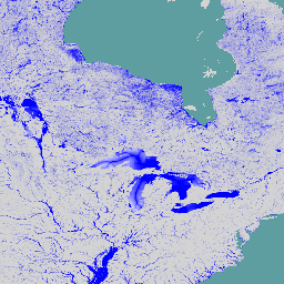
ฐานข้อมูลน้ำท่วมทั่วโลก v1 (2000-2018)
ฐานข้อมูลน้ำท่วมทั่วโลกมีแผนที่ขอบเขตและการกระจายตามเวลาของเหตุการณ์น้ำท่วม 913 ครั้งที่เกิดขึ้นระหว่างปี 2000-2018 ดูข้อมูลเพิ่มเติมได้ในบทความวารสารที่เกี่ยวข้อง เราได้รวบรวมเหตุการณ์น้ำท่วมจาก Dartmouth Flood Observatory และใช้เพื่อรวบรวมภาพ MODIS 913 ที่เลือก … น้ำท่วม ผิวน้ำ น้ำผิวดินและน้ำใต้ดิน น้ำ -
แผนที่อันตรายจากน้ำท่วมแม่น้ำทั่วโลกของ JRC เวอร์ชัน 1 [เลิกใช้งานแล้ว]
แผนที่อันตรายจากน้ำท่วมแม่น้ำทั่วโลกคือชุดข้อมูลแบบกริดที่แสดงถึงการเกิดน้ำท่วมตามเครือข่ายแม่น้ำสำหรับช่วงเวลาที่น้ำท่วมกลับมา 7 ช่วง (ตั้งแต่ 1 ใน 10 ปีไปจนถึง 1 ใน 500 ปี) ข้อมูลการไหลของแม่น้ำที่เป็นอินพุตสำหรับแผนที่ใหม่สร้างขึ้นโดยใช้โมเดลอุทกวิทยาแบบโอเพนซอร์ส … น้ำท่วม การตรวจสอบ น้ำผิวดิน น้ำใต้ดิน wri -
แผนที่แสดงอันตรายจากน้ำท่วมในแม่น้ำทั่วโลกของ JRC เวอร์ชัน 2
แผนที่อันตรายจากน้ำท่วมแม่น้ำทั่วโลกคือชุดข้อมูลแบบกริดที่แสดงถึงการเกิดน้ำท่วมตามเครือข่ายแม่น้ำสำหรับช่วงเวลาที่น้ำท่วมกลับมา 7 ช่วง (ตั้งแต่ 1 ใน 10 ปีไปจนถึง 1 ใน 500 ปี) ข้อมูลการไหลของแม่น้ำที่เป็นอินพุตสำหรับแผนที่ใหม่สร้างขึ้นโดยใช้โมเดลอุทกวิทยาแบบโอเพนซอร์ส … น้ำท่วม การตรวจสอบ น้ำผิวดิน น้ำใต้ดิน wri -
WRI Aqueduct Baseline Annual เวอร์ชัน 4.0
Aqueduct 4.0 เป็นกรอบความเสี่ยงด้านน้ำของ WRI เวอร์ชันล่าสุด ซึ่งออกแบบมาเพื่อแปลข้อมูลอุทกวิทยาที่ซับซ้อนให้เป็นตัวบ่งชี้ความเสี่ยงที่เกี่ยวข้องกับน้ำที่ใช้งานง่าย ชุดข้อมูลนี้ได้รวบรวมตัวบ่งชี้ความเสี่ยงด้านน้ำ 13 รายการสำหรับความกังวลเกี่ยวกับปริมาณ คุณภาพ และชื่อเสียงไว้ในกรอบการทำงานที่ครอบคลุม สำหรับ 5 จาก … aqueduct flood monitoring surface-ground-water table wri -
WRI Aqueduct Baseline Monthly เวอร์ชัน 4.0
Aqueduct 4.0 เป็นกรอบความเสี่ยงด้านน้ำของ WRI เวอร์ชันล่าสุด ซึ่งออกแบบมาเพื่อแปลข้อมูลอุทกวิทยาที่ซับซ้อนให้เป็นตัวบ่งชี้ความเสี่ยงที่เกี่ยวข้องกับน้ำที่ใช้งานง่าย ชุดข้อมูลนี้ได้รวบรวมตัวบ่งชี้ความเสี่ยงด้านน้ำ 13 รายการสำหรับความกังวลเกี่ยวกับปริมาณ คุณภาพ และชื่อเสียงไว้ในกรอบการทำงานที่ครอบคลุม สำหรับ 5 จาก … aqueduct flood monitoring surface-ground-water table wri -
แผนที่แสดงอันตรายจากน้ำท่วมของ Aqueduct ของ WRI เวอร์ชัน 2
ข้อมูลอุทกภัยของ Aqueduct จะวัดความเสี่ยงด้านอาหารในแม่น้ำและชายฝั่งภายใต้สภาวะพื้นฐานปัจจุบันและการคาดการณ์ในอนาคตในปี 2030, 2050 และ 2080 นอกจากจะแสดงแผนที่อันตรายและประเมินความเสี่ยงแล้ว Aqueduct Floods ยังช่วยวิเคราะห์ต้นทุนและผลประโยชน์อย่างครอบคลุมเพื่อประเมินมูลค่าของเขื่อนกั้นน้ำ … น้ำท่วม การตรวจสอบ น้ำผิวดิน น้ำใต้ดิน wri -
WRI Aqueduct Future Annual เวอร์ชัน 4.0
Aqueduct 4.0 เป็นกรอบความเสี่ยงด้านน้ำของ WRI เวอร์ชันล่าสุด ซึ่งออกแบบมาเพื่อแปลข้อมูลอุทกวิทยาที่ซับซ้อนให้เป็นตัวบ่งชี้ความเสี่ยงที่เกี่ยวข้องกับน้ำที่ใช้งานง่าย ชุดข้อมูลนี้ได้รวบรวมตัวบ่งชี้ความเสี่ยงด้านน้ำ 13 รายการสำหรับความกังวลเกี่ยวกับปริมาณ คุณภาพ และชื่อเสียงไว้ในกรอบการทำงานที่ครอบคลุม สำหรับ 5 จาก … aqueduct flood monitoring surface-ground-water table wri
Datasets tagged flood in Earth Engine
[null,null,[],[[["\u003cp\u003eThe Global Flood Database provides maps of 913 flood events from 2000-2018, using MODIS imagery and data from the Dartmouth Flood Observatory.\u003c/p\u003e\n"],["\u003cp\u003eJRC Global River Flood Hazard Maps offer inundation data for various flood return periods, utilizing an open-source hydrological model.\u003c/p\u003e\n"],["\u003cp\u003eWRI Aqueduct Floods Hazard Maps measure current and future riverine and coastal flood risks, including projections for 2030, 2050, and 2080.\u003c/p\u003e\n"]]],["The datasets provide information on global flood events and water risk. The Global Flood Database maps 913 flood events from 2000-2018 using MODIS imagery. The JRC Global River Flood Hazard Maps offer gridded data on river inundation for various flood return periods. WRI Aqueduct Floods data assess riverine and coastal flood risks, including future projections. Aqueduct 4.0 datasets contain 13 water risk indicators related to quantity, quality, and reputational concerns.\n"],null,["# Datasets tagged flood in Earth Engine\n\n-\n\n |---------------------------------------------------------------------------------------------------------------------------------------------------------------------------------------------------------------------------------------------------------------------------------------------------------------------|\n | [### Global Flood Database v1 (2000-2018)](/earth-engine/datasets/catalog/GLOBAL_FLOOD_DB_MODIS_EVENTS_V1) |\n | The Global Flood Database contains maps of the extent and temporal distribution of 913 flood events occurring between 2000-2018. For more information, see the associated journal article. Flood events were collected from the Dartmouth Flood Observatory and used to collect MODIS imagery. The selected 913 ... |\n | [flood](/earth-engine/datasets/tags/flood) [surface](/earth-engine/datasets/tags/surface) [surface-ground-water](/earth-engine/datasets/tags/surface-ground-water) [water](/earth-engine/datasets/tags/water) |\n\n-\n\n |--------------------------------------------------------------------------------------------------------------------------------------------------------------------------------------------------------------------------------------------------------------------------------------------------------|\n | [### JRC Global River Flood Hazard Maps Version 1 \\[deprecated\\]](/earth-engine/datasets/catalog/JRC_CEMS_GLOFAS_FloodHazard_v1) |\n | The global river flood hazard maps are a gridded data set representing inundation along the river network, for seven different flood return periods (from 1-in-10-years to 1-in-500-years). The input river flow data for the new maps are produced by means of the open-source hydrological model ... |\n | [flood](/earth-engine/datasets/tags/flood) [monitoring](/earth-engine/datasets/tags/monitoring) [surface-ground-water](/earth-engine/datasets/tags/surface-ground-water) [wri](/earth-engine/datasets/tags/wri) |\n\n-\n\n |--------------------------------------------------------------------------------------------------------------------------------------------------------------------------------------------------------------------------------------------------------------------------------------------------------|\n | [### JRC Global River Flood Hazard Maps Version 2](/earth-engine/datasets/catalog/JRC_CEMS_GLOFAS_FloodHazard_v2) |\n | The global river flood hazard maps are a gridded data set representing inundation along the river network, for seven different flood return periods (from 1-in-10-years to 1-in-500-years). The input river flow data for the new maps are produced by means of the open-source hydrological model ... |\n | [flood](/earth-engine/datasets/tags/flood) [monitoring](/earth-engine/datasets/tags/monitoring) [surface-ground-water](/earth-engine/datasets/tags/surface-ground-water) [wri](/earth-engine/datasets/tags/wri) |\n\n-\n\n |--------------------------------------------------------------------------------------------------------------------------------------------------------------------------------------------------------------------------------------------------------------------------------------------------------------------|\n | [### WRI Aqueduct Baseline Annual Version 4.0](/earth-engine/datasets/catalog/WRI_Aqueduct_Water_Risk_V4_baseline_annual) |\n | Aqueduct 4.0 is the latest iteration of WRI's water risk framework designed to translate complex hydrological data into intuitive indicators of water related risk. This dataset has curated 13 water risk indicators for quantity, quality and reputational concerns into a comprehensive framework. For 5 of ... |\n | [aqueduct](/earth-engine/datasets/tags/aqueduct) [flood](/earth-engine/datasets/tags/flood) [monitoring](/earth-engine/datasets/tags/monitoring) [surface-ground-water](/earth-engine/datasets/tags/surface-ground-water) [table](/earth-engine/datasets/tags/table) [wri](/earth-engine/datasets/tags/wri) |\n\n-\n\n |--------------------------------------------------------------------------------------------------------------------------------------------------------------------------------------------------------------------------------------------------------------------------------------------------------------------|\n | [### WRI Aqueduct Baseline Monthly Version 4.0](/earth-engine/datasets/catalog/WRI_Aqueduct_Water_Risk_V4_baseline_monthly) |\n | Aqueduct 4.0 is the latest iteration of WRI's water risk framework designed to translate complex hydrological data into intuitive indicators of water related risk. This dataset has curated 13 water risk indicators for quantity, quality and reputational concerns into a comprehensive framework. For 5 of ... |\n | [aqueduct](/earth-engine/datasets/tags/aqueduct) [flood](/earth-engine/datasets/tags/flood) [monitoring](/earth-engine/datasets/tags/monitoring) [surface-ground-water](/earth-engine/datasets/tags/surface-ground-water) [table](/earth-engine/datasets/tags/table) [wri](/earth-engine/datasets/tags/wri) |\n\n-\n\n |-----------------------------------------------------------------------------------------------------------------------------------------------------------------------------------------------------------------------------------------------------------------------------------------------------------------------|\n | [### WRI Aqueduct Floods Hazard Maps Version 2](/earth-engine/datasets/catalog/WRI_Aqueduct_Flood_Hazard_Maps_V2) |\n | Aqueduct Floods data measures riverine and coastal food risks under both current baseline conditions and future projections in 2030, 2050, and 2080. In addition to providing hazard maps and assessing risks, Aqueduct Floods helps to conduct comprehensive cost-benefit analysis to evaluate the value of dike ... |\n | [flood](/earth-engine/datasets/tags/flood) [monitoring](/earth-engine/datasets/tags/monitoring) [surface-ground-water](/earth-engine/datasets/tags/surface-ground-water) [wri](/earth-engine/datasets/tags/wri) |\n\n-\n\n |--------------------------------------------------------------------------------------------------------------------------------------------------------------------------------------------------------------------------------------------------------------------------------------------------------------------|\n | [### WRI Aqueduct Future Annual Version 4.0](/earth-engine/datasets/catalog/WRI_Aqueduct_Water_Risk_V4_future_annual) |\n | Aqueduct 4.0 is the latest iteration of WRI's water risk framework designed to translate complex hydrological data into intuitive indicators of water related risk. This dataset has curated 13 water risk indicators for quantity, quality and reputational concerns into a comprehensive framework. For 5 of ... |\n | [aqueduct](/earth-engine/datasets/tags/aqueduct) [flood](/earth-engine/datasets/tags/flood) [monitoring](/earth-engine/datasets/tags/monitoring) [surface-ground-water](/earth-engine/datasets/tags/surface-ground-water) [table](/earth-engine/datasets/tags/table) [wri](/earth-engine/datasets/tags/wri) |"]]