-
MERIT Hydro: 글로벌 수로 데이터 세트
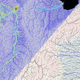
MERIT Hydro는 MERIT DEM 고도 데이터 및 수역 데이터 세트 (G1WBM, GSWO, OpenStreetMap)의 버전 1.0.3에서 파생된 새로운 글로벌 흐름 방향 지도이며 해상도는 3초 (적도에서 약 90m)입니다. MERIT Hydro에는 새로운 …의 출력이 포함되어 있습니다. dem elevation flow-direction hand hydrography hydrosheds -
MERIT Hydro: 보조 시각화 레이어

MERIT Hydro의 보조 시각화 레이어 dem elevation flow-direction hand hydrography hydrosheds
Datasets tagged flow-direction in Earth Engine
[null,null,[],[],["MERIT Hydro offers a global flow direction map with a 3 arc-second resolution, derived from MERIT DEM elevation data and water body datasets (G1WBM, GSWO, OpenStreetMap). It utilizes elevation, flow-direction, and hydrography data. It offers supplementary visualization layers that share the same data origins and tag categories, offering additional tools for understanding the hydrography data. The dataset focuses on mapping water flow direction globally.\n"]]