GPW বার্ষিক প্রভাবশালী তৃণভূমি শ্রেণী v1 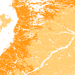
এই ডেটাসেটটি ২০০০ থেকে ২০২২ সাল পর্যন্ত ৩০ মিটার স্থানিক রেজোলিউশনে তৃণভূমির (চাষকৃত এবং প্রাকৃতিক/আধা-প্রাকৃতিক) বিশ্বব্যাপী বার্ষিক প্রভাবশালী শ্রেণীর মানচিত্র প্রদান করে। ল্যান্ড অ্যান্ড কার্বন ল্যাব গ্লোবাল প্যাসচার ওয়াচ উদ্যোগ দ্বারা উত্পাদিত, ম্যাপ করা তৃণভূমির সীমানায় যেকোনো ভূমি আচ্ছাদনের ধরণ অন্তর্ভুক্ত রয়েছে, যার মধ্যে কমপক্ষে … গ্লোবাল গ্লোবাল-প্যাচার-ওয়াচ ল্যান্ড ল্যান্ডকভার ল্যান্ডইউজ ল্যান্ডইউজ-ল্যান্ডকভার চাষকৃত তৃণভূমির GPW বার্ষিক সম্ভাবনা v1 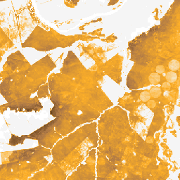
এই ডেটাসেটটি ২০০০ থেকে ২০২২ সাল পর্যন্ত ৩০ মিটার স্থানিক রেজোলিউশনে চাষযোগ্য তৃণভূমির বিশ্বব্যাপী বার্ষিক সম্ভাব্যতা মানচিত্র প্রদান করে। ল্যান্ড অ্যান্ড কার্বন ল্যাব গ্লোবাল প্যাসচার ওয়াচ উদ্যোগ দ্বারা উত্পাদিত, ম্যাপ করা তৃণভূমির সীমানায় যেকোনো ভূমি আচ্ছাদনের ধরণ অন্তর্ভুক্ত রয়েছে, যার মধ্যে কমপক্ষে ৩০% শুষ্ক ... গ্লোবাল গ্লোবাল-প্যাচার-ওয়াচ ল্যান্ড ল্যান্ডকভার ল্যান্ডইউজ ল্যান্ডইউজ-ল্যান্ডকভার প্রাকৃতিক/আধা-প্রাকৃতিক তৃণভূমির GPW বার্ষিক সম্ভাবনা v1 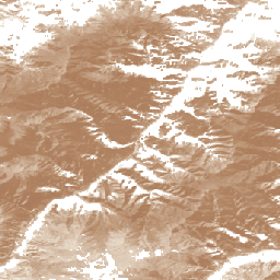
এই ডেটাসেটটি ২০০০ থেকে ২০২২ সাল পর্যন্ত ৩০ মিটার স্থানিক রেজোলিউশনে প্রাকৃতিক/আধা-প্রাকৃতিক তৃণভূমির বিশ্বব্যাপী বার্ষিক সম্ভাব্যতা মানচিত্র প্রদান করে। ল্যান্ড অ্যান্ড কার্বন ল্যাব গ্লোবাল প্যাসচার ওয়াচ উদ্যোগ দ্বারা উত্পাদিত, ম্যাপ করা তৃণভূমির সীমানায় যেকোনো ভূমি আচ্ছাদনের ধরণ অন্তর্ভুক্ত রয়েছে, যার মধ্যে কমপক্ষে ৩০% শুষ্ক ... গ্লোবাল গ্লোবাল-প্যাচার-ওয়াচ ল্যান্ড ল্যান্ডকভার ল্যান্ডইউজ ল্যান্ডইউজ-ল্যান্ডকভার GPW বার্ষিক ছোট গাছপালার উচ্চতা v1 
এই ডেটাসেটটি ২০০০ সাল থেকে ৩০ মিটার স্থানিক রেজোলিউশনে বিশ্বব্যাপী উদ্ভিদের গড় উচ্চতা প্রদান করে। ল্যান্ড অ্যান্ড কার্বন ল্যাবের গ্লোবাল প্যাসচার ওয়াচ উদ্যোগ দ্বারা উত্পাদিত, এই ডেটাসেটটি ২০০০ সাল থেকে ৩০ মিটার স্থানিক রেজোলিউশনে বিশ্বব্যাপী উদ্ভিদের গড় উচ্চতা মান (৫০তম শতাংশ) প্রদান করে। ডেটাসেটটি ভিত্তিক ... ক্যানোপি গ্লোবাল গ্লোবাল-প্যাচার-ওয়াচ ল্যান্ড ল্যান্ডকভার প্ল্যান্ট-উৎপাদনশীলতা GPW বার্ষিক অ-ক্যালিব্রেটেড গ্রস প্রাইমারি প্রোডাক্টিভিটি (uGPP) v1 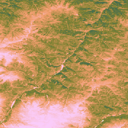
এই ডেটাসেটটি ২০০০ সাল থেকে ৩০-মিটার স্থানিক রেজোলিউশনে বিশ্বব্যাপী অ-ক্যালিব্রেটেড EO-ভিত্তিক গ্রস প্রাইমারি প্রোডাক্টিভিটি প্রদান করে। ল্যান্ড অ্যান্ড কার্বন ল্যাব গ্লোবাল প্যাসচার ওয়াচ উদ্যোগ দ্বারা উত্পাদিত, বর্তমান ডেটাসেটটি ২০০০ সাল থেকে ৩০-মিটার স্থানিক রেজোলিউশনে বিশ্বব্যাপী গ্রস প্রাইমারি প্রোডাক্টিভিটি (GPP) মান প্রদান করে। GPP মান … বিশ্বব্যাপী গ্লোবাল-চারণভূমি-ঘড়ি জমি ভূমি আচ্ছাদন ভূমি ব্যবহার উদ্ভিদ-উৎপাদনশীলতা
Datasets tagged global-pasture-watch in Earth Engine
[null,null,[],[],[]]