-
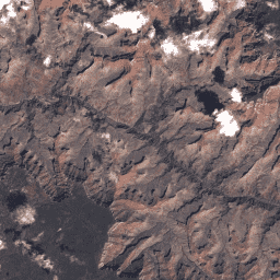
Landsat Global Land Survey 2005, Landsat 5 장면
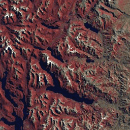
GLS2005 데이터 세트는 2004년에서 2007년 사이에 수집되었으며 지구의 육지를 포함하는 9,500개의 직교 보정된 잎이 있는 중간 해상도 위성 이미지 모음입니다. GLS2005는 주로 Landsat 5와 간격이 채워진 Landsat 7 데이터를 사용하며 EO-1 ALI 및 Terra ASTER 데이터가 누락된 부분을 채웁니다. etm gls l5 landsat radiance 위성 이미지 -
USGS Landsat 5 MSS Collection 2 Tier 1 원시 장면

Landsat 5 MSS Collection 2 Tier 1 DN 값으로, 센서에서의 스케일링되고 보정된 복사 휘도를 나타냅니다. 제공되는 데이터 중 데이터 품질이 가장 높은 Landsat 장면은 Tier 1에 배치되며 시계열 처리 분석에 적합합니다. Tier 1에는 다음을 충족하는 L1TP (Level-1 Precision Terrain) 처리 데이터가 포함되어 있습니다. c2 global l5 landsat lm5 mss -
USGS Landsat 5 MSS Collection 2 Tier 2 원시 장면

Landsat 5 MSS Collection 2 Tier 2 DN 값으로, 센서에서의 스케일링되고 보정된 복사 휘도를 나타냅니다. 처리 중에 Tier 1 기준을 충족하지 않는 장면은 Tier 2에 할당됩니다. 여기에는 체계적 지형 (L1GT) 및 체계적 (L1GS) 처리 장면과 … c2 global l5 landsat lm5 mss -
USGS Landsat 5 TM Collection 2 Tier 1 원시 장면

Landsat 5 TM Collection 2 Tier 1 DN 값으로, 센서에서의 스케일링되고 보정된 복사 휘도를 나타냅니다. 제공되는 데이터 중 데이터 품질이 가장 높은 Landsat 장면은 Tier 1에 배치되며 시계열 처리 분석에 적합합니다. Tier 1에는 다음을 충족하는 L1TP (Level-1 Precision Terrain) 처리 데이터가 포함되어 있습니다. c2 전역 l5 landsat lt5 복사휘도 -
USGS Landsat 5 TM Collection 2 Tier 2 원시 장면
Landsat 5 TM Collection 2 Tier 2 DN 값으로, 센서에서의 스케일링되고 보정된 복사 휘도를 나타냅니다. 처리 중에 Tier 1 기준을 충족하지 않는 장면은 Tier 2에 할당됩니다. 여기에는 체계적 지형 (L1GT) 및 체계적 (L1GS) 처리 장면과 … c2 전역 l5 landsat lt5 복사휘도
Datasets tagged l5 in Earth Engine
[null,null,[],[],["The provided content describes five datasets from the Landsat program. GLS2005 contains 9500 orthorectified satellite images collected from 2004-2007. The other four are Landsat 5 datasets, split into MSS and TM data, and further categorized into Tier 1 and Tier 2. Tier 1 datasets represent the highest quality for time-series analysis, while Tier 2 includes lower-quality scenes that didn't make the Tier 1 cut. All these datasets represent scaled, calibrated at-sensor radiance data.\n"]]