-
FIRMS: Fire Information for Resource Management System(리소스 관리 시스템용 화재 정보)
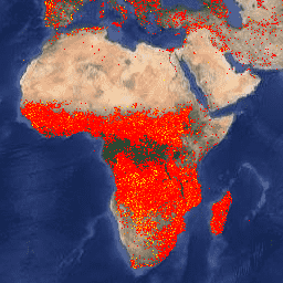
Fire Information for Resource Management System (FIRMS) 데이터 세트의 Earth Engine 버전에는 래스터화된 형식의 LANCE 화재 감지 제품이 포함되어 있습니다. 거의 실시간 (NRT) 활성 화재 위치는 표준 MODIS MOD14/MYD14 화재 및 열 이상치 제품을 사용하여 LANCE에서 처리합니다. 각 … eosdis fire firms geophysical hotspot lance -
VJ114IMGTDL_NRT 일일 래스터: VIIRS (NOAA-20) 밴드 375m 활화산

NOAA-20 (JPSS-1) 가시적 적외선 이미징 방사계 모음 (VIIRS) 활화재 감지 제품은 기기의 375m 명목 해상도 데이터를 기반으로 합니다. 더 낮은 해상도 (≥ 1km)의 다른 위성 화재 감지 제품에 비해 개선된 375m 데이터는 상대적으로 작은 화재에 더 효과적으로 대응할 수 있습니다. eosdis fire firms geophysical hotspot lance -
VNP14IMGTDL_NRT 일일 래스터: VIIRS (S-NPP) 밴드 375m 활성 화재

Suomi NPP 가시적 적외선 이미징 방사계 모음 (VIIRS) 활화재 감지 제품은 기기의 375m 명목 해상도 데이터를 기반으로 합니다. 더 낮은 해상도 (≥ 1km)의 다른 위성 화재 감지 제품에 비해 개선된 375m 데이터는 상대적으로 작은 화재에 더 효과적으로 대응할 수 있습니다. eosdis fire firms geophysical hotspot lance
Datasets tagged lance in Earth Engine
[null,null,[],[],["The Fire Information for Resource Management System (FIRMS) dataset uses LANCE to process near real-time active fire locations from MODIS data. Additionally, VIIRS active fire detection products from NOAA-20 and Suomi NPP are available, both using 375m resolution data. This resolution provides better detection of smaller fires than the coarser resolution (≥ 1km) data.\n"]]