-
Globalny roczny zasięg namorzynów (1984–2023)

Zbiór danych CGMD-Extent30 (Continuous Global Mangrove Dynamics – roczny zasięg namorzynów w rozdzielczości 30 m) zawiera globalne dane o rocznym zasięgu namorzynów z lat 1984–2023. Zbiór danych jest udostępniany jako pojedyncza kolekcja funkcji Earth Engine, a każda funkcja reprezentuje zamapowany wielokąt namorzynów dla określonego roku. Zbiór danych … roczny wybrzeże las biomasa globalny landsat-derived użytkowanie-pokrycie-terenu -
Globalne roczne ułamkowe pokrycie koronami drzew namorzynowych (1984–2023)

Ten zbiór danych zawiera globalne roczne ułamkowe pokrycie koronami drzew (FCC) namorzynowych w rozdzielczości przestrzennej 30 m z lat 1984–2023. Umożliwia on przeprowadzanie analiz na dużą skalę dotyczących długoterminowej dynamiki namorzynów, w tym degradacji i regeneracji koron drzew, oceny niebieskiego węgla oraz monitorowania ekosystemów przybrzeżnych. FCC określa proporcję każdego piksela Landsat … roczny wybrzeże las biomasa globalny landsat-derived namorzyny -
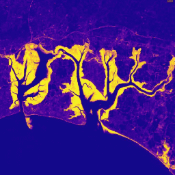
Globalny rozkład lasów namorzynowych, wersja 1 (2000)

Baza danych została przygotowana na podstawie danych satelitarnych Landsat z 2000 r. Ponad 1000 scen Landsat uzyskanych z Centrum Obserwacji i Nauki o Zasobach Ziemi (EROS) USGS zostało sklasyfikowanych przy użyciu hybrydowych technik nadzorowanej i nienadzorowanej cyfrowej klasyfikacji obrazów. Ta baza danych jest pierwszą i najbardziej … roczny ciesin las biomasa globalny landsat-derived namorzyny -
Murray – Globalne zmiany mokradeł pływowych v1.0 (1999–2019)
Zbiór danych Murray Global Tidal Wetland Change (Globalne zmiany mokradeł pływowych) zawiera mapy globalnego zasięgu pływowych terenów podmokłych i ich zmian. Mapy zostały opracowane na podstawie trójstopniowej klasyfikacji, która miała na celu (i) oszacowanie globalnego rozmieszczenia terenów podmokłych pływowych (zdefiniowanych jako ekosystemy bagien pływowych, płycizn pływowych lub … wybrzeże ekosystem międzypływowy landsat-derived namorzyny murray
Datasets tagged mangrove in Earth Engine
[null,null,[],[],[]]