-
머레이 전 세계 조간대 변화 분류
Murray 글로벌 조간대 변화 데이터 세트에는 707,528개의 Landsat 보관처 이미지에 대한 감독 분류를 통해 생성된 전 세계 조간대 생태계 지도가 포함되어 있습니다. 각 픽셀은 전 세계에 배포된 학습 데이터 세트를 참고하여 갯벌, 영구적인 물 또는 기타로 분류되었습니다. … coastal google intertidal landsat-derived murray surface-ground-water -
머레이 전 세계 조간대 변화 데이터 마스크
Murray 글로벌 조간대 변화 데이터 세트에는 707,528개의 Landsat 보관처 이미지에 대한 감독 분류를 통해 생성된 전 세계 조간대 생태계 지도가 포함되어 있습니다. 각 픽셀은 전 세계에 배포된 학습 데이터 세트를 참고하여 갯벌, 영구적인 물 또는 기타로 분류되었습니다. … coastal google intertidal landsat-derived murray surface-ground-water -
머레이 전 세계 조간대 변화 QA 픽셀 수
Murray 글로벌 조간대 변화 데이터 세트에는 707,528개의 Landsat 보관처 이미지에 대한 감독 분류를 통해 생성된 전 세계 조간대 생태계 지도가 포함되어 있습니다. 각 픽셀은 전 세계에 배포된 학습 데이터 세트를 참고하여 갯벌, 영구적인 물 또는 기타로 분류되었습니다. … coastal google intertidal landsat-derived murray surface-ground-water -
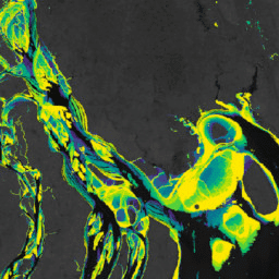
Murray Global Tidal Wetland Change v1.0 (1999~2019)
Murray Global Tidal Wetland Change Dataset에는 전 세계 조간대 습지의 범위와 변화에 관한 지도와 관련 정보가 포함되어 있습니다. 이 지도는 (1) 조간대 습지 (조간대 습지, 조간대 습지 초원, 조간대 습지 숲으로 정의됨)의 전 세계 분포를 추정하고, 해안 생태계 간조역 landsat 파생 맹그로브 murray
Datasets tagged murray in Earth Engine
[null,null,[],[[["\u003cp\u003eThe Murray datasets provide global maps of tidal wetlands and tidal flats, including their changes over time.\u003c/p\u003e\n"],["\u003cp\u003eThese datasets utilize a supervised classification of Landsat imagery to categorize areas into tidal flat, permanent water, or other land cover types.\u003c/p\u003e\n"],["\u003cp\u003eThe Global Tidal Wetland Change dataset specifically focuses on mapping tidal marshes and mangroves, along with their changes between 1999 and 2019.\u003c/p\u003e\n"],["\u003cp\u003eThe Global Intertidal Change dataset offers insights into tidal flat ecosystems based on a large-scale analysis of Landsat Archive images.\u003c/p\u003e\n"],["\u003cp\u003eQuality assessment information is also available through the Global Intertidal Change QA Pixel Count dataset.\u003c/p\u003e\n"]]],["The content describes the Murray Global datasets, which map tidal wetland and intertidal flat ecosystems. The Tidal Wetland Change Dataset estimates the global distribution of tidal marshes and other tidal ecosystems. The Intertidal Change datasets classify pixels from 707,528 Landsat images into tidal flat, permanent water, or other categories. These datasets use a globally distributed training data to classify and map the global extent of intertidal areas and track changes.\n"],null,["# Datasets tagged murray in Earth Engine\n\n-\n\n |---------------------------------------------------------------------------------------------------------------------------------------------------------------------------------------------------------------------------------------------------------------------------------------------------------------------------------------|\n | [### Murray Global Intertidal Change Classification](/earth-engine/datasets/catalog/UQ_murray_Intertidal_v1_1_global_intertidal) |\n | The Murray Global Intertidal Change Dataset contains global maps of tidal flat ecosystems produced via a supervised classification of 707,528 Landsat Archive images. Each pixel was classified into tidal flat, permanent water or other with reference to a globally distributed set of training data. The ... |\n | [coastal](/earth-engine/datasets/tags/coastal) [google](/earth-engine/datasets/tags/google) [intertidal](/earth-engine/datasets/tags/intertidal) [landsat-derived](/earth-engine/datasets/tags/landsat-derived) [murray](/earth-engine/datasets/tags/murray) [surface-ground-water](/earth-engine/datasets/tags/surface-ground-water) |\n\n-\n\n |---------------------------------------------------------------------------------------------------------------------------------------------------------------------------------------------------------------------------------------------------------------------------------------------------------------------------------------|\n | [### Murray Global Intertidal Change Data Mask](/earth-engine/datasets/catalog/UQ_murray_Intertidal_v1_1_data_mask) |\n | The Murray Global Intertidal Change Dataset contains global maps of tidal flat ecosystems produced via a supervised classification of 707,528 Landsat Archive images. Each pixel was classified into tidal flat, permanent water or other with reference to a globally distributed set of training data. The ... |\n | [coastal](/earth-engine/datasets/tags/coastal) [google](/earth-engine/datasets/tags/google) [intertidal](/earth-engine/datasets/tags/intertidal) [landsat-derived](/earth-engine/datasets/tags/landsat-derived) [murray](/earth-engine/datasets/tags/murray) [surface-ground-water](/earth-engine/datasets/tags/surface-ground-water) |\n\n-\n\n |---------------------------------------------------------------------------------------------------------------------------------------------------------------------------------------------------------------------------------------------------------------------------------------------------------------------------------------|\n | [### Murray Global Intertidal Change QA Pixel Count](/earth-engine/datasets/catalog/UQ_murray_Intertidal_v1_1_qa_pixel_count) |\n | The Murray Global Intertidal Change Dataset contains global maps of tidal flat ecosystems produced via a supervised classification of 707,528 Landsat Archive images. Each pixel was classified into tidal flat, permanent water or other with reference to a globally distributed set of training data. The ... |\n | [coastal](/earth-engine/datasets/tags/coastal) [google](/earth-engine/datasets/tags/google) [intertidal](/earth-engine/datasets/tags/intertidal) [landsat-derived](/earth-engine/datasets/tags/landsat-derived) [murray](/earth-engine/datasets/tags/murray) [surface-ground-water](/earth-engine/datasets/tags/surface-ground-water) |\n\n-\n\n |---------------------------------------------------------------------------------------------------------------------------------------------------------------------------------------------------------------------------------------------------------------------------------------------------------------------|\n | [### Murray Global Tidal Wetland Change v1.0 (1999-2019)](/earth-engine/datasets/catalog/JCU_Murray_GIC_global_tidal_wetland_change_2019) |\n | The Murray Global Tidal Wetland Change Dataset contains maps of the global extent of tidal wetlands and their change. The maps were developed from a three stage classification that sought to (i) estimate the global distribution of tidal wetlands (defined as either tidal marsh, tidal ... |\n | [coastal](/earth-engine/datasets/tags/coastal) [ecosystem](/earth-engine/datasets/tags/ecosystem) [intertidal](/earth-engine/datasets/tags/intertidal) [landsat-derived](/earth-engine/datasets/tags/landsat-derived) [mangrove](/earth-engine/datasets/tags/mangrove) [murray](/earth-engine/datasets/tags/murray) |"]]