-
指定: USGS GAP PAD-US v2.0
PAD-US は、生物多様性の保全、その他の自然、レクリエーション、文化的な利用に専用され、法的またはその他の効果的な手段によってこれらの目的のために管理されている、米国の陸上および海洋保護区域の公式な国家インベントリです。このデータベースは次のように分割されています。 conservation-easements designation infrastructure-boundaries management ownership protected-areas -
Easement: USGS GAP PAD-US v2.0
PAD-US は、生物多様性の保全、その他の自然、レクリエーション、文化的な利用に専用され、法的またはその他の効果的な手段によってこれらの目的のために管理されている、米国の陸上および海洋保護区域の公式な国家インベントリです。このデータベースは次のように分割されています。 conservation-easements designation infrastructure-boundaries management ownership protected-areas -
料金: USGS GAP PAD-US v2.0
PAD-US は、生物多様性の保全、その他の自然、レクリエーション、文化的な利用に専用され、法的またはその他の効果的な手段によってこれらの目的のために管理されている、米国の陸上および海洋保護区域の公式な国家インベントリです。このデータベースは次のように分割されています。 conservation-easements designation infrastructure-boundaries management ownership protected-areas -
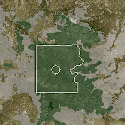
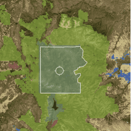
宣言: USGS GAP PAD-US v2.0
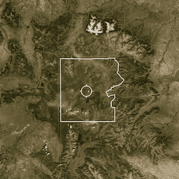
PAD-US は、生物多様性の保全、その他の自然、レクリエーション、文化的な利用に専用され、法的またはその他の効果的な手段によってこれらの目的のために管理されている、米国の陸上および海洋保護区域の公式な国家インベントリです。このデータベースは次のように分割されています。 conservation-easements designation infrastructure-boundaries management ownership protected-areas
Datasets tagged ownership in Earth Engine
[null,null,[],[[["\u003cp\u003eThe PAD-US dataset is the official US inventory of protected terrestrial and marine areas, focusing on biodiversity preservation, recreation, and cultural uses.\u003c/p\u003e\n"],["\u003cp\u003eThis dataset provides data on areas managed for conservation through legal or other effective means, highlighting their diverse purposes.\u003c/p\u003e\n"],["\u003cp\u003eIt is categorized into Designation, Easement, Fee, and Proclamation, representing different types of protected area management.\u003c/p\u003e\n"],["\u003cp\u003ePAD-US helps to identify and understand the extent and types of protected areas across the United States, aiding in conservation efforts.\u003c/p\u003e\n"]]],[],null,["# Datasets tagged ownership in Earth Engine\n\n-\n\n |-----------------------------------------------------------------------------------------------------------------------------------------------------------------------------------------------------------------------------------------------------------------------------------------------------------------------------------------------------------------------------------------------|\n | [### Designation: USGS GAP PAD-US v2.0](/earth-engine/datasets/catalog/USGS_GAP_PAD-US_v20_designation) |\n | PAD-US is America's official national inventory of U.S. terrestrial and marine protected areas that are dedicated to the preservation of biological diversity and to other natural, recreation and cultural uses, managed for these purposes through legal or other effective means. This database is separated into ... |\n | [conservation-easements](/earth-engine/datasets/tags/conservation-easements) [designation](/earth-engine/datasets/tags/designation) [infrastructure-boundaries](/earth-engine/datasets/tags/infrastructure-boundaries) [management](/earth-engine/datasets/tags/management) [ownership](/earth-engine/datasets/tags/ownership) [protected-areas](/earth-engine/datasets/tags/protected-areas) |\n\n-\n\n |-----------------------------------------------------------------------------------------------------------------------------------------------------------------------------------------------------------------------------------------------------------------------------------------------------------------------------------------------------------------------------------------------|\n | [### Easement: USGS GAP PAD-US v2.0](/earth-engine/datasets/catalog/USGS_GAP_PAD-US_v20_easement) |\n | PAD-US is America's official national inventory of U.S. terrestrial and marine protected areas that are dedicated to the preservation of biological diversity and to other natural, recreation and cultural uses, managed for these purposes through legal or other effective means. This database is separated into ... |\n | [conservation-easements](/earth-engine/datasets/tags/conservation-easements) [designation](/earth-engine/datasets/tags/designation) [infrastructure-boundaries](/earth-engine/datasets/tags/infrastructure-boundaries) [management](/earth-engine/datasets/tags/management) [ownership](/earth-engine/datasets/tags/ownership) [protected-areas](/earth-engine/datasets/tags/protected-areas) |\n\n-\n\n |-----------------------------------------------------------------------------------------------------------------------------------------------------------------------------------------------------------------------------------------------------------------------------------------------------------------------------------------------------------------------------------------------|\n | [### Fee: USGS GAP PAD-US v2.0](/earth-engine/datasets/catalog/USGS_GAP_PAD-US_v20_fee) |\n | PAD-US is America's official national inventory of U.S. terrestrial and marine protected areas that are dedicated to the preservation of biological diversity and to other natural, recreation and cultural uses, managed for these purposes through legal or other effective means. This database is separated into ... |\n | [conservation-easements](/earth-engine/datasets/tags/conservation-easements) [designation](/earth-engine/datasets/tags/designation) [infrastructure-boundaries](/earth-engine/datasets/tags/infrastructure-boundaries) [management](/earth-engine/datasets/tags/management) [ownership](/earth-engine/datasets/tags/ownership) [protected-areas](/earth-engine/datasets/tags/protected-areas) |\n\n-\n\n |-----------------------------------------------------------------------------------------------------------------------------------------------------------------------------------------------------------------------------------------------------------------------------------------------------------------------------------------------------------------------------------------------|\n | [### Proclamation: USGS GAP PAD-US v2.0](/earth-engine/datasets/catalog/USGS_GAP_PAD-US_v20_proclamation) |\n | PAD-US is America's official national inventory of U.S. terrestrial and marine protected areas that are dedicated to the preservation of biological diversity and to other natural, recreation and cultural uses, managed for these purposes through legal or other effective means. This database is separated into ... |\n | [conservation-easements](/earth-engine/datasets/tags/conservation-easements) [designation](/earth-engine/datasets/tags/designation) [infrastructure-boundaries](/earth-engine/datasets/tags/infrastructure-boundaries) [management](/earth-engine/datasets/tags/management) [ownership](/earth-engine/datasets/tags/ownership) [protected-areas](/earth-engine/datasets/tags/protected-areas) |"]]