-
可可概率模型 2025a

此图片集提供估计的每像素概率,表示相应区域被相应商品占据的可能性。概率估计值以 10 米为单位提供,由机器学习模型生成。如需了解详情,请参阅有关“森林数据合作伙伴计划”的技术文档… 农业 生物多样性 可可 保护 作物 eudr -
可可概率模型 2025b

此图片集提供估计的每像素概率,表示相应区域被相应商品占据的可能性。概率估计值以 10 米为单位提供,由机器学习模型生成。如需了解详情,请参阅有关“森林数据合作伙伴计划”的技术文档… 农业 alphaearth-derived 生物多样性 可可 保护 农作物 -
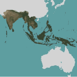
Coffee Probability 模型 2025a

此图片集提供估计的每像素概率,表示相应区域被相应商品占据的可能性。概率估计值以 10 米为单位提供,由机器学习模型生成。如需了解详情,请参阅有关“森林数据合作伙伴计划”的技术文档… 农业 生物多样性 咖啡 保护 作物 eudr -
Coffee Probability 模型 2025b

此图片集提供估计的每像素概率,表示相应区域被相应商品占据的可能性。概率估计值以 10 米为单位提供,由机器学习模型生成。如需了解详情,请参阅有关“森林数据合作伙伴计划”的技术文档… 农业 alphaearth-derived 生物多样性 咖啡 保护 作物 -
EVI:Malaria Atlas Project 填充了缺失数据的增强型植被指数(每 8 天 1 千米)

此增强型植被指数 (EVI) 产品的基础数据集是 MODIS BRDF 校正后的影像 (MCD43B4),该影像已使用 Weiss 等人 (2014) 概述的方法进行了缺口填充,以消除因云覆盖等因素而导致的数据缺失。在填充缺失数据后,数据被剪裁到… evi malariaatlasproject map publisher-dataset 植被 植被指数 -
EVI:Malaria Atlas Project 填充了缺失数据的增强型植被指数(每年 1 千米)

此增强型植被指数 (EVI) 产品的基础数据集是 MODIS BRDF 校正后的影像 (MCD43B4),该影像已使用 Weiss 等人 (2014) 概述的方法进行了缺口填充,以消除因云覆盖等因素而导致的数据缺失。在填充缺失数据后,数据被剪裁到… evi malariaatlasproject map publisher-dataset 植被 植被指数 -
EVI:Malaria Atlas Project 填充了缺失数据的增强型植被指数(每月 1 千米)
此增强型植被指数 (EVI) 产品的基础数据集是 MODIS BRDF 校正后的影像 (MCD43B4),该影像已使用 Weiss 等人 (2014) 概述的方法进行了缺口填充,以消除因云覆盖等因素而导致的数据缺失。在填充缺失数据后,数据被剪裁到… evi malariaatlasproject map publisher-dataset 植被 植被指数 -
Farmscapes 2020
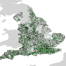
Farmscapes 2020 数据集提供了高分辨率 (25cm) 的概率地图,其中包含英格兰农业景观中的三种关键半自然特征:树篱、林地和石墙。此数据集是与牛津大学 Leverhulme Centre for Nature Recovery 合作开发的,可作为应用的基础数据… 生物多样性 气候 保护 生态连通性 森林 土地利用和土地覆盖 -
Farmscapes 2020 矢量化

这是 Farmscapes 2020 光栅数据集的矢量化版本。该数据集提供了多边形几何图形,用于表示英格兰农业景观中的精细半自然景观特征(具体而言是树篱、林地和石墙)。此数据集是与 Oxford Leverhulme Centre for Nature Recovery 合作开发的,旨在… 生物多样性 气候 保护 生态连通性 森林 土地利用和土地覆盖 -
Forest Persistence v0

此图片提供了一个逐像素得分(范围为 [0, 1]),用于指示相应像素区域在 2020 年是否被未受干扰的森林占据。这些得分以 30 米分辨率提供,是通过一种证据汇聚方法生成的,该方法可将多种森林… 生物多样性 保护 森林砍伐 Eudr 森林生物质 forestdatapartnership -
森林类型学 (ForTy) 2020 v1.0

森林类型学 (ForTy) v1 数据集包含 2020 年全球每类概率地图,分辨率为 10 米,覆盖南纬 65° 至北纬 84° 之间的所有陆地区域。六类分类与粮农组织和欧盟森林砍伐法规 (EUDR) 的定义一致:第 1 类… alphaearth-derived biodiversity climate conservation deforestation eudr -
GPW 草地年主导类 v1

此数据集提供 2000 年至 2022 年全球草地(人工和天然/半天然)年度主要类别地图,空间分辨率为 30 米。此地图由 Land & Carbon Lab Global Pasture Watch 计划制作,其中显示的草地范围包括任何地表覆盖类型,只要其中包含至少 … 全球 全球牧场监测 土地 土地覆盖 土地利用 土地利用和土地覆盖 -
GPW 耕地草地年概率 v1

此数据集提供 2000 年至 2022 年全球人工草地年度概率地图,空间分辨率为 30 米。此地图由 Land & Carbon Lab Global Pasture Watch 计划制作,其中显示的草地范围包括任何土地覆盖类型,这些类型至少包含 30% 的干… 全球 全球牧场监测 土地 土地覆盖 土地利用 土地利用和土地覆盖 -
GPW 天然/半天然草地的年度概率 v1

此数据集提供 2000 年至 2022 年全球天然/半天然草地年度概率地图,空间分辨率为 30 米。此地图由 Land & Carbon Lab Global Pasture Watch 计划制作,其中显示的草地范围包括任何土地覆盖类型,这些类型至少包含 30% 的干… 全球 全球牧场监测 土地 土地覆盖 土地利用 土地利用和土地覆盖 -
GPW 年短植被高度 v1

此数据集提供 2000 年以来的全球植被高度中位数,空间分辨率为 30 米。该数据集由 Land & Carbon Lab 的 Global Pasture Watch 计划生成,提供自 2000 年以来全球 30 米空间分辨率的中值植被高度值(第 50 百分位)。该数据集基于… 冠层 全球 全球牧场监测 土地 土地覆盖 植物生产力 -
GPW 年未校准初级生产总值 (uGPP) v1

此数据集提供自 2000 年以来基于 EO 的全球未校准总初级生产力,空间分辨率为 30 米。当前数据集由 Land & Carbon Lab Global Pasture Watch 计划生成,提供自 2000 年以来全球范围内的总初级生产力 (GPP) 值,空间分辨率为 30 米。GPP 值… 全球 全球牧场监测 土地 土地覆盖 土地利用 植物生产力 -
全球红树林面积年变化图(1984 年至 2023 年)

CGMD-Extent30(连续全球红树林动态 - 分辨率为 30 米的年度红树林范围)数据集提供 1984 年至 2023 年的全球年度红树林范围。该数据集以单个 Earth Engine FeatureCollection 的形式分发,其中每个要素代表特定年份的红树林多边形地图。数据集… 年度 沿海 森林生物质 全球 基于 Landsat 的 土地利用和土地覆盖 -
全球红树林年均部分树冠覆盖率(1984 年至 2023 年)

此数据集提供 1984 年至 2023 年全球红树林冠层覆盖率 (FCC) 的年度数据,空间分辨率为 30 米,可用于大规模分析长期红树林动态,包括冠层退化和恢复、蓝碳评估和沿海生态系统监测。FCC 可量化每个陆地卫星… 年度 沿海 森林生物质 全球 基于 Landsat 的 红树林 -
LST Day:Malaria Atlas Project 填充了缺失数据的昼间地表温度(每 8 天 1 千米)

白天陆地表面温度 (LST) 源自约 1 公里的 MODIS MOD11A2 v6.1 产品。将 8 天合成数据转换为摄氏度,然后使用 Weiss 等人 (2014) 概述的方法进行缺口填充,以消除因云覆盖等因素而导致的数据缺失。… climate lst malariaatlasproject map publisher-dataset surface-temperature -
LST Day:Malaria Atlas Project 填充了缺失数据的昼间地表温度(每年 1 千米)

白天陆地表面温度 (LST) 源自约 1 公里的 MODIS MOD11A2 v6.1 产品。将 8 天合成数据转换为摄氏度,然后使用 Weiss 等人 (2014) 概述的方法进行缺口填充,以消除因云覆盖等因素而导致的数据缺失。… climate lst malariaatlasproject map publisher-dataset surface-temperature -
LST Day:Malaria Atlas Project 填充了缺失数据的白天陆地表面温度(每月 1 千米)

白天陆地表面温度 (LST) 源自约 1 公里的 MODIS MOD11A2 v6.1 产品。将 8 天合成数据转换为摄氏度,然后使用 Weiss 等人 (2014) 概述的方法进行缺口填充,以消除因云覆盖等因素而导致的数据缺失。… climate lst malariaatlasproject map publisher-dataset surface-temperature -
LST Night:Malaria Atlas Project 填充了缺失数据的夜间地表温度(每 8 天 1 千米)

夜间地表温度 (LST) 源自约 1 公里的 MODIS MOD11A2 v6.1 产品。将 8 天合成数据转换为摄氏度,然后使用 Weiss 等人 (2014) 概述的方法进行缺口填充,以消除因云覆盖等因素而导致的数据缺失。… climate lst malariaatlasproject map publisher-dataset surface-temperature -
LST 夜间:Malaria Atlas Project 填充了缺失数据的夜间地表温度(每年 1 千米)

夜间地表温度 (LST) 源自约 1 公里的 MODIS MOD11A2 v6.1 产品。将 8 天合成数据转换为摄氏度,然后使用 Weiss 等人 (2014) 概述的方法进行缺口填充,以消除因云覆盖等因素而导致的数据缺失。… climate lst malariaatlasproject map publisher-dataset surface-temperature -
LST Night:Malaria Atlas Project 填充了缺失数据的夜间地表温度(每月 1 千米)

夜间地表温度 (LST) 源自约 1 公里的 MODIS MOD11A2 v6.1 产品。将 8 天合成数据转换为摄氏度,然后使用 Weiss 等人 (2014) 概述的方法进行缺口填充,以消除因云覆盖等因素而导致的数据缺失。… climate lst malariaatlasproject map publisher-dataset surface-temperature -
Malaria Atlas Project 2015 年城市可达性

此全球可达性地图列出了 2015 年(基准年)北纬 85 度至南纬 60 度之间所有区域到达最近人口稠密区域的陆路行程时间。人口稠密地区是指每平方公里有 1,500 名或更多居民的连续区域,或… 无障碍 malariaatlasproject 地图 人口 publisher-dataset -
Malaria Atlas Project 医疗保健可及性 2019 年

此全球可达性地图列出了 2019 年基准年期间,北纬 85 度至南纬 60 度之间的所有区域前往最近的医院或诊所的陆路行程时间(以分钟为单位)。OpenStreetMap、Google 地图和学术研究人员正在开展大规模数据收集工作,… 无障碍 malariaatlasproject 地图 人口 publisher-dataset -
Malaria Atlas Project 2019 年医疗保健可及性(仅限步行)

此全球可达性地图列出了 2019 年基准年期间,北纬 85 度至南纬 60 度之间的所有区域前往最近的医院或诊所的陆路行程时间(以分钟为单位)。此表面基于“仅步行”的行程时间,使用非机动交通工具… 无障碍 malariaatlasproject 地图 人口 publisher-dataset -
Malaria Atlas Project 全球摩擦表面 2015 年

Friction Surface 2019”。此全球摩擦表面列出了 2015 年基准年所有陆地像素(位于北纬 85 度和南纬 60 度之间)的陆地旅行速度。此地图由牛津大学疟疾地图集项目 (MAP)、Google、… 无障碍 malariaatlasproject 地图 人口 publisher-dataset -
Malaria Atlas Project 全球摩擦表面 2019 年

此全球摩擦表面列出了 2019 年基准年北纬 85 度至南纬 60 度之间所有陆地像素的陆地旅行速度。此地图由 MAP(牛津大学)、Telethon Kids Institute(澳大利亚珀斯)、Google 和… 无障碍 malariaatlasproject 地图 人口 publisher-dataset -
Malaria Atlas Project 全球摩擦表面 2019 年(仅限步行)

此全球摩擦表面列出了 2019 年基准年北纬 85 度至南纬 60 度之间所有陆地像素的陆地旅行速度。此面积是根据“仅步行”的出行速度计算的,仅使用非机动交通工具。此地图是通过… 无障碍 malariaatlasproject 地图 人口 publisher-dataset -
MapBiomas 土地利用和土地覆被 - 玻利维亚 V1.0

MapBiomas 玻利维亚土地利用和土地覆盖 (LULC) 数据集由 MapBiomas 项目每年使用 Landsat 卫星图像和机器学习分类技术生成。该数据集提供分辨率为 30 米的连贯年度土地覆盖地图,涵盖 1985 年至 2024 年期间。玻利维亚的… landsat-derived landuse-landcover mapbiomas-public publisher-dataset -
MapBiomas 土地利用和土地覆盖 - 巴西 V1.0

MapBiomas 巴西土地利用和土地覆盖 (LULC) 数据集由 MapBiomas 项目每年使用 Landsat 卫星图像和机器学习分类技术生成。该数据集提供分辨率为 30 米的连贯且主题详细的地图,涵盖数十年,每年都会更新。每个图片… landsat-derived landuse-landcover mapbiomas-public publisher-dataset -
MapBiomas 土地利用和土地覆盖 - 厄瓜多尔 V1.0

厄瓜多尔的 MapBiomas 土地使用和土地覆盖 (LULC) 数据集由 MapBiomas 项目每年使用 Landsat 卫星图像和机器学习分类技术生成。该数据集提供分辨率为 30 米的连贯年度土地覆盖地图,涵盖 1985 年至 2024 年期间。厄瓜多尔的… landsat-derived landuse-landcover mapbiomas-public publisher-dataset -
MethaneAIR L3 浓度 V1.1.0

此数据集提供甲烷空气成像光谱仪观测到的甲烷大气柱干空气摩尔分数总量的地理空间数据,即“XCH4”。XCH4 定义为甲烷(“CH4”)的总柱含量(分子数)除以总含量… atmosphere climate edf edf-methanesat-ee emissions ghg -
MethaneAIR L4 点源 V1.1.0

此数据集提供了 13 个石油和天然气或煤炭开采区域(从西部的科罗拉多州、新墨西哥州和得克萨斯州到东部的宾夕法尼亚州、俄亥俄州和西弗吉尼亚州)以及 3 个城市区域(纽约市、… atmosphere climate edf edf-methanesat-ee emissions ghg -
MethaneSAT L3 浓度公开预览版 V1.0.0
此早期“公开预览版”数据集提供从 MethaneSAT 成像光谱仪的测量结果中检索到的甲烷在大气中的柱平均干空气摩尔分数“XCH4”的地理空间数据。XCH4 定义为…的总柱含量(单位表面积上方的分子数量) atmosphere climate edf edf-methanesat-ee emissions ghg -
MethaneSAT L4 区域源公开预览版 V1.0.0
分散区域排放模型仍在开发中,不代表最终产品。此早期“公开预览版”数据集可提供分散区域源的甲烷排放高精度数据。这些排放数据来自美国… atmosphere climate edf edf-methanesat-ee emissions ghg -
MethaneSAT L4 面积源公开预览版 V2.0.0
分散区域排放模型仍在开发中,不代表最终产品。此早期“公开预览版”数据集可提供分散区域源的甲烷排放高精度数据。这些新颖的测量结果表明,高精度量化甲烷总排放量对于…至关重要 atmosphere climate edf edf-methanesat-ee emissions ghg -
MethaneSAT L4 点源公开预览版 V1.0.0

此早期“公开预览版”数据集可提供来自离散点源的甲烷排放高精度数据。这些甲烷排放通量是使用专门用于利用…的高空间分辨率、广阔的空间覆盖范围和高精度的点源检测和排放量化框架生成的。 atmosphere climate edf edf-methanesat-ee emissions ghg -
NEON 冠层高度模型 (CHM)

冠层顶部相对于裸地的海拔高度(冠层高度模型;CHM)。CHM 源自 NEON LiDAR 点云,通过在 LiDAR 调查的整个空间域内创建连续的冠层高度估计值表面来生成。… 机载 冠层 森林 森林生物质 高分辨率 激光雷达 -
NEON 冠层氮含量 (CNC)

模型化的冠层氮浓度,使用 NEON 植物叶面化学观测数据进行校准,并使用从 NEON 成像光谱仪 (NIS) 获得的 L1 表面方向反射率进行预测。波段包括:1) 冠层氮百分比;2) 冠层氮模型不确定性;3) 针叶与非针叶模型的分类结果;以及… 机载 冠层 森林 高分辨率 高光谱 neon -
NEON 数字高程模型 (DEM)
根据 NEON LiDAR 数据得出的地表数字模型 (DSM) 和地形数字模型 (DTM)。DSM:地表特征(包含植被和人造结构的地形信息)。DTM:裸地高程(已移除植被和人造结构的地形信息)。图片中给出的高度单位为米,以平均海平面为基准。 机载 数字高程模型 海拔地形 森林 高分辨率 激光雷达 -
NEON RGB 相机影像

高分辨率红绿蓝 (RGB) 正射校正相机图像,使用最近邻重采样方法拼接并输出到固定的均匀空间网格上;空间分辨率为 0.1 米。数码相机是 NEON 机载观测平台 (AOP) 上的一组仪器之一,该平台还包括… airborne forest highres neon neon-prod-earthengine orthophoto -
NEON 表面双向反射率

NEON AOP 地表双向反射率是一种高光谱 VSWIR(可见光到短波红外)数据产品,包含 426 个波段,波长范围约为 380 nm 到 2510 nm。反射率按 10000 的系数进行缩放。将 1340-1445 nm 和 1790-1955 nm 之间的波长设置为 … airborne forest highres hyperspectral neon neon-prod-earthengine -
NEON 地表方向性反射率

NEON AOP 地表定向反射率是一种高光谱 VSWIR(可见光到短波红外)数据产品,包含 426 个波段,波长范围约为 380 nm 到 2510 nm。反射率按 10000 的系数进行缩放。将 1340-1445 nm 和 1790-1955 nm 之间的波长设置为 … 机载 森林 高光谱 neon neon-prod-earthengine publisher-dataset -
NICFI 卫星数据计划:用于热带森林监测的基础地图 - 非洲
此图片集提供对热带地区的高分辨率卫星监测数据,主要目的是减少和扭转热带森林的损失,从而有助于应对气候变化、保护生物多样性、促进森林再生、恢复和增强,以及推动可持续发展,所有这些都… basemaps forest nicfi planet planet-nicfi publisher-dataset -
NICFI 卫星数据计划热带森林监测基本地图 - 美洲
此图片集提供对热带地区的高分辨率卫星监测数据,主要目的是减少和扭转热带森林的损失,从而有助于应对气候变化、保护生物多样性、促进森林再生、恢复和增强,以及推动可持续发展,所有这些都… basemaps forest nicfi planet planet-nicfi publisher-dataset -
NICFI 卫星数据计划热带森林监测基本地图 - 亚洲
此图片集提供对热带地区的高分辨率卫星监测数据,主要目的是减少和扭转热带森林的损失,从而有助于应对气候变化、保护生物多样性、促进森林再生、恢复和增强,以及推动可持续发展,所有这些都… basemaps forest nicfi planet planet-nicfi publisher-dataset -
2020 年世界天然森林

“2020 年世界天然森林”数据集提供了一张 2020 年全球天然森林概率地图,分辨率为 10 米。此图层旨在支持《欧盟零毁林法案》(EUDR) 等倡议,以及其他森林保护和监测工作。地图… biodiversity climate conservation deforestation eudr forest -
OpenET DisALEXI 月度蒸发蒸腾量 v2.0

大气-陆地交换逆向 / 大气-陆地交换逆向的分解 (ALEXI/DisALEXI)。DisALEXI 已作为 OpenET 框架的一部分移植到 Google Earth Engine。Anderson 等人 (2012 年、2018 年) 介绍了基准 ALEXI/DisALEXI 模型结构。ALEXI 蒸散 (ET) 模型专门使用时间… 蒸发蒸腾 Landsat 衍生 月度 OpenET 发布者-数据集 水 -
OpenET DisALEXI 月度蒸散量 v2.1

大气-陆地交换逆向 / 大气-陆地交换逆向的分解 (ALEXI/DisALEXI)。DisALEXI 已作为 OpenET 框架的一部分移植到 Google Earth Engine。Anderson 等人 (2012 年、2018 年) 介绍了基准 ALEXI/DisALEXI 模型结构。ALEXI 蒸散 (ET) 模型专门使用时间… 蒸发蒸腾 Landsat 衍生 月度 OpenET 发布者-数据集 水 -
OpenET Ensemble Monthly Evapotranspiration v2.0

OpenET 数据集包含基于卫星的数据,这些数据反映了通过蒸发蒸腾 (ET) 过程从地表转移到大气中的总水量。OpenET 提供来自多个卫星驱动模型的 ET 数据,还会根据这些数据计算出一个“集成值”,… 蒸散量 派生自 GridMET 派生自 Landsat 月度 OpenET 发布者-数据集 -
OpenET Ensemble Monthly Evapotranspiration v2.1

OpenET 数据集包含基于卫星的数据,这些数据反映了通过蒸发蒸腾 (ET) 过程从地表转移到大气中的总水量。OpenET 提供来自多个卫星驱动模型的 ET 数据,还会根据这些数据计算出一个“集成值”,… 蒸散量 派生自 GridMET 派生自 Landsat 月度 OpenET 发布者-数据集 -
OpenET PT-JPL 月度蒸发蒸腾 v2.0

Priestley-Taylor Jet Propulsion Laboratory (PT-JPL)。OpenET 框架中 PT-JPL 模型的核心公式与 Fisher 等人 (2008) 详述的原始公式相比没有变化。不过,我们对 PT-JPL 的模型输入和时间积分进行了增强和更新,以考虑… 蒸散量 派生自 GridMET 派生自 Landsat 月度 OpenET 发布者-数据集 -
OpenET PT-JPL 月度蒸散量 v2.1

Priestley-Taylor Jet Propulsion Laboratory (PT-JPL)。OpenET 框架中 PT-JPL 模型的核心公式与 Fisher 等人 (2008) 详述的原始公式相比没有变化。不过,我们对 PT-JPL 的模型输入和时间积分进行了增强和更新,以考虑… 蒸散量 派生自 GridMET 派生自 Landsat 月度 OpenET 发布者-数据集 -
OpenET SIMS 月度蒸发蒸腾量 v2.0

Satellite Irrigation Management Support (SIMS)。美国宇航局卫星灌溉管理支持 (SIMS) 模型最初旨在支持通过卫星绘制灌溉土地的作物系数和蒸发蒸腾 (ET) 地图,并增加对这些数据的访问权限,以支持在灌溉调度和区域评估中使用这些数据… 蒸散量 派生自 GridMET 派生自 Landsat 月度 OpenET 发布者-数据集 -
OpenET SIMS 月度蒸散量 v2.1

Satellite Irrigation Management Support (SIMS)。美国宇航局卫星灌溉管理支持 (SIMS) 模型最初旨在支持通过卫星绘制灌溉土地的作物系数和蒸发蒸腾 (ET) 地图,并增加对这些数据的访问权限,以支持在灌溉调度和区域评估中使用这些数据… 蒸散量 派生自 GridMET 派生自 Landsat 月度 OpenET 发布者-数据集 -
OpenET SSEBop 月度蒸发蒸腾量 v2.0

Operational Simplified Surface Energy Balance (SSEBop)。Senay 等人(2013 年、2017 年)提出的简化的业务化地表能量平衡 (SSEBop) 模型是一种基于热量的简化地表能量模型,用于根据卫星湿度测量原理(Senay,2018 年)估计实际蒸散量。OpenET SSEBop 实现使用 … 蒸散量 派生自 GridMET 派生自 Landsat 月度 OpenET 发布者-数据集 -
OpenET SSEBop 月度蒸发蒸腾量 v2.1

Operational Simplified Surface Energy Balance (SSEBop)。简化的运行表面能平衡 (SSEBop) 模型(Senay 等人,2013 年;2023 年)是一种基于热量的实际蒸散量 (ET) 估算方法,它利用了卫星湿度测量原理(Senay,2018 年)。作为…中的核心模型之一 蒸散量 派生自 GridMET 派生自 Landsat 月度 OpenET 发布者-数据集 -
OpenET eeMETRIC 月度蒸发蒸腾量 v2.0

利用内部校准模型 (eeMETRIC) 以高分辨率绘制蒸散量的 Google Earth Engine 实现。eeMETRIC 应用了 Allen 等人 (2007 年;2015 年) 和 Allen 等人 (2013b 年) 的高级 METRIC 算法和流程,其中近地表气温与… 蒸散量 派生自 GridMET 派生自 Landsat 月度 OpenET 发布者-数据集 -
OpenET eeMETRIC 月度蒸发蒸腾量 v2.1

利用内部校准模型 (eeMETRIC) 以高分辨率绘制蒸散量的 Google Earth Engine 实现。eeMETRIC 应用了 Allen 等人 (2007 年;2015 年) 和 Allen 等人 (2013b 年) 的高级 METRIC 算法和流程,其中近地表气温与… 蒸散量 派生自 GridMET 派生自 Landsat 月度 OpenET 发布者-数据集 -
OpenET geeSEBAL 月度蒸发蒸腾 v2.0

Google Earth Engine 对陆地表面能平衡算法 (SEBAL) 模型的实现。如需了解当前 geeSEBAL 版本的概览,请参阅 Laipelt 等人 (2021) 的文章,该文章基于 Bastiaanssen 等人 (1998) 开发的原始算法。OpenET geeSEBAL … 蒸散量 派生自 GridMET 派生自 Landsat 月度 OpenET 发布者-数据集 -
OpenET geeSEBAL 月度蒸散量 v2.1

Google Earth Engine 对陆地表面能平衡算法 (SEBAL) 模型的实现。如需了解当前 geeSEBAL 版本的概览,请参阅 Laipelt 等人 (2021) 的文章,该文章基于 Bastiaanssen 等人 (1998) 开发的原始算法。OpenET geeSEBAL … 蒸散量 派生自 GridMET 派生自 Landsat 月度 OpenET 发布者-数据集 -
Overture Maps - Places:地点

Overture Maps Places 主题包含超过 6,400 万个现实世界实体的点表示形式,包括商家、学校、医院、宗教组织、地标、山峰等等。每条地点记录都包含位置坐标、名称、类别、联系信息(网站、社交媒体、电子邮件地址、电话号码)、品牌信息、地址,以及… 全球 基础设施边界 地图 人口 发布商数据集 城市 -
Oya:5km 近似全球降水估计

Oya 是一个准全球高分辨率降水估计数据集,源自静止轨道 (GEO) 卫星观测数据。Oya 模型利用 GEO 卫星群(包括 GOES-16/18、Meteosat-9/10 和 Himawari-8/9)的全光谱可见光和红外 (VIS-IR) 渠道来生成降水估计值,覆盖范围包括… climate geophysical gpm precipitation publisher-dataset weather -
PML_V2.2a:耦合的蒸发蒸腾和初级生产总值 (GPP)

该数据集由大规模水文实验室制作,该实验室专门通过将多源地球观测数据与基于流程的建模相结合,推进全球和区域水循环研究。PML-V2.2a 产品提供 500 米 8 天分辨率的全球陆地蒸散量 (ET) 和总初级生产力 (GPP),数据来自… 蒸散 gpp 植物生产力 publisher-dataset 水汽 -
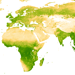
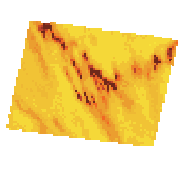
Palm Probability 模型 2025a

此图片集提供估计的每像素概率,表示相应区域被相应商品占据的可能性。概率估计值以 10 米为单位提供,由机器学习模型生成。如需了解详情,请参阅有关“森林数据合作伙伴计划”的技术文档… 农业 生物多样性 保护 作物 eudr forestdatapartnership -
Palm 概率模型 2025b

此图片集提供估计的每像素概率,表示相应区域被相应商品占据的可能性。概率估计值以 10 米为单位提供,由机器学习模型生成。如需了解详情,请参阅有关“森林数据合作伙伴计划”的技术文档… 农业 alphaearth-derived 生物多样性 保护 作物 eudr -
Rubber Probability 模型 2025b

此图片集提供估计的每像素概率,表示相应区域被相应商品占据的可能性。概率估计值以 10 米为单位提供,由机器学习模型生成。如需了解详情,请参阅有关“森林数据合作伙伴计划”的技术文档… 农业 alphaearth-derived 生物多样性 保护 作物 eudr -
Rubber Tree Probability 模型 2025a

此图片集提供估计的每像素概率,表示相应区域被相应商品占据的可能性。概率估计值以 10 米为单位提供,由机器学习模型生成。如需了解详情,请参阅有关“森林数据合作伙伴计划”的技术文档… 农业 生物多样性 保护 作物 eudr forestdatapartnership -
SCANFI:加拿大空间化国家森林清查数据产品 1.2

此数据发布包含一组 30 米分辨率的栅格文件,表示 2020 年加拿大全境的广义土地覆盖类型、森林冠层高度、郁闭度和地上树木生物量,以及几种主要树种的物种组成。The Spatialized CAnadian National … 加拿大 森林 森林生物质 发布者数据集 树木覆盖率 -
物种分布,澳大利亚哺乳动物

这些物种分布模型输出由 Google 与 QCIF 和 EcoCommons 合作开发,表示物种相对出现可能性的估计值(即,值越高表示在给定调查方法和给定调查… alphaearth-derived biodiversity conservation ecosystems nature-trace publisher-dataset -
TCB:Malaria Atlas Project 填充了缺失数据的 Tasseled Cap 亮度(每 8 天 1 千米)

此填充了缺失数据的 Tasseled Cap 亮度 (TCB) 数据集是将 Lobser 和 Cohen (2007) 中定义的 tasseled-cap 方程应用于 MODIS BRDF 校正后的影像 (MCD43B4) 而创建的。使用 Weiss 等人 (2014) 概述的方法对生成的数据进行了缺口填充,以消除因…而导致的数据缺失。 亮度 malariaatlasproject 地图 publisher-dataset tasseled-cap tcb -
TCB:Malaria Atlas Project 填充了缺失数据的 Tasseled Cap 亮度(每年 1 千米)

此填充了缺失数据的 Tasseled Cap 亮度 (TCB) 数据集是将 Lobser 和 Cohen (2007) 中定义的 tasseled-cap 方程应用于 MODIS BRDF 校正后的影像 (MCD43B4) 而创建的。使用 Weiss 等人 (2014) 概述的方法对生成的数据进行了缺口填充,以消除因…而导致的数据缺失。 亮度 malariaatlasproject 地图 publisher-dataset tasseled-cap tcb -
TCB:Malaria Atlas Project 填充了缺失数据的 Tasseled Cap 亮度(每月 1 千米)

此填充了缺失数据的 Tasseled Cap 亮度 (TCB) 数据集是将 Lobser 和 Cohen (2007) 中定义的 tasseled-cap 方程应用于 MODIS BRDF 校正后的影像 (MCD43B4) 而创建的。使用 Weiss 等人 (2014) 概述的方法对生成的数据进行了缺口填充,以消除因…而导致的数据缺失。 亮度 malariaatlasproject 地图 publisher-dataset tasseled-cap tcb -
TCW:Malaria Atlas Project 填充了缺失数据的 Tasseled Cap 湿度(每 8 天 1 千米)

此填充了缺失数据的 Tasseled Cap 湿度 (TCW) 数据集是将 Lobser 和 Cohen (2007) 中定义的 tasseled-cap 方程应用于 MODIS BRDF 校正后的影像 (MCD43B4) 而创建的。使用 Weiss 等人 (2014) 概述的方法对生成的数据进行了缺口填充,以消除因…而导致的数据缺失。 malariaatlasproject map publisher-dataset tasseled-cap tcw vegetation -
TCW:Malaria Atlas Project 填充了缺失数据的 Tasseled Cap 湿度(每年 1 千米)

此填充了缺失数据的 Tasseled Cap 湿度 (TCW) 数据集是将 Lobser 和 Cohen (2007) 中定义的 tasseled-cap 方程应用于 MODIS BRDF 校正后的影像 (MCD43B4) 而创建的。使用 Weiss 等人 (2014) 概述的方法对生成的数据进行了缺口填充,以消除因…而导致的数据缺失。 malariaatlasproject map publisher-dataset tasseled-cap tcw vegetation -
TCW:Malaria Atlas Project 填充了缺失数据的 Tasseled Cap 湿度(每月 1 千米)

此填充了缺失数据的 Tasseled Cap 湿度 (TCW) 数据集是将 Lobser 和 Cohen (2007) 中定义的 tasseled-cap 方程应用于 MODIS BRDF 校正后的影像 (MCD43B4) 而创建的。使用 Weiss 等人 (2014) 概述的方法对生成的数据进行了缺口填充,以消除因…而导致的数据缺失。 malariaatlasproject map publisher-dataset tasseled-cap tcw vegetation -
USFS Landscape Change Monitoring System v2025-11(美国大陆和美国境外)

此产品是景观变化监测系统 (LCMS) 数据套件的一部分。它显示了每个年份的 LCMS 建模变化、土地覆盖和/或土地利用类别,覆盖了美国本土 (CONUS) 以及 CONUS 以外的地区 (OCONUS),包括阿拉斯加 (AK)、波多黎各… change-detection forest gtac gtac-data-publish landcover landuse -
美国林务局树冠覆盖率 v2025-6(CONUS 和 OCONUS)

树冠覆盖率 (TCC) 数据套件由美国农业部林务局 (USFS) 制作,是基于遥感的年度地图输出,涵盖 1985 年至 2025 年。这些数据支持美国地质调查局 (USGS) 管理的国家土地覆盖数据库 (NLCD) 项目,… 森林 gtac gtac-data-publish landuse-landcover publisher-dataset redcastle-resources -
WDKBA:全球关键生物多样性区域 (KBA) 数据库 - 2026 年 3 月

如果您有兴趣访问 KBA 数据集,请填写 KBA 数据请求表单,获得批准后即可直接在 GEE 中访问该数据集。关键生物多样性区域 (KBA) 是“对全球生物多样性持续存在做出重大贡献的地点”,包括陆地、淡水和海洋生态系统。… 生物多样性 边界 生态系统 全球 iucn 管理 -
WRI/Google DeepMind 全球森林损失驱动因素 2001-2022 年 v1.0

此数据集以 1 公里的分辨率绘制了 2001 年至 2022 年全球树木覆盖率损失的主要驱动因素。该数据由世界资源研究所 (WRI) 和 Google DeepMind 共同制作,使用在全球范围内收集的一组样本训练的全球神经网络模型 (ResNet) 开发而成… 农业 森林砍伐 森林 森林生物质 Google landandcarbon -
WRI/Google DeepMind 全球森林损失驱动因素 2001-2023 年 v1.1

此数据集以 1 公里分辨率绘制了 2001 年至 2023 年全球树木覆盖率损失的主要驱动因素。该数据由世界资源研究所 (WRI) 和 Google DeepMind 共同制作,使用在全球范围内收集的一组样本训练的全球神经网络模型 (ResNet) 开发而成… 农业 森林砍伐 森林 森林生物质 Google landandcarbon -
WRI/Google DeepMind,“2001-2024 年全球森林损失驱动因素”v1.2

此数据集以 1 公里分辨率绘制了 2001 年至 2024 年全球树木覆盖率损失的主要驱动因素。该数据由世界资源研究所 (WRI) 和 Google DeepMind 共同制作,使用在全球范围内收集的一组样本训练的全球神经网络模型 (ResNet) 开发而成… 农业 森林砍伐 森林 森林生物质 Google landandcarbon -
WRI/Google DeepMind 全球森林损失驱动因素 2001-2025 年 v1.3

此数据集以 1 公里的分辨率绘制了 2001 年至 2025 年全球树木覆盖率损失的主要驱动因素。该数据由世界资源研究所 (WRI) 和 Google DeepMind 共同制作,使用在全球范围内收集的一组样本训练的全球神经网络模型 (ResNet) 开发而成… 农业 森林砍伐 森林 森林生物质 Google landandcarbon -
WeatherNext 2

WeatherNext 2 是一个实验性数据集,包含由 Google DeepMind 的功能网络生成式天气模型的业务版本生成的全球中期集合天气预报。此实验性数据集包含实时数据和历史数据。实时数据是指与… climate forecast gcp-public-data-weathernext precipitation publisher-dataset temperature -
WeatherNext 2 平均值

WeatherNext 2 Mean 是一个实验性数据集的 64 个集合的平均值,该数据集包含由 Google DeepMind 的功能网络生成式天气模型的业务版本生成的全球中期集合天气预报。对于包含所有集成成员的数据集,请参阅(非平均)WeatherNext 2… climate forecast gcp-public-data-weathernext precipitation publisher-dataset temperature -
WeatherNext Gen 预报

弃用通知:此数据集计划于 2026 年 7 月 15 日弃用。为确保服务持续性,用户必须将所有有效工作流迁移到 WeatherNext 2。如需了解详情,请参阅我们的弃用页面。WeatherNext Gen 是一个实验性数据集,包含由 … 生成的全球中期集合天气预报 climate forecast gcp-public-data-weathernext precipitation publisher-dataset temperature -
WeatherNext 图表预报

弃用通知:此数据集计划于 2026 年 7 月 15 日弃用。为确保服务持续性,用户必须将所有有效工作流迁移到 WeatherNext 2。如需了解详情,请参阅我们的弃用页面。WeatherNext Graph 是一个实验性数据集,包含由…生成的全球中期天气预报 climate forecast gcp-public-data-weathernext precipitation publisher-dataset temperature
Datasets tagged publisher-dataset in Earth Engine
[null,null,[],[],[]]