-
머레이 전 세계 조간대 변화 분류
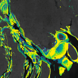
Murray 글로벌 조간대 변화 데이터 세트에는 707,528개의 Landsat 보관처 이미지에 대한 감독 분류를 통해 생성된 전 세계 조간대 생태계 지도가 포함되어 있습니다. 각 픽셀은 전 세계에 배포된 학습 데이터 세트를 참고하여 갯벌, 영구적인 물 또는 기타로 분류되었습니다. … coastal google intertidal landsat-derived murray surface-ground-water -
머레이 전 세계 조간대 변화 데이터 마스크
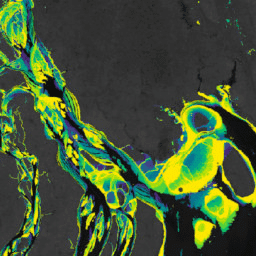
Murray 글로벌 조간대 변화 데이터 세트에는 707,528개의 Landsat 보관처 이미지에 대한 감독 분류를 통해 생성된 전 세계 조간대 생태계 지도가 포함되어 있습니다. 각 픽셀은 전 세계에 배포된 학습 데이터 세트를 참고하여 갯벌, 영구적인 물 또는 기타로 분류되었습니다. … coastal google intertidal landsat-derived murray surface-ground-water -
머레이 전 세계 조간대 변화 QA 픽셀 수
Murray 글로벌 조간대 변화 데이터 세트에는 707,528개의 Landsat 보관처 이미지에 대한 감독 분류를 통해 생성된 전 세계 조간대 생태계 지도가 포함되어 있습니다. 각 픽셀은 전 세계에 배포된 학습 데이터 세트를 참고하여 갯벌, 영구적인 물 또는 기타로 분류되었습니다. … coastal google intertidal landsat-derived murray surface-ground-water
Datasets tagged tidal-flats in Earth Engine
[null,null,[],[[["\u003cp\u003eThe Murray Global Intertidal Change Dataset provides global maps of tidal flat ecosystems, classified into tidal flat, permanent water, or other.\u003c/p\u003e\n"],["\u003cp\u003eThe dataset was created by analyzing 707,528 Landsat Archive images using a supervised classification method with globally distributed training data.\u003c/p\u003e\n"],["\u003cp\u003eThree different data products are available: data mask, global intertidal classification, and QA pixel count, each providing specific insights into tidal flat ecosystems.\u003c/p\u003e\n"]]],[],null,["# Datasets tagged tidal-flats in Earth Engine\n\n-\n\n |---------------------------------------------------------------------------------------------------------------------------------------------------------------------------------------------------------------------------------------------------------------------------------------------------------------------------------------|\n | [### Murray Global Intertidal Change Classification](/earth-engine/datasets/catalog/UQ_murray_Intertidal_v1_1_global_intertidal) |\n | The Murray Global Intertidal Change Dataset contains global maps of tidal flat ecosystems produced via a supervised classification of 707,528 Landsat Archive images. Each pixel was classified into tidal flat, permanent water or other with reference to a globally distributed set of training data. The ... |\n | [coastal](/earth-engine/datasets/tags/coastal) [google](/earth-engine/datasets/tags/google) [intertidal](/earth-engine/datasets/tags/intertidal) [landsat-derived](/earth-engine/datasets/tags/landsat-derived) [murray](/earth-engine/datasets/tags/murray) [surface-ground-water](/earth-engine/datasets/tags/surface-ground-water) |\n\n-\n\n |---------------------------------------------------------------------------------------------------------------------------------------------------------------------------------------------------------------------------------------------------------------------------------------------------------------------------------------|\n | [### Murray Global Intertidal Change Data Mask](/earth-engine/datasets/catalog/UQ_murray_Intertidal_v1_1_data_mask) |\n | The Murray Global Intertidal Change Dataset contains global maps of tidal flat ecosystems produced via a supervised classification of 707,528 Landsat Archive images. Each pixel was classified into tidal flat, permanent water or other with reference to a globally distributed set of training data. The ... |\n | [coastal](/earth-engine/datasets/tags/coastal) [google](/earth-engine/datasets/tags/google) [intertidal](/earth-engine/datasets/tags/intertidal) [landsat-derived](/earth-engine/datasets/tags/landsat-derived) [murray](/earth-engine/datasets/tags/murray) [surface-ground-water](/earth-engine/datasets/tags/surface-ground-water) |\n\n-\n\n |---------------------------------------------------------------------------------------------------------------------------------------------------------------------------------------------------------------------------------------------------------------------------------------------------------------------------------------|\n | [### Murray Global Intertidal Change QA Pixel Count](/earth-engine/datasets/catalog/UQ_murray_Intertidal_v1_1_qa_pixel_count) |\n | The Murray Global Intertidal Change Dataset contains global maps of tidal flat ecosystems produced via a supervised classification of 707,528 Landsat Archive images. Each pixel was classified into tidal flat, permanent water or other with reference to a globally distributed set of training data. The ... |\n | [coastal](/earth-engine/datasets/tags/coastal) [google](/earth-engine/datasets/tags/google) [intertidal](/earth-engine/datasets/tags/intertidal) [landsat-derived](/earth-engine/datasets/tags/landsat-derived) [murray](/earth-engine/datasets/tags/murray) [surface-ground-water](/earth-engine/datasets/tags/surface-ground-water) |"]]