-
DESS China Terrace Map v1
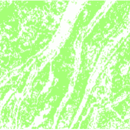
Ten zbiór danych to mapa tarasów w Chinach w 2018 r. z rozdzielczości 30 m. Został on opracowany za pomocą nadzorowanej klasyfikacji opartej na pikselach przy użyciu danych wieloźródłowych i wielkotymowych na platformie Google Earth Engine. Osiągnięta ogólna dokładność i współczynnik kappa wynosiły odpowiednio 94% i 0, 72. Najpierw… agriculture landcover landuse landuse-landcover tsinghua -
Tsinghua FROM-GLC Year of Change to Impervious Surface
Ten zbiór danych zawiera informacje o rocznych zmianach globalnej powierzchni nieprzepuszczalnej w latach 1985–2018 w rozdzielczości 30 m. Przejście z przepuszczalności na nieprzepuszczalność zostało określone za pomocą połączonego podejścia polegającego na klasyfikacji nadzorowanej i sprawdzaniu spójności czasowej. Nieprzepuszczalne piksele to piksele o przepuszczalności powyżej 50%. … zbudowany ludność tsinghua miejski
Datasets tagged tsinghua in Earth Engine
[null,null,[],[[["\u003cp\u003eThe DESS China Terrace Map provides a 30m resolution view of terrace farming across China in 2018, achieving high accuracy through supervised classification using multi-source data.\u003c/p\u003e\n"],["\u003cp\u003eThe Tsinghua FROM-GLC dataset offers insights into annual changes in global impervious surfaces from 1985 to 2018 at 30m resolution, identifying areas where pervious land has become impervious.\u003c/p\u003e\n"]]],["Two datasets are described: a 2018 China terrace map at 30m resolution, created via supervised pixel-based classification using multisource and multi-temporal data. The method had an overall accuracy of 94% and a kappa coefficient of 0.72. The second dataset provides annual changes in global impervious surface area, from 1985 to 2018 at 30m resolution. This was done by a combination of supervised classification and temporal consistency checking. Impervious pixels are above 50% impervious.\n"],null,["# Datasets tagged tsinghua in Earth Engine\n\n-\n\n |--------------------------------------------------------------------------------------------------------------------------------------------------------------------------------------------------------------------------------------------------------------------------------------------------------------------|\n | [### DESS China Terrace Map v1](/earth-engine/datasets/catalog/Tsinghua_DESS_ChinaTerraceMap_v1) |\n | This dataset is a China terrace map at 30 m resolution in 2018. It was developed through supervised pixel-based classification using multisource and multi-temporal data based on the Google Earth Engine platform. The overall accuracy and kappa coefficient achieved 94% and 0.72, respectively. This first ... |\n | [agriculture](/earth-engine/datasets/tags/agriculture) [landcover](/earth-engine/datasets/tags/landcover) [landuse](/earth-engine/datasets/tags/landuse) [landuse-landcover](/earth-engine/datasets/tags/landuse-landcover) [tsinghua](/earth-engine/datasets/tags/tsinghua) |\n\n-\n\n |---------------------------------------------------------------------------------------------------------------------------------------------------------------------------------------------------------------------------------------------------------------------------------------------------------------------------------|\n | [### Tsinghua FROM-GLC Year of Change to Impervious Surface](/earth-engine/datasets/catalog/Tsinghua_FROM-GLC_GAIA_v10) |\n | This dataset contains annual change information of global impervious surface area from 1985 to 2018 at a 30m resolution. Change from pervious to impervious was determined using a combined approach of supervised classification and temporal consistency checking. Impervious pixels are defined as above 50% impervious. ... |\n | [built](/earth-engine/datasets/tags/built) [population](/earth-engine/datasets/tags/population) [tsinghua](/earth-engine/datasets/tags/tsinghua) [urban](/earth-engine/datasets/tags/urban) |"]]