-
2015 도시 접근성
이 전 세계 접근성 지도는 2015년을 기준으로 북위 85도와 남위 60도 사이의 모든 지역에서 가장 인구가 밀집한 지역까지의 육상 이동 시간을 보여줍니다. 인구 밀집 지역은 제곱킬로미터당 1,500명 이상의 인구가 거주하는 연속된 지역 또는 … accessibility jrc map oxford population twente -
2019년 의료 접근성
이 전 세계 접근성 지도는 2019년을 기준으로 북위 85도와 남위 60도 사이의 모든 지역에서 가장 가까운 병원 또는 클리닉까지의 육상 이동 시간 (분)을 보여줍니다. 또한 비동력 수단만을 이용한 '도보 전용' 이동 시간도 포함됩니다. 주요 … accessibility jrc map oxford population twente -
글로벌 마찰 표면 2019
이 전 세계 마찰 노출 영역은 2019년을 기준으로 북위 85도와 남위 60도 사이의 모든 육지 픽셀에 대한 육상 이동 속도를 열거합니다. 또한 비동력 수단만을 사용하는 '걷기 전용' 이동 속도도 포함됩니다. 이 지도는 …과의 공동작업을 통해 제작되었습니다. accessibility jrc map oxford population twente
Datasets tagged twente in Earth Engine
[null,null,[],[[["\u003cp\u003eThe datasets provide global accessibility maps for cities, healthcare, and travel speed.\u003c/p\u003e\n"],["\u003cp\u003eThese maps cover land areas between 85 degrees north and 60 degrees south.\u003c/p\u003e\n"],["\u003cp\u003eTravel time is calculated for a nominal year of either 2015 or 2019, depending on the dataset.\u003c/p\u003e\n"],["\u003cp\u003eAccessibility is evaluated based on land-based travel, including options for motorized and non-motorized transportation.\u003c/p\u003e\n"],["\u003cp\u003eThe maps were produced through a collaboration between several organizations, including Oxford, JRC, and Twente.\u003c/p\u003e\n"]]],[],null,["# Datasets tagged twente in Earth Engine\n\n-\n\n |---------------------------------------------------------------------------------------------------------------------------------------------------------------------------------------------------------------------------------------------------------------------------------------------------------------|\n | [### Accessibility to Cities 2015](/earth-engine/datasets/catalog/Oxford_MAP_accessibility_to_cities_2015_v1_0) |\n | This global accessibility map enumerates land-based travel time to the nearest densely-populated area for all areas between 85 degrees north and 60 degrees south for a nominal year 2015. Densely-populated areas are defined as contiguous areas with 1,500 or more inhabitants per square kilometer or ... |\n | [accessibility](/earth-engine/datasets/tags/accessibility) [jrc](/earth-engine/datasets/tags/jrc) [map](/earth-engine/datasets/tags/map) [oxford](/earth-engine/datasets/tags/oxford) [population](/earth-engine/datasets/tags/population) [twente](/earth-engine/datasets/tags/twente) |\n\n-\n\n |--------------------------------------------------------------------------------------------------------------------------------------------------------------------------------------------------------------------------------------------------------------------------------------------------------------|\n | [### Accessibility to Healthcare 2019](/earth-engine/datasets/catalog/Oxford_MAP_accessibility_to_healthcare_2019) |\n | This global accessibility map enumerates land-based travel time (in minutes) to the nearest hospital or clinic for all areas between 85 degrees north and 60 degrees south for a nominal year 2019. It also includes \"walking-only\" travel time, using non-motorized means of transportation only. Major ... |\n | [accessibility](/earth-engine/datasets/tags/accessibility) [jrc](/earth-engine/datasets/tags/jrc) [map](/earth-engine/datasets/tags/map) [oxford](/earth-engine/datasets/tags/oxford) [population](/earth-engine/datasets/tags/population) [twente](/earth-engine/datasets/tags/twente) |\n\n-\n\n |----------------------------------------------------------------------------------------------------------------------------------------------------------------------------------------------------------------------------------------------------------------------------------------------------------------------|\n | [### Global Friction Surface 2019
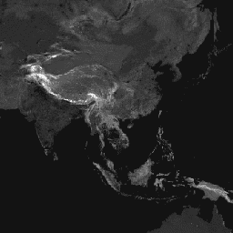
](/earth-engine/datasets/catalog/Oxford_MAP_friction_surface_2019) |\n | This global friction surface enumerates land-based travel speed for all land pixels between 85 degrees north and 60 degrees south for a nominal year 2019. It also includes \"walking-only\" travel speed, using non-motorized means of transportation only. This map was produced through a collaboration between ... |\n | [accessibility](/earth-engine/datasets/tags/accessibility) [jrc](/earth-engine/datasets/tags/jrc) [map](/earth-engine/datasets/tags/map) [oxford](/earth-engine/datasets/tags/oxford) [population](/earth-engine/datasets/tags/population) [twente](/earth-engine/datasets/tags/twente) |"]]