-
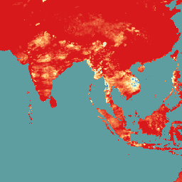
CHIRPS Precipitation Daily Near-Real-Time: Climate Hazards Center InfraRed Precipitation With Station Data (Version 3.0, IMERG-based)

Climate Hazards Center Infrared Precipitation with Stations (CHIRPS v3) הוא מערך נתונים של משקעים ברזולוציה גבוהה, שכולל נתונים מ-40 שנה ויותר, ומכסה את רוב העולם. הוא משתרע מ-60°N עד 60°S ומכסה את כל קווי האורך, ומספק נתונים משנת 1981 ועד היום. CHIRPS v3 משלב הערכות גשם מבוססות אינפרא-אדום תרמי מלוויין עם תצפיות מתחנות בשטח… chc climate geophysical precipitation ucsb weather -
ניתוח מחדש יומי של נתוני משקעים מ-CHIRPS: נתוני משקעים מ-Climate Hazards Center InfraRed Precipitation With Station Data (גרסה 3.0, מבוססת על ERA5)

Climate Hazards Center Infrared Precipitation with Stations (CHIRPS v3) הוא מערך נתונים של משקעים ברזולוציה גבוהה, שכולל נתונים מ-40 שנה ויותר, ומכסה את רוב העולם. הוא משתרע מ-60°N עד 60°S ומכסה את כל קווי האורך, ומספק נתונים משנת 1981 ועד היום. CHIRPS v3 משלב הערכות גשם מבוססות אינפרא-אדום תרמי מלוויין עם תצפיות מתחנות בשטח… chc climate geophysical precipitation ucsb weather -
CHIRPS Precipitation Daily: Climate Hazards Center InfraRed Precipitation With Station Data (גרסה 2.0 סופית)

Climate Hazards Center InfraRed Precipitation with Station data (CHIRPS) הוא מערך נתונים של משקעים גלובליים למחצה, שכולל נתונים מ-30 השנים האחרונות. ב-CHIRPS משולבים נתונים של תמונות לוויין ברזולוציה של 0.05° עם נתונים מתחנות מדידה באתר, כדי ליצור סדרות זמן של גשמים עם רשת משבצות לניתוח מגמות ולמעקב אחרי בצורות עונתיות. chg climate geophysical precipitation ucsb weather -
CHIRPS Precipitation Pentad: Climate Hazards Center InfraRed Precipitation With Station Data (Version 2.0 Final)

Climate Hazards Center InfraRed Precipitation with Station data (CHIRPS) הוא מערך נתונים של משקעים גלובליים למחצה, שכולל נתונים מ-30 השנים האחרונות. ב-CHIRPS משולבים נתונים של תמונות לוויין ברזולוציה של 0.05° עם נתונים מתחנות מדידה באתר, כדי ליצור סדרות זמן של גשמים עם רשת משבצות לניתוח מגמות ולמעקב אחרי בצורות עונתיות. chg climate geophysical precipitation ucsb weather -
CHIRPS Precipitation Pentad: Climate Hazards Center InfraRed Precipitation With Station Data (Version 3.0)

Climate Hazards Center Infrared Precipitation with Stations (CHIRPS v3) הוא מערך נתונים של משקעים ברזולוציה גבוהה, שכולל נתונים מ-40 שנה ויותר, ומכסה את רוב העולם. הוא משתרע מ-60°N עד 60°S ומכסה את כל קווי האורך, ומספק נתונים משנת 1981 ועד היום. CHIRPS v3 משלב הערכות גשם מבוססות אינפרא-אדום תרמי מלוויין עם תצפיות מתחנות בשטח… chc chg climate geophysical precipitation ucsb -
CHIRTS Temperature Daily: Climate Hazards Center InfraRed Temperature with Stations daily data product

מוצר הנתונים של טמפרטורת האינפרא-אדום עם נתוני טמפרטורה יומיים של תחנות (CHIRTS-daily; Verdin et al. 2020) של Climate Hazards Center הוא קבוצת נתונים גלובלית למחצה ברזולוציה גבוהה (רזולוציה של 0.05° × 0.05°, 60°S - 70°N) שמספקת נתונים יומיים של טמפרטורה מינימלית (Tmin) וטמפרטורה מקסימלית (Tmax) בגובה 2 מטר וארבעה משתנים נגזרים: לחץ אדים רווי … chg climate daily era5 geophysical reanalysis -
The Climate Hazards Center (CHC) Coupled Model Intercomparison Project Phase 6 (CHC-CMIP6)
CHC-CMIP6 פותח במיוחד כדי לתמוך בניתוח של סכנות שקשורות לאקלים בעבר הקרוב ובעתיד הקרוב. קבוצת הנתונים הזו של תחזיות אקלים מכילה נתונים גלובליים יומיים ברשתות, לתקופות של תצפיות (1983-2016) ותחזיות (2030 ו-2050), לשימוש בזיהוי ו… climate geophysical precipitation ucsb weather
Datasets tagged ucsb in Earth Engine
[null,null,[],[],["CHIRPS provides a 30+ year quasi-global rainfall dataset by combining 0.05° resolution satellite imagery with in-situ station data. It creates gridded rainfall time series for trend analysis and drought monitoring. CHIRTS-daily offers a quasi-global, high-resolution (0.05°) gridded dataset with daily minimum and maximum 2-meter temperatures (Tmin, Tmax), spanning 60°S to 70°N, along with four derived variables.\n"]]