-
CHIRPS Precipitation Daily Near-Real-Time: Climate Hazards Center InfraRed Precipitation With Station Data (Version 3.0, IMERG-based)

क्लाइमेट हैज़र्ड सेंटर इन्फ़्रारेड प्रेसिपिटेशन विद स्टेशंस (सीएचआईआरपीएस v3), 40 से ज़्यादा सालों का, हाई रिज़ॉल्यूशन वाला, दुनिया भर में हुई बारिश का डेटासेट है. यह 60°N से 60°S तक फैला हुआ है और इसमें सभी देशांतर शामिल हैं. इसमें 1981 से लेकर अब तक का डेटा उपलब्ध है. CHIRPS v3, सैटलाइट से मिले थर्मल इन्फ़्रारेड डेटा के आधार पर बारिश के अनुमान को, स्टेशन पर मौजूद डेटा के साथ जोड़ता है … chc climate geophysical precipitation ucsb weather -
CHIRPS Precipitation Daily Reanalysis: Climate Hazards Center InfraRed Precipitation With Station Data (Version 3.0, ERA5-based)

क्लाइमेट हैज़र्ड सेंटर इन्फ़्रारेड प्रेसिपिटेशन विद स्टेशंस (सीएचआईआरपीएस v3), 40 से ज़्यादा सालों का, हाई रिज़ॉल्यूशन वाला, दुनिया भर में हुई बारिश का डेटासेट है. यह 60°N से 60°S तक फैला हुआ है और इसमें सभी देशांतर शामिल हैं. इसमें 1981 से लेकर अब तक का डेटा उपलब्ध है. CHIRPS v3, सैटलाइट से मिले थर्मल इन्फ़्रारेड डेटा के आधार पर बारिश के अनुमान को, स्टेशन पर मौजूद डेटा के साथ जोड़ता है … chc climate geophysical precipitation ucsb weather -
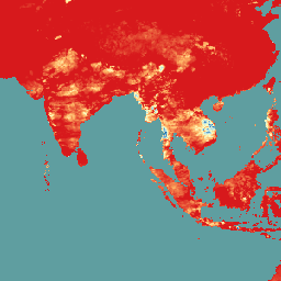
CHIRPS Precipitation Daily: Climate Hazards Center InfraRed Precipitation With Station Data (Version 2.0 Final)

क्लाइमेट हैज़र्ड सेंटर इंफ़्रारेड प्रेसिपिटेशन विद स्टेशन डेटा (सीएचआईआरपीएस), बारिश का 30 साल से ज़्यादा पुराना डेटासेट है. यह डेटासेट, दुनिया के ज़्यादातर हिस्सों के लिए उपलब्ध है. CHIRPS, 0.05° रिज़ॉल्यूशन वाली सैटलाइट इमेज को इन-सिटु स्टेशन के डेटा के साथ जोड़ता है. इससे, बारिश के ट्रेंड का विश्लेषण करने और सूखे की निगरानी करने के लिए, ग्रिड में बारिश की टाइम सीरीज़ बनाई जाती है. chg climate geophysical precipitation ucsb weather -
CHIRPS Precipitation Pentad: Climate Hazards Center InfraRed Precipitation With Station Data (Version 2.0 Final)

क्लाइमेट हैज़र्ड सेंटर इंफ़्रारेड प्रेसिपिटेशन विद स्टेशन डेटा (सीएचआईआरपीएस), बारिश का 30 साल से ज़्यादा पुराना डेटासेट है. यह डेटासेट, दुनिया के ज़्यादातर हिस्सों के लिए उपलब्ध है. CHIRPS, 0.05° रिज़ॉल्यूशन वाली सैटलाइट इमेज को इन-सिटु स्टेशन के डेटा के साथ जोड़ता है. इससे, बारिश के ट्रेंड का विश्लेषण करने और सूखे की निगरानी करने के लिए, ग्रिड में बारिश की टाइम सीरीज़ बनाई जाती है. chg climate geophysical precipitation ucsb weather -
CHIRPS Precipitation Pentad: Climate Hazards Center InfraRed Precipitation With Station Data (Version 3.0)

क्लाइमेट हैज़र्ड सेंटर इन्फ़्रारेड प्रेसिपिटेशन विद स्टेशंस (सीएचआईआरपीएस v3), 40 से ज़्यादा सालों का, हाई रिज़ॉल्यूशन वाला, दुनिया भर में हुई बारिश का डेटासेट है. यह 60°N से 60°S तक फैला हुआ है और इसमें सभी देशांतर शामिल हैं. इसमें 1981 से लेकर अब तक का डेटा उपलब्ध है. CHIRPS v3, सैटलाइट से मिले थर्मल इन्फ़्रारेड डेटा के आधार पर बारिश के अनुमान को, स्टेशन पर मौजूद डेटा के साथ जोड़ता है … chc chg climate geophysical precipitation ucsb -
CHIRTS Temperature Daily: Climate Hazards Center InfraRed Temperature with Stations daily data product

स्टेशन के साथ क्लाइमेट हैज़र्ड सेंटर इंफ़्रारेड तापमान, हर दिन के तापमान का डेटा प्रॉडक्ट (CHIRTS-daily; Verdin et al. 2020) एक तरह का ग्लोबल, हाई-रिज़ॉल्यूशन ग्रिडेड डेटासेट (0.05° × 0.05° रिज़ॉल्यूशन, 60°S - 70°N) है. यह हर दिन के कम से कम (Tmin) और ज़्यादा से ज़्यादा 2 मीटर तापमान (Tmax) के साथ-साथ चार वैरिएबल देता है: सैचुरेशन वेपर … chg climate daily era5 geophysical reanalysis -
क्लाइमेट हैज़र्ड सेंटर (सीएचसी) कपल्ड मॉडल इंटरकंपैरिज़न प्रोजेक्ट फ़ेज़ 6 (सीएचसी-सीएमआईपी6)
CHC-CMIP6 को खास तौर पर, हाल ही के समय और आने वाले समय में जलवायु से जुड़ी समस्याओं के विश्लेषण में मदद करने के लिए बनाया गया है. इस क्लाइमेट प्रोजेक्शन डेटासेट में, दुनिया भर का रोज़ाना का ग्रिड वाला डेटा शामिल है. यह डेटा, ऑब्ज़र्वेशन (1983-2016) और प्रोजेक्शन (2030 और 2050) की अवधि के लिए है. इसका इस्तेमाल, पहचान करने और … climate geophysical precipitation ucsb weather
Datasets tagged ucsb in Earth Engine
[null,null,[],[],["CHIRPS provides a 30+ year quasi-global rainfall dataset by combining 0.05° resolution satellite imagery with in-situ station data. It creates gridded rainfall time series for trend analysis and drought monitoring. CHIRTS-daily offers a quasi-global, high-resolution (0.05°) gridded dataset with daily minimum and maximum 2-meter temperatures (Tmin, Tmax), spanning 60°S to 70°N, along with four derived variables.\n"]]