通过样式设置隐藏地图项
使用集合让一切井井有条
根据您的偏好保存内容并对其进行分类。
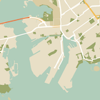
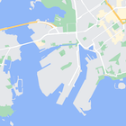
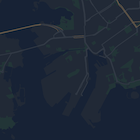
除了更改地图上的地图项样式之外,您还可以完全隐藏地图项。以下示例展示了如何隐藏地图上的商家地图注点 (POI) 和公共交通图标。
样式设置仅适用于 kGMSTypeNormal
地图类型。
为地图应用样式
如需将自定义地图样式应用于地图,请调用 GMSMapStyle(...)
以创建 GMSMapStyle
实例,并传入本地 JSON 文件的网址或包含样式定义的 JSON 字符串。将 GMSMapStyle
实例分配给地图的 mapStyle
属性。
使用 JSON 文件
以下示例展示了如何调用 GMSMapStyle(...)
并传递本地文件的网址:
以下代码示例假定您的项目包含一个名为 style.json
的文件:
Swift
import GoogleMaps
class MapStyling: UIViewController {
// Set the status bar style to complement night-mode.
override var preferredStatusBarStyle: UIStatusBarStyle {
return .lightContent
}
override func loadView() {
let camera = GMSCameraPosition.camera(withLatitude: -33.86, longitude: 151.20, zoom: 14.0)
let mapView = GMSMapView.map(withFrame: CGRect.zero, camera: camera)
do {
// Set the map style by passing the URL of the local file.
if let styleURL = Bundle.main.url(forResource: "style", withExtension: "json") {
mapView.mapStyle = try GMSMapStyle(contentsOfFileURL: styleURL)
} else {
NSLog("Unable to find style.json")
}
} catch {
NSLog("One or more of the map styles failed to load. \(error)")
}
self.view = mapView
}
}
Objective-C
#import "MapStyling.h"
@import GoogleMaps;
@interface MapStyling ()
@end
@implementation MapStyling
// Set the status bar style to complement night-mode.
- (UIStatusBarStyle)preferredStatusBarStyle {
return UIStatusBarStyleLightContent;
}
- (void)loadView {
GMSCameraPosition *camera = [GMSCameraPosition cameraWithLatitude:-33.86
longitude:151.20
zoom:12];
GMSMapView *mapView = [GMSMapView mapWithFrame:CGRectZero camera:camera];
mapView.myLocationEnabled = YES;
NSBundle *mainBundle = [NSBundle mainBundle];
NSURL *styleUrl = [mainBundle URLForResource:@"style" withExtension:@"json"];
NSError *error;
// Set the map style by passing the URL for style.json.
GMSMapStyle *style = [GMSMapStyle styleWithContentsOfFileURL:styleUrl error:&error];
if (!style) {
NSLog(@"The style definition could not be loaded: %@", error);
}
mapView.mapStyle = style;
self.view = mapView;
}
@end
如需定义样式选项,请向您的项目添加一个名为 style.json
的新文件,然后粘贴以下 JSON 样式声明以隐藏商家地图注点 (POI) 和公共交通图标:
显示/隐藏 JSON。
[
{
"featureType": "poi.business",
"elementType": "all",
"stylers": [
{
"visibility": "off"
}
]
},
{
"featureType": "transit",
"elementType": "labels.icon",
"stylers": [
{
"visibility": "off"
}
]
}
]
使用字符串资源
以下示例展示了如何调用 GMSMapStyle()
并传递字符串资源:
Swift
class MapStylingStringResource: UIViewController {
let MapStyle = "JSON_STYLE_GOES_HERE"
// Set the status bar style to complement night-mode.
override var preferredStatusBarStyle: UIStatusBarStyle {
return .lightContent
}
override func loadView() {
let camera = GMSCameraPosition.camera(withLatitude: -33.86, longitude: 151.20, zoom: 14.0)
let mapView = GMSMapView.map(withFrame: CGRect.zero, camera: camera)
do {
// Set the map style by passing a valid JSON string.
mapView.mapStyle = try GMSMapStyle(jsonString: MapStyle)
} catch {
NSLog("One or more of the map styles failed to load. \(error)")
}
self.view = mapView
}
}
Objective-C
@implementation MapStylingStringResource
// Paste the JSON string to use.
static NSString *const kMapStyle = @"JSON_STYLE_GOES_HERE";
// Set the status bar style to complement night-mode.
- (UIStatusBarStyle)preferredStatusBarStyle {
return UIStatusBarStyleLightContent;
}
- (void)loadView {
GMSCameraPosition *camera = [GMSCameraPosition cameraWithLatitude:-33.86
longitude:151.20
zoom:12];
GMSMapView *mapView = [GMSMapView mapWithFrame:CGRectZero camera:camera];
mapView.myLocationEnabled = YES;
NSError *error;
// Set the map style by passing a valid JSON string.
GMSMapStyle *style = [GMSMapStyle styleWithJSONString:kMapStyle error:&error];
if (!style) {
NSLog(@"The style definition could not be loaded: %@", error);
}
mapView.mapStyle = style;
self.view = mapView;
}
@end
以下样式声明将隐藏商家地图注点 (POI) 和公共交通图标。将以下样式字符串粘贴为 kMapStyle
变量的值:
显示/隐藏 JSON。
@"["
@" {"
@" \"featureType\": \"poi.business\","
@" \"elementType\": \"all\","
@" \"stylers\": ["
@" {"
@" \"visibility\": \"off\""
@" }"
@" ]"
@" },"
@" {"
@" \"featureType\": \"transit\","
@" \"elementType\": \"labels.icon\","
@" \"stylers\": ["
@" {"
@" \"visibility\": \"off\""
@" }"
@" ]"
@" }"
@"]"
JSON 样式声明
自定样式的地图利用以下两种概念,将颜色和其他样式更改应用到地图:
- 选择器:指定可以在地图上设置样式的地理区域组件,包括道路、公园、水体等项目以及它们的标签。选择器包括地图项和元素,分别以
featureType
和 elementType
属性来表示。
- 样式器:可应用于地图元素的颜色和可见性属性,通过色调、颜色和亮度/灰度系数值的组合来定义显示的颜色。
有关 JSON 样式设置选项的详细说明,请参阅样式参考。
使用 Maps Platform 样式设置向导可以快速生成 JSON 样式设置对象。Maps SDK for iOS 支持与 Maps JavaScript API 相同的样式声明。
完整代码示例
GitHub 上的 ApiDemos 代码库包含相关示例,展示了如何使用样式设置。
如未另行说明,那么本页面中的内容已根据知识共享署名 4.0 许可获得了许可,并且代码示例已根据 Apache 2.0 许可获得了许可。有关详情,请参阅 Google 开发者网站政策。Java 是 Oracle 和/或其关联公司的注册商标。
最后更新时间 (UTC):2025-08-31。
[null,null,["最后更新时间 (UTC):2025-08-31。"],[[["\u003cp\u003eLearn how to hide map features like business POIs and transit icons using the Google Maps SDK for iOS.\u003c/p\u003e\n"],["\u003cp\u003eApply custom styles by providing a local JSON file or a JSON string containing style definitions to the \u003ccode\u003emapStyle\u003c/code\u003e property of your map.\u003c/p\u003e\n"],["\u003cp\u003eUtilize the \u003ccode\u003efeatureType\u003c/code\u003e and \u003ccode\u003eelementType\u003c/code\u003e properties in your JSON to select the specific map components you want to style.\u003c/p\u003e\n"],["\u003cp\u003eControl the visibility and color of map elements through \u003ccode\u003estylers\u003c/code\u003e in your JSON style declaration.\u003c/p\u003e\n"],["\u003cp\u003eExplore the Maps Platform Styling Wizard for a user-friendly way to generate JSON styling objects for your map.\u003c/p\u003e\n"]]],["To style maps, you can hide features like business POIs and transit icons. Apply styles using `GMSMapStyle`, either with a local JSON file URL or a JSON string. Create a `style.json` file, and use selectors (features and elements) and stylers (visibility) to define map styles. Use the `mapStyle` property on the map to apply styles. Alternatively, you can define a JSON string with the same style options. You can utilize the [Maps Platform Styling Wizard](https://mapstyle.withgoogle.com) for an efficient JSON style object creation.\n"],null,["Select platform: [Android](/maps/documentation/android-sdk/hiding-features \"View this page for the Android platform docs.\") [iOS](/maps/documentation/ios-sdk/hiding-features \"View this page for the iOS platform docs.\") [JavaScript](/maps/documentation/javascript/json-styling-overview \"View this page for the JavaScript platform docs.\")\n\n\u003cbr /\u003e\n\nAs well as changing the style of features on the map, you can also hide them\nentirely. This example shows you how to hide business points of interest (POIs)\nand public transit icons on your map.\n\nStyling works only on the `kGMSTypeNormal` map type.\n\nApplying styles to your map\n\nTo apply custom map styles to a map, call `GMSMapStyle(...)` to create a\n`GMSMapStyle` instance, passing in a URL for a local JSON file, or a JSON\nstring containing style definitions. Assign the `GMSMapStyle` instance to the\n`mapStyle` property of the map.\n\nUsing a JSON file\n\nThe following examples show calling `GMSMapStyle(...)` and passing a URL for a\nlocal file:\n\nThe following code sample assumes your project contains a file named\n`style.json`:\n\n\nSwift \n\n```swift\nimport GoogleMaps\n\nclass MapStyling: UIViewController {\n\n // Set the status bar style to complement night-mode.\n override var preferredStatusBarStyle: UIStatusBarStyle {\n return .lightContent\n }\n\n override func loadView() {\n let camera = GMSCameraPosition.camera(withLatitude: -33.86, longitude: 151.20, zoom: 14.0)\n let mapView = GMSMapView.map(withFrame: CGRect.zero, camera: camera)\n\n do {\n // Set the map style by passing the URL of the local file.\n if let styleURL = Bundle.main.url(forResource: \"style\", withExtension: \"json\") {\n mapView.mapStyle = try GMSMapStyle(contentsOfFileURL: styleURL)\n } else {\n NSLog(\"Unable to find style.json\")\n }\n } catch {\n NSLog(\"One or more of the map styles failed to load. \\(error)\")\n }\n\n self.view = mapView\n }\n}\n \n```\n\nObjective-C \n\n```objective-c\n#import \"MapStyling.h\"\n@import GoogleMaps;\n\n@interface MapStyling ()\n\n@end\n\n@implementation MapStyling\n\n// Set the status bar style to complement night-mode.\n- (UIStatusBarStyle)preferredStatusBarStyle {\n return UIStatusBarStyleLightContent;\n}\n\n- (void)loadView {\n GMSCameraPosition *camera = [GMSCameraPosition cameraWithLatitude:-33.86\n longitude:151.20\n zoom:12];\n GMSMapView *mapView = [GMSMapView mapWithFrame:CGRectZero camera:camera];\n mapView.myLocationEnabled = YES;\n\n NSBundle *mainBundle = [NSBundle mainBundle];\n NSURL *styleUrl = [mainBundle URLForResource:@\"style\" withExtension:@\"json\"];\n NSError *error;\n\n // Set the map style by passing the URL for style.json.\n GMSMapStyle *style = [GMSMapStyle styleWithContentsOfFileURL:styleUrl error:&error];\n\n if (!style) {\n NSLog(@\"The style definition could not be loaded: %@\", error);\n }\n\n mapView.mapStyle = style;\n self.view = mapView;\n}\n\n@end\n \n```\n\n\u003cbr /\u003e\n\nTo define the style options, add a new file to your project named `style.json`,\nand paste the following JSON style declaration to hide business points of\ninterest (POIs) and public transit icons:\nShow/Hide the JSON. \n\n```text\n[\n {\n \"featureType\": \"poi.business\",\n \"elementType\": \"all\",\n \"stylers\": [\n {\n \"visibility\": \"off\"\n }\n ]\n },\n {\n \"featureType\": \"transit\",\n \"elementType\": \"labels.icon\",\n \"stylers\": [\n {\n \"visibility\": \"off\"\n }\n ]\n }\n]\n```\n\nUsing a string resource\n\nThe following examples show calling `GMSMapStyle()` and passing a string\nresource:\n\n\nSwift \n\n```swift\nclass MapStylingStringResource: UIViewController {\n\n let MapStyle = \"JSON_STYLE_GOES_HERE\"\n\n // Set the status bar style to complement night-mode.\n override var preferredStatusBarStyle: UIStatusBarStyle {\n return .lightContent\n }\n\n override func loadView() {\n let camera = GMSCameraPosition.camera(withLatitude: -33.86, longitude: 151.20, zoom: 14.0)\n let mapView = GMSMapView.map(withFrame: CGRect.zero, camera: camera)\n\n do {\n // Set the map style by passing a valid JSON string.\n mapView.mapStyle = try GMSMapStyle(jsonString: MapStyle)\n } catch {\n NSLog(\"One or more of the map styles failed to load. \\(error)\")\n }\n\n self.view = mapView\n }\n}\n \n```\n\nObjective-C \n\n```objective-c\n@implementation MapStylingStringResource\n\n// Paste the JSON string to use.\nstatic NSString *const kMapStyle = @\"JSON_STYLE_GOES_HERE\";\n\n// Set the status bar style to complement night-mode.\n- (UIStatusBarStyle)preferredStatusBarStyle {\n return UIStatusBarStyleLightContent;\n}\n\n- (void)loadView {\n GMSCameraPosition *camera = [GMSCameraPosition cameraWithLatitude:-33.86\n longitude:151.20\n zoom:12];\n GMSMapView *mapView = [GMSMapView mapWithFrame:CGRectZero camera:camera];\n mapView.myLocationEnabled = YES;\n\n NSError *error;\n\n // Set the map style by passing a valid JSON string.\n GMSMapStyle *style = [GMSMapStyle styleWithJSONString:kMapStyle error:&error];\n\n if (!style) {\n NSLog(@\"The style definition could not be loaded: %@\", error);\n }\n\n mapView.mapStyle = style;\n self.view = mapView;\n}\n\n@end\n \n```\n\n\u003cbr /\u003e\n\nThe following style declaration hides business points of interest (POIs) and\npublic transit icons. Paste the following style string as the value of\nthe `kMapStyle` variable:\nShow/Hide the JSON. \n\n```objective-c\n@\"[\"\n@\" {\"\n@\" \\\"featureType\\\": \\\"poi.business\\\",\"\n@\" \\\"elementType\\\": \\\"all\\\",\"\n@\" \\\"stylers\\\": [\"\n@\" {\"\n@\" \\\"visibility\\\": \\\"off\\\"\"\n@\" }\"\n@\" ]\"\n@\" },\"\n@\" {\"\n@\" \\\"featureType\\\": \\\"transit\\\",\"\n@\" \\\"elementType\\\": \\\"labels.icon\\\",\"\n@\" \\\"stylers\\\": [\"\n@\" {\"\n@\" \\\"visibility\\\": \\\"off\\\"\"\n@\" }\"\n@\" ]\"\n@\" }\"\n@\"]\"\n```\n\nJSON style declarations\n\nStyled maps use two concepts to apply colors and other style changes to a\nmap:\n\n- **Selectors** specify the geographic components that you can style on the map. These include roads, parks, bodies of water, and more, as well as their labels. The selectors include *features* and *elements* , specified as `featureType` and `elementType` properties.\n- **Stylers** are color and visibility properties that you can apply to map elements. They define the displayed color through a combination of hue, color, and lightness/gamma values.\n\nSee the [style reference](/maps/documentation/ios-sdk/style-reference) for a detailed description of the\nJSON styling options.\n\nMaps Platform Styling Wizard \n[](https://mapstyle.withgoogle.com) \n[](https://mapstyle.withgoogle.com) \n[](https://mapstyle.withgoogle.com)[](https://mapstyle.withgoogle.com/) \n[](https://mapstyle.withgoogle.com/) \n[](https://mapstyle.withgoogle.com/) \n[](https://mapstyle.withgoogle.com/) \n[](https://mapstyle.withgoogle.com/) \n[](https://mapstyle.withgoogle.com/) \n[Create\ncustom styles for the Google Maps Platform APIs](https://mapstyle.withgoogle.com)\n\nUse the [Maps Platform Styling Wizard](https://mapstyle.withgoogle.com) as a quick way\nto generate a JSON styling object. The Maps SDK for iOS supports the\nsame style declarations as the Maps JavaScript API.\n\nFull code samples\n\nThe [ApiDemos repository](https://github.com/googlemaps-samples/maps-sdk-for-ios-samples) on GitHub includes\nsamples that demonstrate the use of styling."]]