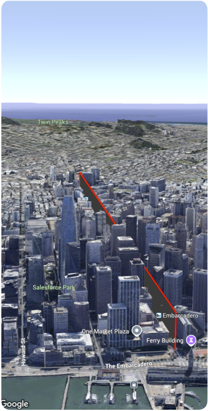
[null,null,["上次更新時間:2025-08-31 (世界標準時間)。"],[],[],null,["# Add a polyline to a map\n\nSelect platform: [Android](/maps/documentation/maps-3d/android-sdk/add-polylines \"View this page for the Android platform docs.\") [iOS](/maps/documentation/maps-3d/ios-sdk/add-polylines \"View this page for the iOS platform docs.\") [JavaScript](/maps/documentation/javascript/3d/shapes-lines \"View this page for the JavaScript platform docs.\")\n\n\u003cbr /\u003e\n\n| This product or feature is Experimental (pre-GA). Pre-GA products and features might have limited support, and changes to pre-GA products and features might not be compatible with other pre-GA versions. Pre-GA Offerings are covered by the [Google\n| Maps Platform Service Specific Terms](https://cloud.google.com/maps-platform/terms/maps-service-terms). For more information, see the [launch stage descriptions](/maps/launch-stages).\n\n\nYou can add a polyline to a 3D map.\n\n\nThe following code sample demonstrates how to use the [`Polyline`](/maps/documentation/maps-3d/ios-sdk/reference/Structs/Polyline) struct to add a polyline and position it in 3D space. \n\n### Swift\n\n```swift\n Polyline(coordinates: [\n .init(latitude: 37.7749, longitude: -122.4194, altitude: 100),\n .init(latitude: 37.7750, longitude: -122.4193, altitude: 100),\n .init(latitude: 37.7751, longitude: -122.4192, altitude: 100)\n ]\n .stroke(.init(strokeColor: .red, strokeWidth: 5.0, outerColor: .blue, outerWidth: 0.2))\n .contour(.init(isGeodesic: false, extruded: true, drawOccludedSegments: true)))\n \n \n```"]]